Good Friday to one and all. As we head into the final weekend of June, the weather pattern is about as amped up as it can be in the summer months. Rounds of strong to severe storms rumble through with the increased threat for significant flash flooding.
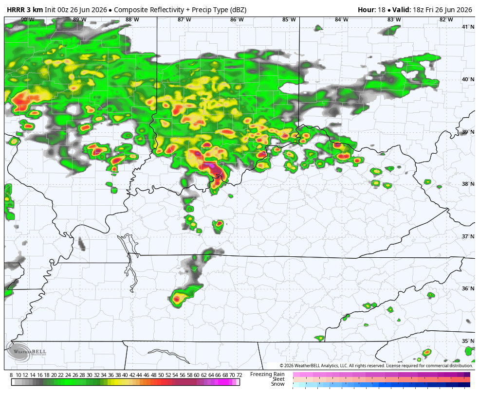
A boundary gets in today and slows down allowing waves of low pressure to develop along it. This means rounds of showers and thunderstorms for Kentucky and the future radar from the HRRR shows just that.
This animation runs from this afternoon through 8pm Saturday…
Some of the storms out there today may be severe with areas of damaging winds and large hail. There’s also the chance for a tornado or two to spin up. Here’s today’s Severe Weather Outlook from the Storm Prediction Center…

The threat for a few more severe storms will be noted again on Saturday…

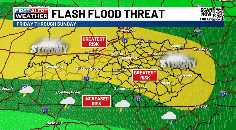
The main concern continues to be flash flooding as these storms will pack a ton of rain and may move over some of the same areas one right after another. I have no real changes to the Greatest Risk area…
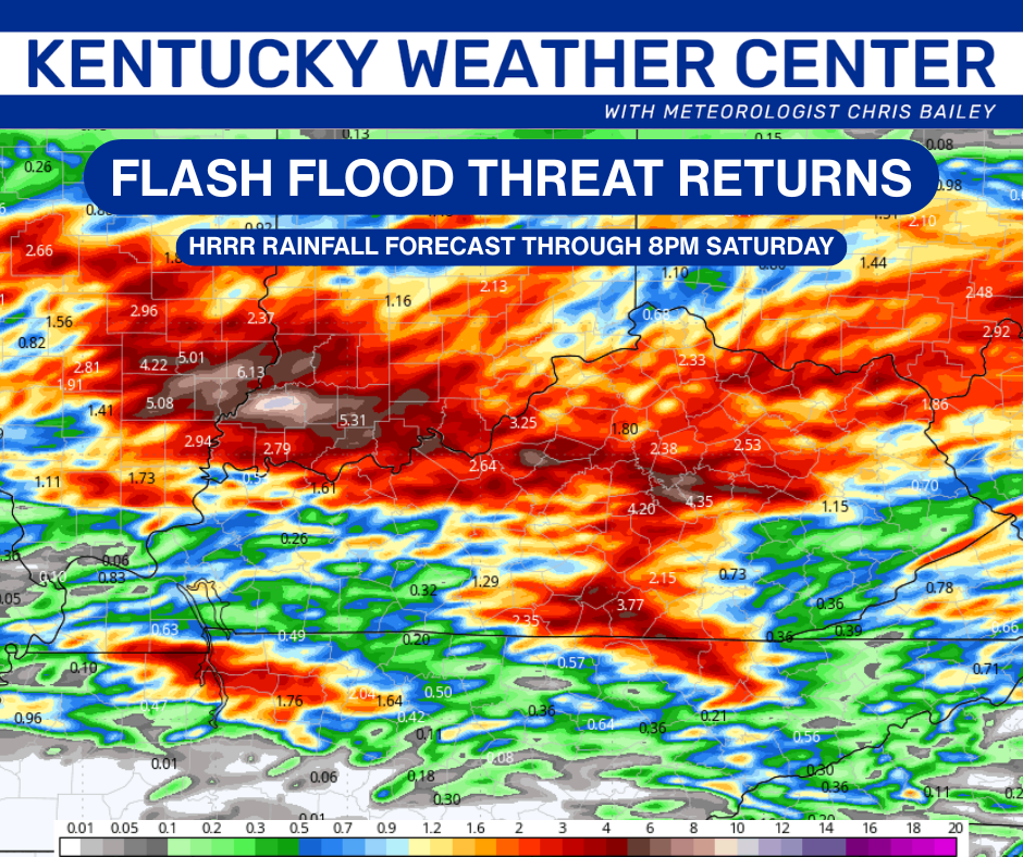
The HRRR shows this potential well…
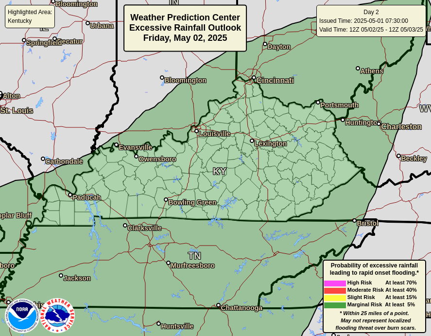
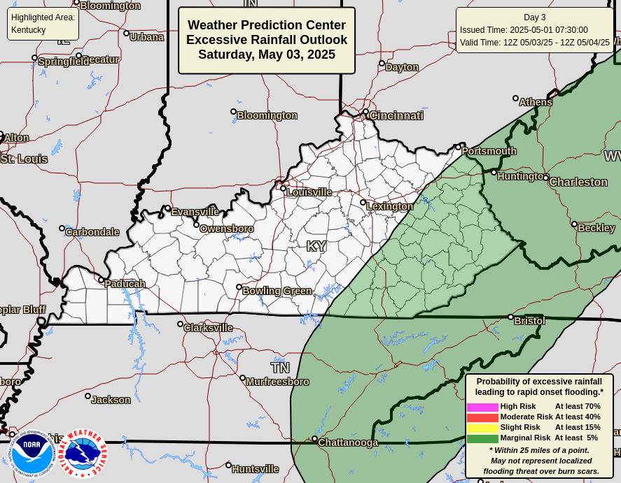
The Weather Prediction Center is monitoring the potential for flooding in our region through early next week. Here’s a daily breakdown of what they’re thinking, starting with today and running through Sunday…
The Sunday storms will be coming at us from the northwest and may cause additional issues, especially across central and eastern Kentucky. Those storms are on the leading edge of some summer sizzle showing up for most of next week and into the 4th of July weekend.
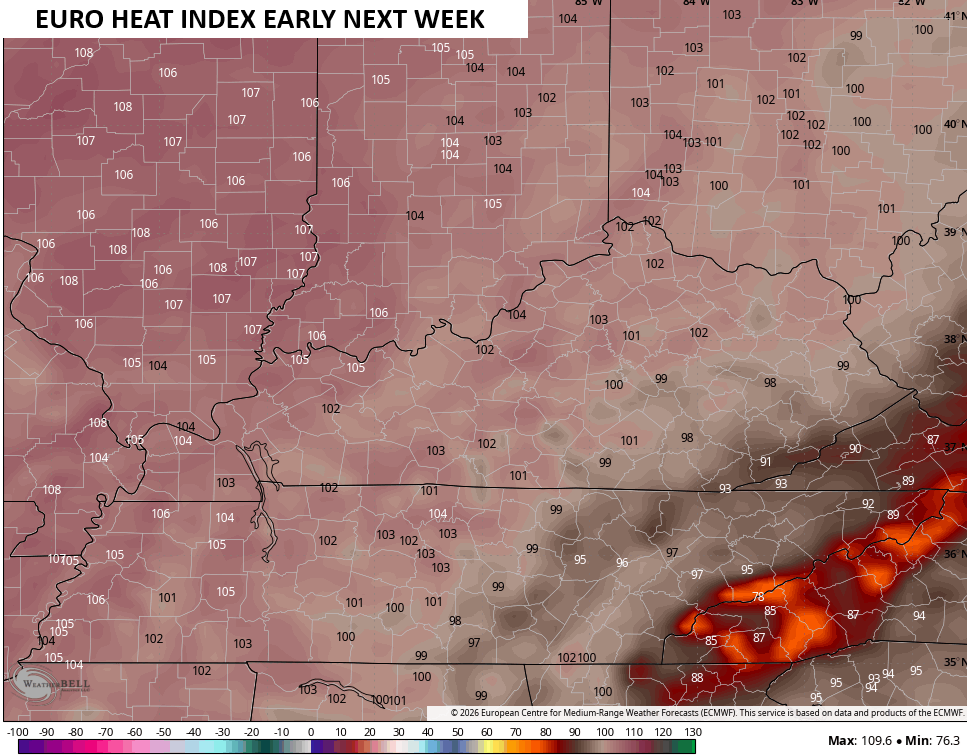
Humidity levels will be crazy high and will combine with 90-95 degree high temps to spit out heat indices around 100 or a little higher…
I may drop by for another update later today and will have the latest on WKYT and WKYT+. As always, I leave you with your daily tracking toys…


Current watches

Possible Watch Areas

Make it a fantastic Friday and take care.

I hope it dries out.