Good Wednesday, everyone. A typical summertime hot and humid air mass continues across the Commonwealth with today and Thursday likely being the hottest of the bunch. The numbers then start to come down by the 4th of July weekend as storm chances flare up.
Temps and heat index numbers from the past few days have been hot, but nothing about the digits have been remotely close to being considered extreme. Heck most areas of Kentucky haven’t even hit Heat Advisory criteria yet.
Temps today reach 90-95 with humidity levels making it feel 100-105 in many cases. Similar temps will be noted on Thursday with the chance for a storm or two going up, especially in the west and south.
The 4th of July weekend will feature a few storms rumbling across the region. Given the amount of moisture in the air, we will need to be on guard for some hit and run flash flooding. Here’s the GFS from Friday through Sunday…
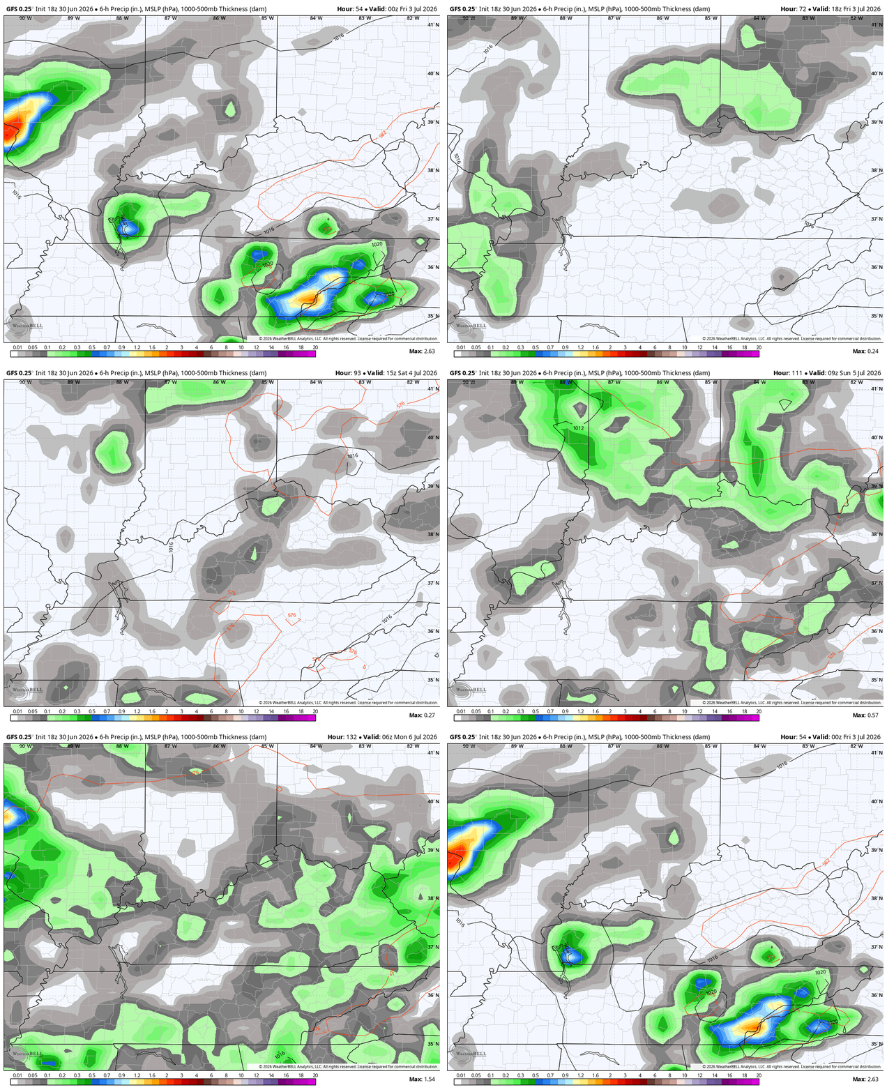
The pattern may feature a few strong or locally severe storms, too. The Storm Prediction Center keeps the Thursday low-end severe risk to our south…
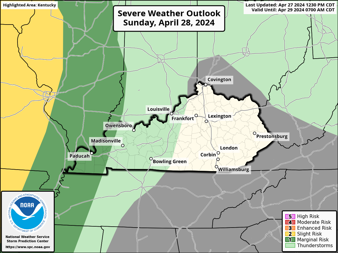
Here’s the Friday Severe Weather Outlook from the Storm Prediction Center…

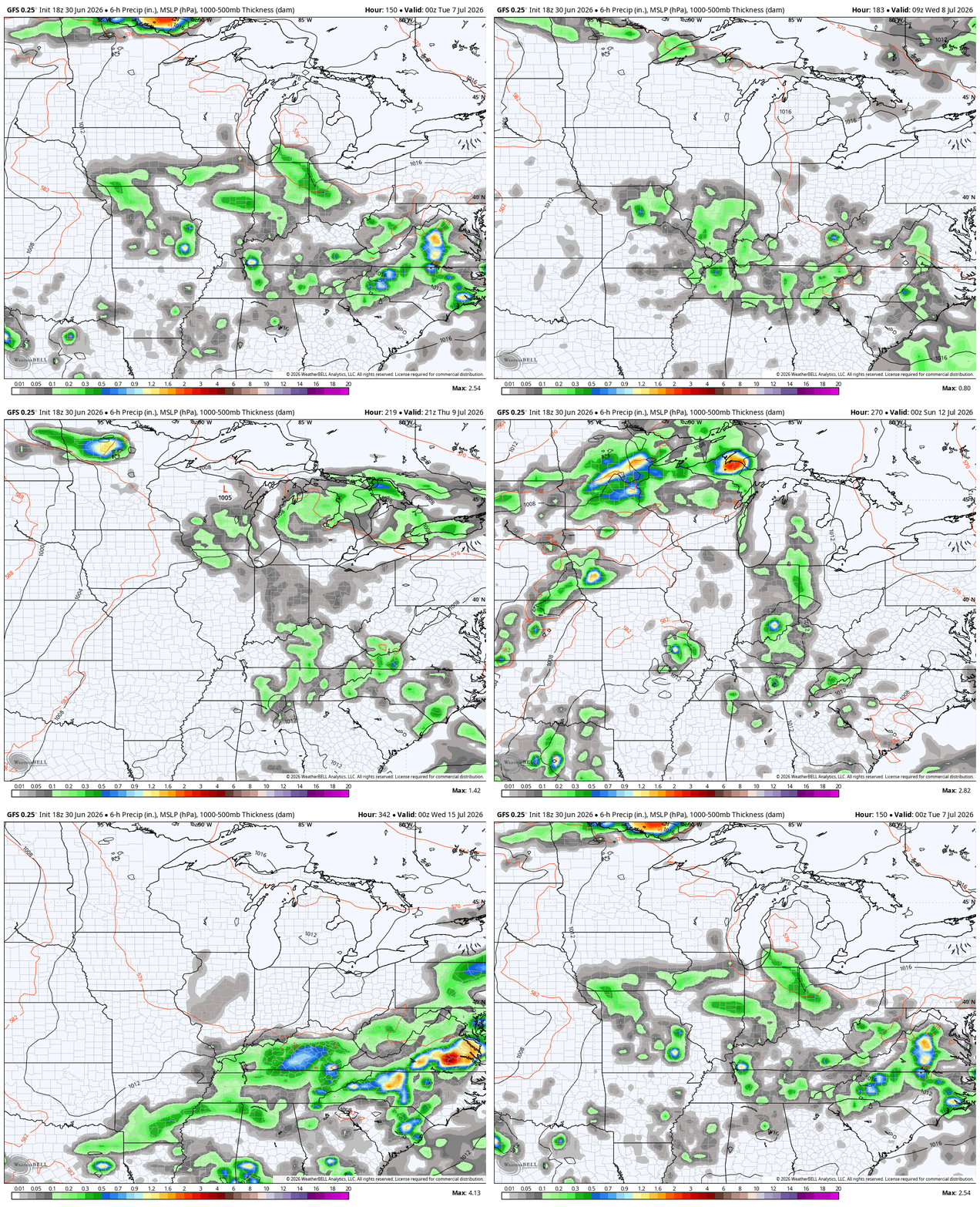
Rounds of showers and storms then look to become a thing again over the next few weeks. This animation from the GFS starts Monday adn goes through July 16…
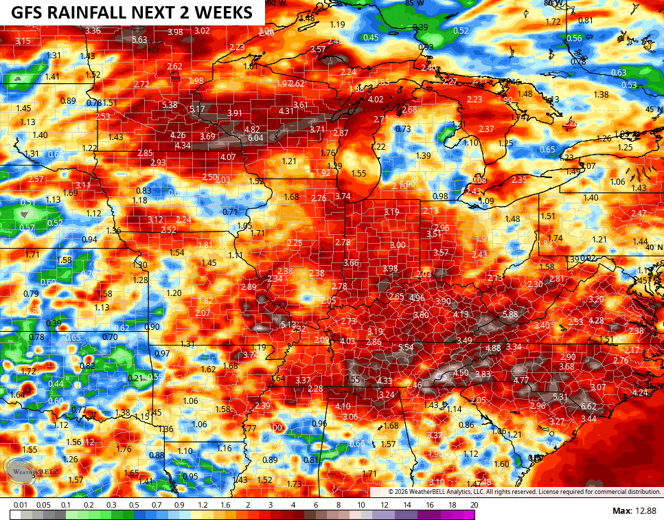
Rainfall numbers during this two week span…
As always, I leave you with your daily tracking toys…




Current watches

Possible Watch Areas

Make it a wonderful Wednesday and take care.

100% Agree Chris…. I think (although it’s still hot and miserable and I wouldn’t want to be outside for long amounts of time) this is totally nothing alarming (so far) and very typical… Max 100 degree heat index. Temps 91 ish. Honestly, I think the reason is we all basically got waterlogged right before the heat dome moved over us totally taming what could have been 100+ degree temps. The usual warm spots in KY are still getting big heat indexes like where Joe lives. I think if you live anywhere near a farm field/ corn it’s going to be so much MORE humid.
Thanks Chris. I too agree.
Yesterday’s high temperature at my PWS was 98°F and the heat index peaked at 112°F. One thing surprising was that the dewpoint high was “only” 78°F, unlike the past few years where dewpoint levels exceeded 80°F multiple times, though I have no doubt that those levels will return.
At 8:15am CDT the current temp is 86.2°F, which is 9.6°F higher than the same time yesterday.
Dew points over 80 degrees is incredibly rare. On July 2, 1980, Louisville hit a verified record of 83 degrees. I don’t think I would be able to tolerate that. Hope it doesn’t happen.
Because of the vegetation surrounding my property, my local humidity/dewpoint values are higher than other regional reporting sites. Reviewing my readings from last year, I had 8 days when the dewpoint exceeded 80°F. None so far this year, but I’m sure that we’ll see at least a couple of +80 days.
Joe, I have lots and lots of vegetation. I wonder what the Dew point is here ? I haven’t any weather equipment to measure such.
Current temperature 88 degrees, humidity 66%, dew point 75 degrees, heat index 98 degrees. Measurements taken at the Taylor County Airport ( K aas. ) Miles away from where I live.
As usual, Chris is downplaying the well above normal temps.
Jeff, I would say the temperatures here lately are the norm.
They’re at minimum 5 degrees above. Yet if it were 5 degrees below, it would be some apocalyptic freeze “well below normal”.