Good Monday to one and all. The first full work week of July is off and running with an upper level low spinning through the region. This is the first in a series of such systems set to impact our weather over the next week and change. This means rounds of scattered storms and tepid summer temps.
Temps out there today range from the low 80s to the upper 80s, depending on where you are in relation to afternoon storms. These storms can put down enough rain to cause local flash flooding issues to develop and may even pulse to severe limits for a brief time.
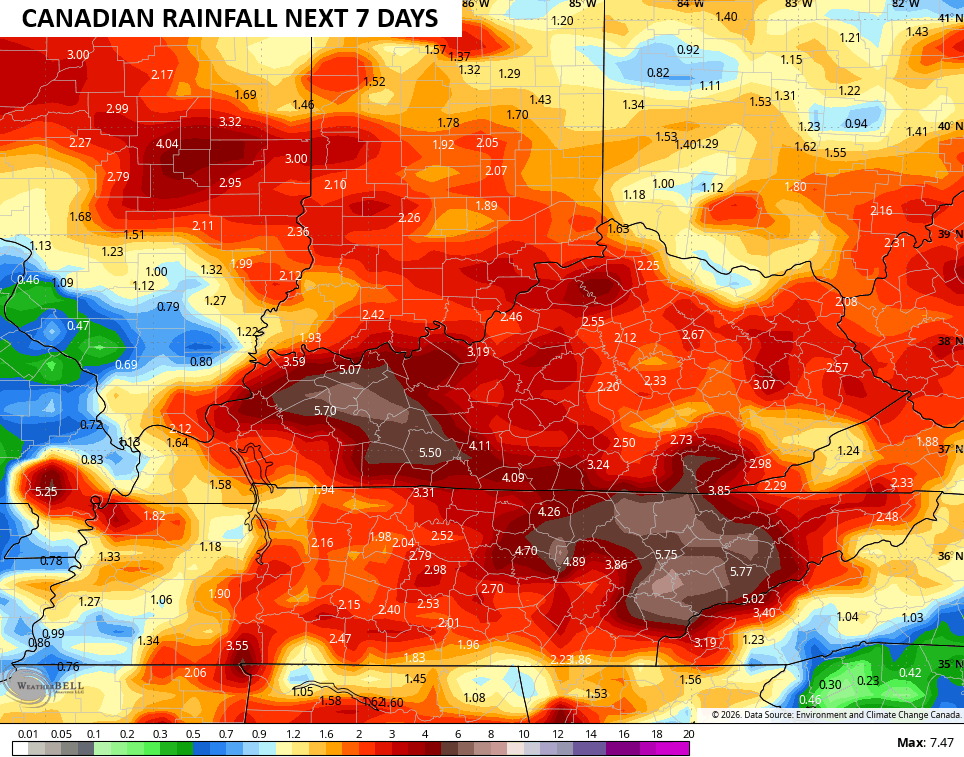
With this upper system spinning just to our south, the greatest concentration of showers and storms will be across the south and east through Wednesday night. I think the Short Range Canadian has a good handle on this action…
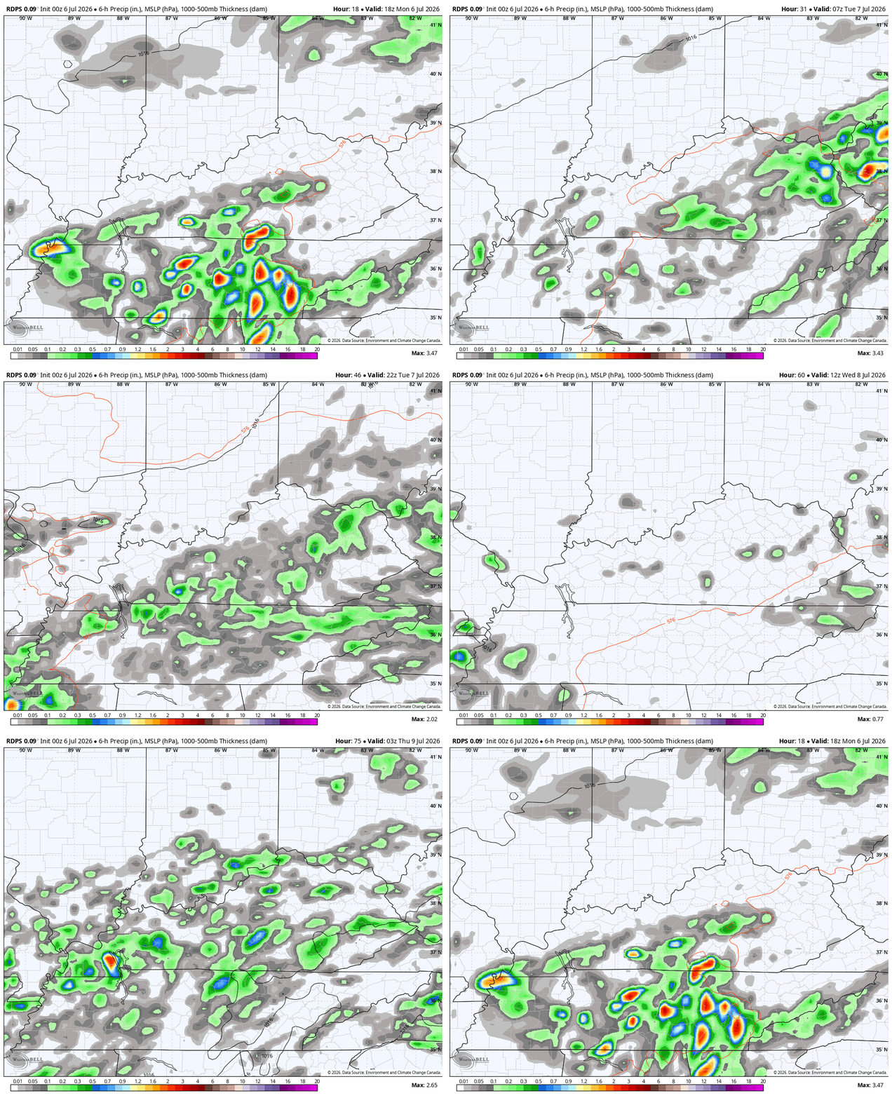
Notice how that run is spitting out some pockets of torrential rains, especially in the south and southeast…
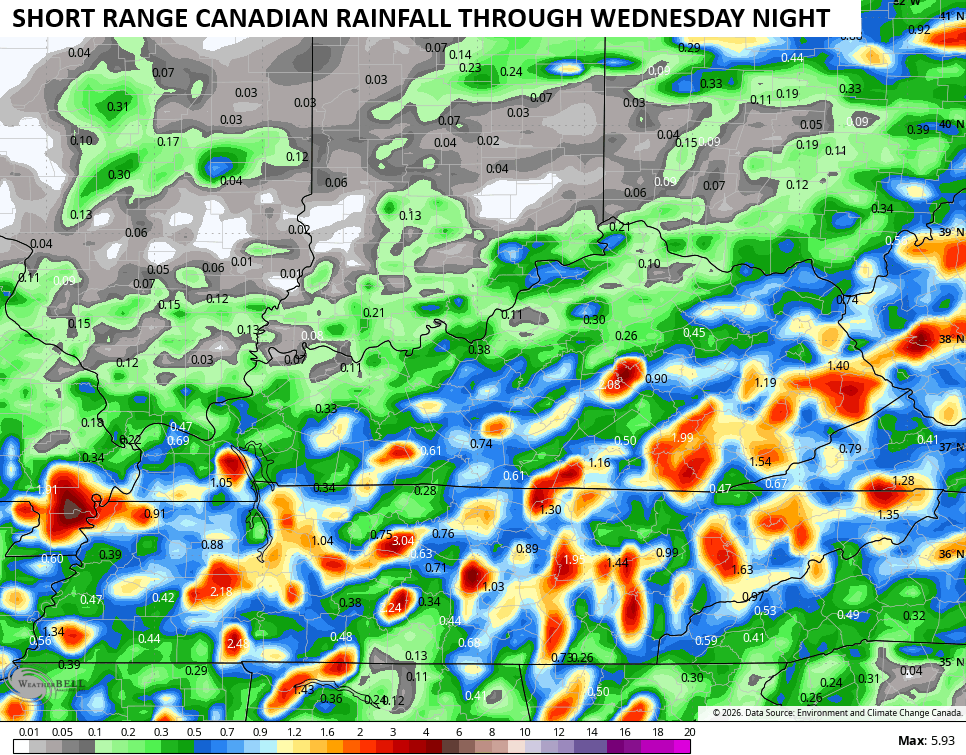
It’s flash flood season around here, so we need to keep an eye on these storms.
In terms of temps, the numbers will be similar to today with readings generally in the 80s. Normal highs for this time of year are 85-90.
A more potent system drops in here Friday into the upcoming weekend, bringing more in the way of widespread showers and storms…
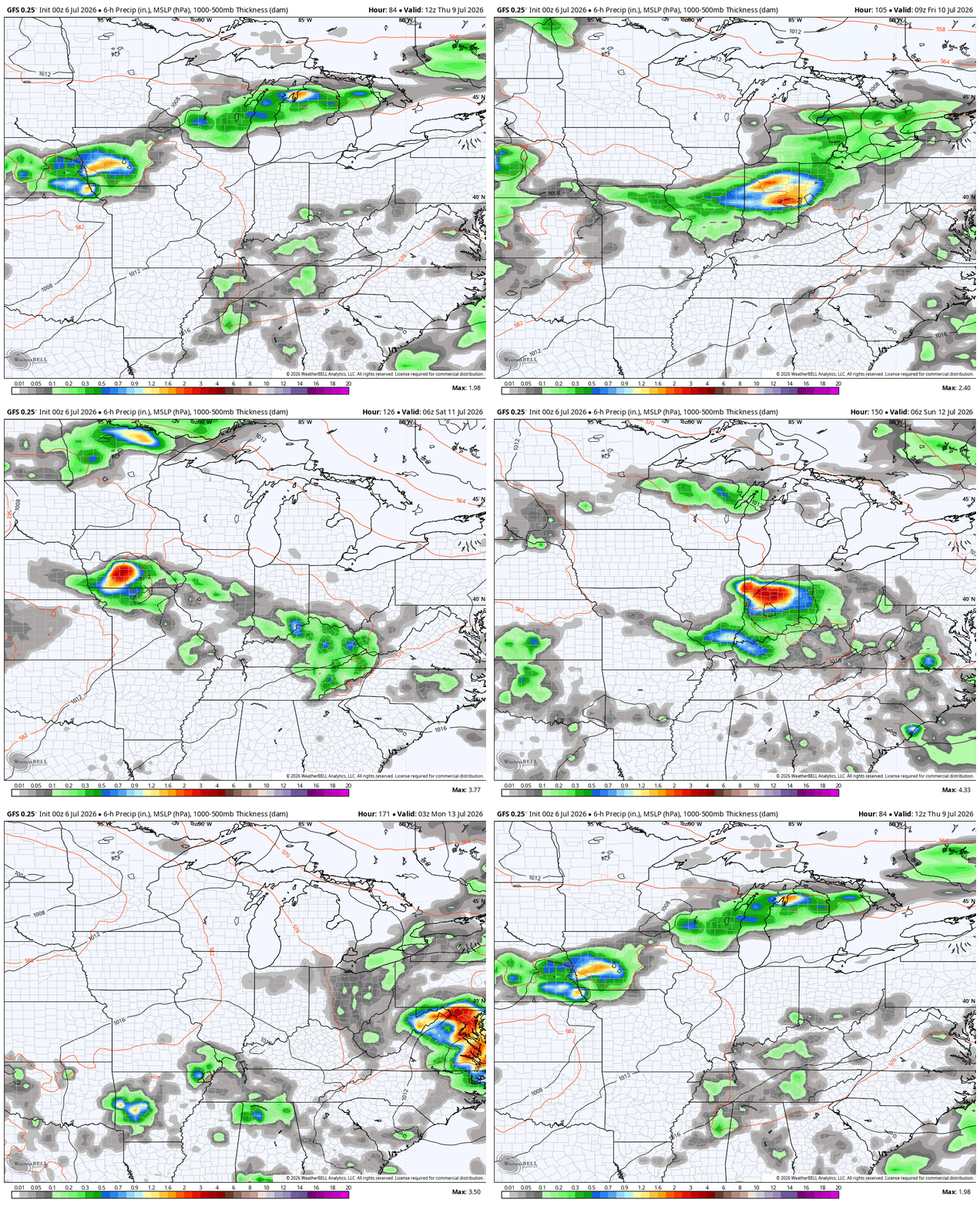
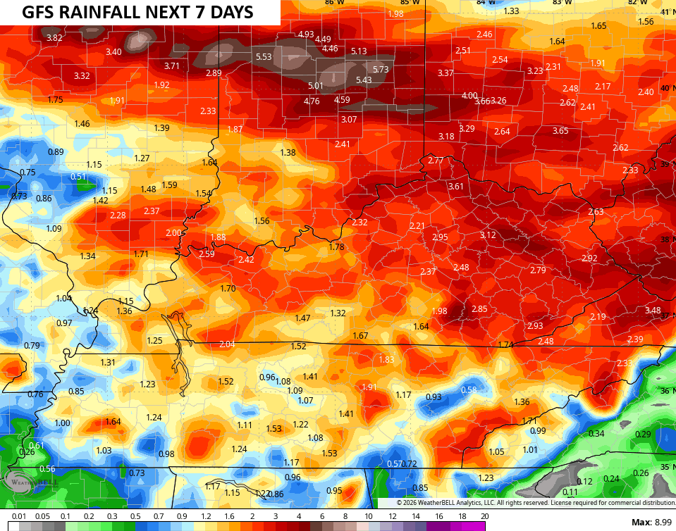
Once again, locally heavy rains may cause high water concerns, and a few storms may be strong or severe. Check out the rainfall forecasts for the next 7 days from the GFS and Canadian…
As always, I leave you with your daily tracking toys…


Current watches

Possible Watch Areas

Make it a magnificent Monday and take care.

Thanks Chris. Hoping that the western high pressure ridge stays to our west, and the models are correct on rainfall. If the western high pressure should happen to retrograde towards the east, it would merge with the Bermuda High giving our area drought conditions.
I hope they’re not correct.
Here is the link for the summary of last week’s heat wave and severe weather events for the Chicago Metro Area. There were four separate rounds of severe weather from July 2nd to July 4th. https://weather.gov/lot/2026_07_02-2026_07_04_ActiveWeather
Mike, Thanks for the link. Very interesting how the Bermuda High has your area in storms and rains. Here in Kentucky we are in the grips of the Bermuda high, with calm winds and sinking air. Stormy just around the northern and western edges of the high. A few areas in Kentucky are receiving brief showers where there is weakness within the high pressure, where the air is rising and condensation is taking place in the atmosphere.
Link to storm reports in your area Mike. A very detailed report : )
https://climateimpactcompany.com/u-s-sunday-report-1602-severe-weather-event-reports-fri-sat-more-mid-atlantic-severe-storms-today-excessive-rainfall-event-northeast-u-s-extends-to-tuesday-2/
Thanks Mr. Schroeder!
Fortunately, our area is drying out for the next three days, with temps in the low to mid 80s. We had so many broken tree branches from the strong winds from the storms, I spent over an hour a day for two days picking them up and putting them in lawn waste bags. At least our power stayed on, but for a brief three-minute outage.
Next chance of rain here isn’t until Thursday.
Your welcome Mike.
The latest update from the Climate Prediction Center shows that sea surface temperature increases in the equatorial Pacific continue to accelerate at rates that outstrip previous forecast estimates, and climatologists tracking El Nino believe that previous record levels were too conservative. This includes both the ultimate level of intensity and how long El Nino conditions will continue. Previous estimates of February 2027 will likely be extended to spring. Meanwhile, shifts in the jet stream over the northern hemisphere caused by El Nino are reinforcing the Bermuda high in the short term, but generating dips in the jet stream long term, which will result in instability as we get deeper into summer.
Joe, This is going to be a very strong El Nino event, like we had in 2015 – 16. It’s already effecting Florida with a bad drought and Wildfires. I think we will have one coming soon ?