Good Tuesday, everyone. Spiraling bands of showers and storms continue to spin across the region over the next few days, bringing the potential for local high-water issues. A bigger system arrives later in the week and weekend, keeping the flash flood threat going.
The upper-level system spawning the showers and storms is spinning through the region through Wednesday. The storms associated with this system could briefly pulse to severe limits and put down enough rain to cause local flash flooding.
You can see all this showing up on this animation that runs through Wednesday night…
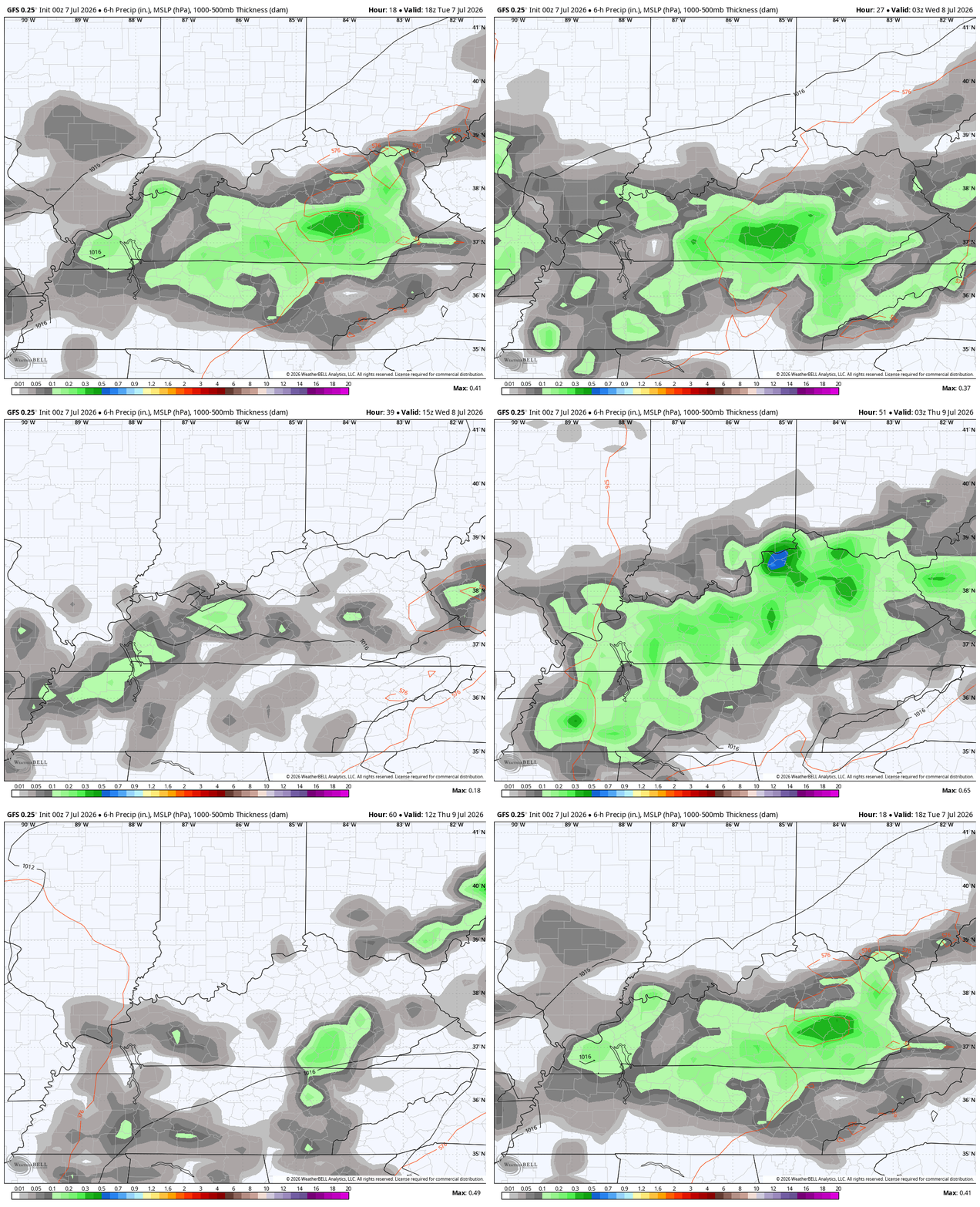
The next system then drops in later Thursday and hangs around into the upcoming weekend. Rounds of showers and storms will be noted during this time, bringing another threat for strong storms and flash flooding…
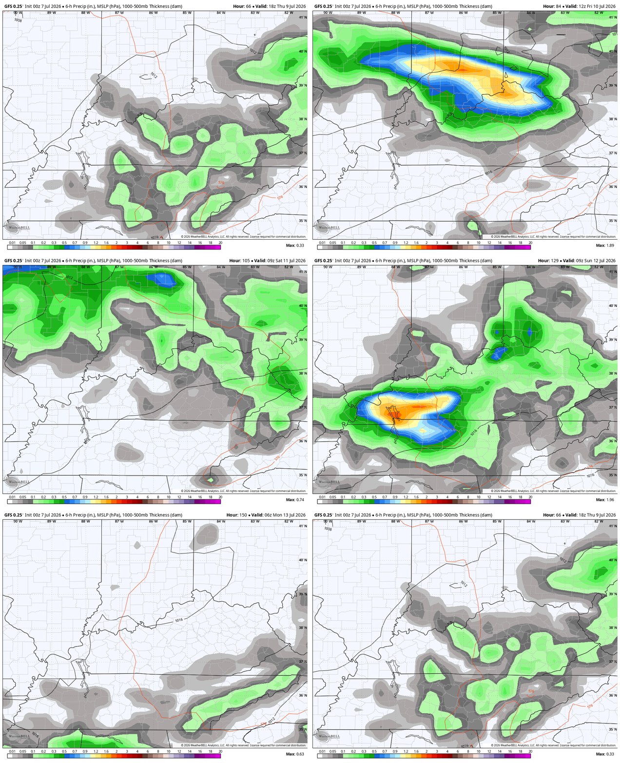
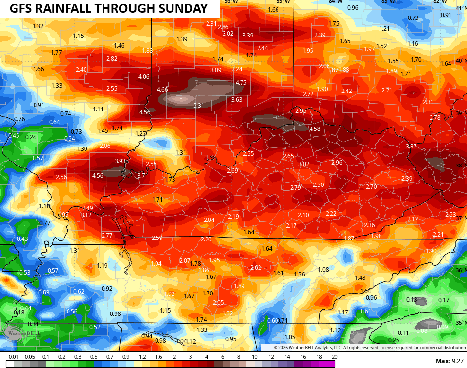
Several inches of rain will be possible through this weekend…
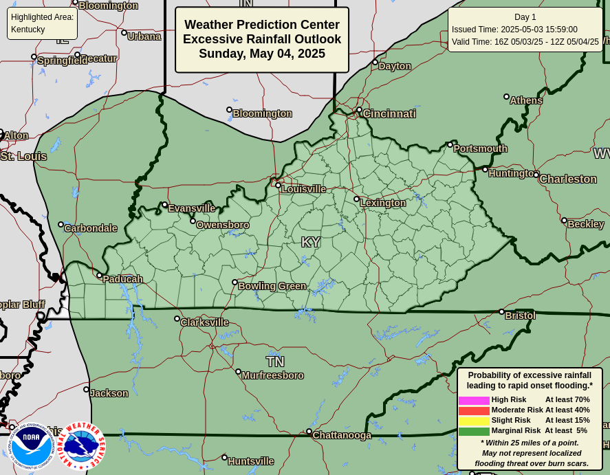
The Weather Prediction Center is highlighting the potential for high water issues through the start of the weekend. Here’s their day by day breakdown…
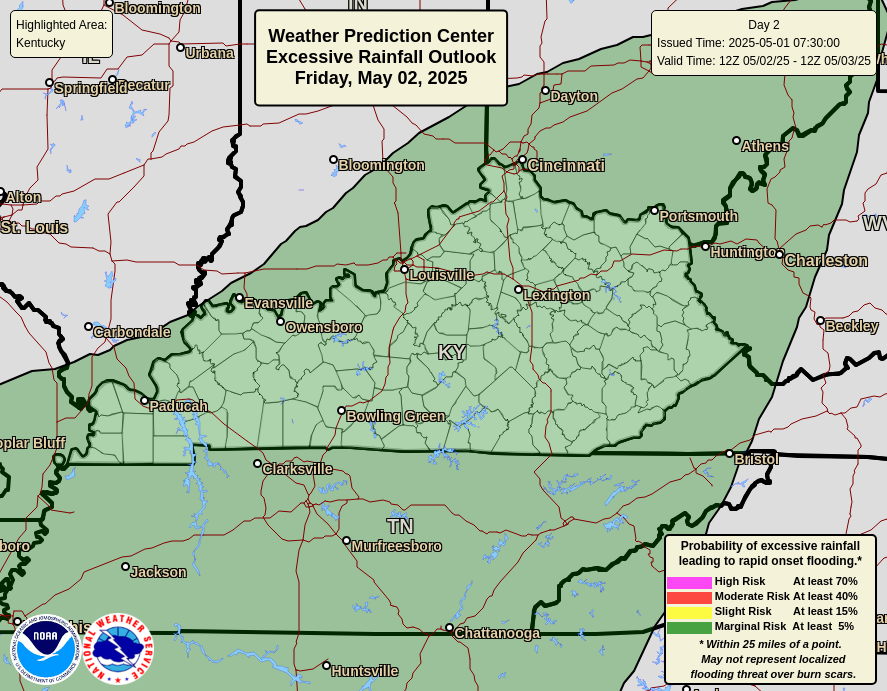
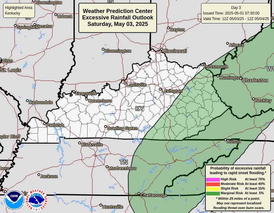

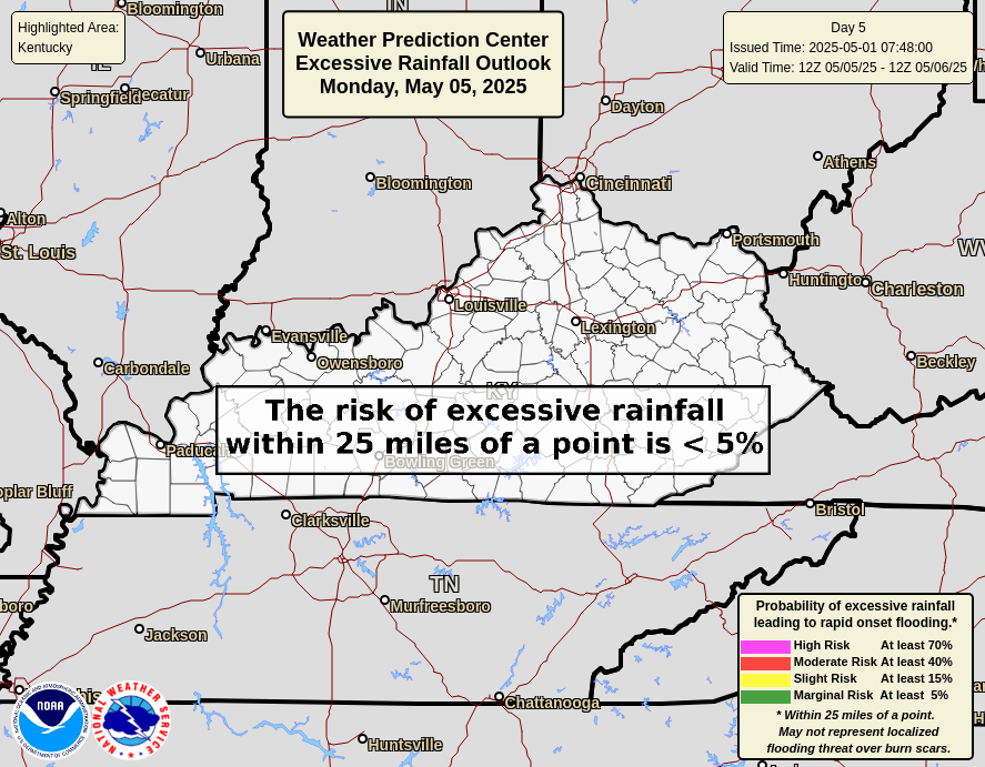
While all this is happening, a massive heat ridge flexes across the west and tries to spread east. It makes a run at us early next week, but a deepening trough drops into the east and crushes it…
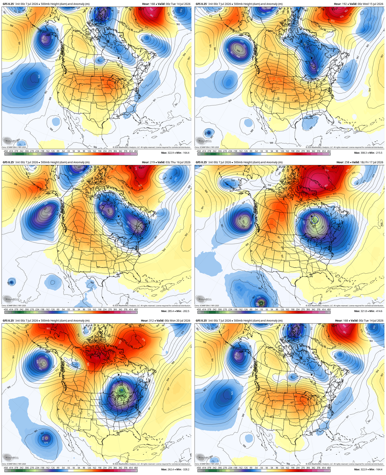
That’s a forecast model for the middle of July?? That looks more like the cold weather season than summertime.
As always, I leave you with your daily tracking toys…




Current watches

Possible Watch Areas

Make it a great Tuesday and take care.

I love seeing a trough pushing a heat ridge away. It warms my heart.
Lame
I hope the forecast is wrong.
Thanks Chris. I’m more concerned about all the Wildfires out West that are under that huge High Pressure Ridge. I wish they would receive the Troughs to alleviate that problem which could become a national disaster of Nature. I wouldn’t mind if the ridge moves our way and links up with the Bermuda High. Yes, we will have a Heat Wave, but I have never seen a cooler than normal July and August. Exception from, 1967 to 1969 was a cooler than normal Summer up in South Central Indiana. Could have been caused by Volcanic activity during that period.
Here’s the link to the Colorado Wildfires : )
https://www.frontlinewildfire.com/live-fire-map-track-wildfires-near-you/
Adding to the above : ) We need Above Normal Rainfall, over the entire Midwest and Southeast. Before the large high pressure ridge moves east and couples with the stronger than normal Bermuda High. Mother Nature, please no Wildfires anywhere.