Good Wednesday to one and all. Rounds of showers and storms are back in the Bluegrass state and are bringing the threat for flooding along for the ride. As a matter of fact, the threat for flash flooding and a few severe storms will increase over the next few days.
Let’s break down how things may play out:
- A small low pressure moves across the region today and tonight, sparking showers and thunderstorms.
- These storms will put down locally torrential rains, causing flash flooding in some areas.
- We need to watch for a bit of an uptick in the action later tonight and Thursday morning.
- A much bigger system then drops in late Thursday and hangs around into the upcoming weekend.
- Clusters of strong to severe storms will be possible with this setup. Damaging wind will be the main threat.
- These storms will bring an increase in the flash flood threat for the entire region.
- Several inches of rain may fall in several locations through early Sunday.
Many of the forecast models have been showing some ugly looking rain maps over the next several days, but they differ in terms of placement and amounts. That’s pretty common, but the signal is certainly there for some flooding issues. Take a look…
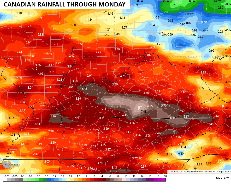
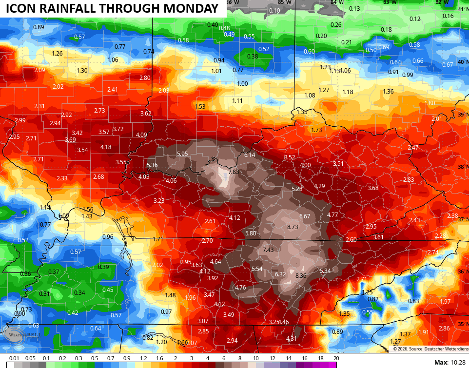
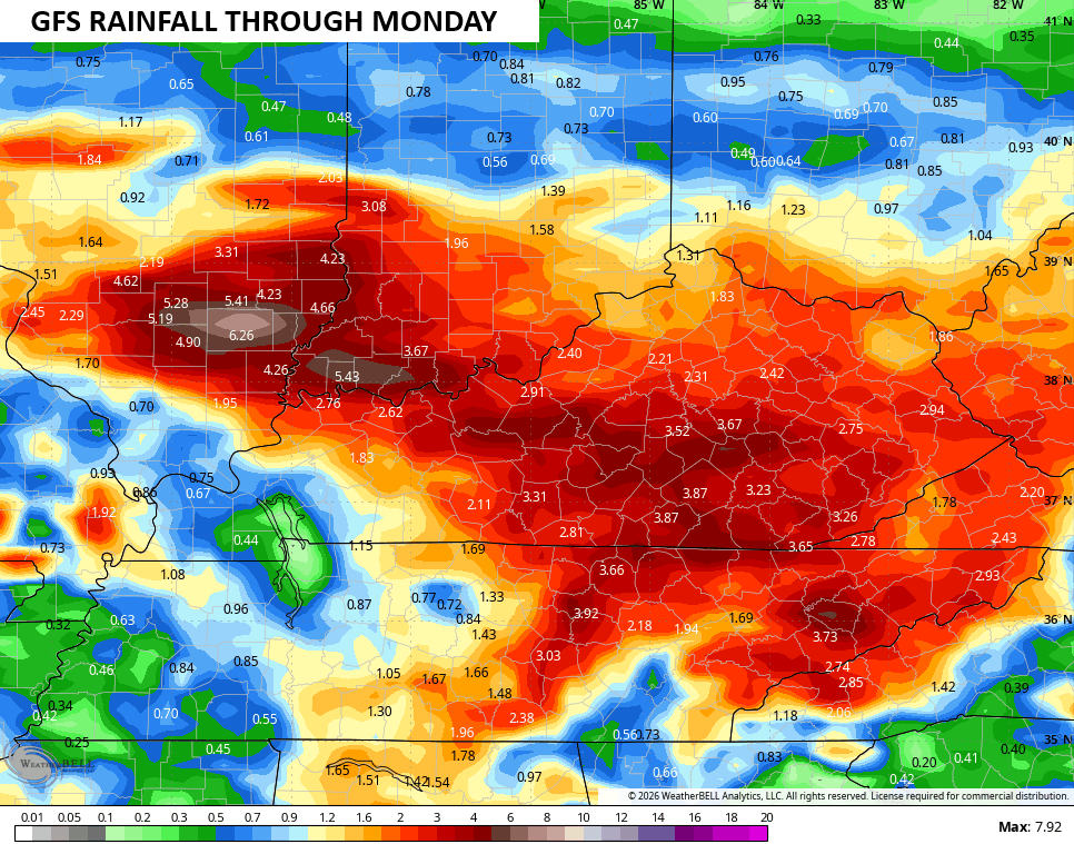
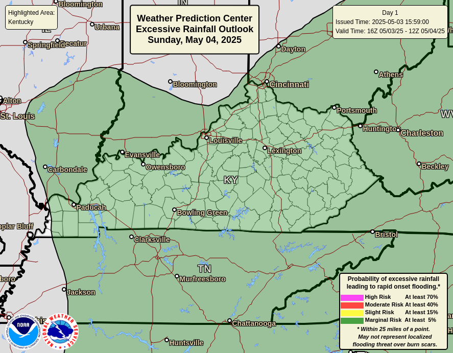
In terms of the daily threats, let’s start with the flash flood potential from the Weather Prediction Center…
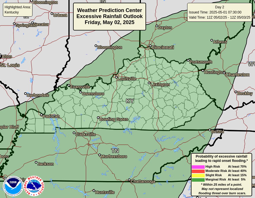
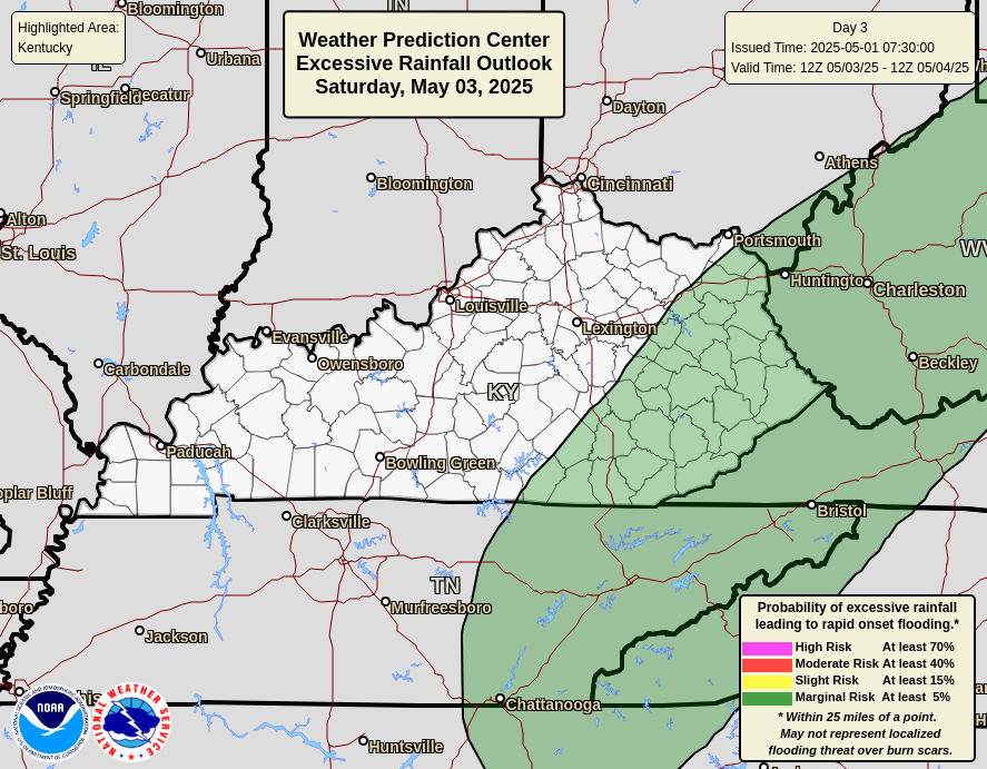

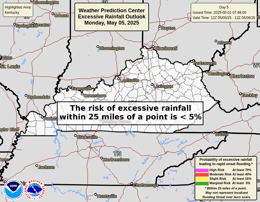
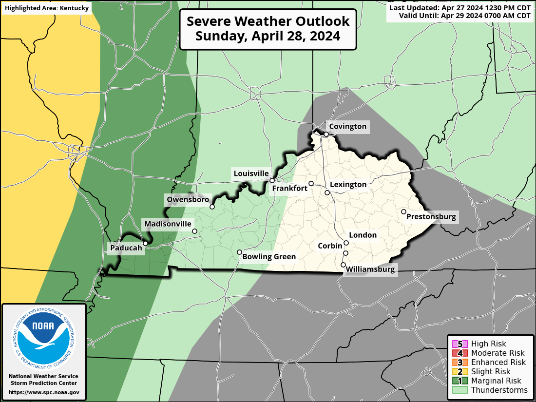
The Storm Prediction Center is showing the low-end potential for severe storms Thursday and Friday. Here’s a look…

As always, I leave you with your daily tracking toys…




Current watches

Possible Watch Areas

Make it a wonderful Wednesday and take care.

Thanks Chris. Going into town this morning, the visibility was almost zero. A dense Fog Advisory should have been issued for the entire County of Taylor. Late yesterday, we had loud thunder, and three drops of rain on a brick bat. Hopefully, we will have a better chance today ?
Hoping the models don’t verify.
Enjoying 98° with a 104° heat index in Austin, Texas on my work trip. 🙂
Make that 100 and 106!
No thanks Jeff.