Good Saturday, everyone. The potential for significant flash flooding issues ramps up this weekend as a slow-moving system spins through the region. In addition to the flooding, the potential is there for a few strong or severe storms.
Let’s start with the potential for flash flooding. Rounds of storms will continue to spin through here today, but it’s not raining all day. When it does rain, these storms will put down a tremendous amount of rain ins a short amount of time. This will lead to areas of flash flooding.
The Flood Watch continues for most of the region through the weekend…

As this system continues to slowly spin to our south, it has the potential to spit out some big time rains across the region through Sunday night and early Monday. I’m growing more concerned about southern and southeastern Kentucky during this time.
You can see how the focus of the heaviest rains shows up a bit differently on each model with the bullseye on the south and southeast…
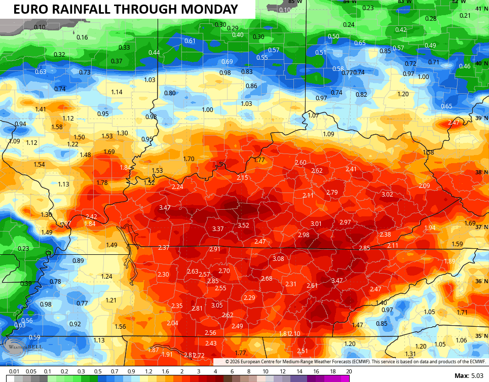
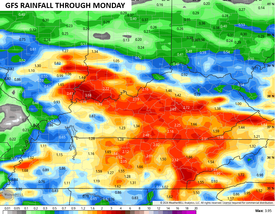
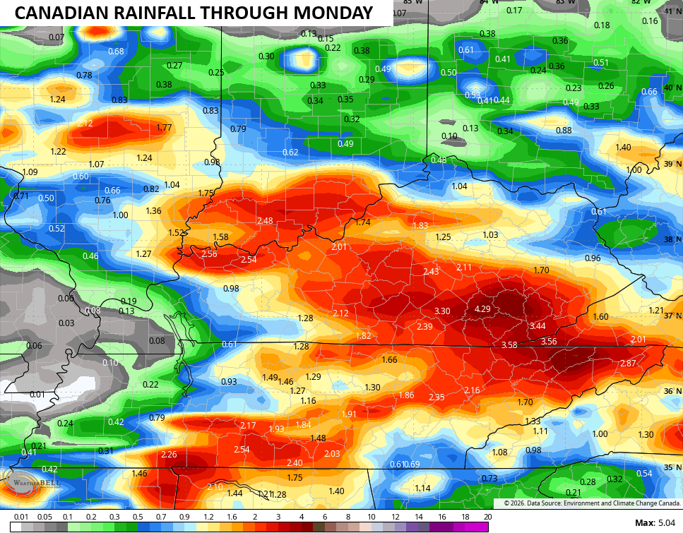
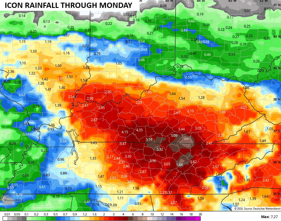
The Excessive Rainfall Outlook from the Weather Prediction Center continues to highlight the flood threat today through Monday…
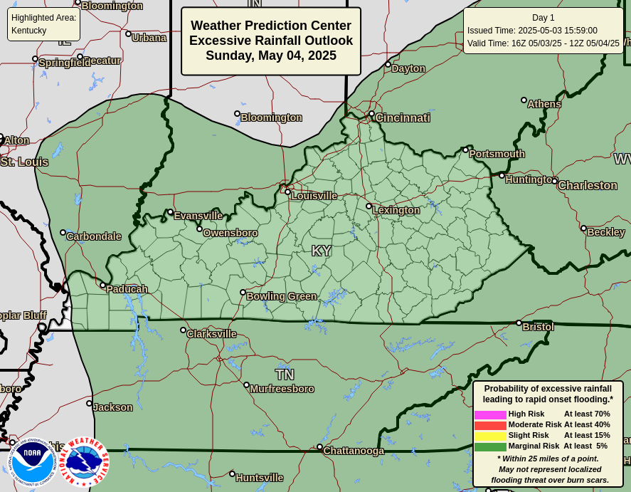
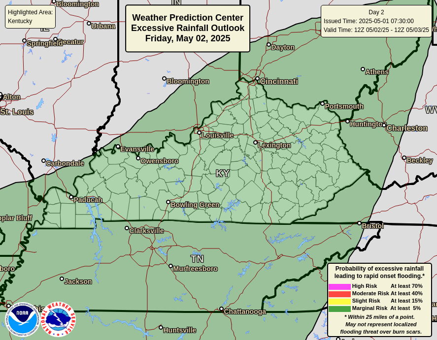
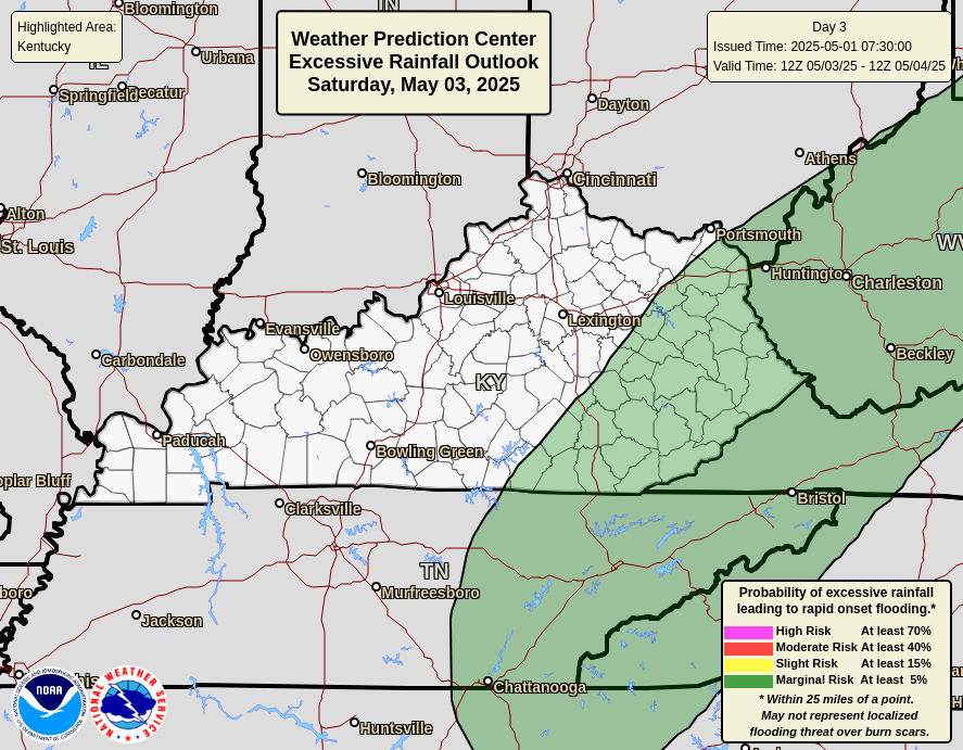
The severe storms threat today is the greatest in the west and south. Once again, the Storm Prediction Center has a Marginal Risk to a Slight Risk out…

As always, I leave you with your daily tracking toys…



Current watches

Possible Watch Areas

Make it a sensational Saturday and take care.

Thanks Chris. Not our usual Summer weather pattern. Really starting to see a definite change in our climate.
The loud storm that rolled through here this morning dropped 1.77 inches at my house. I hope the next round isn’t as generous with the rains.
We received some Thunder last night, but only managed to pick up 0.01 ” of rain. The other day we received 1.25 ” so we are good on soil moisture.
Just wait til the tap shuts off.
And it will.
The July ENSO update is out, which states that El Nino continues to strengthen, and confidence is high that El Niño will continue well into 2027. The report also states that there is an 81% chance for a very strong El Niño during October-December, one that is likely to rank among the largest El Niño events in the historical record, going back to 1950.
El Niño’s have always presented a challenge to forecasters, and as our climate grows warmer we can anticipate changes in its commonly observed effects, such as the northward shift of the polar jet stream, which can lead to the establishment of heat domes, and a strengthening of the Bermuda High over the Mid-Atlantic, New England, and into the Canadian maritime provinces. We can also expect to see reduced hurrican activity in the Atlantic, and an increase in Pacific hurricanes and cyclones.
https://www.ospo.noaa.gov/products/ocean/sst/anomaly/
Exactly Joe.
Which is why the tap will eventually shut off.
The Southeast ridge ( Bermuda High ) has really broken up this latest rain event.
Richmond had some showers earlier today.