Good Sunday, everyone. It’s another day of potential flash flooding as rounds of showers and storms spin around a low pressure. This system slowly crosses the region today and begins to slowly leave us alone to start the new week.
This low is spinning across southern Kentucky and northern Tennessee. Spiraling bands of showers and storms will continue to target the region today with the greatest threat for flooding being across the south and southeast. This map was made Saturday afternoon to show the flooding potential from that point into today…
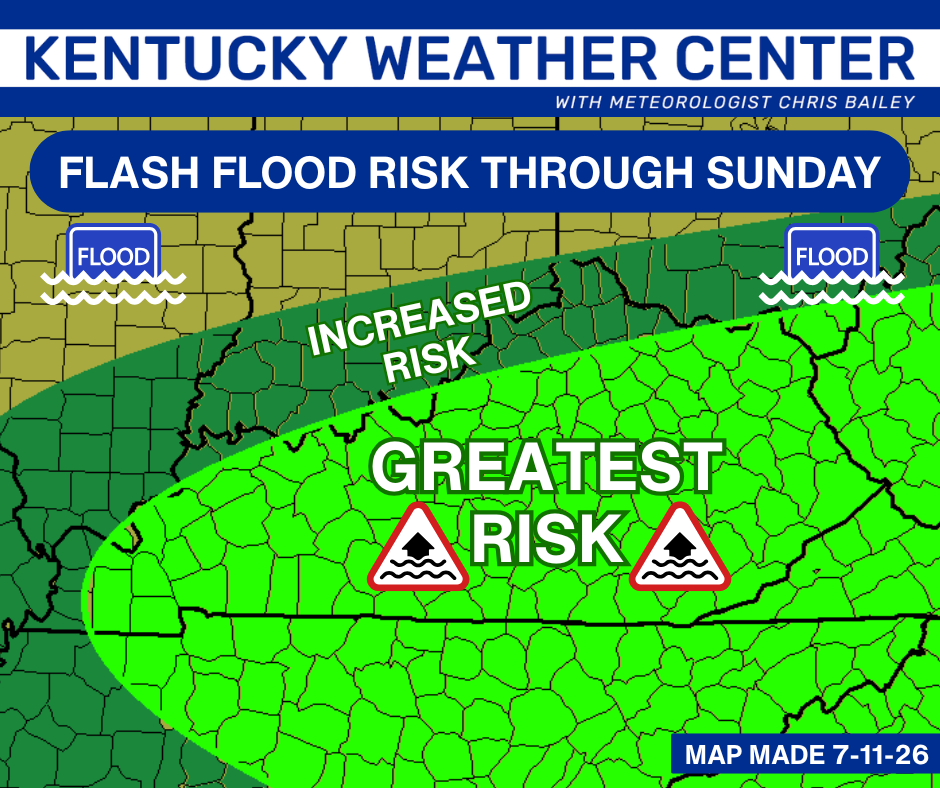
Several inches of rain will fall in a short amount of time in narrow corridors, leading to the possibility of extensive flooding on a local scale.
A Flood Watch continues through the day for much of the state…

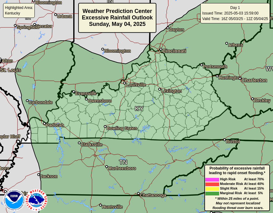
Here’s today’s Excessive Rainfall Outlook from The Weather Prediction Center…
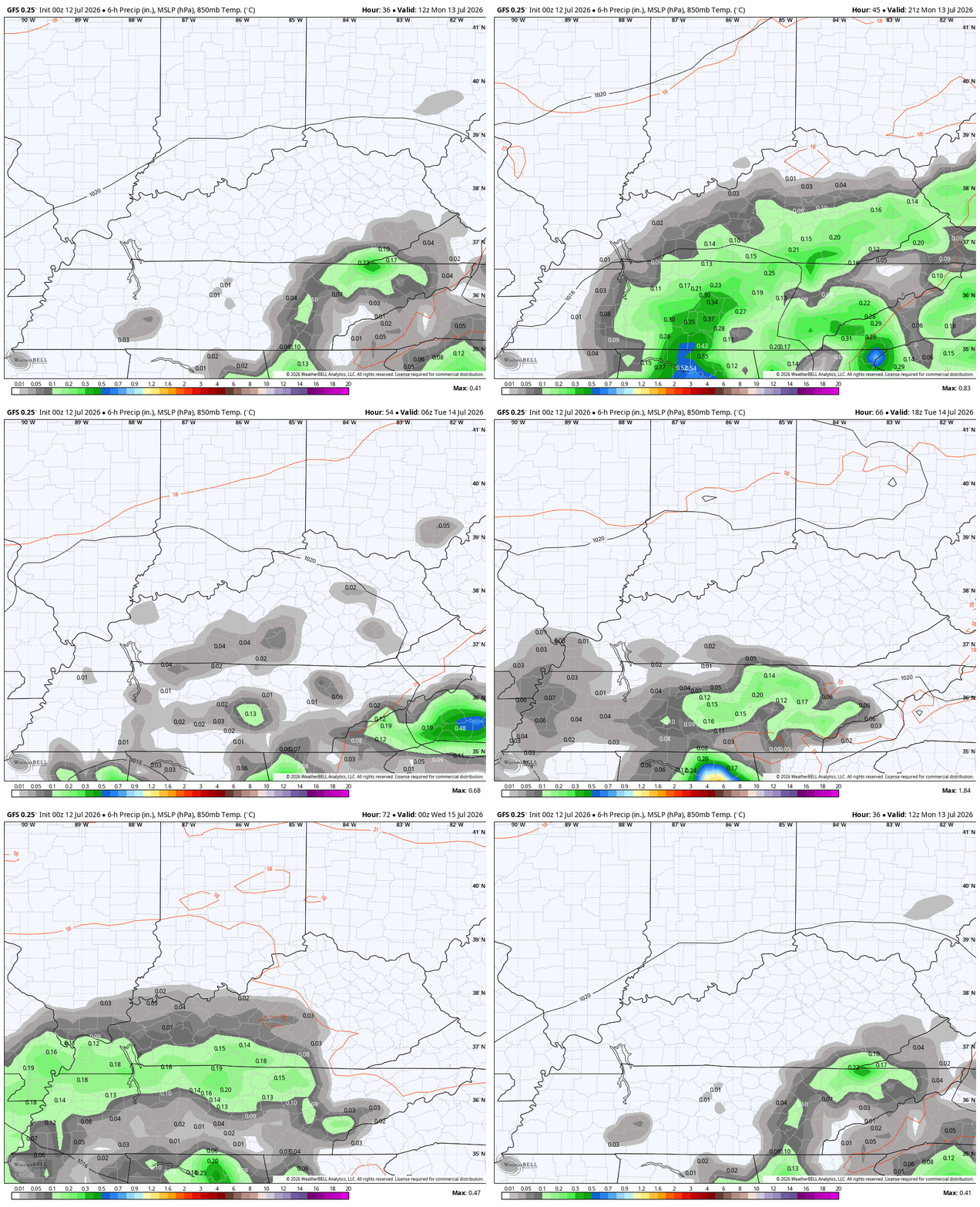
The low will continue to spin close enough for additional spiraling bands of showers and storms Monday into a part of Tuesday…
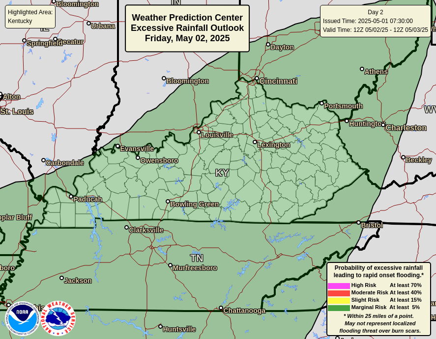
The WPC’s Excessive Rainfall Outlook for Monday looks like this…
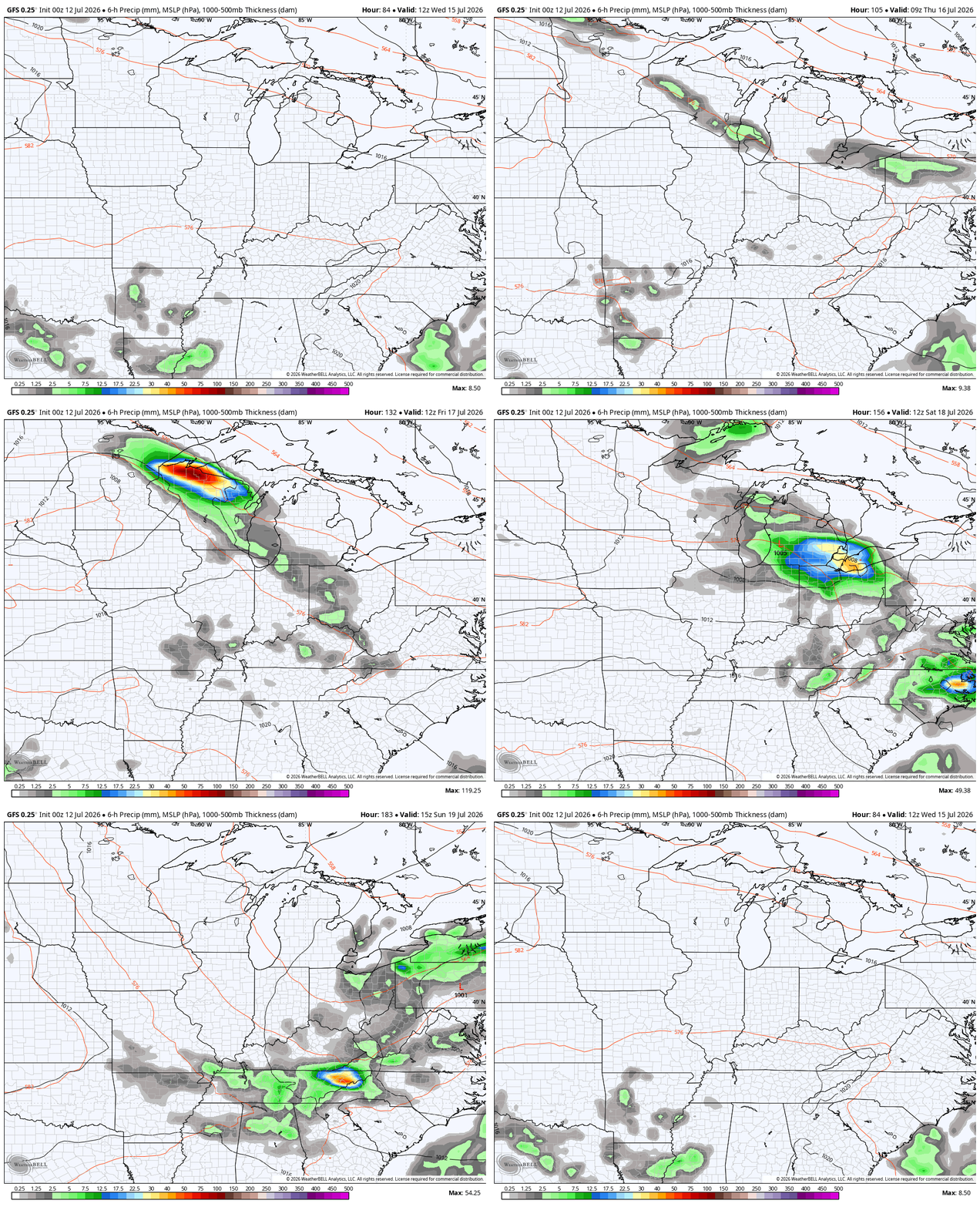
This spin may actually fire back up later in the week and combine with an approaching cold front from the north. Those two in tandem can bring more in the way of hefty rains in here. This animation goes from Wednesday through Sunday…
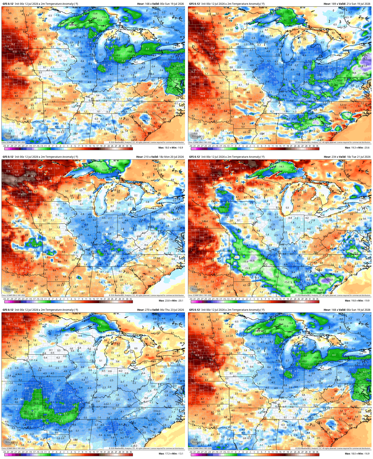
This setup ushers in below normal temps by next weekend into the following week…
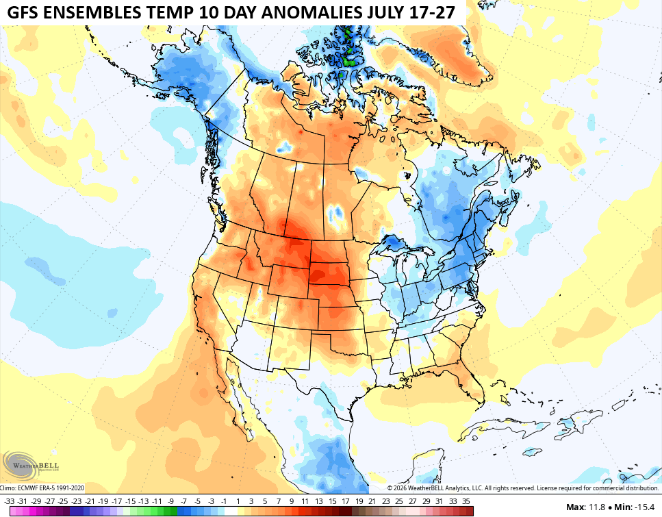
Looking farther down the road, we continue to see signs of a deepening trough across the eastern half of the country. While this is happening, some big time heat is likely across the west. This 10 day departure from normal map from the GFS Ensembles and runs from July 17-27…
As always, I leave you with your daily tracking toys…



Current watches

Possible Watch Areas

Make it a sensational Sunday and take care.

I will celebrate when it stops raining for at least a week. It’s coming very soon.
Yeah, Also some Sunshine please.
And low humidity.
That and sunshine! I’m not rooting for a 2012 type drought, to be fair.