Good Thursday, everybody. Normal mid-July steam is about to be accompanied by some summer storms as our wet pattern rumbles on. The storms will really flare up over the weekend, but things won’t be a total washout by any means.
Let us begin with today and roll forward. Highs out there today are in the upper 80s to low 90s again with scattered showers and storms going up, especially across central and western Kentucky.
This action increases as we hit Friday and Saturday as an old friend pays a return visit to the Commonwealth. It’s the ghost of the low that rolled brought the flash flooding last weekend and into Monday. That low moved across Kentucky last Sunday then hit the southern Appalachian Mountains Monday and Tuesday. That low then drifted west to near the Mississippi River and is slowly turning back to the north and then east, right across Kentucky.
This boomerang of a low is super uncommon for any month and is rare for July. While it won’t have the juice it had last weekend, it can still bring some locally heavy rains in here over the next few days. This will be followed by a cold front dropping in from the north with a few more showers and storms on Sunday.
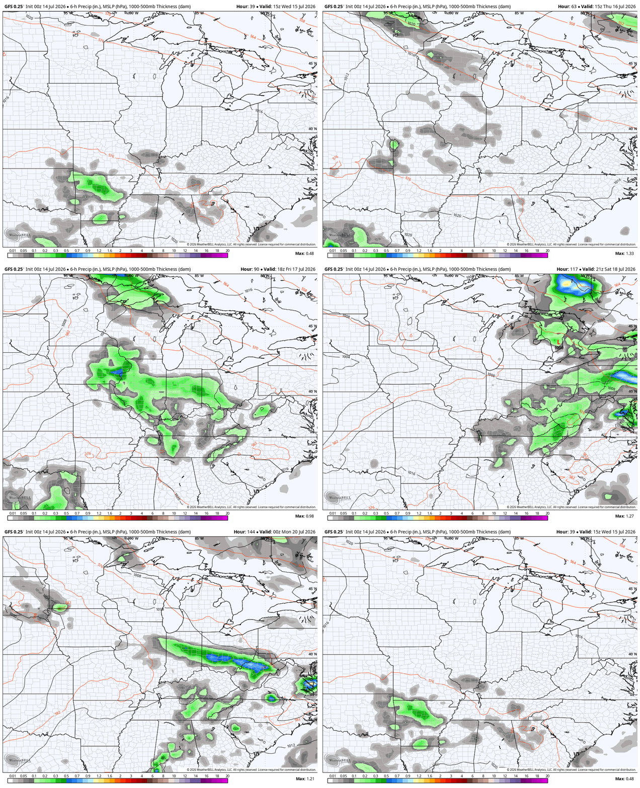
This animation shows all of this from this evening through Sunday…
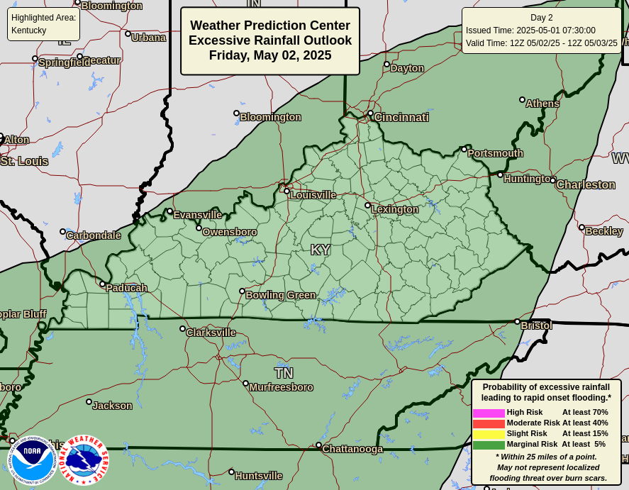
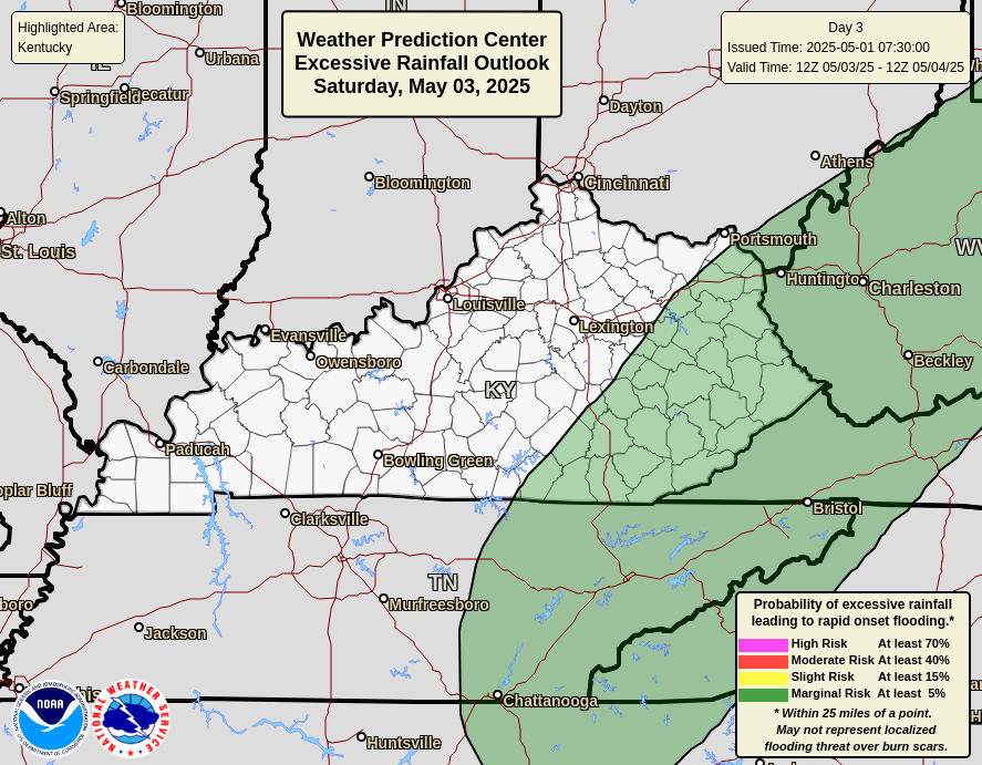
The Weather Prediction Center has a low-end threat for Excessive Rainfall for Friday and Saturday…
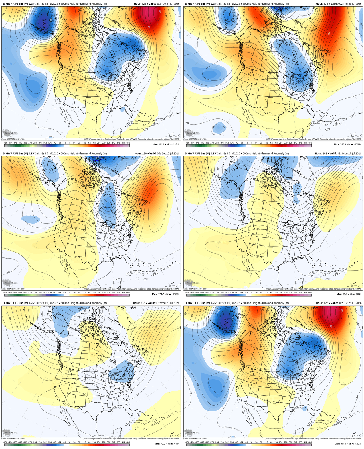
Another system drops in with more showers and storms early next week. That’s ahead of a deeper trough diving into the east with the models showing another trying to do the same a few days later…
As always, I leave you with your daily tracking toys…




Current watches

Possible Watch Areas

Make it a great Thursday and take care.

Thanks Chris. Very interesting. We shall see what happens.
The strong El Nino that has develop in the tropical Pacific will definitely have a positive or negative impact on our weather pattern here in the Ohio Valley. Hoping that it will be like the strong El Nino of 2015 – 16, but the PDO will have to come down to positive before that happens. As we get closer to the Winter Solstice, we should have a better idea on what could happen. Interesting article on the subject : )
https://climateimpactcompany.com/july-2026-monthly-enso-outlook-record-strength-el-nino-ahead-for-later-2026-2-2/