Good Wednesday to one and all. A little more steam is moving into Kentucky today as we get ready for more in the way of scattered showers and storms. These storms will roll through the weekend into early next week before a much cooler change blows in.
Temps out there today reach the upper 80s to low 90s with a mix of sun and clouds. The low spinning to our southwest will spawn another shower or storm across the west and south central parts of the state this afternoon and evening.
What’s left of this low spins back across the state later Thursday through Friday night, bringing an increase in showers and storms…
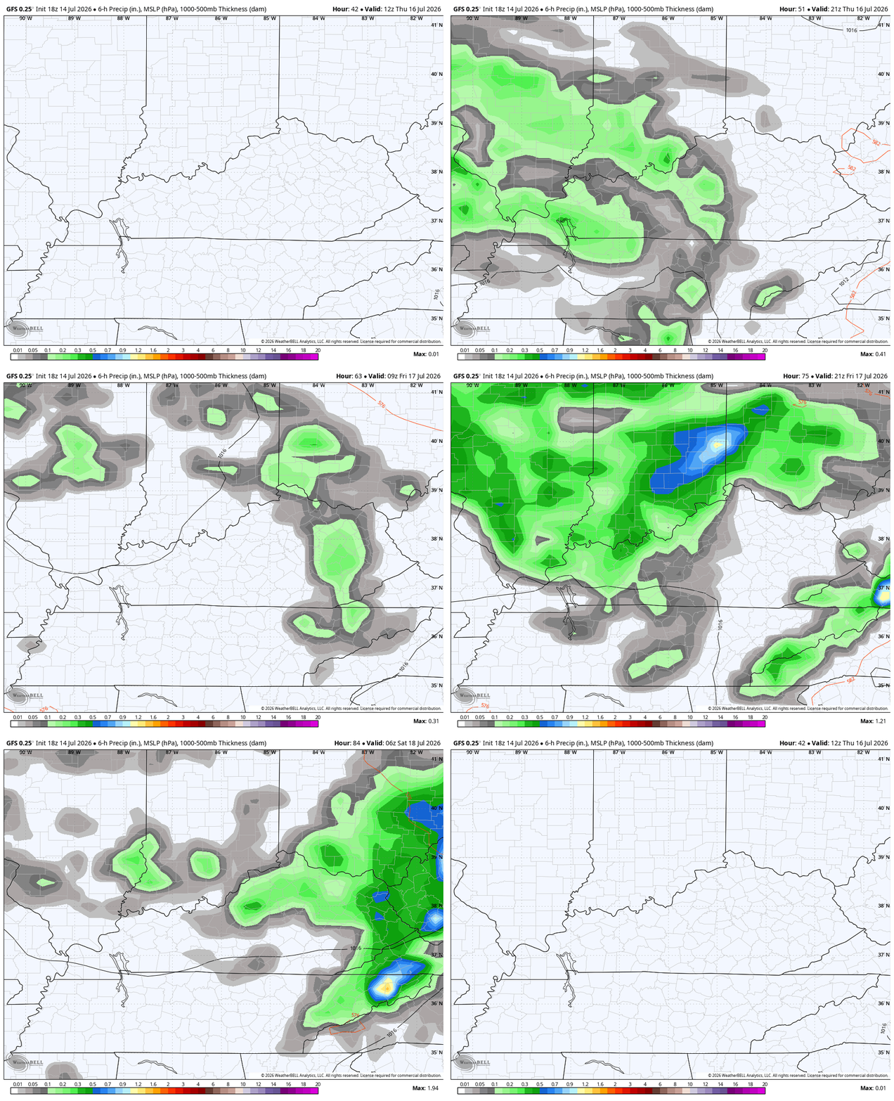
Some locally heavy downpours will be likely with this action.
From there, we watch rounds of showers drop through here from the weekend into next week. This action won’t be constant, but it will show up ahead of several cold fronts sweeping through here. This animation from the GFS runs from this Saturday to the following Saturday…
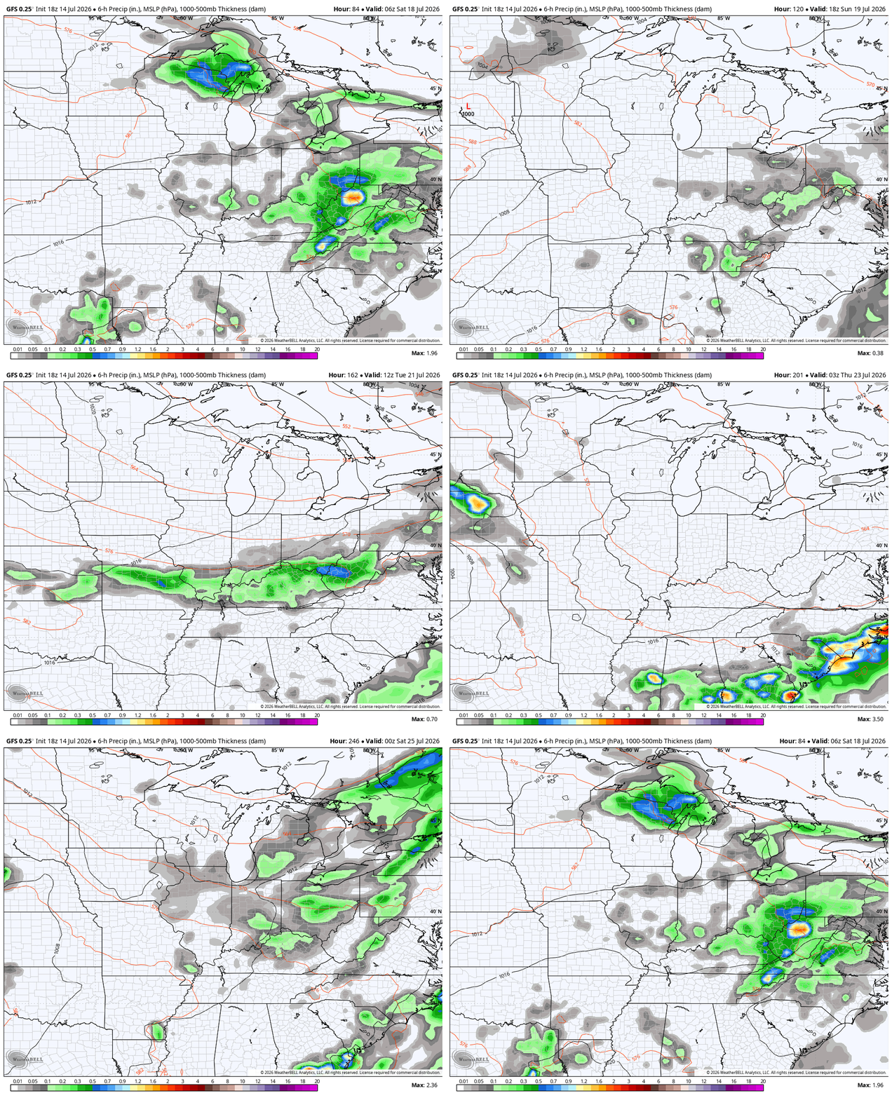
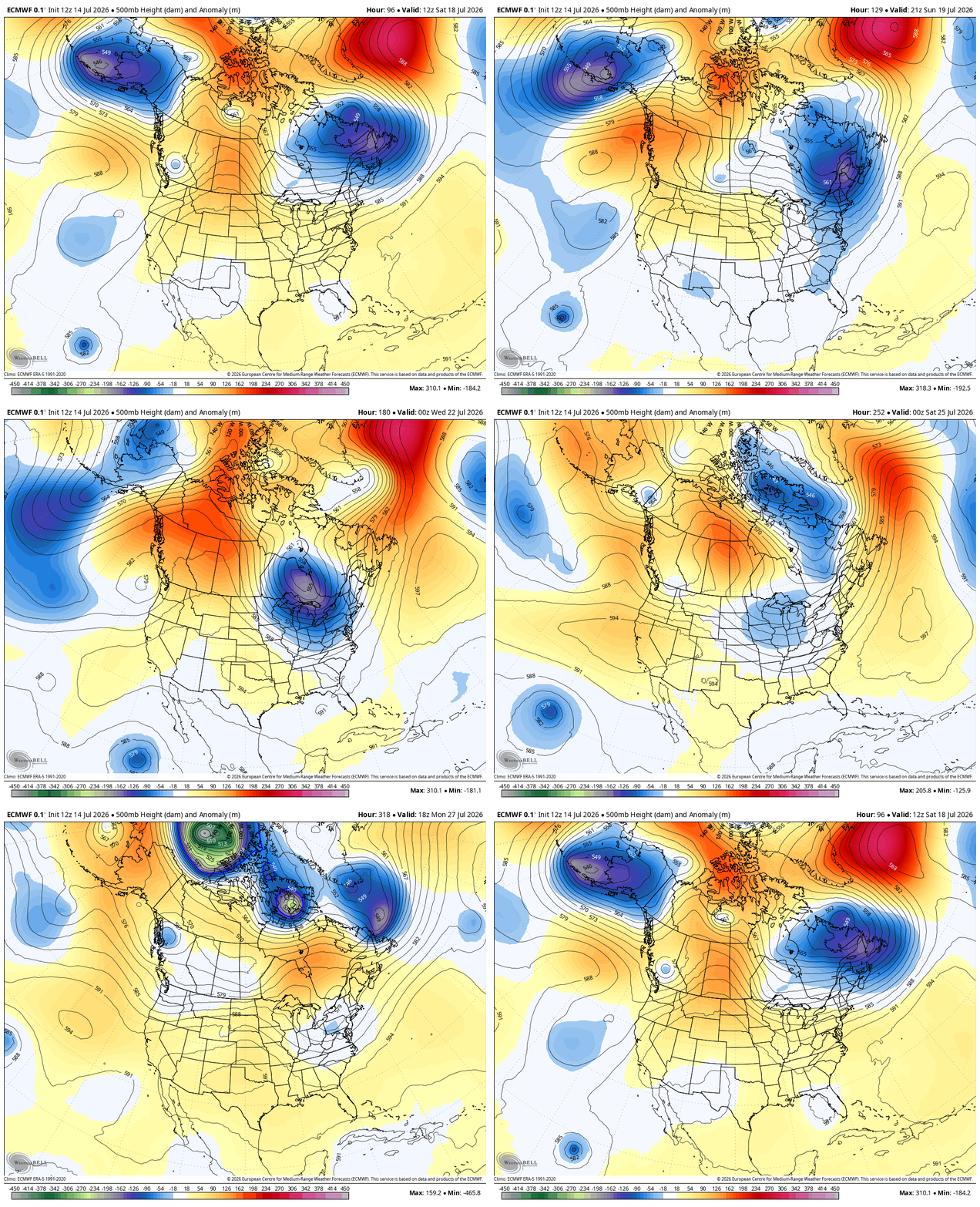
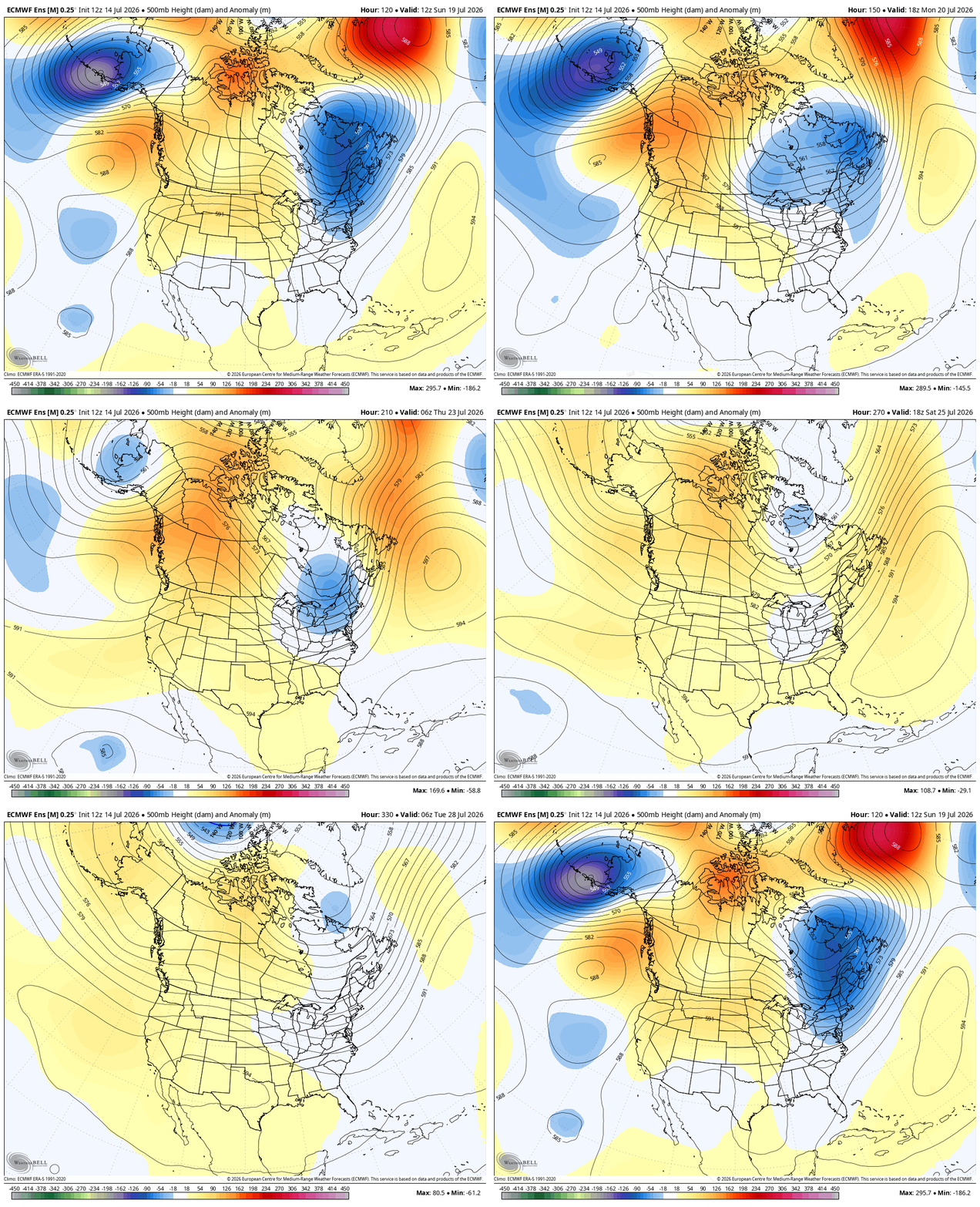
All of this is from a jet stream that looks to take several BIG dips into the eastern half of the country for the closing two weeks of the month. Here’s the EURO…
The Euro Ensembles is similar…
Those big dips would mean cooler than normal temps and the GFS is really amped up on well below normal temps for this 10 day stretch…
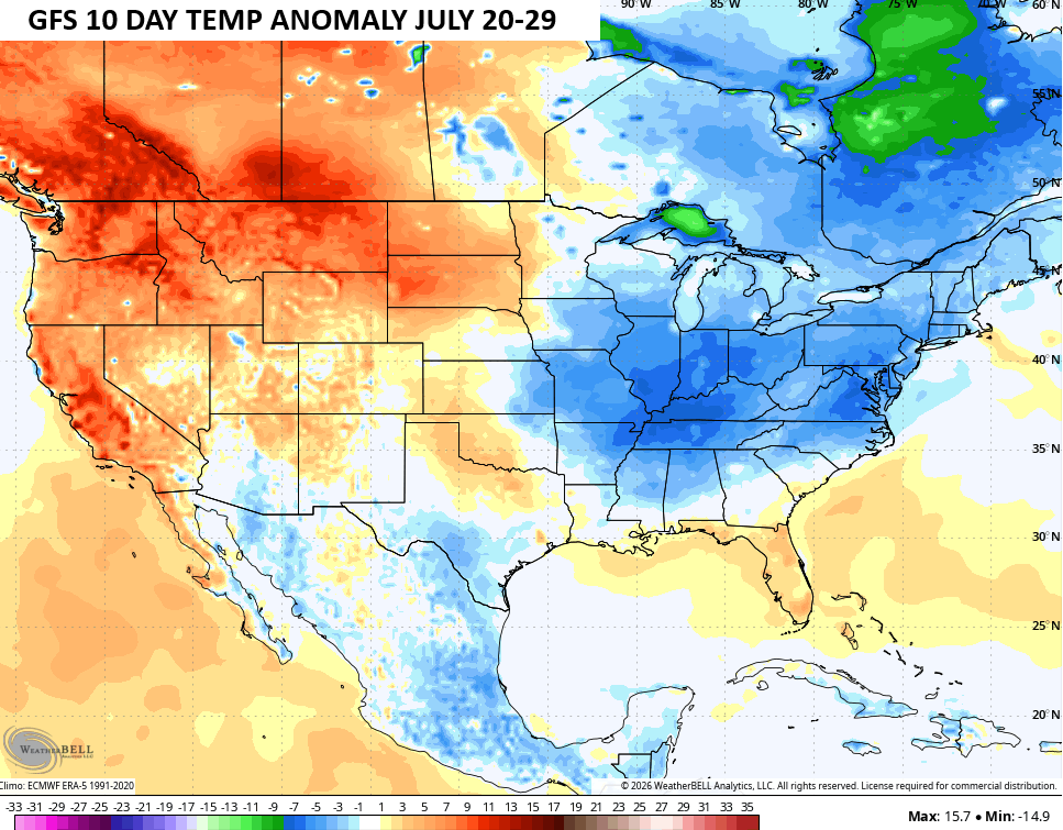
Woot!
As always, I leave you with your daily tracking toys…




Current watches

Possible Watch Areas

Make it a wonderful Wednesday and take care.

Thanks Chris. So far this Summer has been great for the Agricultural industry. May be a record harvest, but it’s weather in the Midwest that is subject to change either to the positive or negative mode. We shall see in the coming days.
Woot? What a bad take.
Jeff, I found a climate in the US that you would really like. Here’s the link : )
https://www.ventusky.com/phoenix
https://chatgpt.com/c/6a579db5-2980-83ea-8941-9cac3c8c1a1c