Good Tuesday, everyone. Our slow-moving upper low is going back to the west today, but it may very well come back at us later this week. That’s ahead of a series of potent cold fronts dropping in from the north as a big trough takes up residence into the eastern half of the country.
Temps today are mainly in the mid and upper 80s with 90 showing up along the Ohio River from Covington to Paducah. A couple of showers and storms may still spin up across south central and southwestern parts of the state.
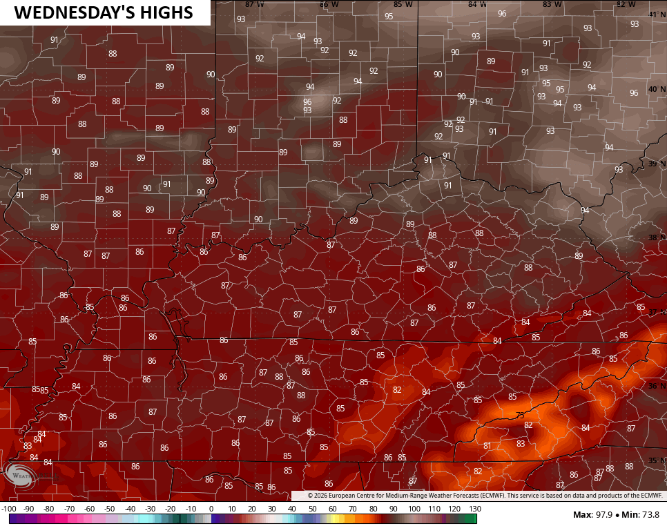
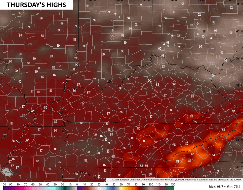
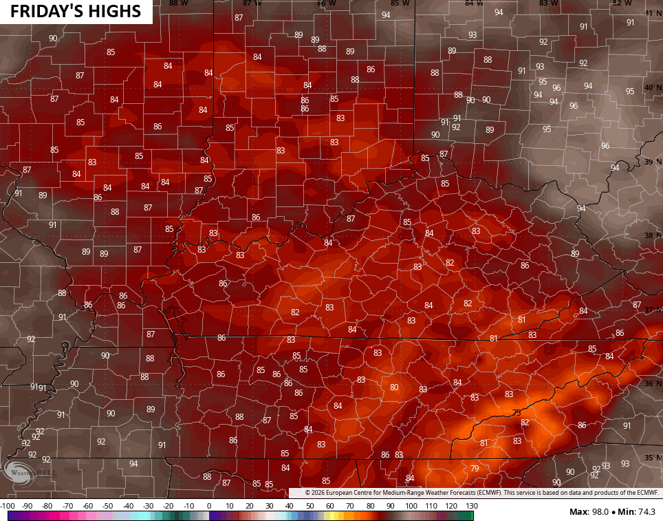
Temps jump up over the next few days, but the core of the heat stays well to our north and west and the WPC even shows this…

You can clearly see the hotter temps to our north over the next few days…
The same low that’s spinning to our west and southwest slows and starts to come right back at us for the second half of the week into the weekend. That will combine with a cold front dropping in from the northwest to produce showers and storms.
This animation starts Wednesday and goes through Monday…
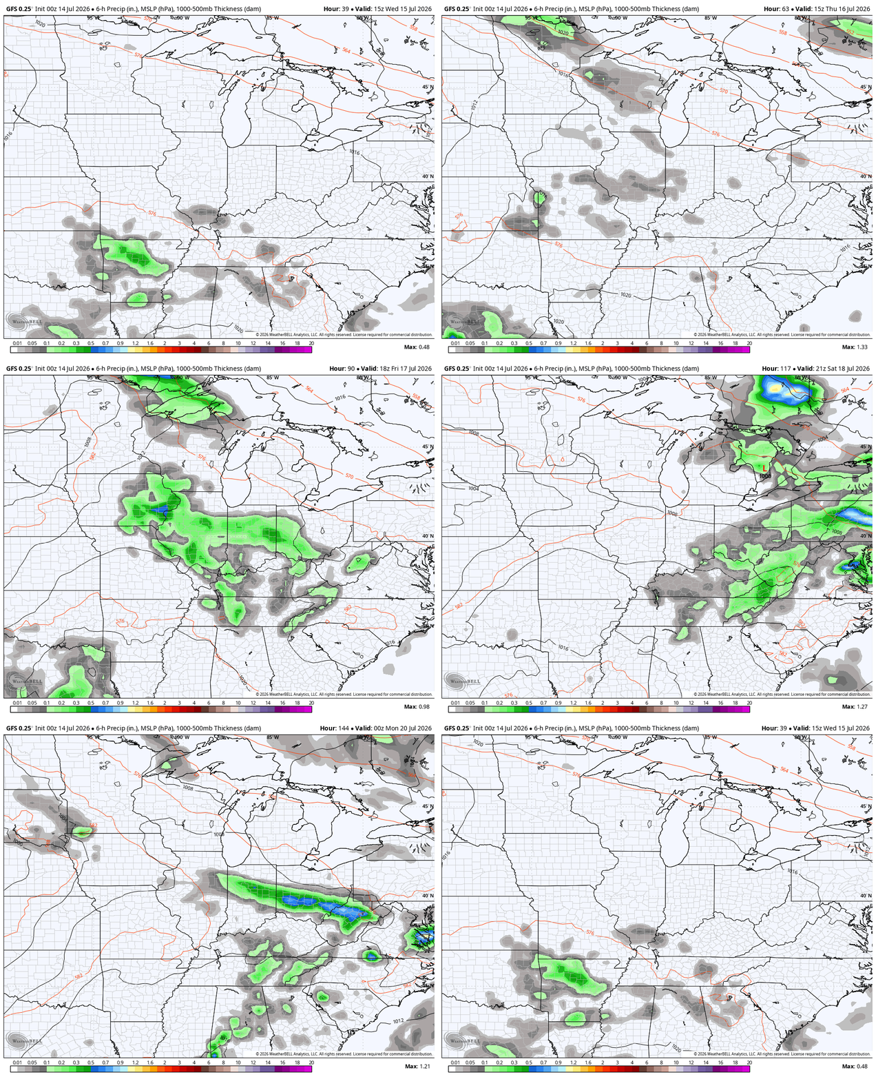
Yay… More rain and storms. Sigh.
On a better note, we will soon start looking ahead to fall and winter. I’ll share some early thoughts in the coming days.
As always, I leave you with your daily tracking toys…




Current watches

Possible Watch Areas

Make it a terrific Tuesday and take care.

Thanks Chris. Could this mild and wet Summer be the results of El Nino ? Looking forward to your Fall and Winter forecast.
The second half of summer will be dry and hot.
Winter will be dull and boring, just as I like it.
Looks to be a record breaking very strong El Niño especially this early..PDO is usually positive in these strong events but it’s currently negative..Maybe it will change later on..With increase in moisture from El Niño there’s always a chance to see a major snow storm.. Cfs2 model would agree..Interesting times coming up folks if you like tracking the weather..
Sometimes the PDO lags behind the developing El Nino. Last month the PDO was a negative 1.24, so it is moving towards the positive. It’s going to be a very interesting Fall and Winter. Meteorologist are getting very interested in what the results will be. The warmer oceans are adding tons of moisture to the atmosphere, that would make the Snow events much more intense than normal.
Here’s the PDO readings of the past and present : )
https://www.ncei.noaa.gov/access/monitoring/pdo/
A very rare intense heat wave is hitting the Upper Midwest this week. On Monday, International Falls, MN had a record-high for the date of 99 degrees, and Marquette, MI had a record-high of 96 degrees. Marquette is located right off Lake Superior, and International Falls is known as “The Nation’s Ice Box”.
Extreme Heat Warnings remain in place for much of the Upper Midwest through this evening.
I wish that heat would come here.
Yeah, too bad your work travels didn’t take you up there this week!
Mike, That’s a very strong subtropical high pressure system causing the intense heat wave. It’s a matter of time the large high pressure out to our west couples up with the Bermuda High to the east, then the Ohio Valley will be in that awful heat with high dew points and humidity. Can’t wait till Autumn weather arrives.
Here’s a link to the actual weather map. The satellite image shows how large that high pressure is : )
https://www.star.nesdis.noaa.gov/GOES/conus_band.php?sat=G19&band=GEOCOLOR&length=24
Here’s a link to the medium – range – forecast : )
https://climateimpactcompany.com/u-s-medium-range-forecast-excessive-heat-possible-days-6-10-northwest-eases-days-11-15-reborn-mid-south-u-s-days-16-20-2-2/