Good Friday, everyone. We continue to track an increase in showers and storms today, kicking off a weekend featuring more in the way of scattered boomers. This leads us into a pattern that may very well throw a September feel in here by the middle and end of next week.
Today’s scattered storms increase from west to east as a weak low pressure rolls back in. Hit and run high water issues may develop as these storms won’t be in any hurry to move along.
Scattered showers and storms will also be noted on Saturday, especially across central and eastern Kentucky. That will be followed by a cold front dropping in with a line of strong storms Saturday evening into early Sunday.
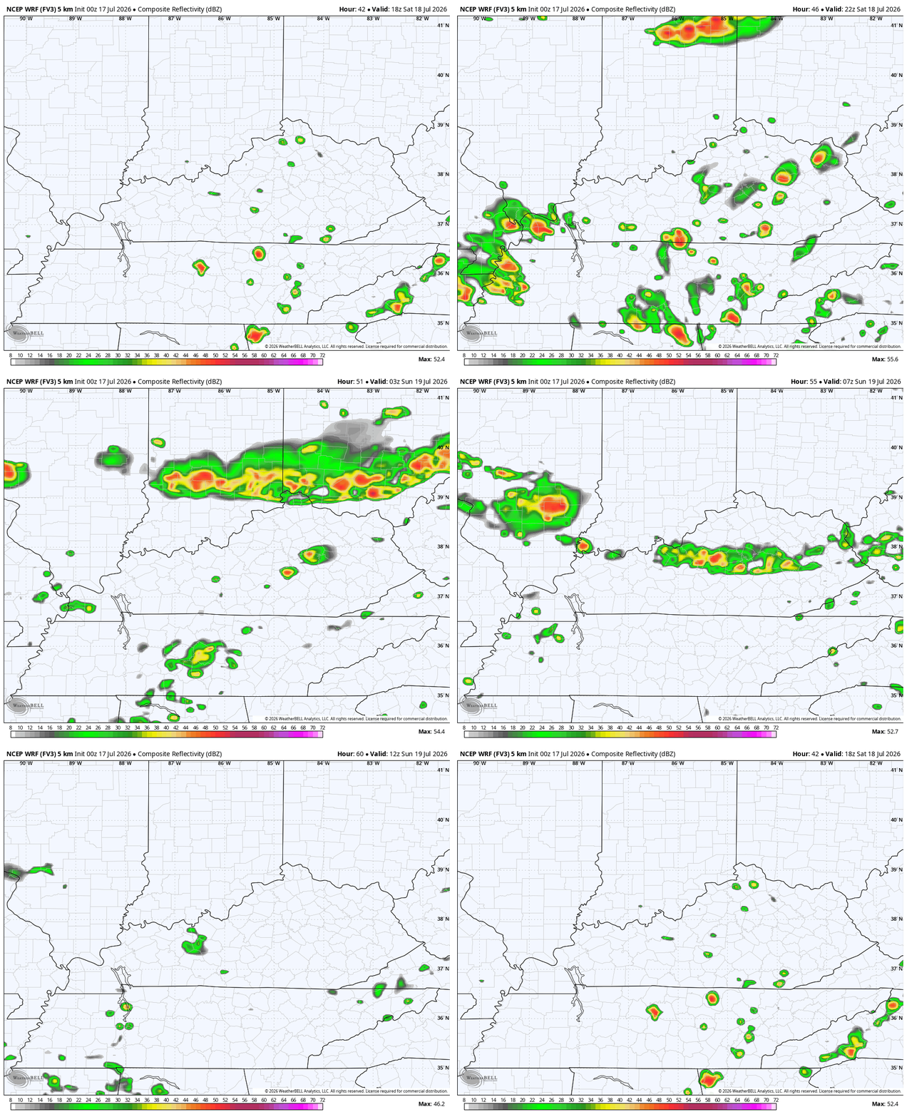
This future radar runs from Saturday afternoon through 8am Sunday…
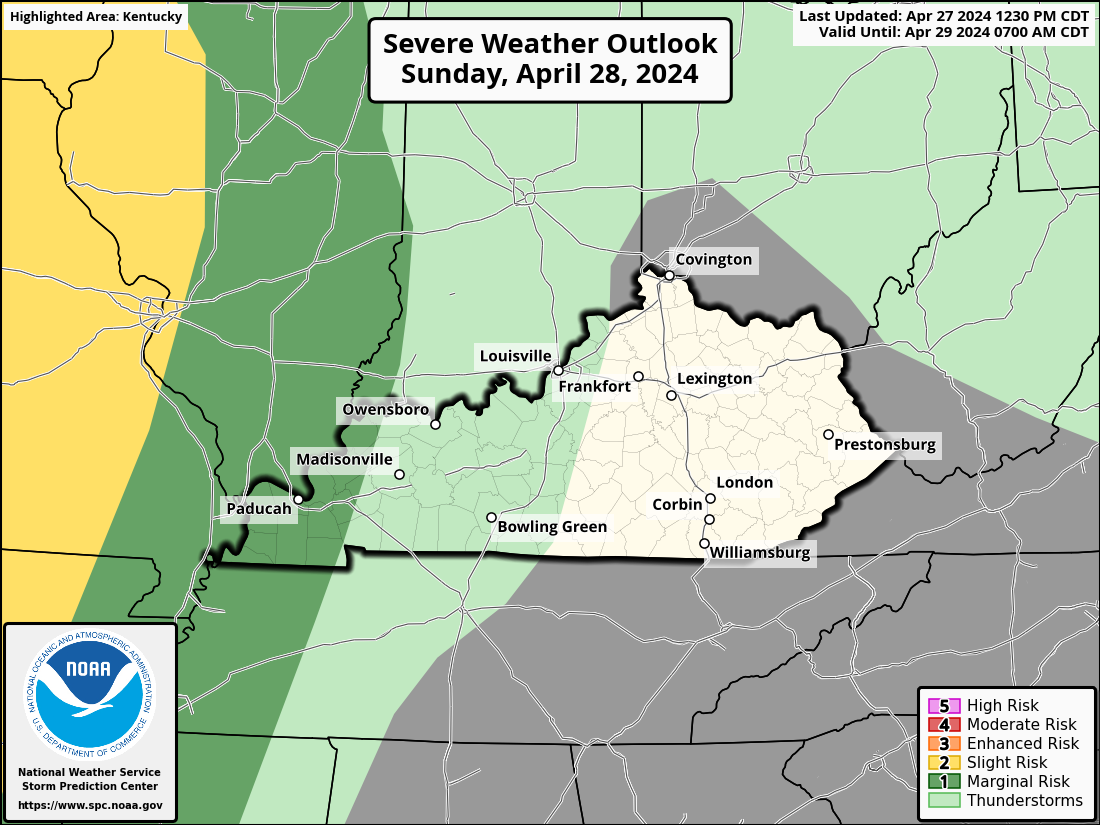
The Storm Prediction Center has a Marginal Risk to Slight Risk across our region, with the greatest threat to our northeast…
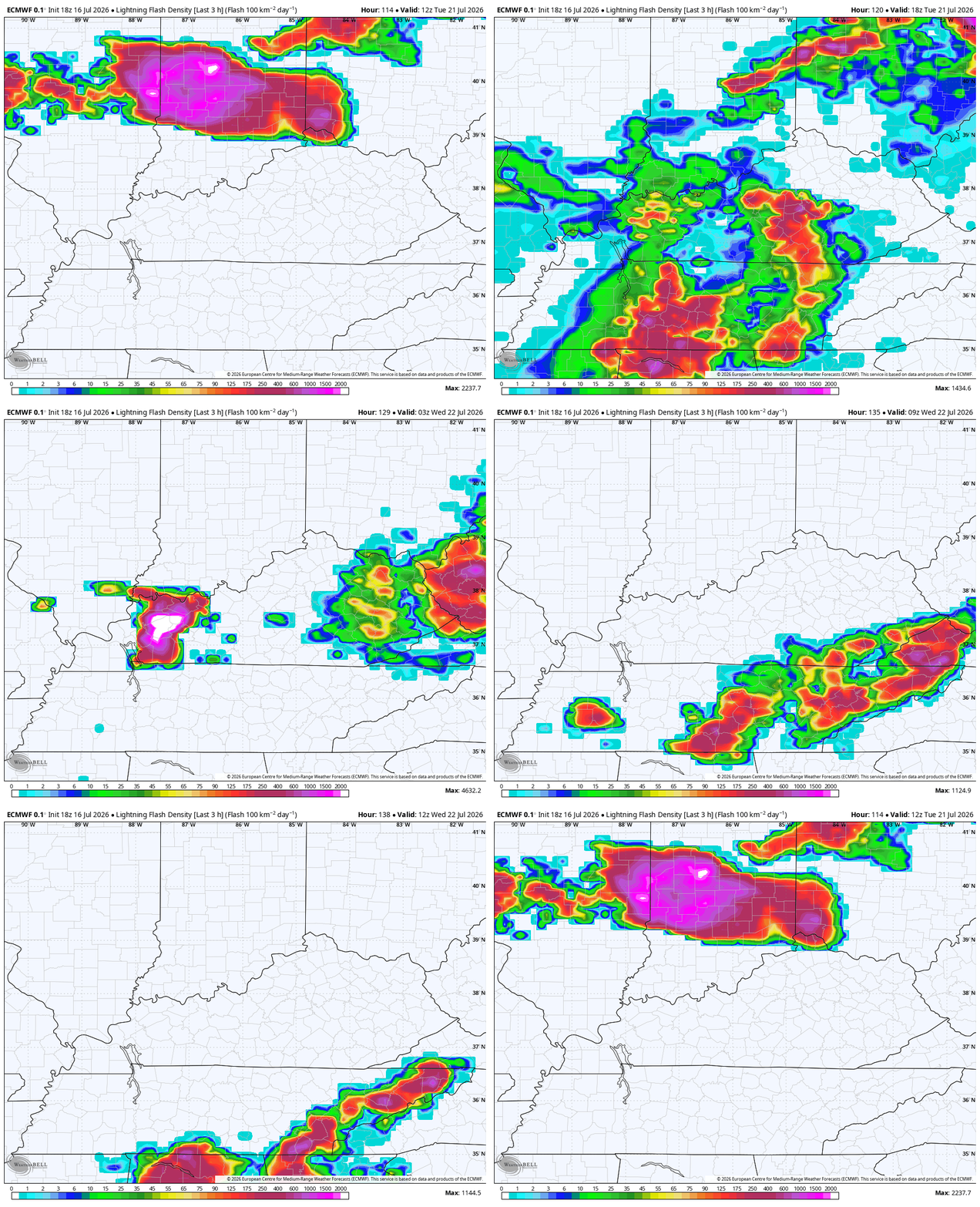
Scattered storms linger into the south on Sunday as a front works in and slows down. Temps surge again on Monday as we get set for an even stronger front to arrive by Tuesday. Some strong to severe storms will be possible along and ahead of this bounday.
Look at all the lightning the EURO is spitting out Tuesday and Tuesday night…
This front opens the door to some VERY pleasant Canadian air that will bring us a taste of September…
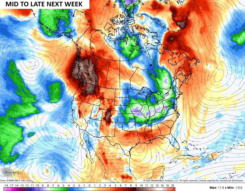
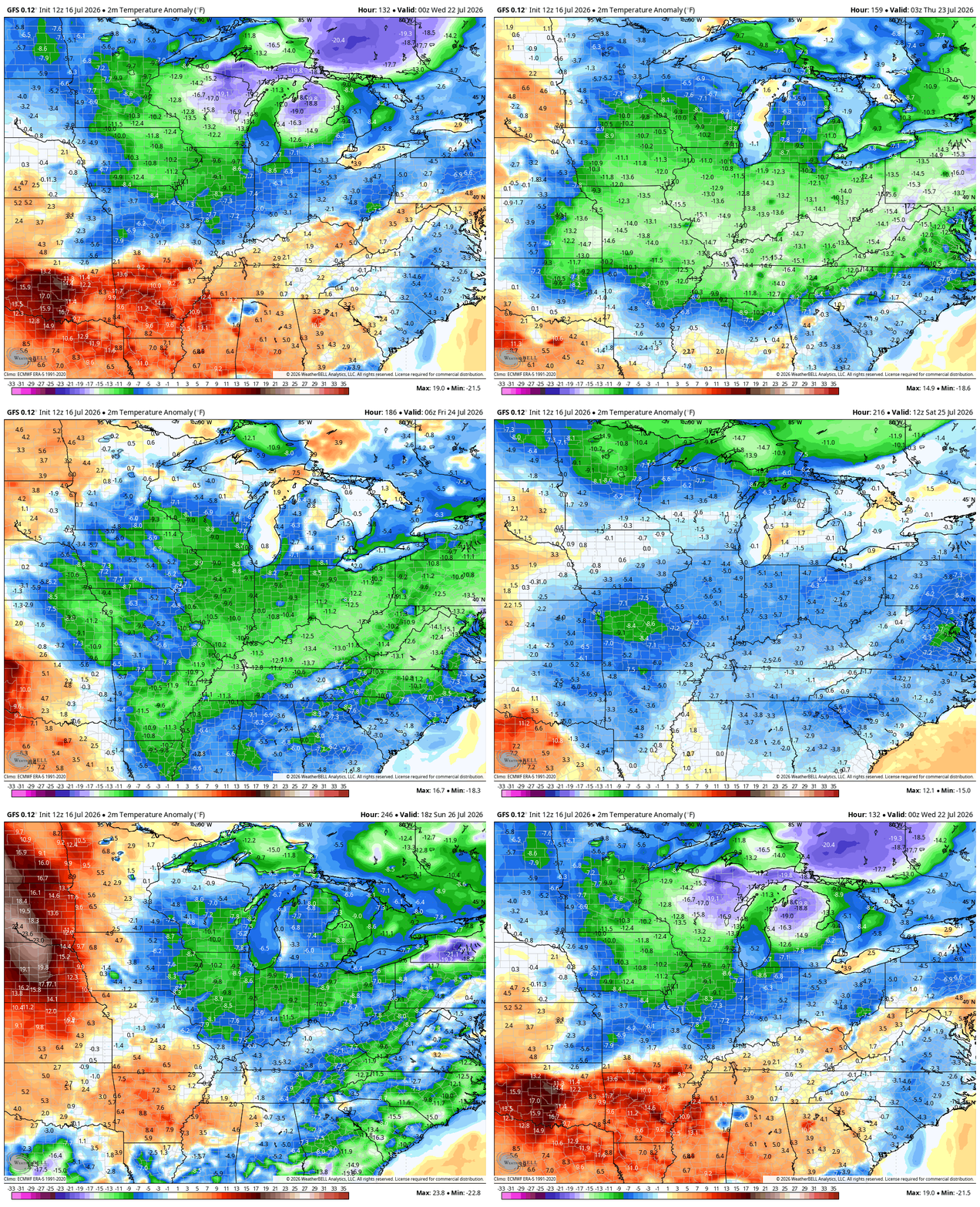
That air is solidly below normal for much of the eastern half of the country with the chance for another front behind that the following weekend. This animation from the GFS shows the possibility of an extended period of below normal temps…
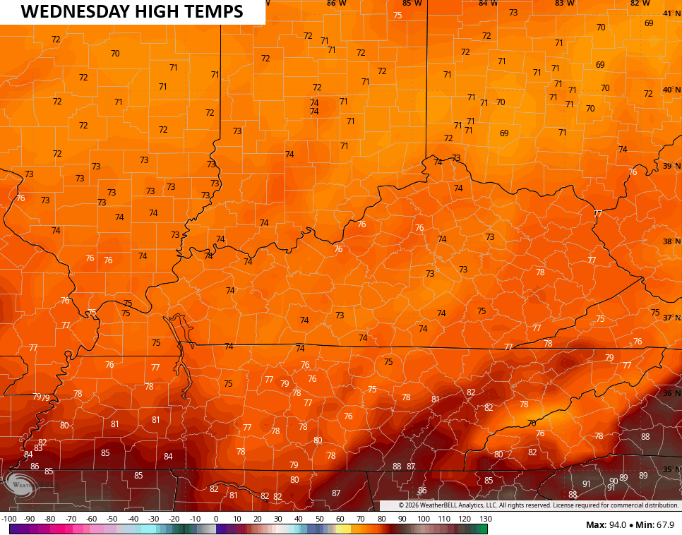
Highs next Wednesday may not get out of the 70s…
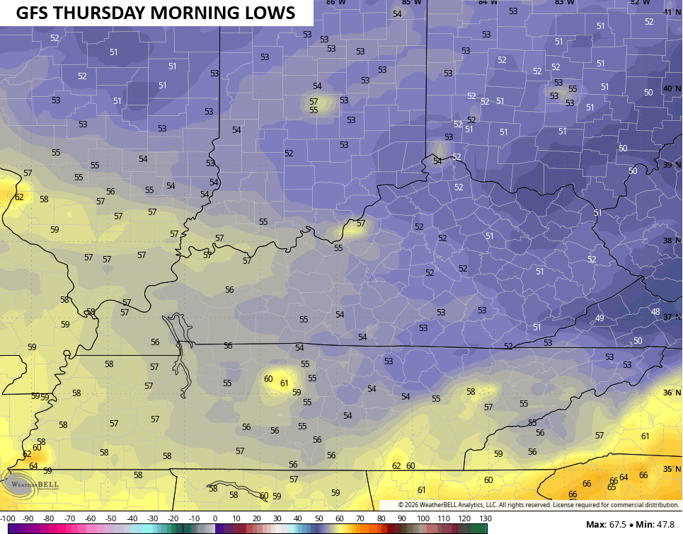
Lows can reach the 50s on a morning or two…
Bring it!
As always, I leave you with your daily tracking toys…




Current watches

Possible Watch Areas

Make it a fantastic Friday and take care.

Thanks Chris. This Summer’s weather really reminds me of Summer weather in 1969.
Very unhealthy air quality throughout the Chicago Metro Area yesterday due to smoke from the forest fires in Canada. It was particularly bad in Chicago and the Northern Suburbs, where air quality was reported in the dangerous category.
Visibility was noticeably lower this morning as I was driving home from work in the SW Suburbs , as Air Quality Alerts remain in effect for all of NE IL. Conditions are predicted to improve by later this afternoon, as the winds are going to shift and blow the smoke more toward the northeast.
Today could be the fifth day in a row of highs over 90 degrees here also.
No smoke here, but early this morning the fog was very thick.
The latest SSTA shows surface temperature anomalies increasing in intensity, and one thing to note is the extremely warm patch in the Gulf of Alaska. By itself an El Nino will push the jet stream over the Pacific further north, and the high pressure created by that very warm patch will move the jet even further north. Very concerning to note is the cold patch in the north Atlantic being fed by melt water from Greenland. It overlays the northern leg of the Gulf Stream, and could be a symptom of the A.M.O.C., the system that actually drives the Gulf Stream, weakening.
https://www.ospo.noaa.gov/products/ocean/sst/anomaly/
The current El Nino continues to strengthen and could be the strongest one since they started keeping records in 1950, and there is a chance that it may be in effect through spring of 2027. This is because not only are sea surface temperatures rising, the ocean temperature 1 or 2 feet below the surface is also increasing.
https://oceanservice.noaa.gov/facts/amoc.html
It’s going to be difficult to predict this Fall and Winter weather patterns.
Bring it? Incorrect take.
In the years, 1969 – 70 there was a weak positive PDO El Nino which produced the Snowiest Winter I have ever experience. Snow was on the ground most of the Winter. We had training Snowstorms about every three days. A lot of time out from school. The funny thing, this all started on the first day of Winter.