Good Wednesday to one and all. Toasty temps and gusty winds are showing up out there today as we get ready for a fairly busy setup. Rounds of showers and storms rumble in starting late today and carry us into the start of the upcoming weekend. Heavy rains are a good bet during this itme.
South winds are cranking today and may reach 25-30mph at times. Temps in the west reach 90-95 with mid 80s to around 90 across central and eastern Kentucky. Isolated afternoon showers and storms may increase a bit into the evening.
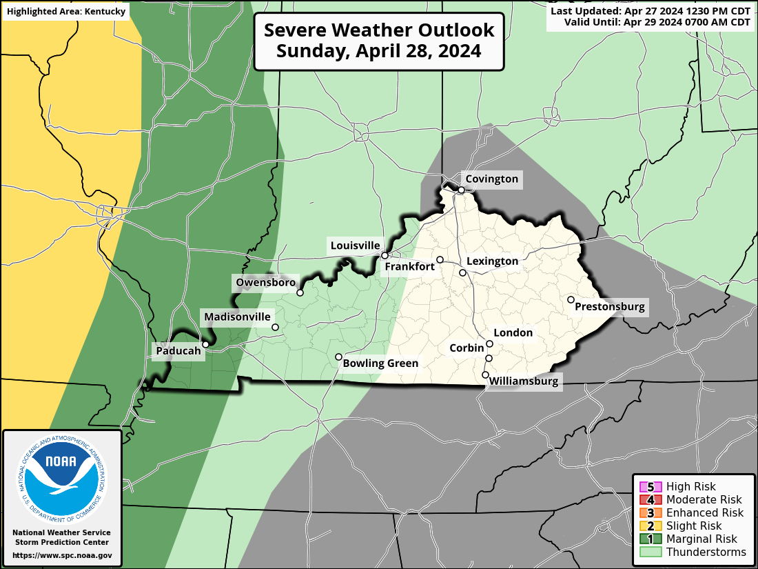
That’s when a broken line of showers and storms moves in from the west and northwest. While there is a low-end risk for a few strong or severe storms, the best chance is likely northwest of the Ohio River. That’s where the Storm Prediction Center has the low-end risk for severe storms today…

The potential for rounds of showers and storms will increase tonight through Thursday. The latest future radar from the WRF shows some pretty good storm clusters rolling through here…
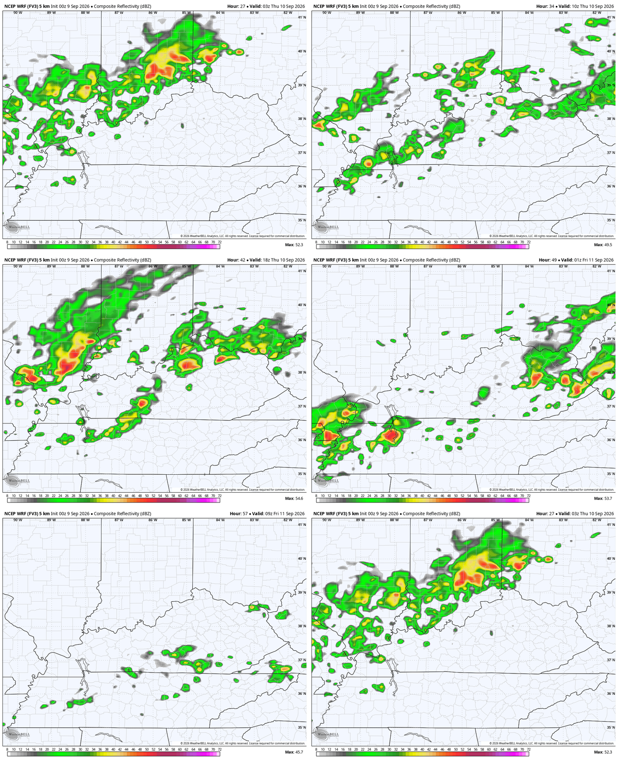
There’s the chance for a few of those storms to be strong or severe. The SPC didn’t see that potential with their updates on Tuesday, but may start to see the low-end threat with what they put out today…
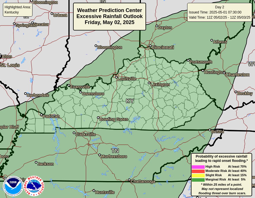
These storms may produce some very heavy rains, leading to the local high water concern. Here’s the Excessive Rainfall Outlook from The Weather Center…
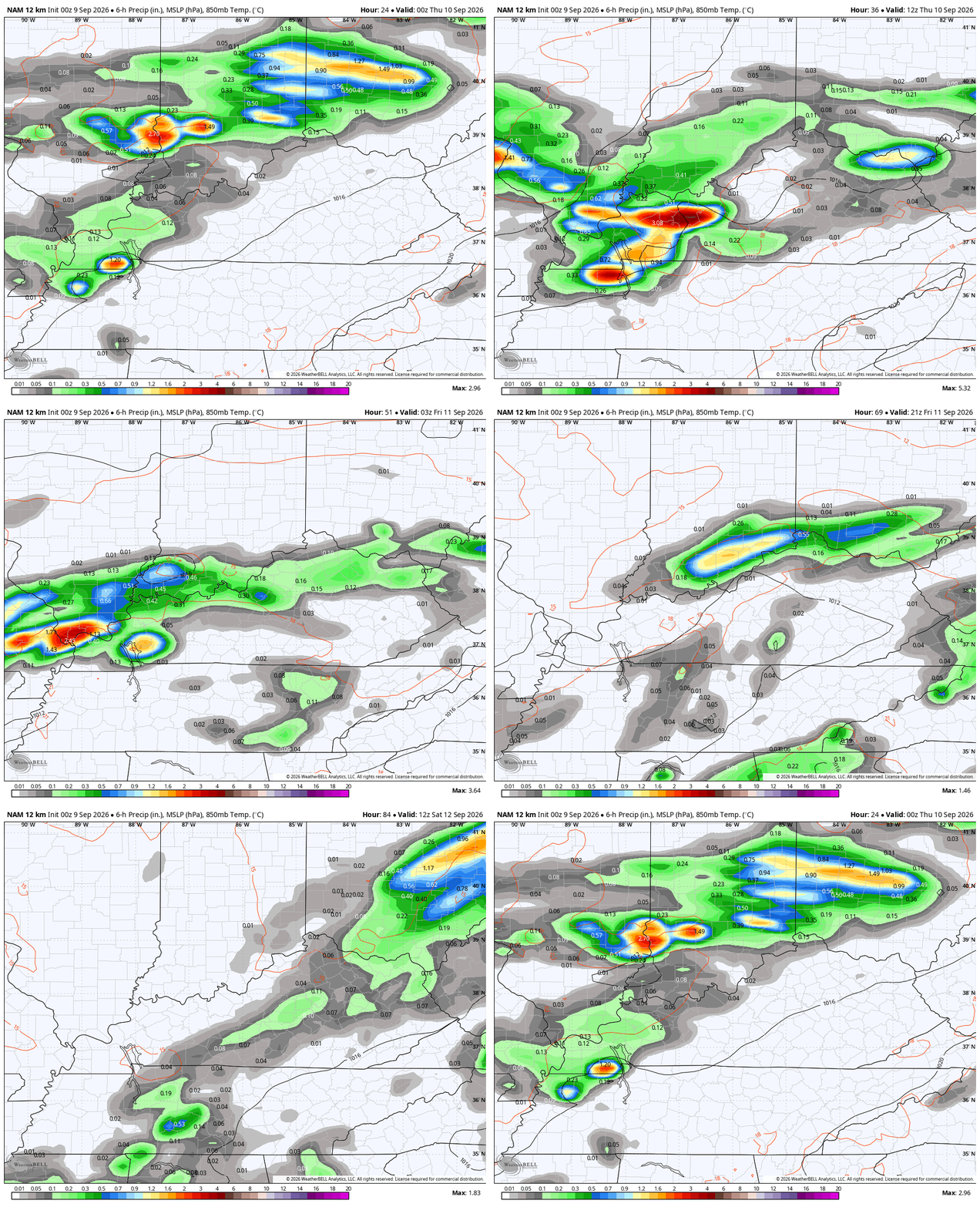
Several other models are showing the potential for heavier rains that take us into the start of the weekend. Here’s the NAM from this evening through 8am Saturday…
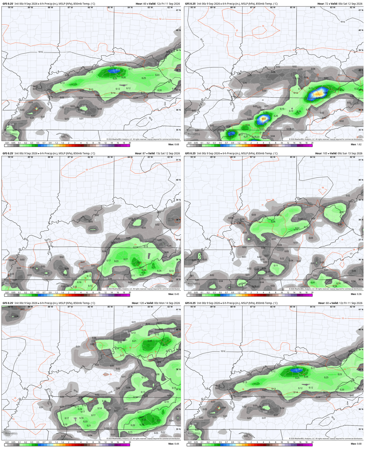
The potential for additional showers and storms, at least scattered, will likely be with us into the weekend. Here’s the GFS from Friday morning through Sunday evening…
In the longer range, I keep looking at the composite of the GFS Super Ensembles to see the most similar years to the pattern being forecast. The below image is centered on September 19th and shows the years most similar for this time of year…
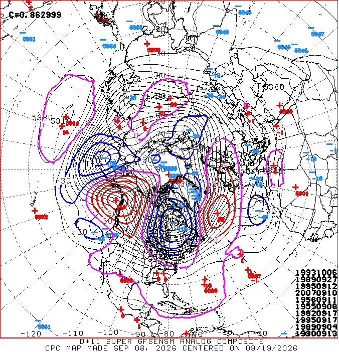
Only 1982 is an El Nino year and that was also a Super, like this year. I’ve made a point to illustrate how this year is not following the script for a Super El Nino and the analog package backs that up. Most of the years listed were actually La Nina years. 1995 was a moderate La Nina and it’s listed twice. 1955 was also a moderate La Nina. 2007 was a strong La Nina. 1993, 1989, 1956 and 1990 were all neutral years.
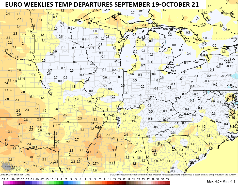
Speaking of the longer range, the EURO Weeklies for the second half of September into the middle of October has cooled substantially compared to recent runs…
As always, I leave you with your daily storm tracking toys…




Current watches

Possible Watch Areas

Make it a wonderful Wednesday and take care.
