Good Thursday, everyone. We have a cold front dropping into the region from the north, bringing a few waves of showers and storms along for the ride. These showers and storms will put down hit and run heavy rains during this time.
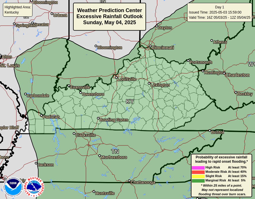
Today’s setup isn’t all day rain and won’t be producing a lot of rain for everyone. Still, the chance is there for some local high-water issues. The Weather Prediction Center is highlighting this possibility in today’s Excessive Rainfall Outlook…
There’s also the low-end risk for a few strong to severe storms. Today’s Severe Weather Outlook from the Storm Prediction Center isn’t very threatening…

The boundary pushes to the south as we head into Friday, but keeps some scattered stuff going across the south. A wave of low pressure then develops along this boundary and pushes through here Friday night and Saturday, bringing more showers and storms to the region. This animation rolls from Friday evening through Saturday night…
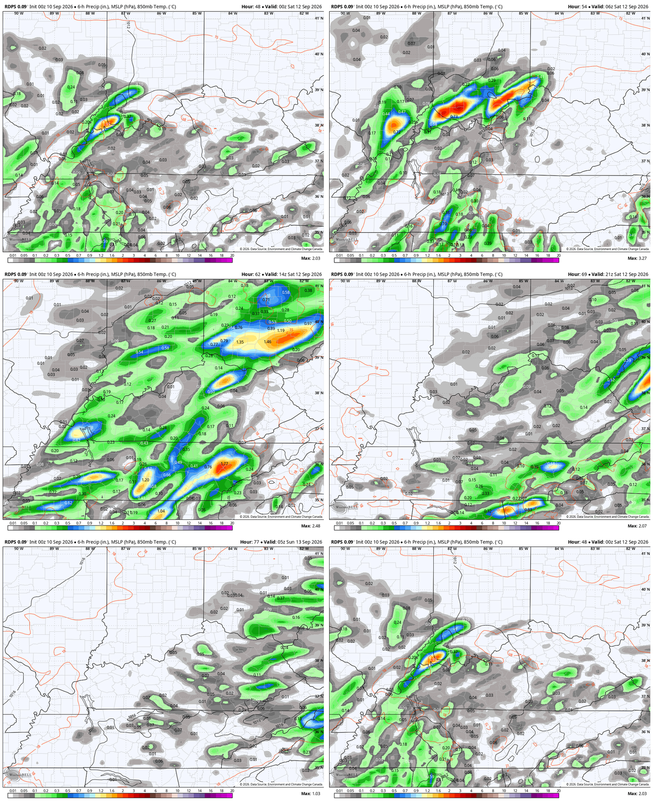
That may very well impact college football games across the state and region.
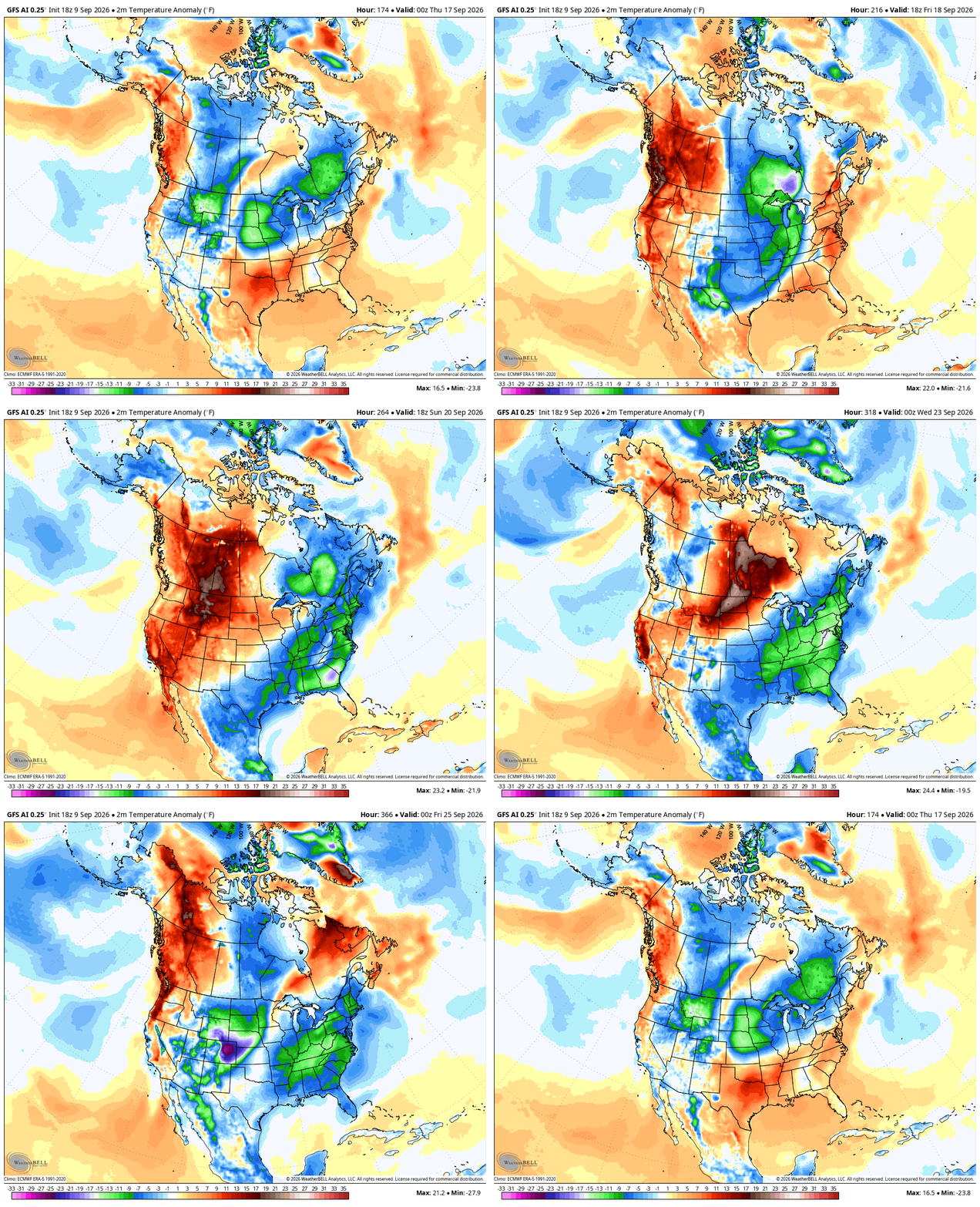
Sunday and Monday look much better as temps rebound to normal or above normal yet again. Changes continue to show up later next week into the following week as the pattern attempts to realign itself. Watch how the troughs dive into the east and a big ridge goes up in the west during this time…
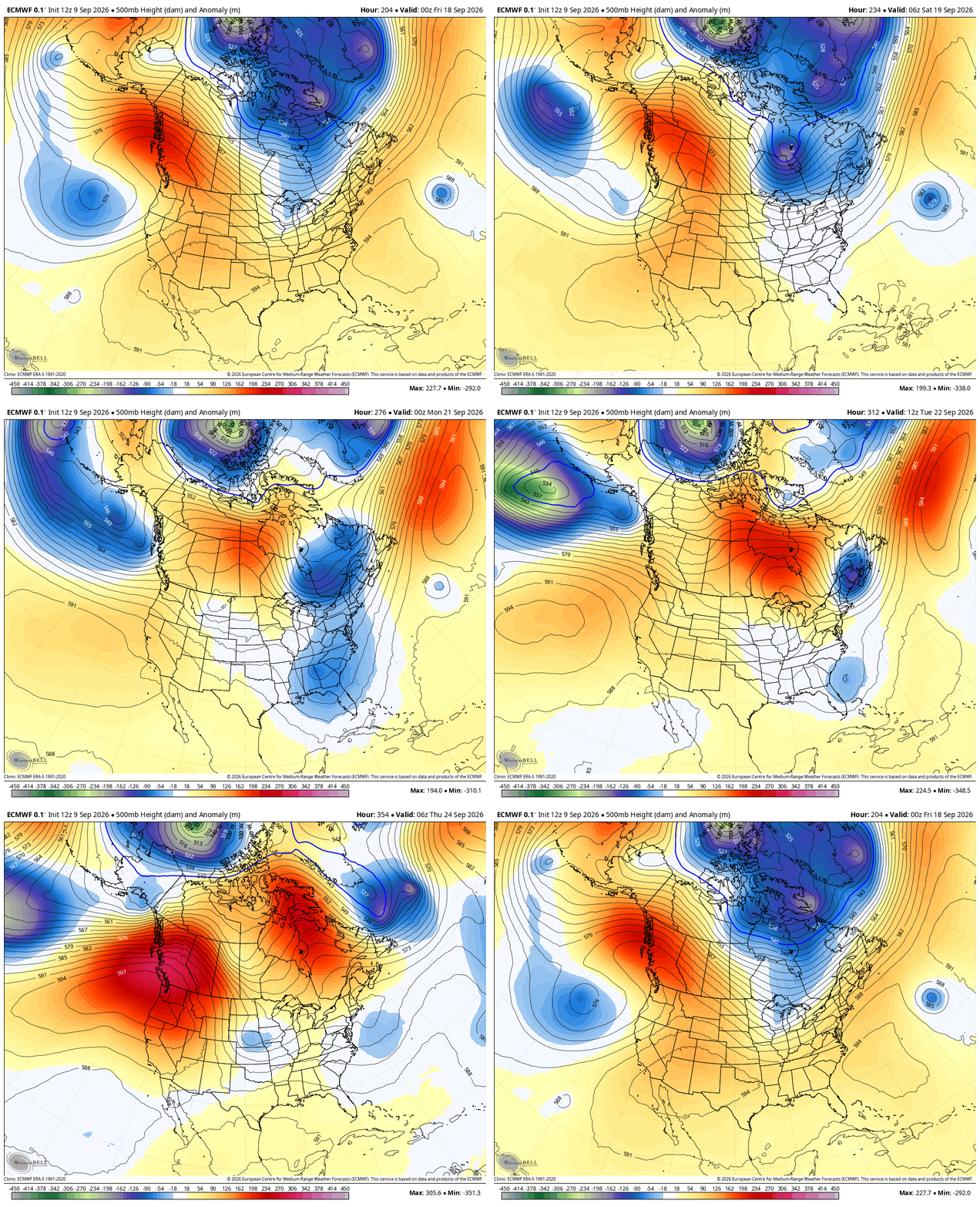
That’s the EURO and it’s also showing colder than normal temps heading into the east during that same time period…
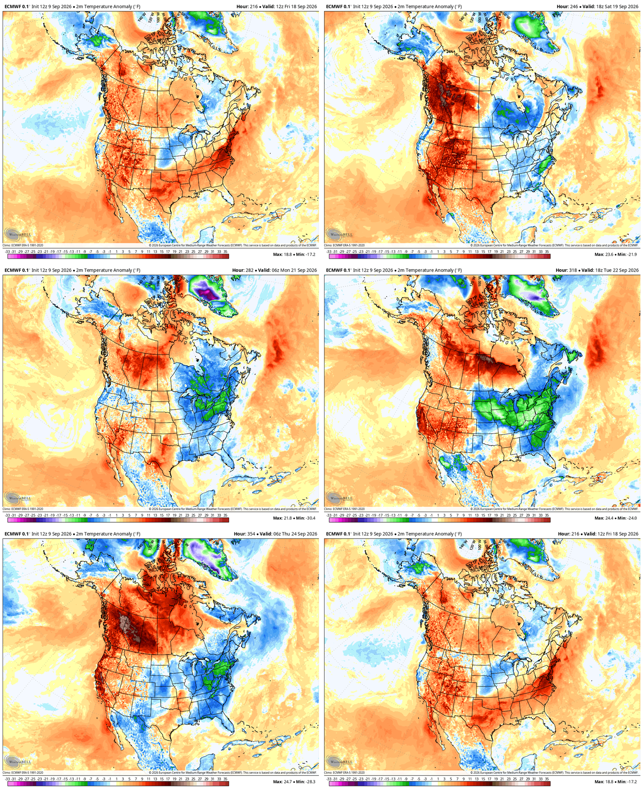
The similar setup shows up on the GFS AI…
As always, I leave you with your daily storm tracking toys…




Current watches

Possible Watch Areas

Make it a great Thursday and take care.
