Good Wednesday to one and all. The heat is back in the Bluegrass State as summer just refuses to go quietly into the night. This hot pattern may take a punch from a cold front on Friday with a bigger punch arriving early next week.
Temps today reach the 90-95 degree range across central and eastern Kentucky with mid and upper 90s in the west. Humidity levels make it feel hotter than that, especially in the west.
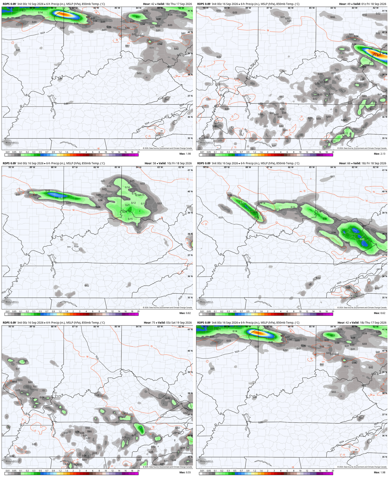
The chance for a storm or two is there today as some moisture pushes in. This is ahead of a cold front dropping in from the northwest late Thursday into Friday. The models are pushing this boundary much farther south now, bringing the potential for a few showers and storms and much cooler air across central and eastern Kentucky.
You can see this backdoor front showing up on the short-range Canadian…
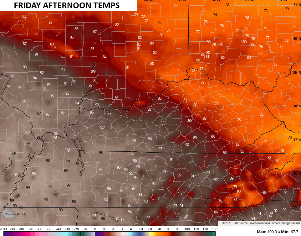
Friday afternoon temps are still scorching hot in the west, but come way down for the rest of the state…
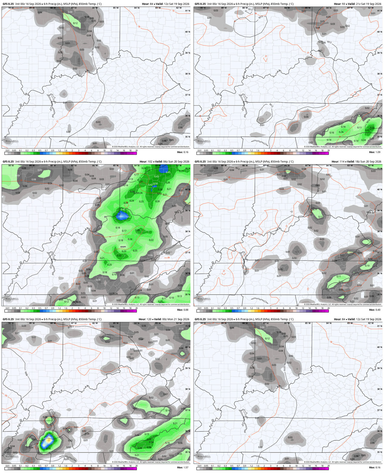
The heat attempts to fight back to the northeast but a few showers and storms cut it off at the pass Saturday and Sunday…
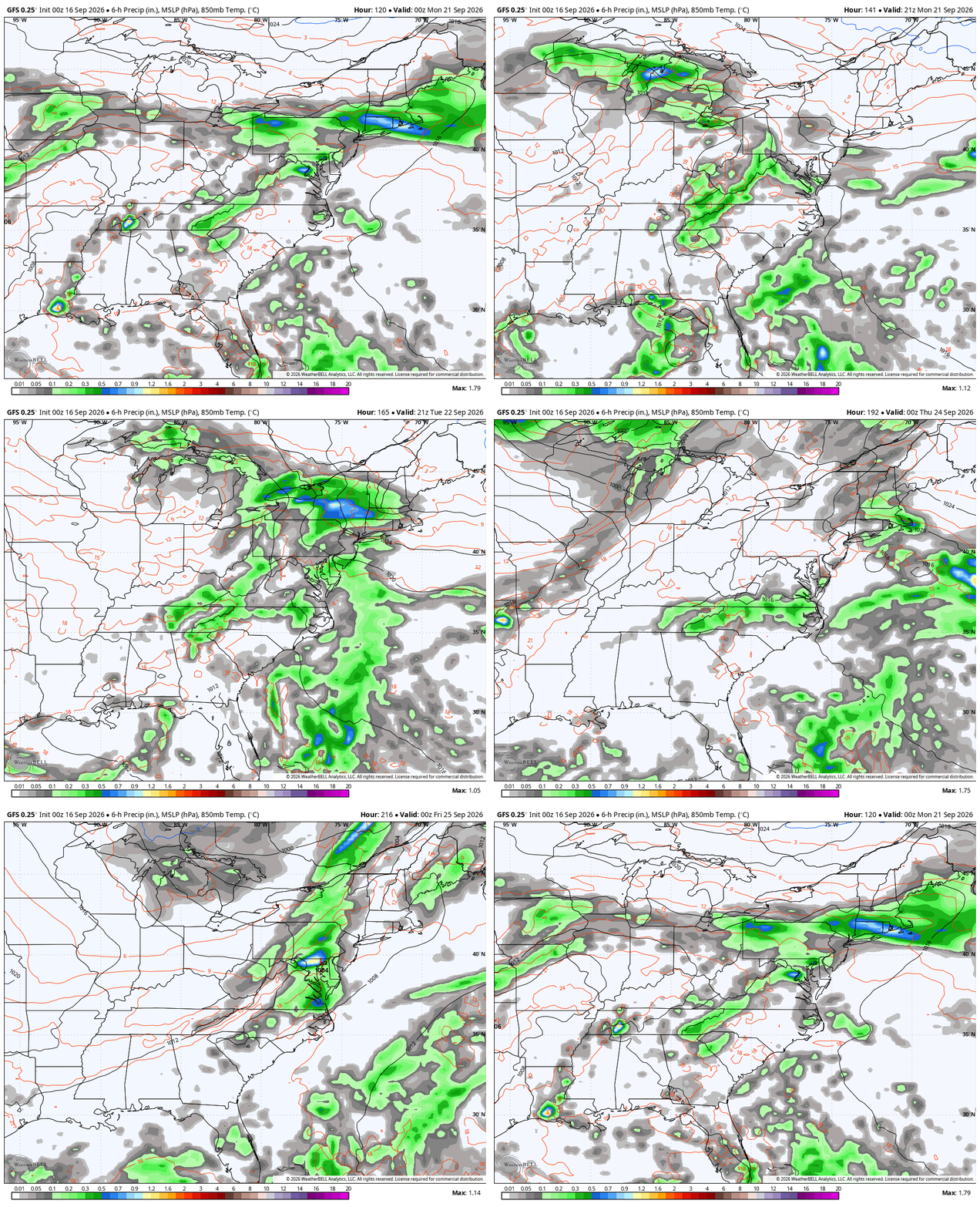
Temps still run above normal into the first half of next week, but nothing like right now. Several systems dropping in from the northwest will team up with some tropical moisture streaming northward to create showers and storms into much of next week. This animation runs from Sunday night through Friday…
In terms of the tropics, the system out in the Atlantic is no longer a threat from the National Hurricane Center…

This incredibly quiet hurricane season rolls on, folks.
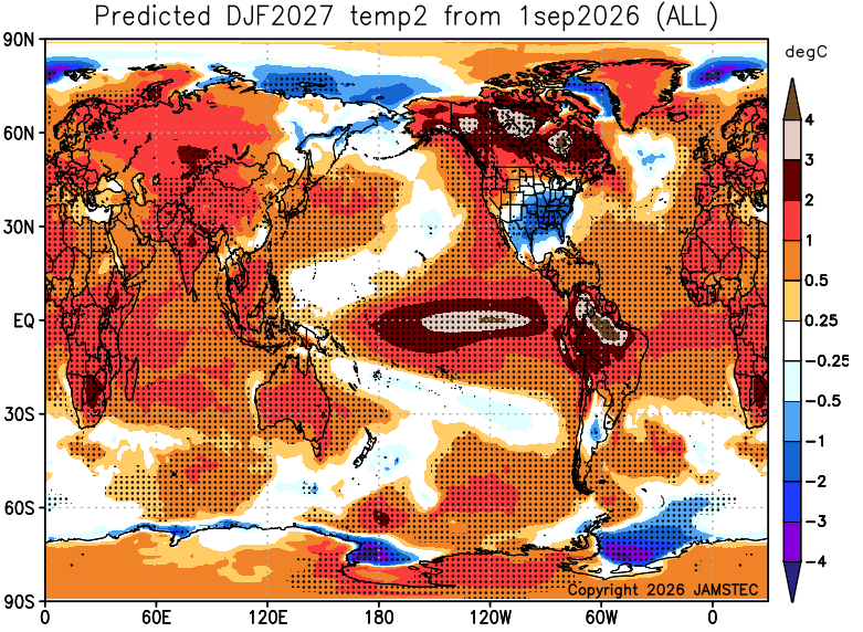
Looking farther down the road, the latest winter forecast from the JAMSTEC Seasonal Model continues to show our region has one of the lone below normal temp pattern across the entire globe. This shows the 3-month average from December through February…
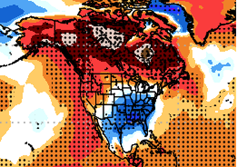
Here’s what that looks like for North America…
You have to squint, but you can see how it’s indicating an active storm track to our southeast with much above normal precipitation across the south and east…
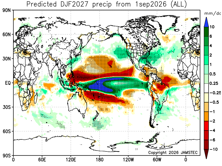
A little colder than normal with a storm track to our south and east? Hmm
As always, I leave you with your daily storm tracking toys…




Current watches

Possible Watch Areas

Make it a Wonderful Wednesday and take care.

Taking those long-term models with many grains of salt while noticing that September is playing out exactly as I predicted.