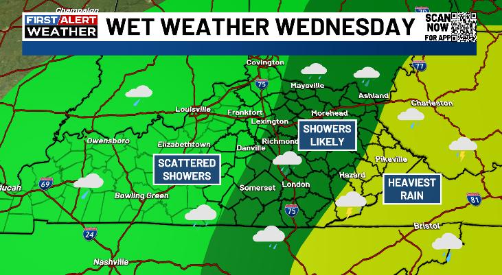
Good Wednesday, everyone. October weather is showing up a little earlier than normal as cool winds continue to take up residence here in the Bluegrass State. Today’s cool air is coming along with gusty showers as low pressure spins across the southern Appalachian Mountains.
This low is spinning up some pretty good showers across central and eastern Kentucky with the potential for some thunder in the east. This is also a part of the state that may see heavy rains that can cause hit and run high water issues.
Farther west, just a few showers will be able to spin up. Here’s a breakdown of how the day may look…
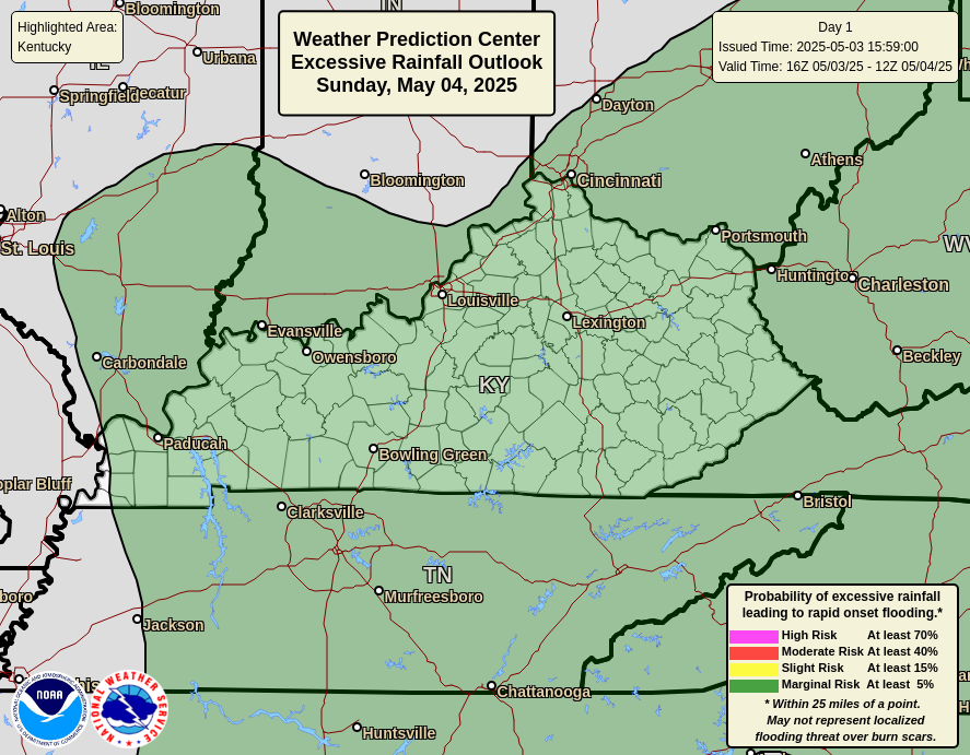
The Weather Prediction Center is highlighting the chance for local high water across areas of eastern and southeastern Kentucky…
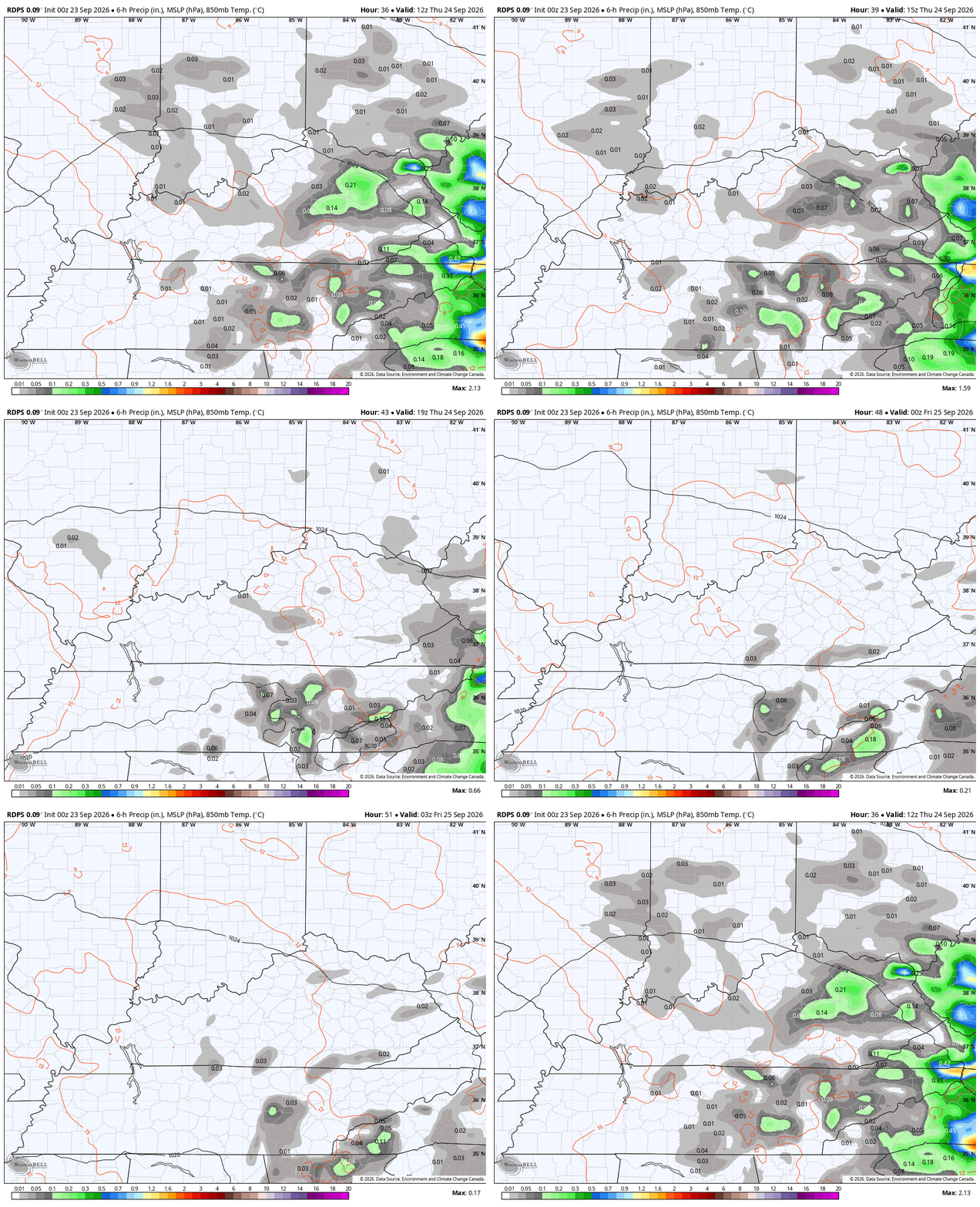
Temps today likely stay in the 60s for many areas, making it two days in a row with highs only in the 60s. Can we make it three in a row for Thursday? That’s a possibility, especially across central and eastern Kentucky as a few showers linger…
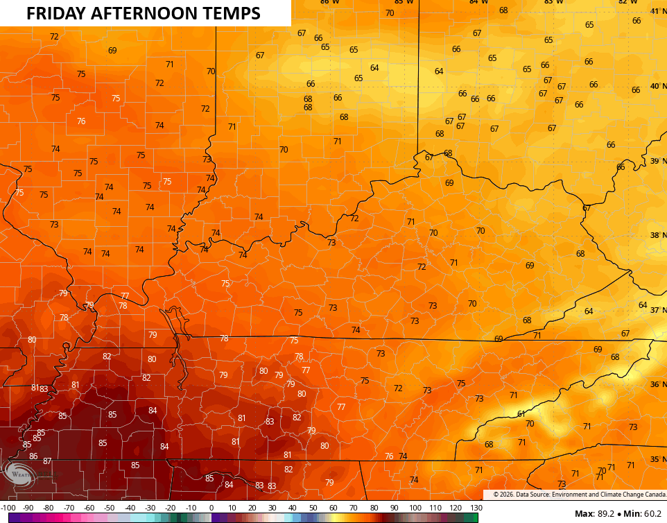
The air grows much drier for Friday into the weekend as a strong northeast flow continues. Friday morning will start with upper 40s to middle 50s from east to west. How about highs around 70 to start the weekend? That’s the case for central and eastern Kentucky with low and mid 70s west for Friday afternoon…
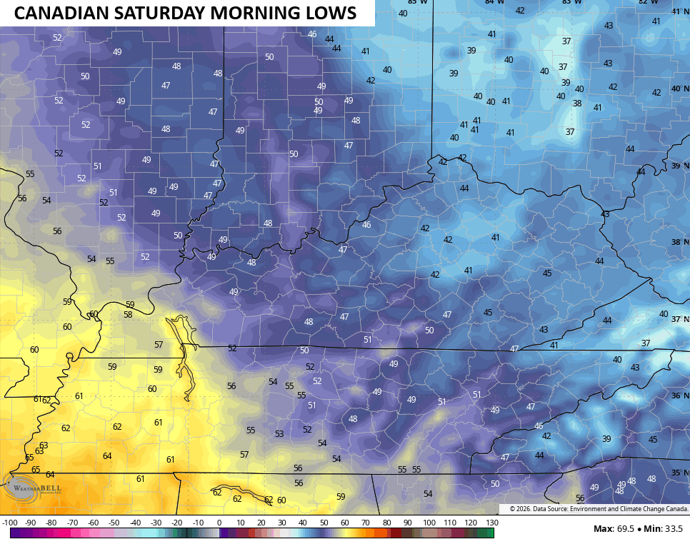
This dry air means temps can absolutely tank by Saturday morning. Low to middle 40s will be possible across areas of central and eastern Kentucky…
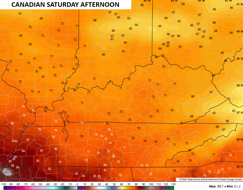
Saturday afternoon amazing with upper 60s and low 70s for central and eastern Kentucky with 70-75 in the west…
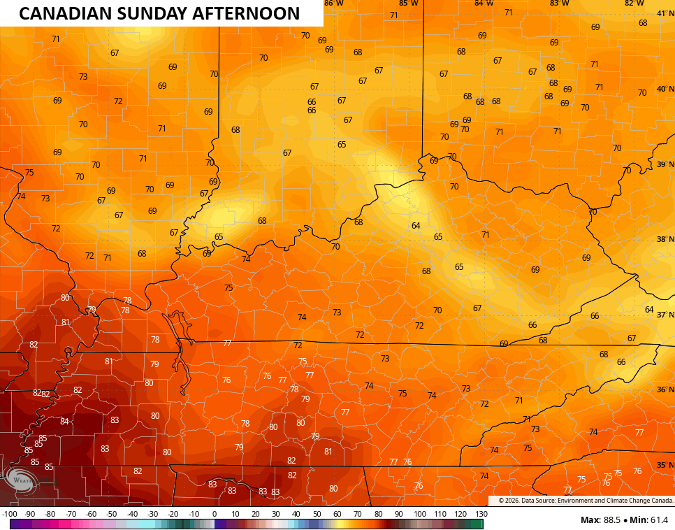
A few clouds filter in later Saturday into Sunday and may help keeps temps down a bit for some areas into Sunday…
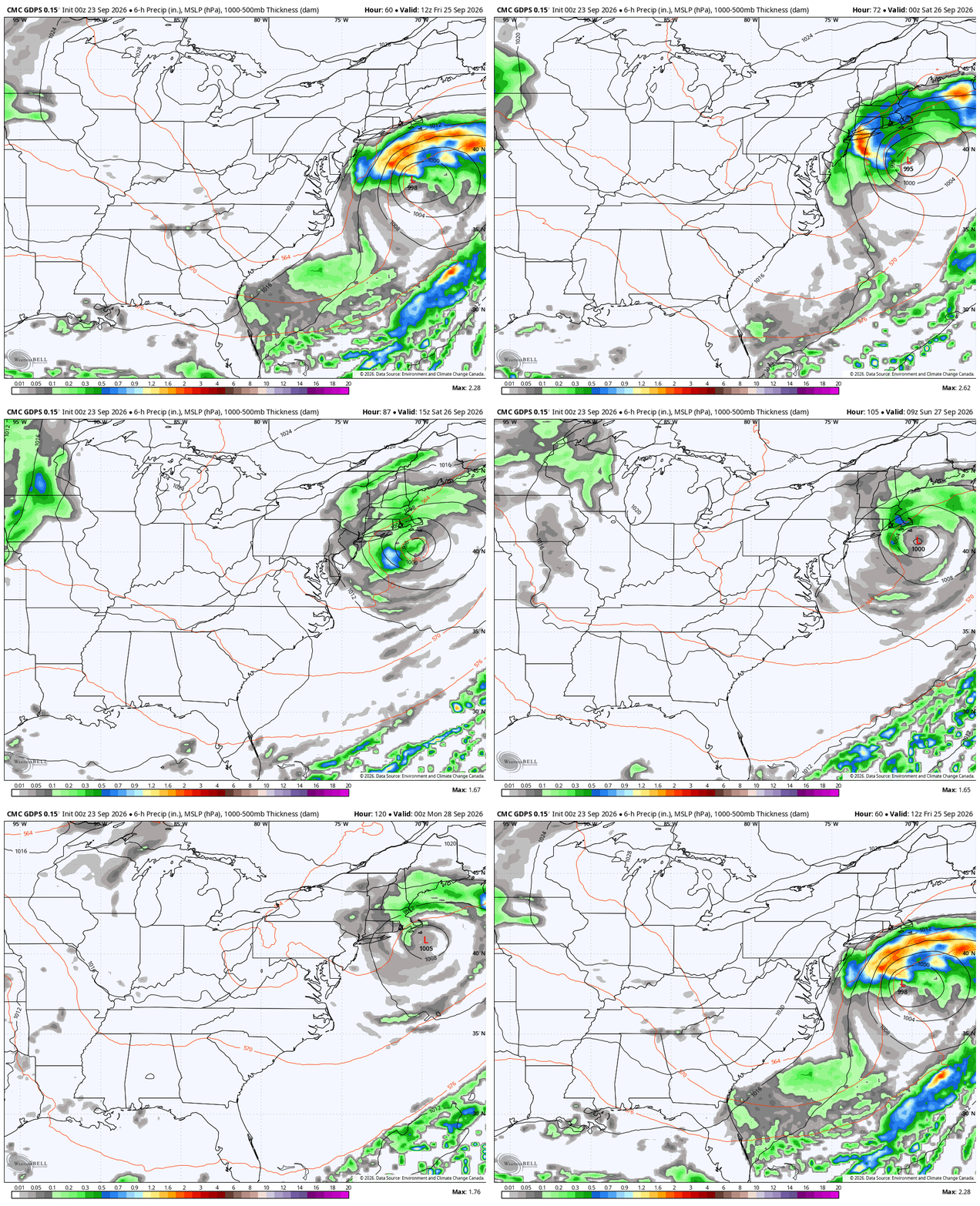
As we are enjoying some amazing fall weather, a full-blown nor’easter will be battering areas from the Mid-Atlantic to New England…
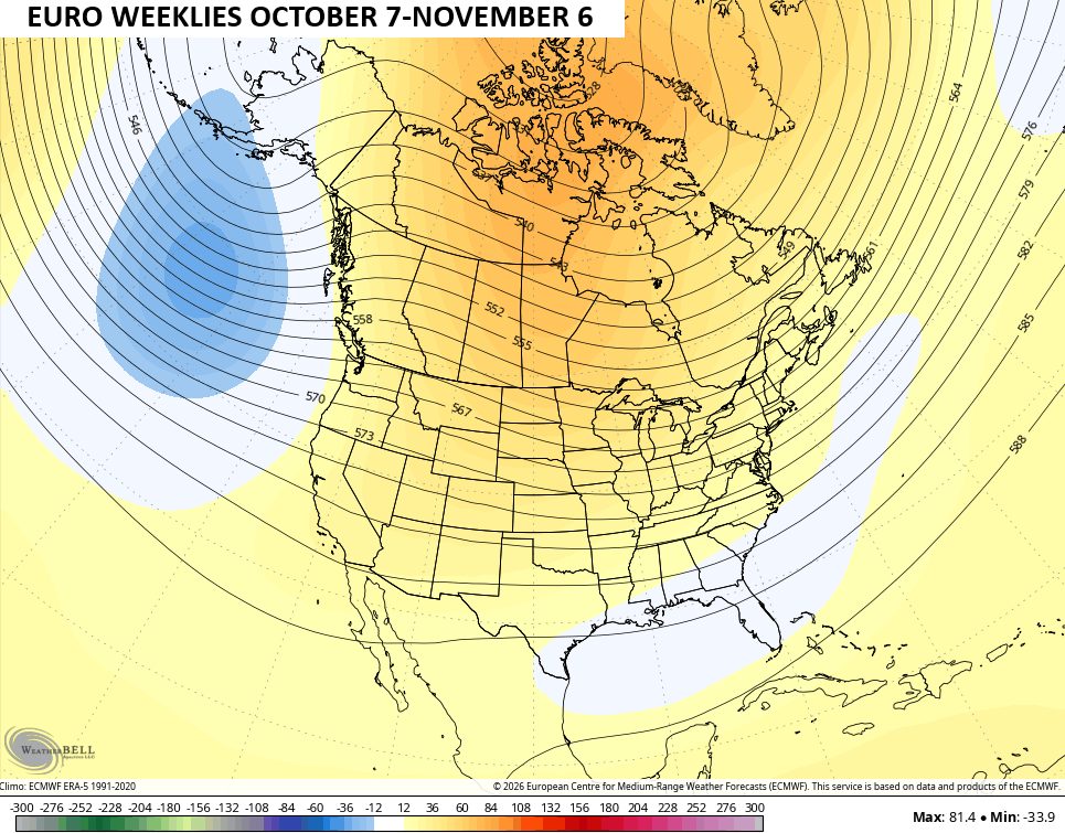
Let’s look farther down the road toward October into early November. We find the EURO Weeklies showing more of a trough showing up across the eastern half of the country with ridging in western Canada toward Alaska. Remember, this is the 30-day average of 100 different members that make up the EURO Weeklies…
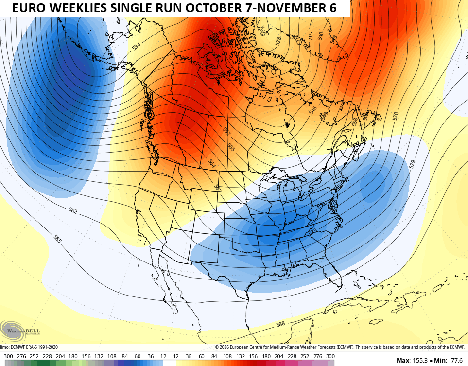
The single run of the EURO Weeklies give us a more pronounced trough…
As always, I leave you with your daily storm tracking toys…




Current watches

Possible Watch Areas

Make it a wonderful Wednesday and take care.

We have not seen our last 80-degree high. 🙂
Totally agree, Jeff.
Part of the reason for that trough in Gulf of Alaska is due to much warmer than normal surface waters in the northern Pacific. It’s a feature that been in place for a couple of years and shows no sign of depleting. It may play an important role in the winter to come by pushing the polar jet farther to the north, which, as it dips down through western Canada, could pull cold air into the midwest and east.
That nor’easter could cause some serious flooding along the coast, as it is scheduled to arrive at astronomical high tide
The current super El Nino is in the books as the strongest since they started keeping records on them in the early 1950’s, and parts of the world are already seeing some of its effect: heavy rainfall in southeast Asia, wildfires in Indonesia, drought and water shortages in India, a record low in Atlantic hurricane activity, above normal pacific hurricane and typhoon activity, and intense heat and drought in portions of the US. As we transition from fall into winter, a shift in the path of the southern jet stream increases the likelihood of severe storms and tornadoes in the south.
I can definitely see a February 1998 special coming up.
From September 17th – 20th, the SW Suburbs of Chicago received a total of 5.17 inches of rain, after receiving just 0.23 inches of rain for the first 16 days of the month.
We’ve only had four days of below normal temperatures so far this month.