Good Saturday and welcome to the final weekend of September. The weather is, in a word, awesome! Temps are amazing and that sky looks pretty darn nice. The good stuff is locked in for the next several days before changes show up as we flip the calendar to October.
Our weekend weather is pretty straight forward. Highs are mainly 70-75 for central and eastern Kentucky with mid and upper 70s west. Overnight lows reach the 40s in many areas. Winds will be gusty from the northeast with a mix of sun and clouds.
The nice weather carries unto Monday and Tuesday as temps inch up just a bit, but it’s still awesome.
This awesome weather is because the pattern is pretty much stuck in neutral with nothing really moving across the country. The roadblock is a massive Canadian high pressure over top of a stout nor’easter.
This thing is churning off the Mid-Atlantic coast and heading toward the NYC area…

Coastal flooding and beach erosion will be off the charts with this. High winds and heavy rains will also cause issues.
That’s certainly the most action we’ve seen from the Atlantic this tropical season and that’s not even a tropical system.
You’ve heard of the game, Marco Polo, but have you ever heard about Nolo Polo? No? That’s about to change.
Hurricane Polo is a monster Cat 5 hurricane is forecast to head toward Baja California, Mexico with what’s left of it winding up in west Texas by the middle of the upcoming week…

That tropical moisture has a chance to get entrained into a big system that may impact our weather. More on that in a bit.
The Nolo part of the Nolo Polo combo is a strengthening hurricane impacting parts of Hawaii…

Hawaii has been unusually busy this season.
Back to Polo as some of that moisture gets into a huge system spinning into the Plains States early next week. That system will then move our way by the end of the week into next weekend, being pushed by a big dip in the jet stream. Given the fact we have a tropical system from the Pacific getting into the mix, the models are having a whale of a time with how they handle all this.
Throw in the fact many of the models continue to spin up phantom hurricanes from the Gulf, and you get more model chaos.
Here’s the GFS showing what I’m talking about…
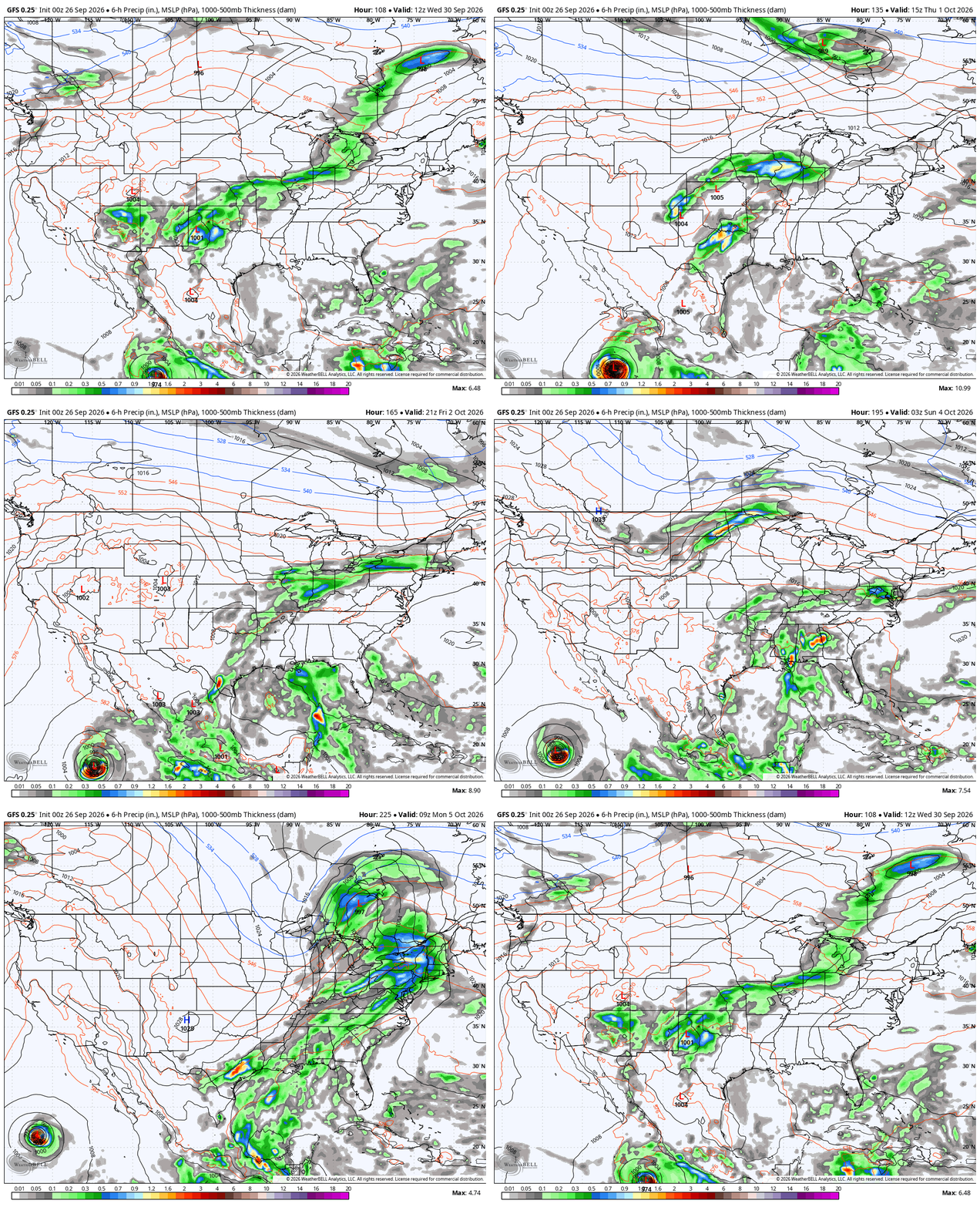
Even looking beyond that, it’s still trying to spin up something in the Gulf while another deep trough dives in…
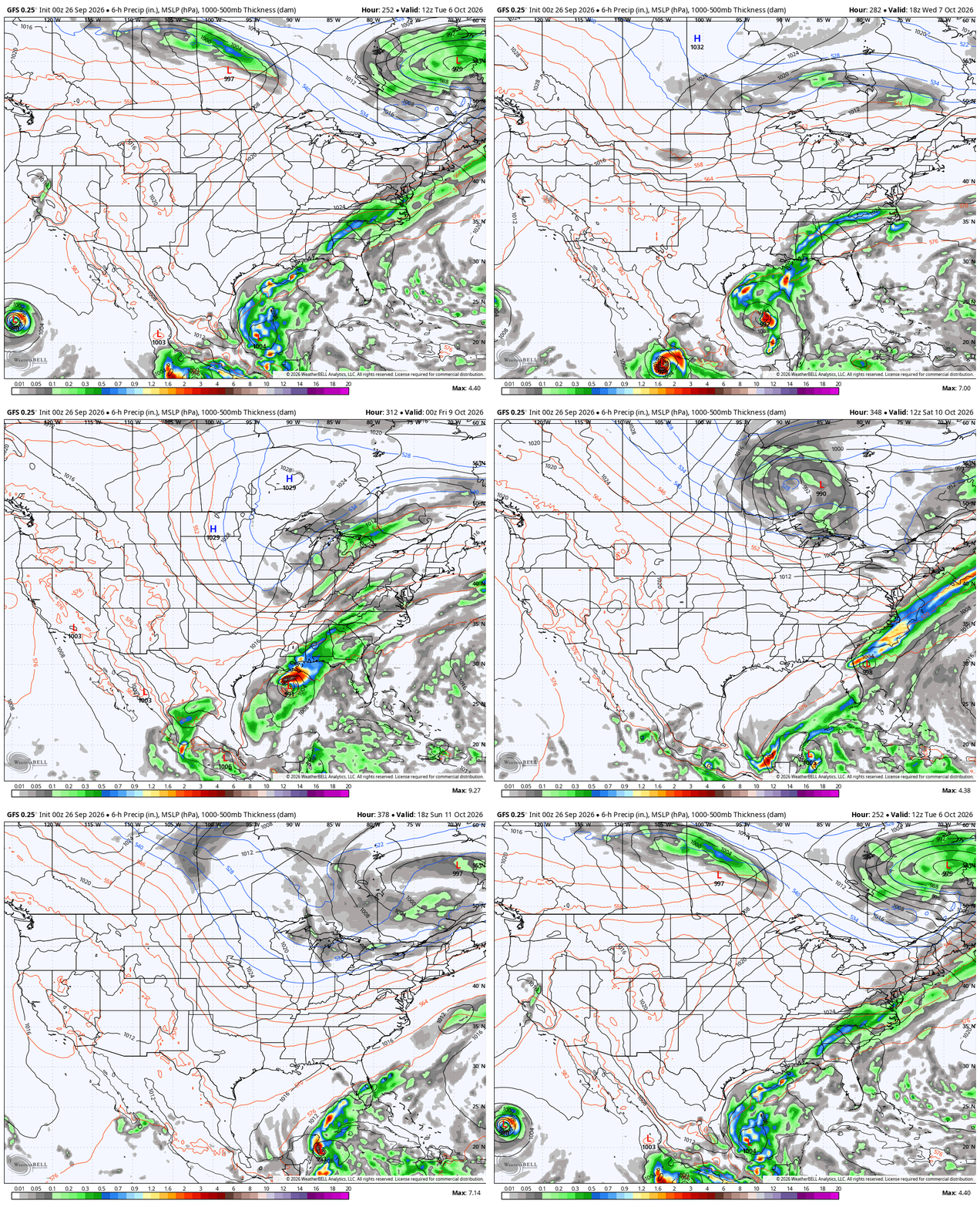
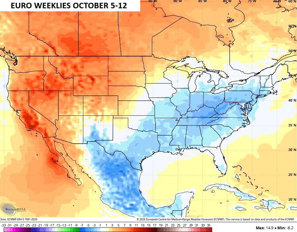
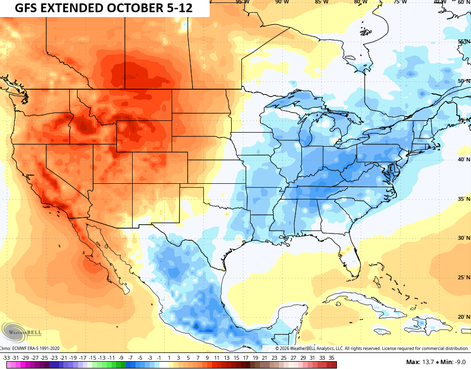
All of this is also showing up on the Euro Weeklies and GFS Extended as both have a much colder than normal signal showing up as we get into the 2nd week of October…
Have a sensational Saturday and take care.

I’m not convinced that we get impacted by the Nolo Polo remnants, but I can see an early frost in October.
Major League Baseball moved Sunday’s Cubs/Red Sox game from Fenway Park in Boston to Tropicana Field in St. Petersburg, FL due to the impending Nor’Easter.
This was the coolest morning of the young Fall season here in the Chicago Metro Area, as many locations saw temps in the upper 40s.
Mike, Nor’easters destroy our rain chances here in the Midwest, along with slowing down cold fronts across the country. When they happen in the Winter months potential Snowstorms for our area are a no show.