Good Monday, folks. Our string of fantastic fall days continues out there to start the week, but some hefty changes are on the way. This change comes in the form of a big fall storm system that can bring a lot of rain. That will be followed by our first threat of frost.
Speaking of frost, we weren’t too far from frosty lows this past weekend as we did manage to squeeze out a few upper 30s Sunday morning…
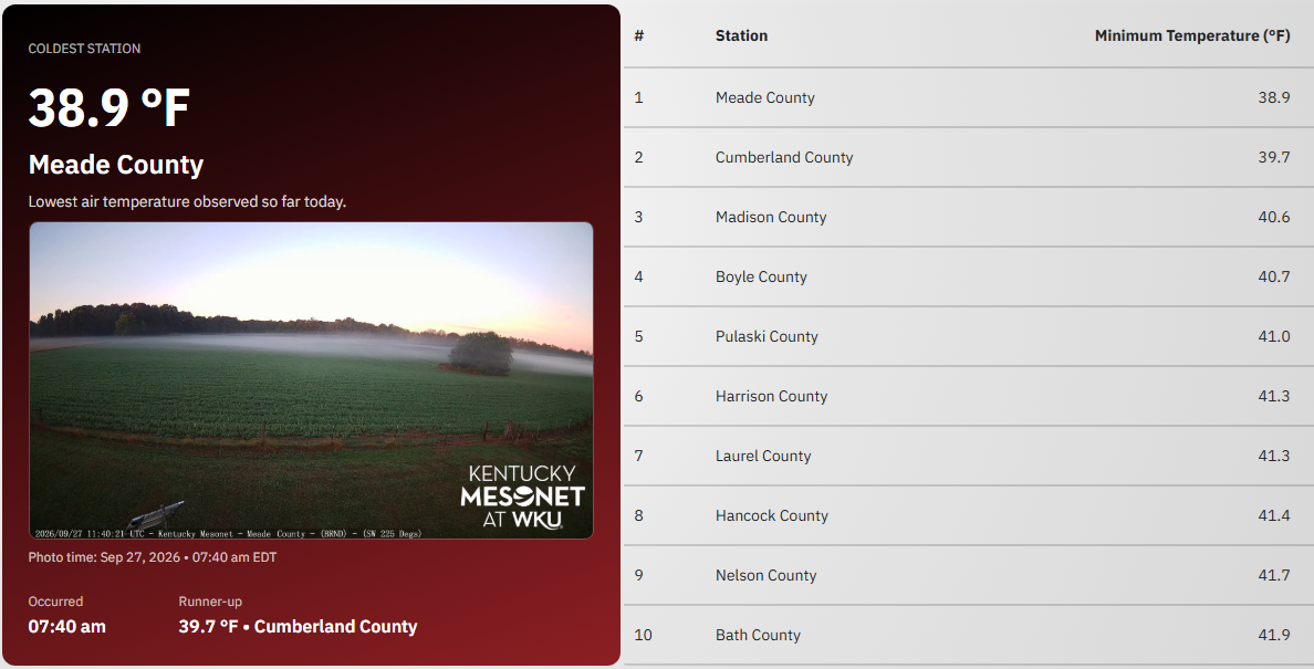
Lows this morning may be in similar territory with the rest of the day being pretty similar to the weekend. Highs are in the low to middle 70s central and east with upper 70s to around 80 in the west.
Temps are a little above today’s numbers for Tuesday, but remain in pretty darn awesome shape.
Southwest winds crank for the final day of September into the first day of October and that means warmth. Highs are in the 80s with lots of dry skies.
That warmth is ahead of a Friday cold front dropping in from the north and northwest. This will combine with a storm system rolling out of the lower Mississippi River Valley and some tropical juice from the Gulf to produce increasing amounts of rain this weekend.
The exact timing and evolution of this storm system is a work in progress on the models, but I dig what the GFS AI is doing…
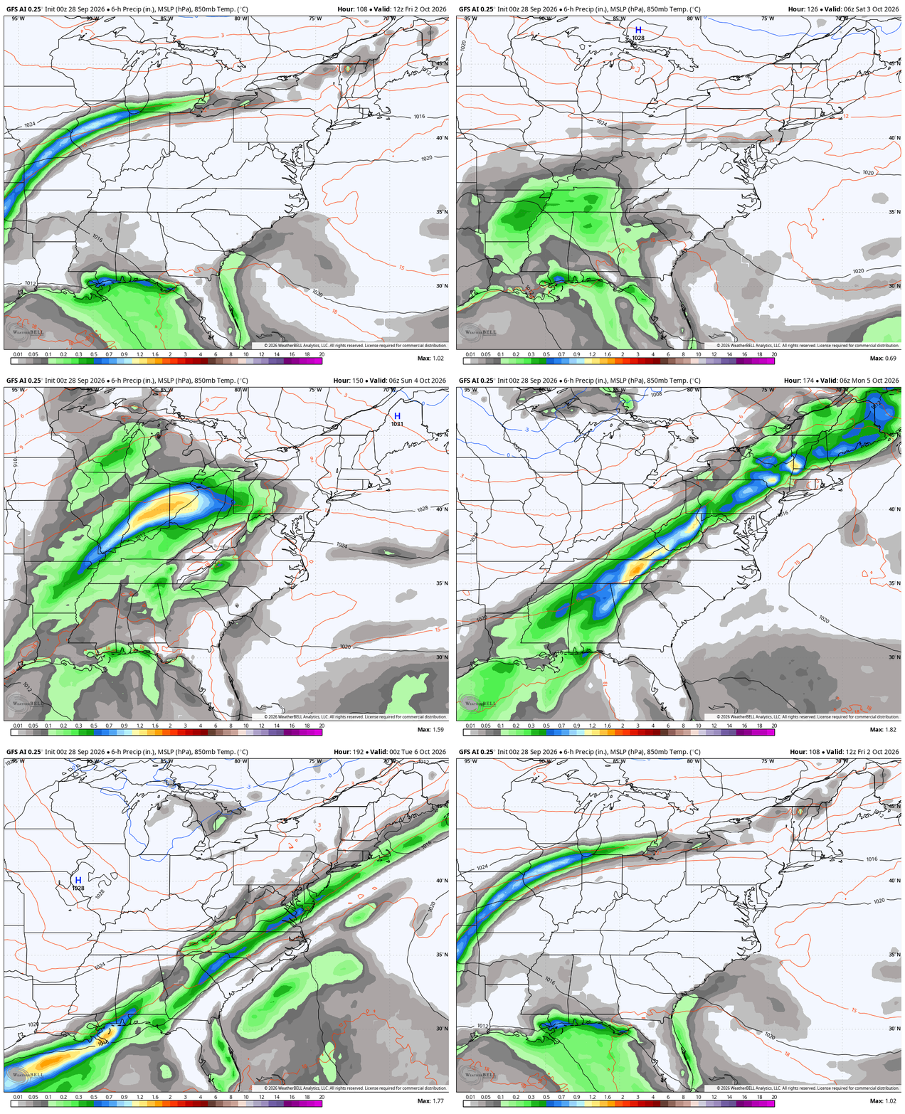
Seasonably chilly air comes in behind this system with the chance for some upper 30s for lows early next week.
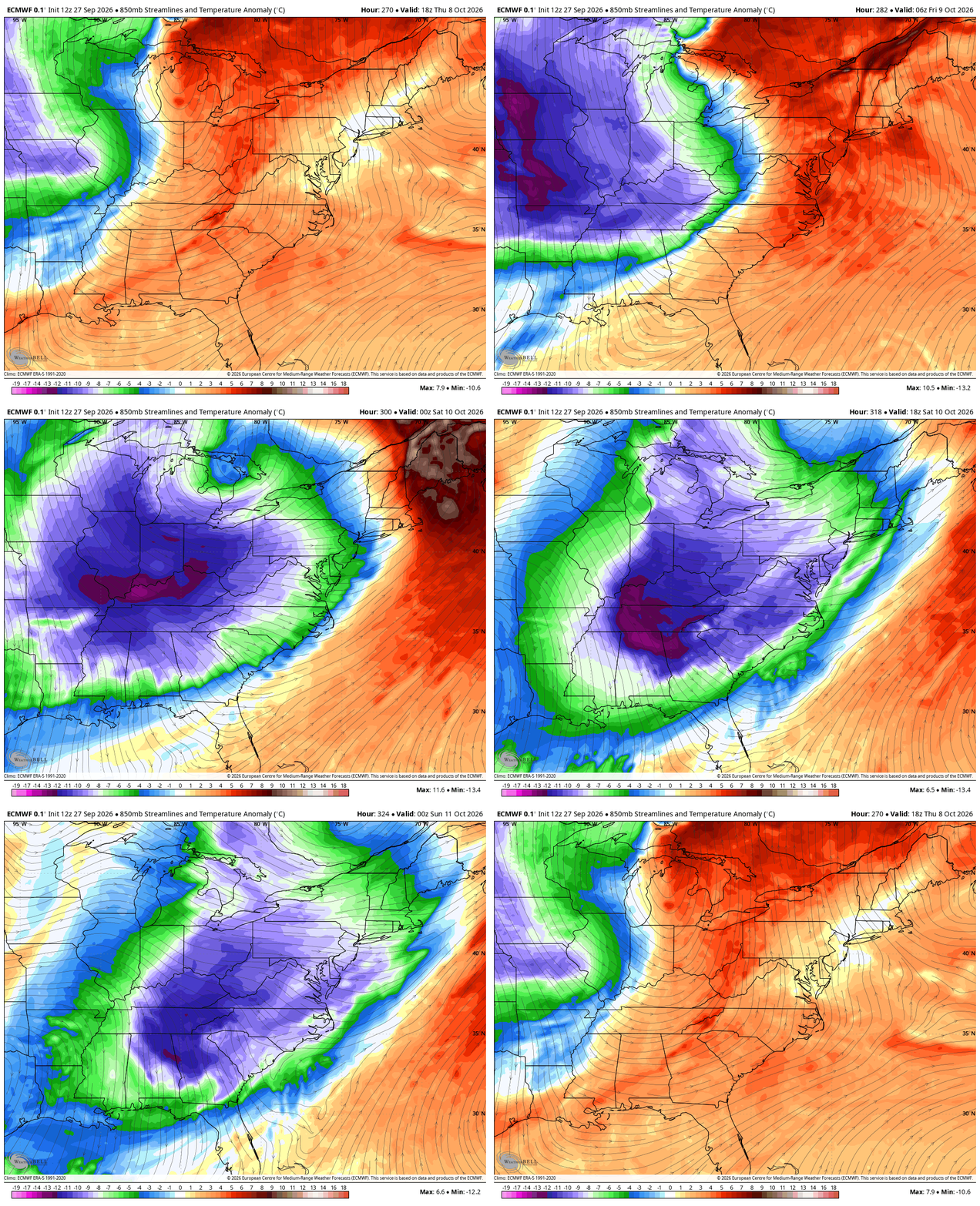
You’ve heard me talk a lot over the 2 decades+ I’ve been doing a weather blog (how crazy is that?) about how recurving typhoons typically precede deep troughs diving into the eastern half of the country. We’ve already had one recurve and will soon have another…

Right on cue, the models go toward a deep trough with cold air showing up during the October 7-14 window I’ve been highlighting. The EURO is a fan of Barney…
End. This. Growing, Season!
Make it magnificent Monday and take care.

I’ll believe it when I see it.
Thanks Chris. Looks like a very interesting pattern developing. I’ll take the ‘ wait and see ‘ approach until we see how the weekend system actually evolves. Hopefully, we finally get some much – needed rain here in Kentucky.
Maybe El Niño finally showing up..Should of been a bunch of these recurving typhoons already..Also see on modeling a Aleutian low trying to develop which is common in a El Niño..PDO is still negative which is strange it being a super El Niño..Unknown territory with this El Niño going to make for a interesting winter..
Very good point for discussion, why the PDO is still negative, with a very strong El Nino developing. This tells me that La Nina is still in our atmosphere. What this negative PDO will do to El Nino’s reaction is, simply decrease the reaction that El Nino would normally have under a positive PDO. I wouldn’t even guess how our Winter will turn out.’ Wait and see.’
This is kind of interesting. The PDO was negative 1.35 in July to a negative 1.11 in August, So the PDO is making progress towards neutral. We shall see in a few days what the reading is for September.
Let’s hope 1972-73 don’t show up for winter..Believe it was a super El Niño with a negative PDO like we’re having now..One of the least snowiest winters..Also 23-24 very strong El Niño with a negative PDO..Again almost a snowless winter..But unlike 72-73 this El Niño is going to be the most east base Event we’ve ever seen..That’s why it’s going to be interesting tracking this winter..
One year that really stands out is 1969 – 70. I was a senior in high school in Washington, Indiana. Our first Snow was on the 21st of December, and after that we had training snowstorms through mid – March. It was a weak El Nino year under a positive PDO.
https://climateimpactcompany.com/daily-feature-nep25a-mjo-and-major-hurricane-polo-combine-to-flood-the-southwest-south-central-u-s-this-week-2-2/