Good Tuesday, folks. The winds of temperature change are blowing out there today as warmer air fights back in to close September. This air holds into the first day or two of October before a big fall storm system changes that up this weekend.
Temps this morning are back in the 40s for many areas with afternoon temps ranging from 75-80 in central and eastern Kentucky with low 80s west.
Everybody reaches the 80s Wednesday and Thursday as a southwest wind really kicks in. Gusts up to 30mph will be possible, especially Thursday and Thursday night…
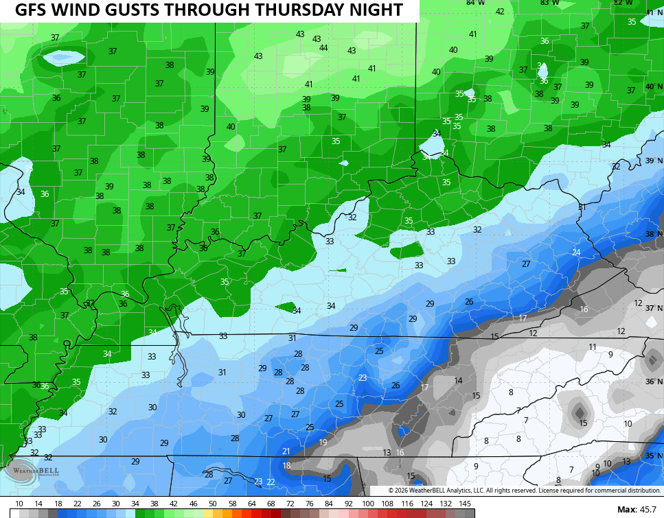
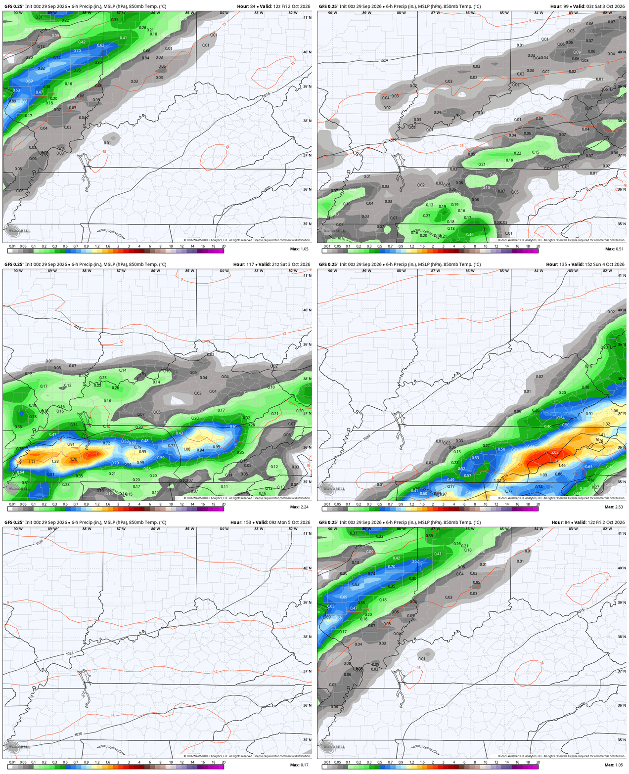
This is ahead of a strong fall cold front dropping in from the west and northwest late Friday. This front brings scattered showers and storms in here late Friday into Friday night. As this front slows down just to our south on Saturday, low pressure rolls toward us from the southwest. This brings an increase in showers and some thunder that likely lasts into Sunday. All of that ends by Monday as another strong fall front blasts through from the northwest.
Just how far north does that low get? That’s the deciding factor in whether or not we see a washout of a weekend or one with just scattered stuff.
If it’s far enough north, some heavy rains may fall in some areas…
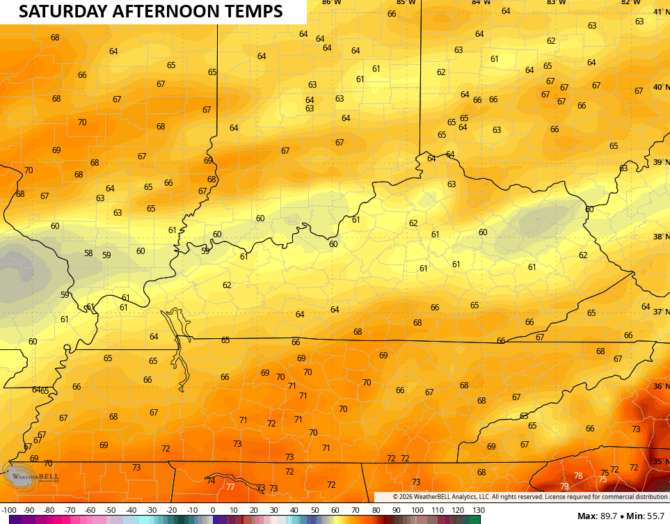
If we have clouds and rain for much of the day on Saturday, temps are chilly…
Seasonably chilly air then locks in behind this departing system…
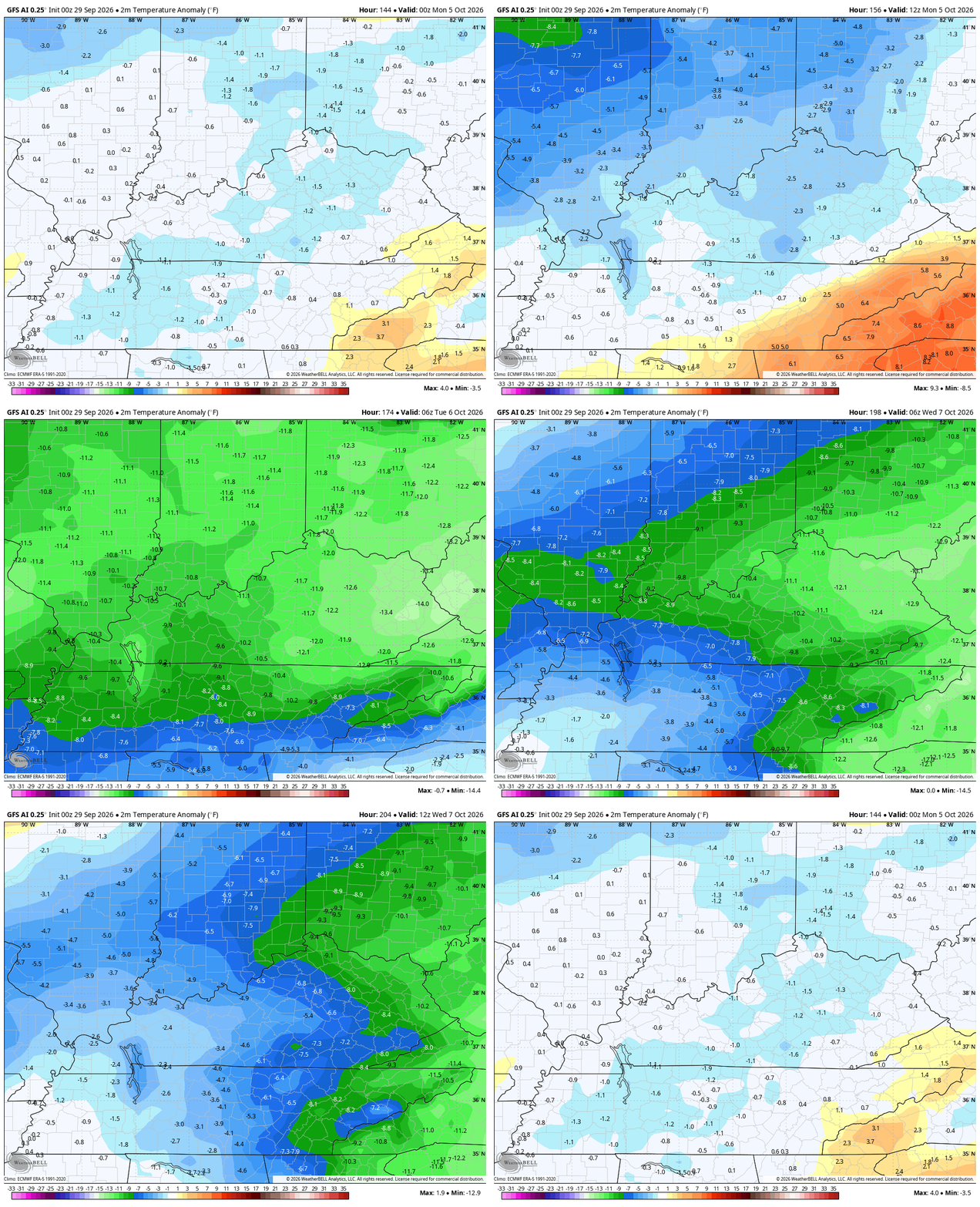
Temps can drop in the upper 30s for lows, leading to the potential for patchy frost.
From there, the models are back to struggling because they can’t stop firing up Gulf hurricanes that are never going to happen. It’s really something to behold.
Make it terrific Tuesday and take care.

Thanks Chris. The weekend system will be interesting to watch, especially the track of the low and how far north the heavier rains get. After such a dry September we could certainly use a good soaking. The chilly air and possible upper – 30’s lows behind it would really feel like Autumn. It’s the ” up and down ” temperature pattern we have to deal with in this Midwest climate.
Latest on the ” Super El Nino ” from the Climate Impact Company. Here’s the link : )
https://climateimpactcompany.com/weekly-enso-diagnostics-report-record-warm-nino34-nino3-and-nino12-ssta-still-warming-warming-may-accelerate-next-couple-months-2-2/