Good Friday, folks. We have a cold front dropping through the state today bringing gusty showers and much cooler winds. Some of those showers will then hang tough into the weekend, with the best chance being in the south and southeast.
Let’s start with the temps of the day because we will likely see a rather large gradient. Temps across the south and southeast reach the 80s as the showers won’t get in there until later today. Farther north, temps drop into the mid and upper 60s early today with those 60s settling south behind the boundary through the afternoon and evening.
Showers and some rumbles of thunder will work from northwest to southeast today. Locally heavy rains will be noted, but not everyone gets in on a lot of rain. Here’s the Hi Res NAM future radar from this morning through 11pm…
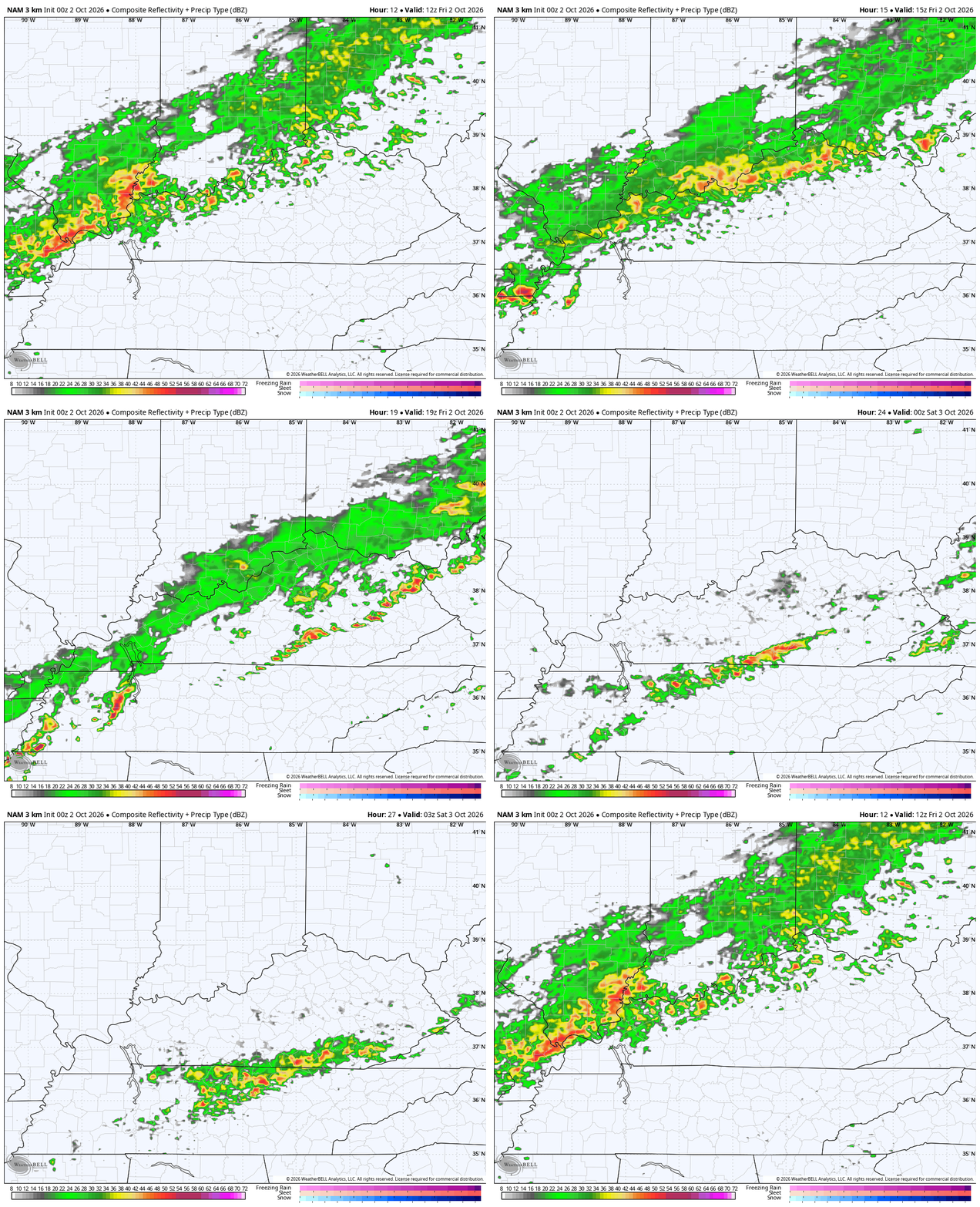
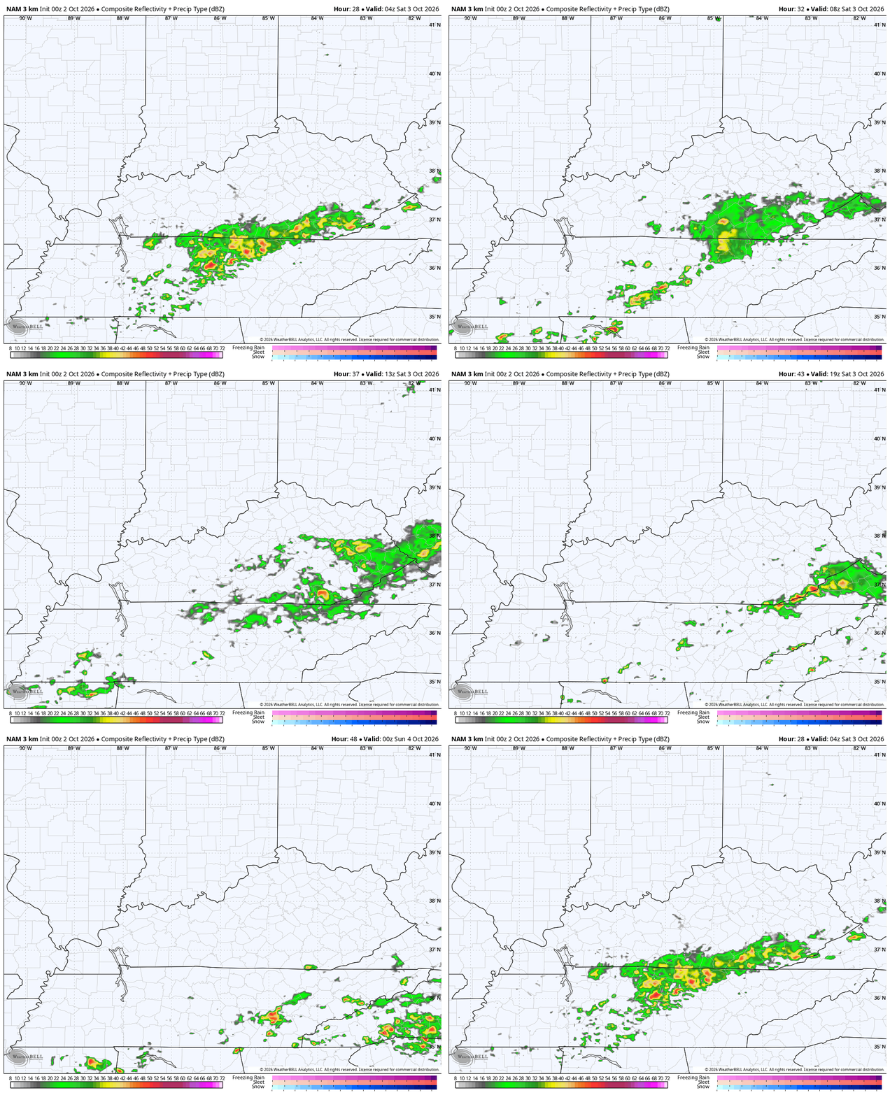
This boundary slows down across the Tennessee Valley with a couple of waves of low pressure rolling along it. This keeps some showers going tonight into Saturday, especially across the southeast.
The Hi Res NAM future radar shows this action through Saturday afternoon…
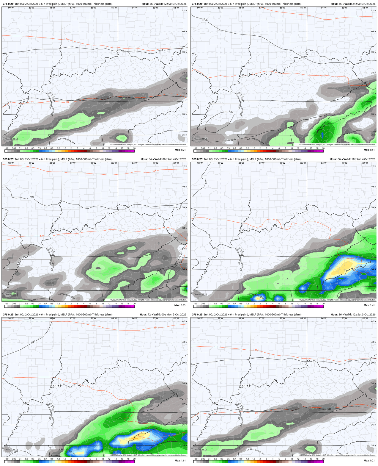
The GFS is finally seeing the southern and southeastern showers on Saturday and is also finally seeing the second round across the southeast on Sunday. This animation runs from 8am Saturday through 8pm Sunday…
Temps Saturday range from the low and mid 60s with showers to the low 70s with some sun. The numbers are largely in the 70s for Sunday ahead of another cold front arriving Sunday night. This brings chillier air into the east from late Monday through Wednesday…
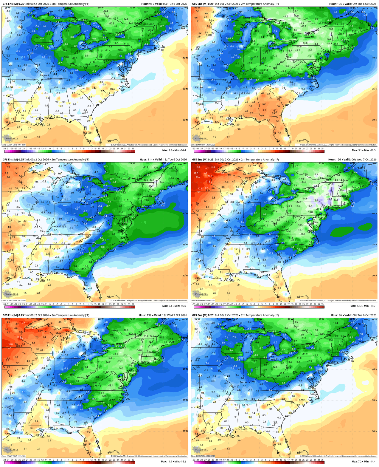
This may even give us some patchy frost by Tuesday morning with temps in the mid and upper 30s. The weather for the week as a whole looks incredibly nice with mild afternoons and seasonably chilly mornings.
Even as the forecast models continue to spin up fake tropical systems on a daily basis, the reality is there’s really nothing to track in the Atlantic Basin…

When the medium range models stop spinning up systems in the Gulf, they will see the pattern better. When that happens remains to be seen, though.
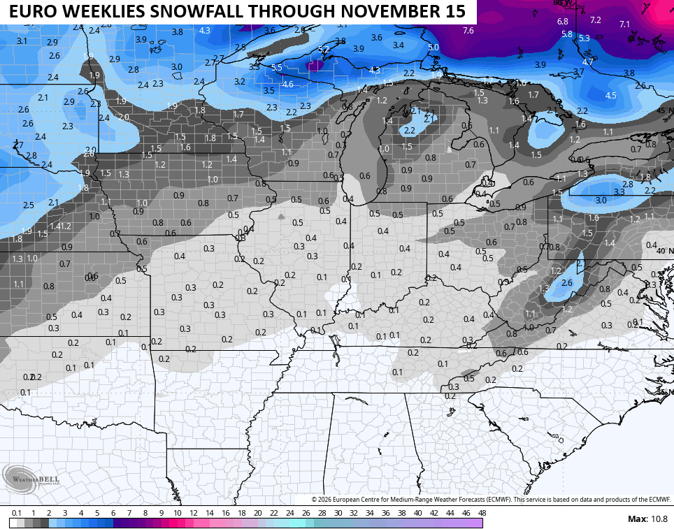
For you winter lovers, the EURO Weeklies continue to give hope for some early season flakes…
As always, I leave you with your daily storm tracking toys…




Current watches

Possible Watch Areas

Make it a fantastic Friday and take care.

We won’t see early flakes around here.
Watching the line of storms on the NAM forecast radar as they move east, but then seem determined to avoid south central Kentucky at all costs. Because lately that’s what happens, ALL OF THE TIME!!
Looking at the radar around 2:30 PM EDT, there appears to be a robust area of rain heading for Bowling Green. Hope it holds together, I know you need the rain Joe!
The Chicago area got another good, soaking rain yesterday, with 1.41 inches of rain at O’Hare Airport and 1.51 inches at the NWS Forecast Office in the SW Suburbs.
Illinois Mike I was in Chicago for work today and it was a perfect day, mid 60s and sunny.