Good Sunday, gang. We have a few showers grazing parts of the state today as we gear up for another fall cold front. This arrives tonight with little fanfare, but does unleash air that’s chilly enough for the first touch of patchy frost of the season.
The best chance for showers today is across the south and southeast as a wave of low pressure rolls quickly across the southern Appalachians. Most of the state is dry with a mix of sun and clouds and temps in the 70s.
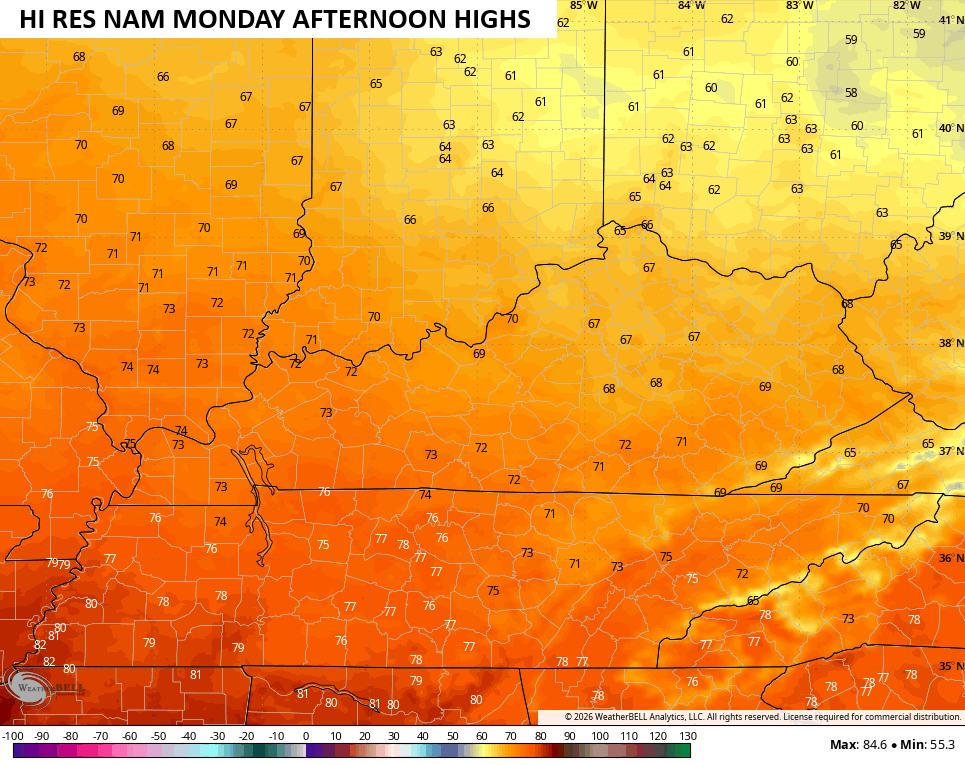
The front dropping in tonight is moisture starved, so don’t expect anything other than a few clouds. Temps come down behind this with Monday highs ranging from the mid 60s to low 70s…
This air mass is incredibly dry and that dry air will chill down very quickly once the sun goes down. This sends Monday night temps dropping into the upper 30s to low 40s for many…
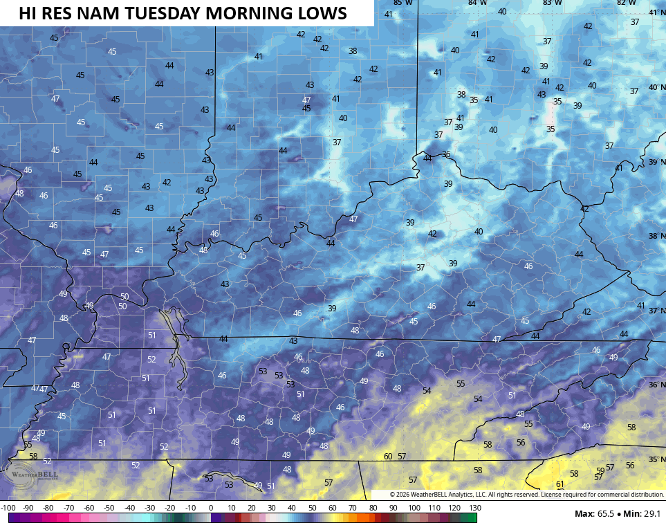
Some areas will see fog and that will keep the temp from reaching the high 30s in those areas. For those who stay clear, a touch of frost is possible by Tuesday morning.
Temps on Tuesday will be similar to our Monday with milder readings for the rest of the week, which looks absolutely awesome!
Before we get to where the pattern goes after this, we finally have the National Hurricane Center showing something to watch…

That’s part of the unsettled weather we see developing down in the Gulf in the next week or so, but that certainly does not mean something develops. That said, any disturbance or storm system there has a chance to wind up here later next weekend or early the following week.
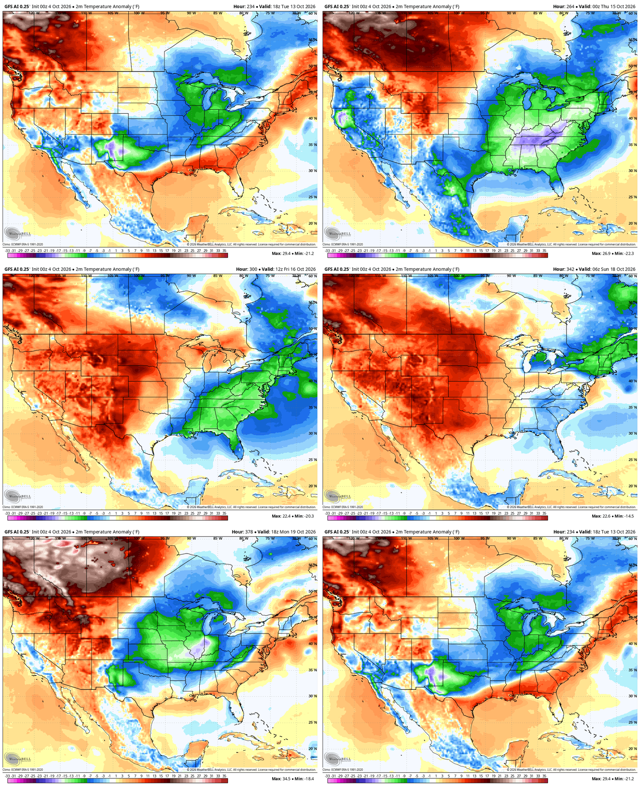
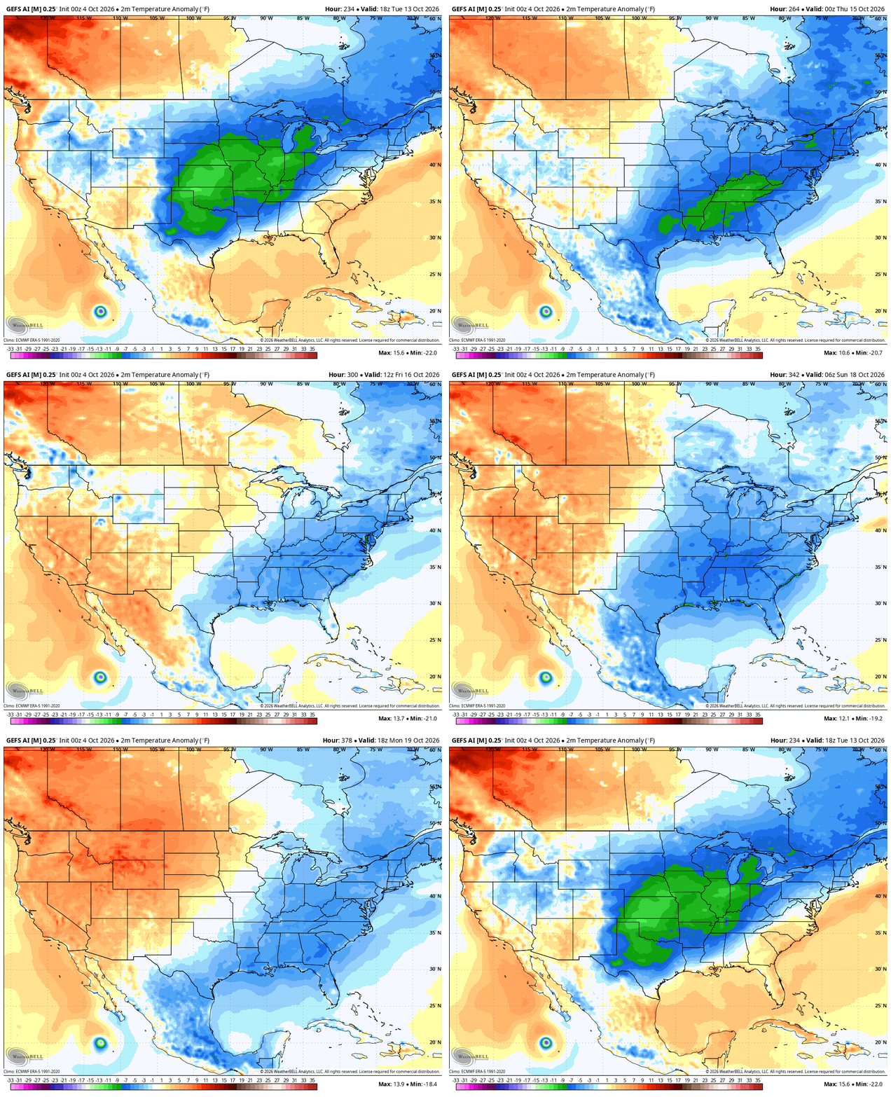
The signal continues for that colder look and it’s not just on the operational models. Here’s the AI GFS and AI GFS Ensembles from October 13 through October 19…
GFS AI
GFS AI Ensembles
I’m growing more interested in November as some of my initial analog years did have some early season winter. The EURO Weeklies are showing a pattern with much higher heights up in Canada with troughing developing underneath that across the USA. This runs from October 31-November 17…
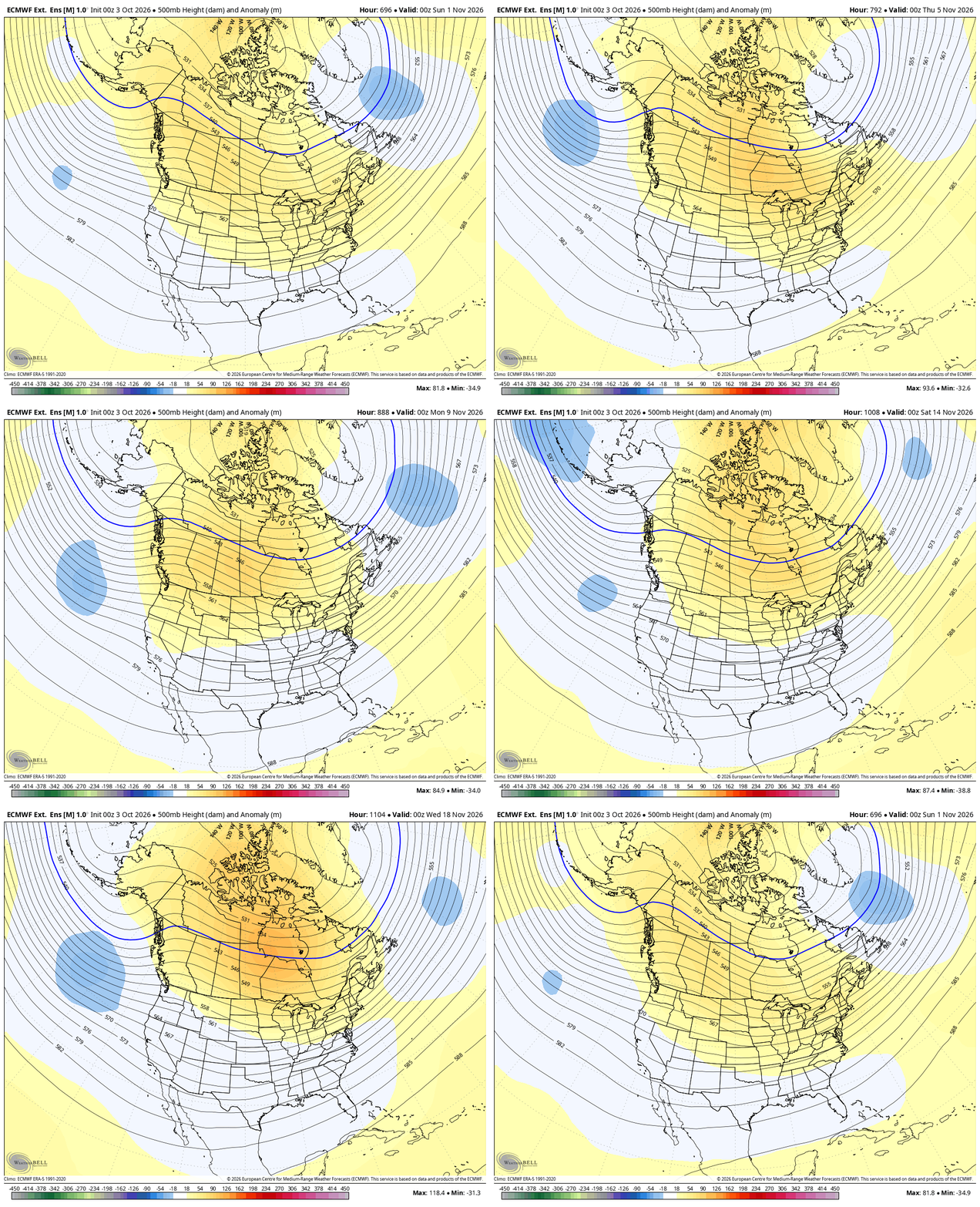
It’s also worth nothing that we’ve seen that pattern on more than one occasion over the past few years. It’s also notable that the above look is what many of the winter forecasts look like from the seasonal models, suggesting they may be onto something.
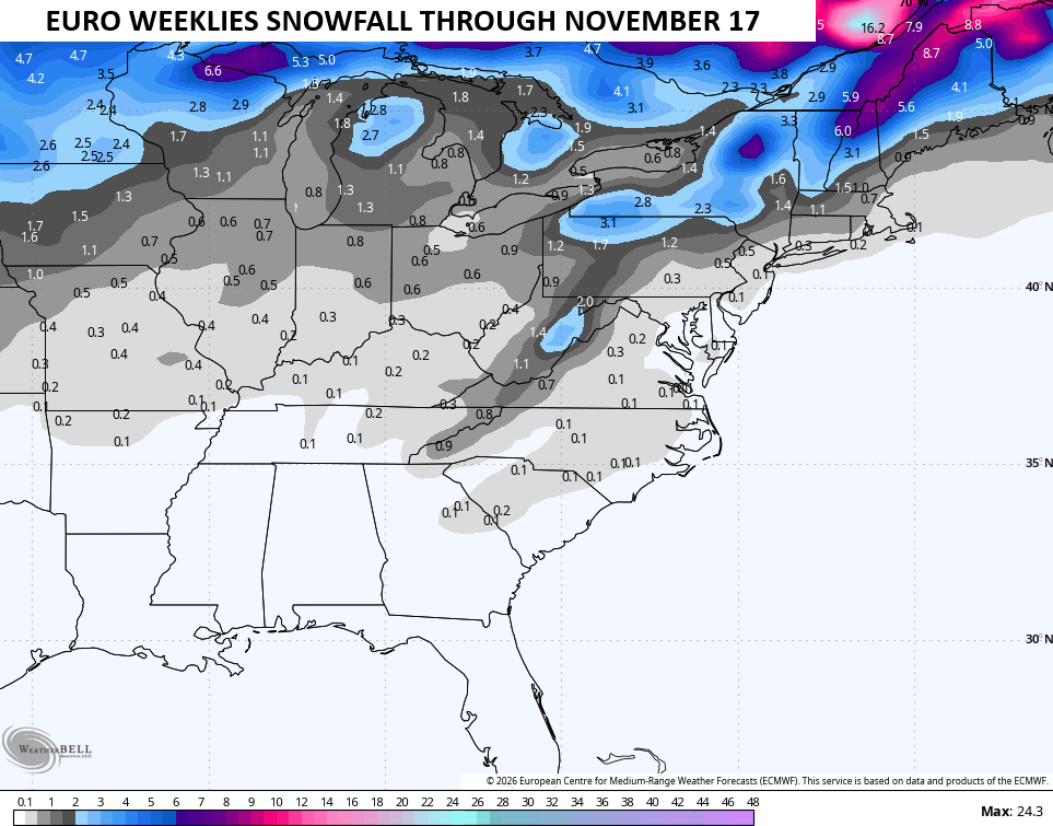
Btw, that same run of the EURO Weeklies keeps seeing the potential for early season flakes…
As always, I leave you with your daily storm tracking toys…




Current watches

Possible Watch Areas

Make it a great Sunday and take care.

I call shenanigans on the EURO weeklies.
That tropical system in the Gulf of Mexico bears watching, as that area of the Gulf contains some of the warmest water temperatures in the northern hemisphere, prevailing upper air winds are southwest to northeast, and there is very little shear. Low level winds are light, and though the system may meander for a while, it’s probably our best chance to get some meaningful rainfall.
Regarding the super El Nino, most climatologists believe that it will continue to strengthen through year end, and based on the fact that the warm water layer extends to a depth of nearly 100 meters, I believe that El Nino will remain with us well into winter, if not the beginning of spring. Speaking of spring, I continue to see a signal indicating chances are elevated for significant severe weather throughout the season. The chief analog I’m watching is 1997-98.