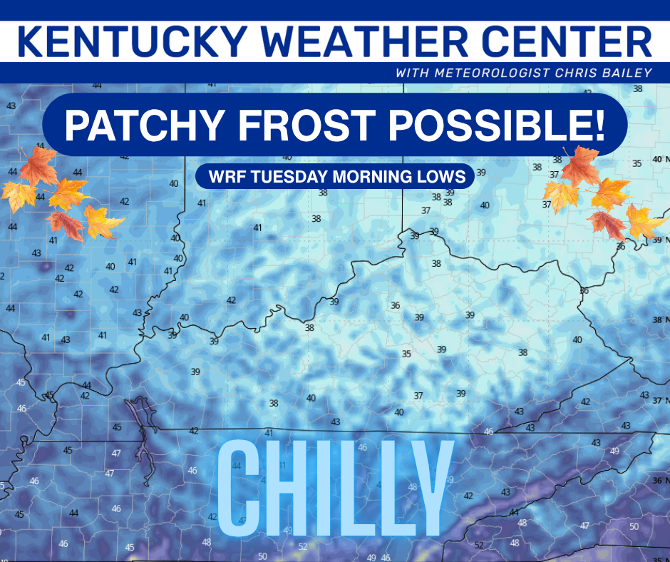
Good Monday, everyone. Today is another amazing fall weather day as we kick off a great week of fall weather. This begins with enough of a chill for a touch of frost to possibly show up in some of the coldest valleys tonight.
Otherwise, the temps will warm later in the week into the start of the weekend as we watch the Gulf for a system that tries to impact our weather.
Temps today are awesome with upper 60s to low 70s for much of the state on a northeast wind. Skies look good after some areas of fog burn away.
This leads to the potential for a touch of frost tonight in the valley locations as temps make a run into the upper 30s and low 40s. This won’t be anything widespread at all, but the chance is there in a few of the traditional colder locations…
Tuesday looks equally amazing with another terrific temperature day taking shape…
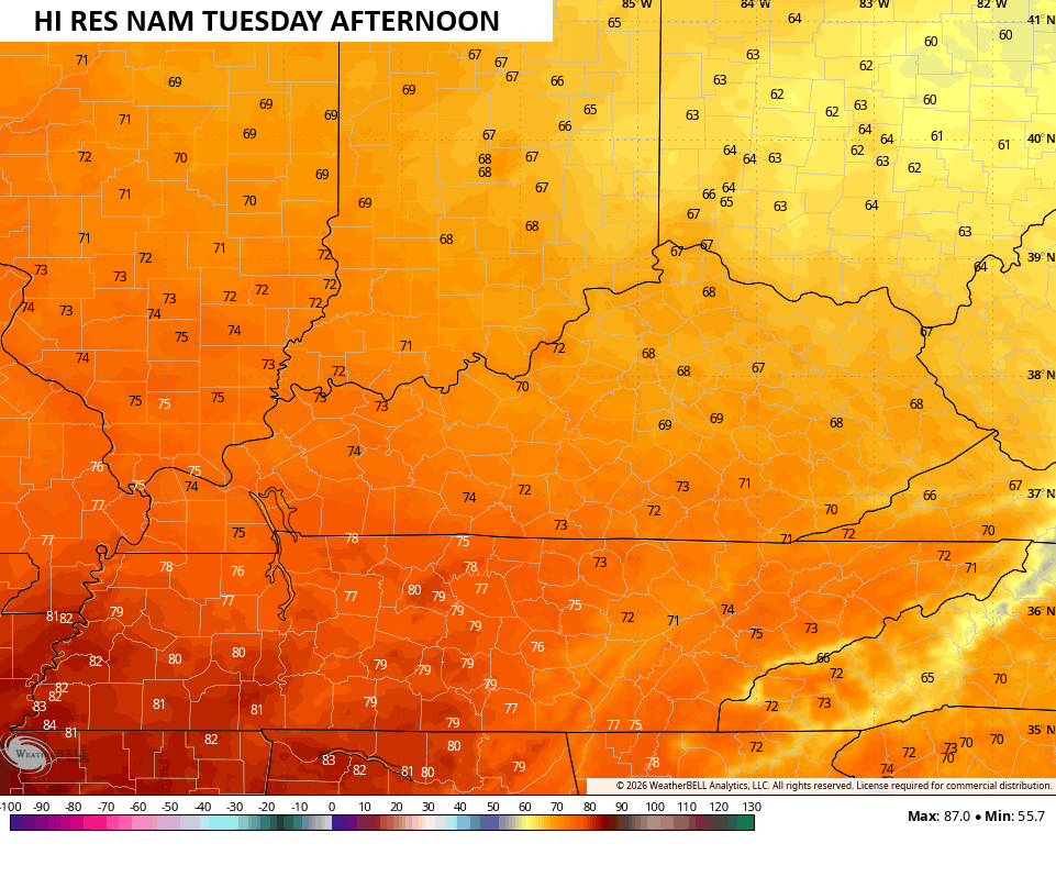
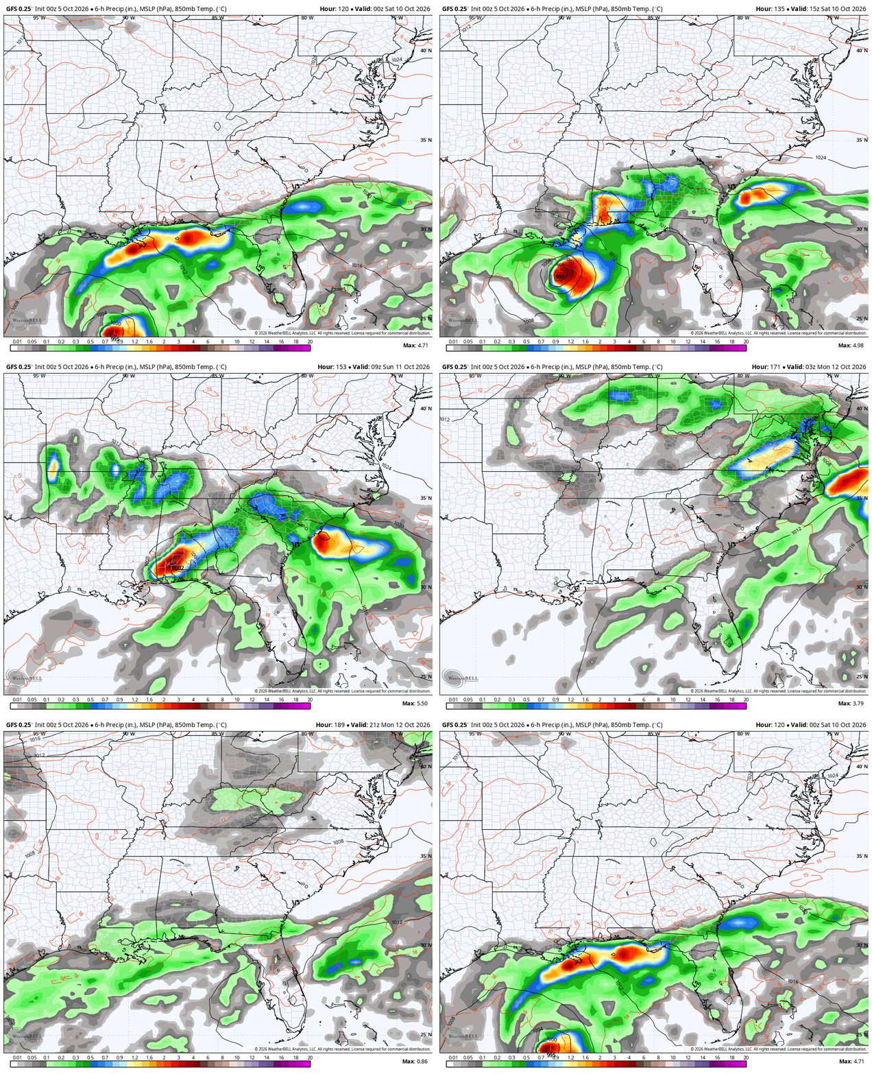
Temps climb a little more each day and likely top 80 later in the week into the start of the weekend. While all this is going on, we are watching the Gulf for a lot of unsettled weather with the chance of something tropical trying to finally develop.
The National Hurricane Center is monitoring the setup…

Whatever comes out of that mess has a realistic chance to bring rain our way as the overall pattern fits the look for our region. Plus, all of the medium range forecast models are picking up on this setup…
That would be ahead of a big dip in the jet stream showing up.
If we look at the GFS Super Ensembles centered on October 15th, we find the composite of analogs looking like this…
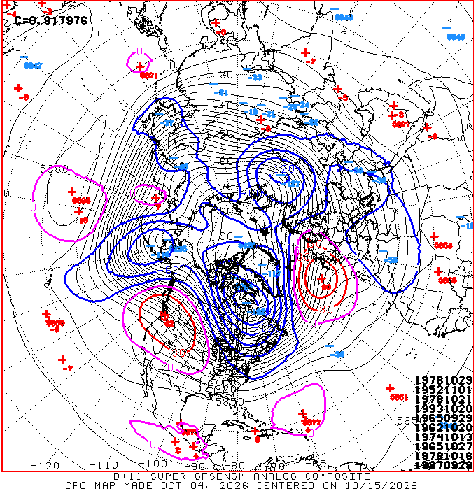
The list of the 10 best analog dates shows up at the bottom right of the map and we still have no Super El Nino’s as the best match for the upcoming pattern. However, we do see two strong El Nino years showing up in 1987 and 1965, which shows up twice. 1978 actually shows up 3 times and it was a neutral year as was 1993 and 1962. 1952 was a weak El Nino. 1974 was a weak La Nino.
What does all this tell me? That this Super El Nino still isn’t in control of the overall pattern of the Northern Hemisphere. We will have to wait and see if this changes before we get into the winter months.
Make it a great Monday and take care.

Tropical coupling is already strong in the southern hemisphere…Guess we now wait and see where the forcing sets up the ridges/troughs in the northern hemisphere..Really is no true analog for the possibility of the strongest El Niño and most east base on record…Could see 4-6 degrees above normal this winter with the possibility of a historic snow/ice event..interesting times..
I agree, and if we get a Polar Vortex incursion or two, which are actually more like to occur in El Nino years, the result could be historic. Analogs have been growing less reliable as the atmosphere and especially the oceans grow warmer. The oceans take longer to warm, but at the same time they are many times slower in giving up that heat. One way that happens is when colder water at depth is churned to the surface, but now we are seeing waters considerably warmer than normal, far deeper than ever. Water temperatures ina large percentage of the equitorial Pacific Ocean are much above normal to a depth of 100 meters. Added up, the state of our atmosphere today is far different than what we have observed in recent history, including the years when the algorithms used in many of the forecast models today, were developed, Therefore, trying to create a long or medium range forecast by using weather patterns as they existed years ago for a data model, in an atmospheric environment that significantly differs from that which existed less than a decade ago, promises to be problematic at the very least. Many months ago, the earliest reports by the CPC on the upcoming El Nino predicted a moderate event that would peak in September, and begin to phase into ENSO Neutral by January. Now, some climatologists think that it will continue to strengthen and persist into spring.
Yes Joe i agree..Really fascinating watching this El Niño develop..Models have another WWB pushing the warm waters further east..Niño 1+2 is already at a record high.These kelvin waves carry deep intense heat…Can’t rule out flooding in this setup..Uncharted territory for sure..