Good Tuesday to one and all. It’s another in a long line of awesome fall weather days and this continues through the end of the week. All of that looks to change this weekend with a potential impact of a tropical system coming at us from the Gulf.
Our day is starting on a seasonably chilly note with temps in the upper 30s to low 40s. Some patchy frost may even show up in a few of the sheltered valleys. Temps this afternoon range from the upper 60s to mid 70s from east to west.
Skies are awesome and this same sky will be with us through Friday. Temps come up Wednesday and Thursday with 80 possible in some areas. Another weak cold front drops in Thursday night, knocking the temps back down several degrees for Friday.
Everything that happens after this revolves around what’s developing down in the Gulf. This system is likely to become Isaias in the next few days…

Here’s what this area looks like on satellite…

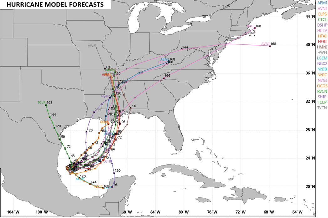
The latest spaghetti plots from the Hurricane Models just east of the Mississippi River before what’s left takes a turn toward us…
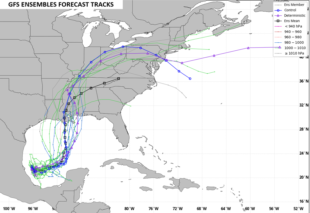
The GFS Ensembles are similar but keep this entity a little more intact…
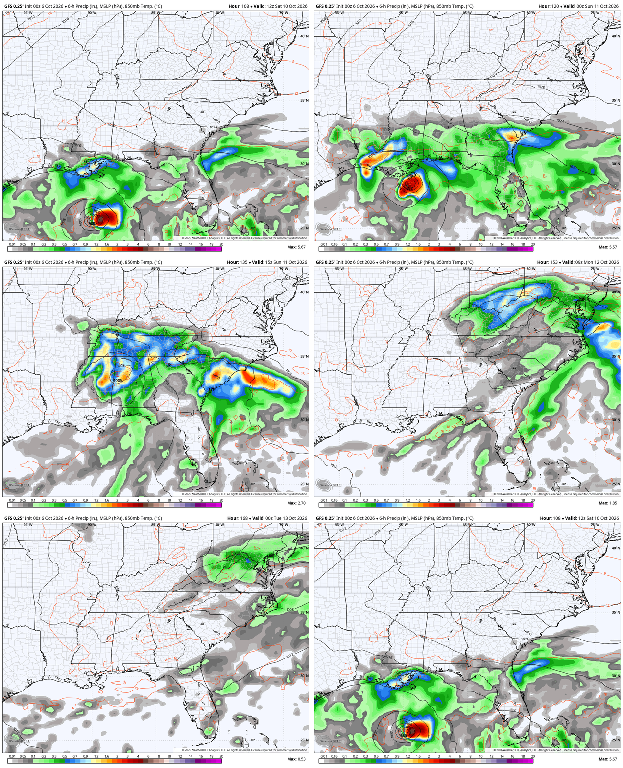
The operational models will change a lot, but they’ve been singing a similar tune lately. The GFS takes this from the Gulf Coast to Kentucky with rain and wind increasing Saturday night and Sunday…
The AI version of the GFS is a bit quicker with the overall movement…
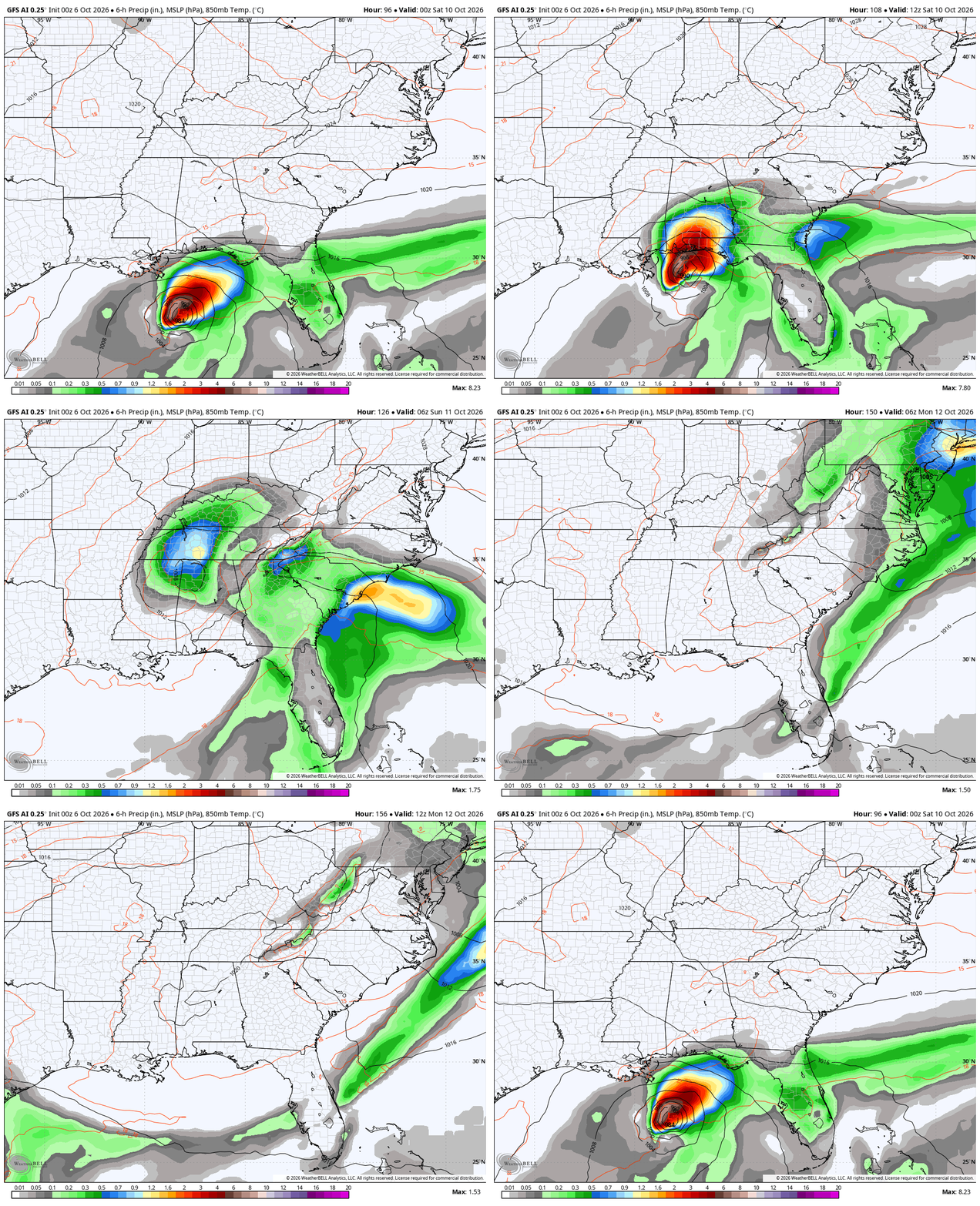
Again, locally heavy rains and gusty winds would be possible from Saturday night into Sunday and part of Monday. The exact arrival and departure times are TBD.
I may stop by for another update later today. Make it a great day and take care.

As long as no floods happen, all is good.
Until El Nino ‘s storm track kicks in, this could be the only way that South Central Kentucky will see any meaningful rain.