Good Wednesday to one and all. As our awesome fall weather rolls on for a few more days, we are focused on a developing Gulf hurricane and the impact it may have on our weather. This impact looks likely from late Saturday through Monday as what’s left spins through here.
Since the weather is awesome through Friday, let’s get straight into the tropical system.
Isaias is forecast to intensify today and may become a hurricane on Thursday. From there, this storm continues to strengthen as it heads toward a late Friday landfall along the central Gulf Coast. From there, this rapidly zips northward toward our region later Saturday and Sunday.
Here’s the latest information and forecast track from the National Hurricane Center…

If this does become a hurricane, it would be notable on two fronts. First is that this is the latest we’ve been in the Atlantic Hurricane Season without a hurricane in the modern era. This would also mark the first Gulf hurricane in October during a Super El Nino.
The satellite shot shows this system slowly getting better organized…

The spaghetti plot from the Hurricane Models continues to be pretty consistent with how they handle the track toward Kentucky…
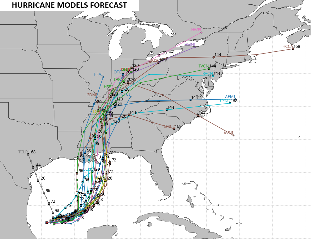
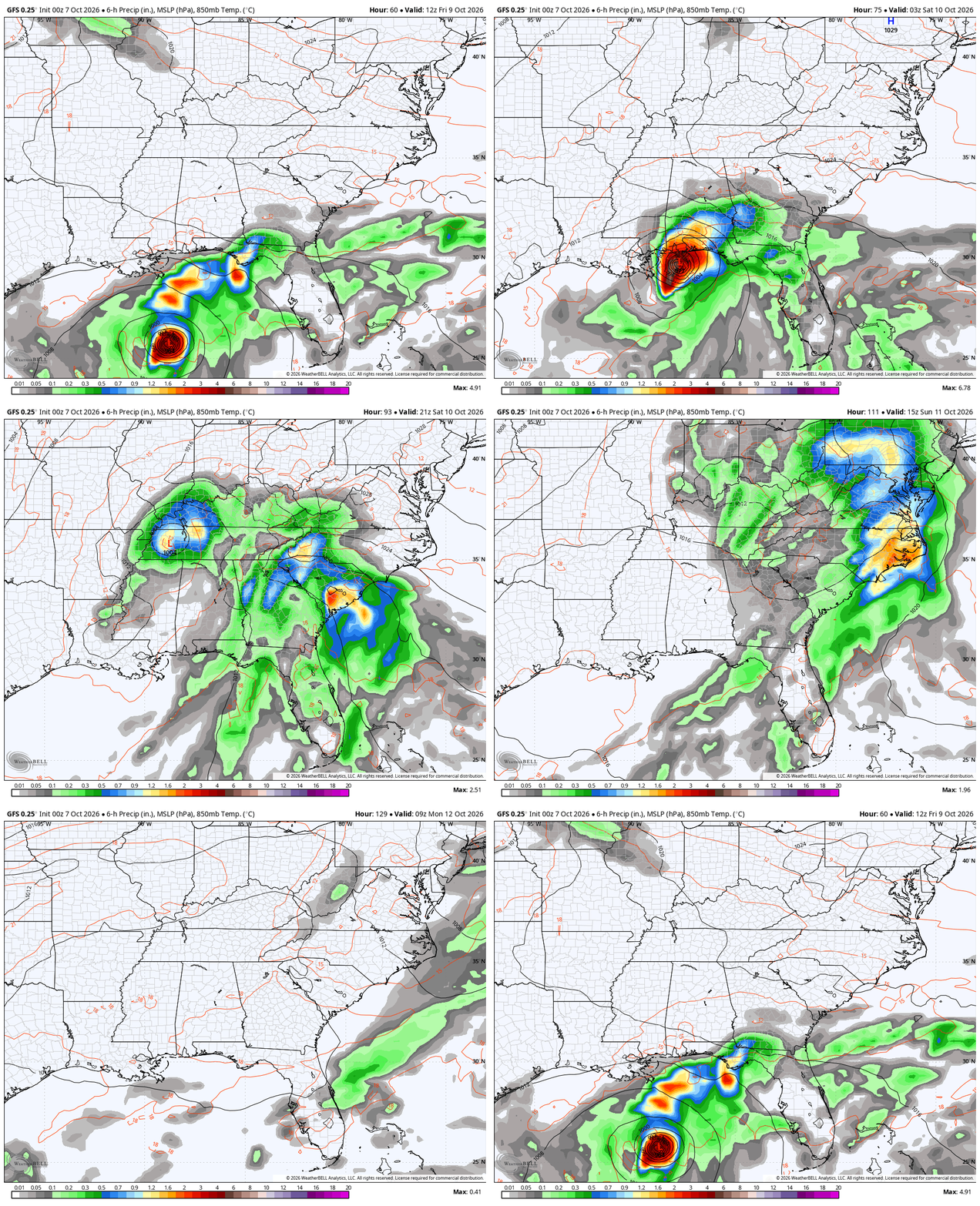
The exact arrival time of this system in Kentucky is a work in progress as we still have some disagreement from the forecast models. The hurricane models have been faster with the arrivial, bringing rain and wind in here on Saturday. The operational models were slower, but they’re starting to speed up the process.
Here’s the GFS from Friday morning through Monday morning…
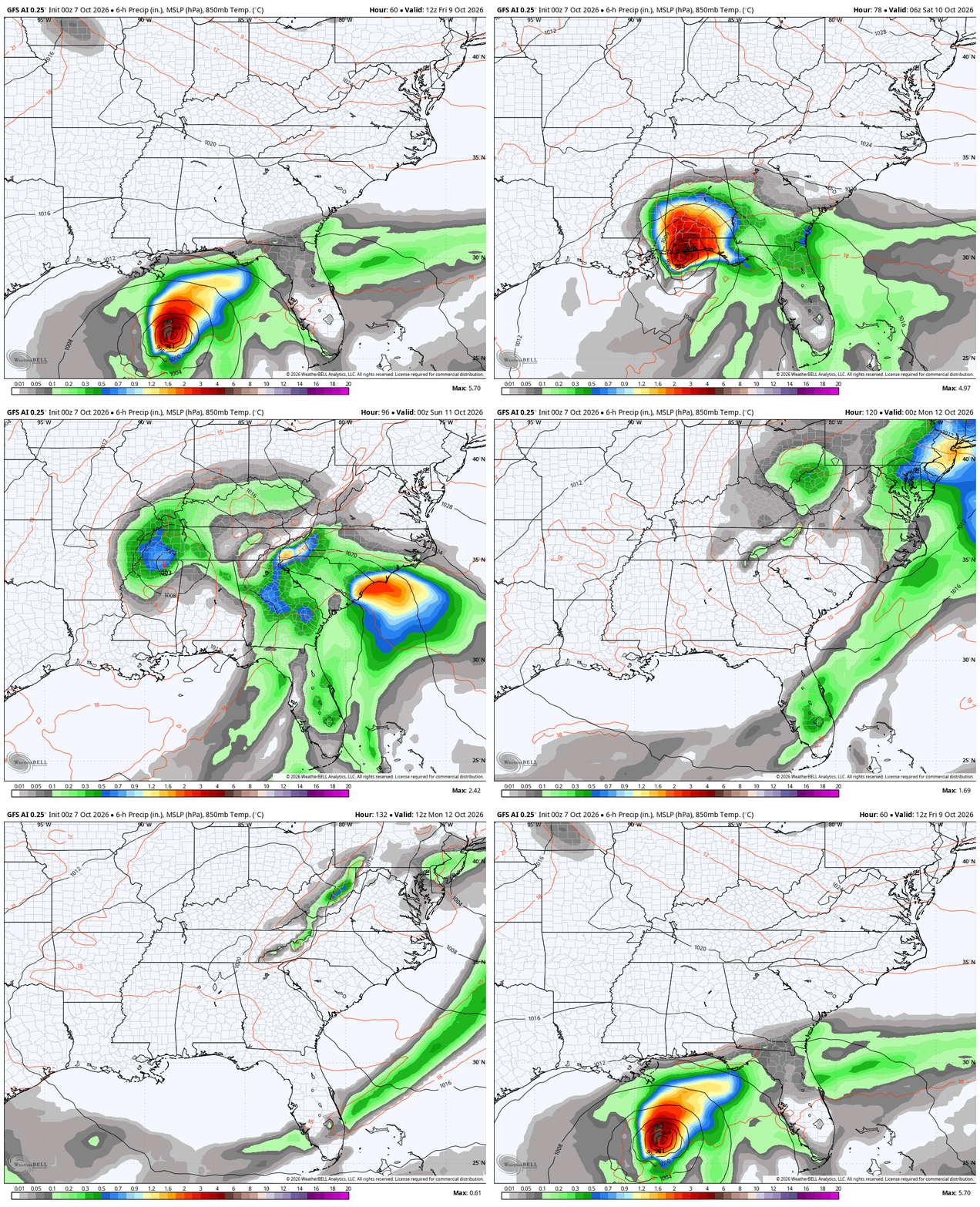
The AI version of the GFS is similar…
With a faster moving storm, those models keep the wind field more intact well inland…
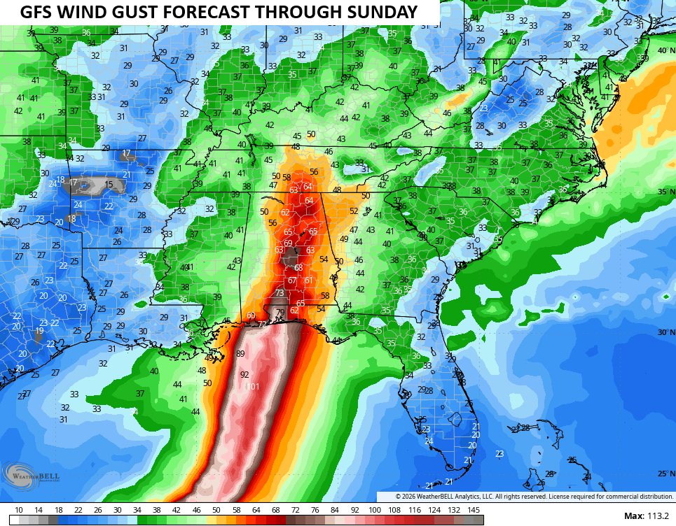
Areas along and to the right of the center of circulation also have the chance to spin up a few strong or severe storms, even into our part of the world.
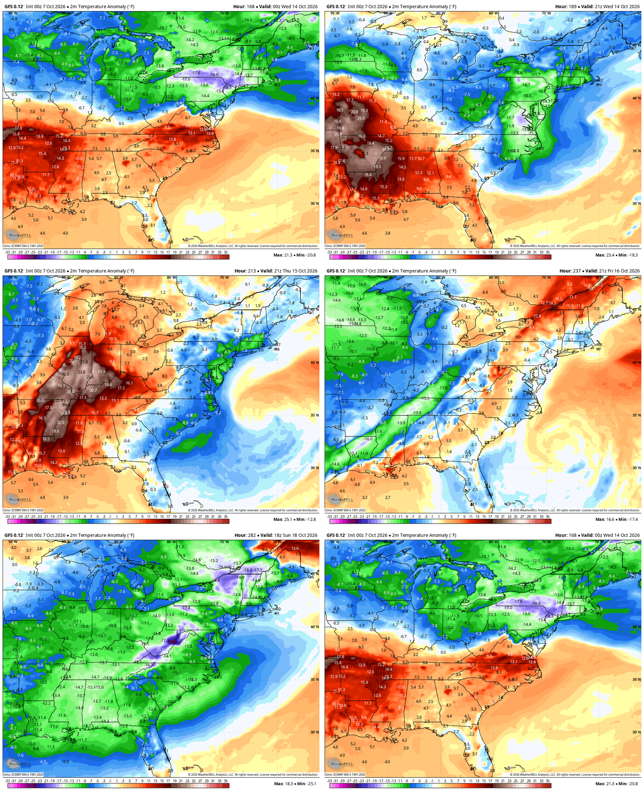
Once this system goes by, it really changes up the overall pattern. Things look more like later in November instead of the middle of October…
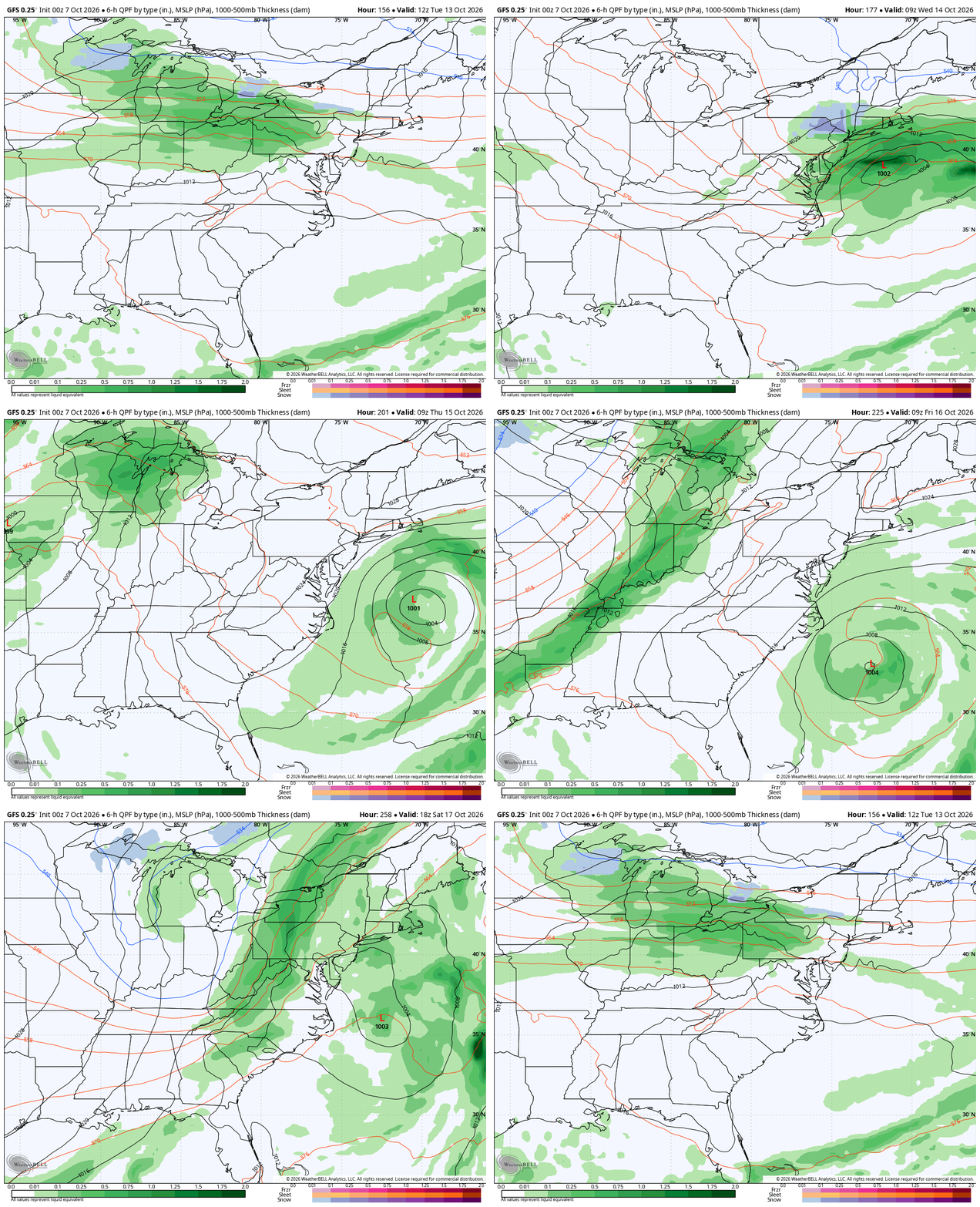
Ending the growing season is on the table with those cold shots later next week into next weekend..
I’ll stop by for an update later today and I’ll be on WKYT and WKYT+ with the latest.
Have a great day and take care.

I don’t foresee anything but a good soaker.
To the people who are saying “we finally have our first Atlantic hurricane of the season…”, I say nope. There needs to be a distinction between hurricanes that spawn in the Gulf of Mexico and those that get their start in the equitorial Atlantic, especially during a strong El Nino. The upper and mid level wind environment in the Atlantic is simply too hostile to sustain development; anything that gets started is either pulled apart by shear, or pushed to the northeast into colder waters. On the other hand, the water temperature in the Gulf of Mexico makes it seem like a tropical storm petri dish. Water temperatures in the low 90’s and winds moderated by the mountain ranges to the west, makes it easier for tropical systems to develop and build in strength.