Good Thursday to one and all. The focus of the forecast continues to be on a Gulf tropical system that will impact Kentucky this weekend. What’s left of Isaias will bring heavy rain, a few strong storms and gusty winds to the Commonwealth.
Isaias is likely a hurricane by the time you’re reading this and it will continue to strengthen today and Friday. Here’s an updating satellite loop showing what this storm looks light right now…

The National Hurricane Center shows this becoming a Cat 2 hurricane with the chance it can push Major Hurricane status before it makes landfall Friday night along the central Gulf Coast. This will then barrel its way to the north with the remnant low passing right on top of central and eastern Kentucky Saturday night and Sunday.
Here’s the latest information and forecast track from the NHC…

The NHC won’t show the cone going behind where they believe this system still carries some tropical characteristics.
The latest spaghetti plot from the Hurricane Forecast Models continues to take this system into Kentucky then turning it to the east on top of us…
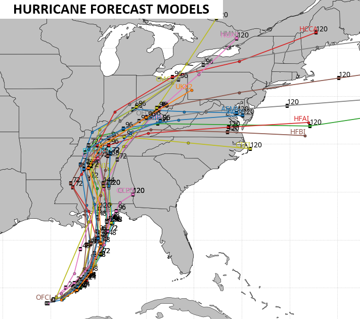
The various forecast models are pretty much in line with this thinking now. The GFS has been on board with this for a while now…
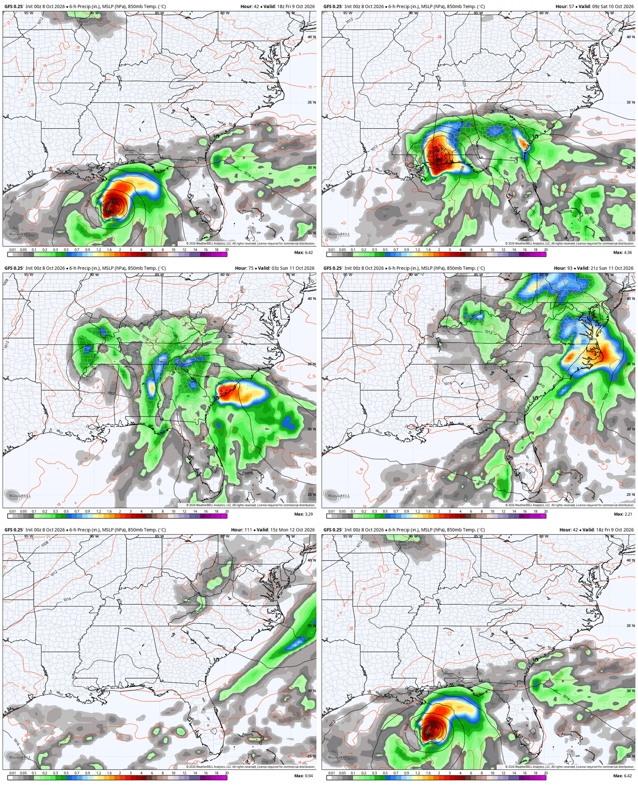
What does all this mean for us? Here we go:
- Spiraling bands of showers and some storms arrive from south to north Saturday afternoon and evening.
- This action increases during the evening and overnight as the threat for a few storms increases.
- Winds will increase as well with gusts Saturday evening and night topping 30-40mph at times.
- The remnant low enters southwestern Kentucky late Saturday night then rolls east across the state Sunday.
- More in the way of spiraling bands of showers and storms spread east along and ahead of this low.
- We will need to watch for a few strong or locally severe storms to fire up during this time.
- Areas of 1″-3″ rains may show up this weekend, with the opportunity for a little more in a few spots.
- Local flash flooding issues can’t be ruled out.
- This system moves way Sunday night and early Monday, taking any lingering showers with it.
Here’s a look at what the Storm Prediction Center is thinking for the Saturday severe risk…

The Sunday risk is outside of the 3-day window, so it may not show much…

In terms of the Excessive Rainfall Outlook for Saturday, here’s what the Weather Prediction Center has…
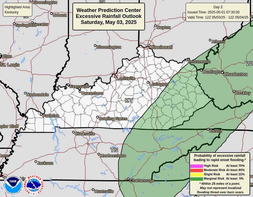
And here’s the outlook for Sunday…

While we are tracking a Gulf Hurricane, a Pacific Hurricane named Rachael is weakening but will have a rare southern California impact. Here’s the National Hurricane Center forecast for that odd storm…

As always, I leave you with your daily storm tracking toys…




Current watches

Possible Watch Areas

Make it a great Thursday and take care.

Chances a good that hurricane Isaias will achieve Category 3 status before making landfall because water temperatures in the Gulf of Mexico are 90°F. Sure hope it performs well for South Central Kentucky.
Pacific hurricanes almost never take a northeast track, except in the presence of a strong El Nino, because it causes the prevailing winds to blow from west to east, as opposed to the normal east to west direction.
1-3 inches isn’t too bad.
Has anyone notice every time they mention rain they always say flash flood is possible. It seems its been a common theme lately, that been said with the rain that’s forecast this weekend with the ground is so dry whatever rain we get the ground will absorb it than it be runoff.
Regarding the potential for flash flooding on ground that has been severely moisture-starved, I think it really depends on the intensity of the rain. If it begins as a gentle shower, then the ground will start absorbing the moisture at once, and if it should graduate later to a downpour it will tend to absorb until the ground is saturated. But if you take very dry, compacted soil and hit it with a very heavy shower, the ground will initially behave like pavement, and you’ll see more runoff until the top layers are moistened. Incidentally, I can’t remember the last time we had a steady, gentle, hours long rain in BG!