Good Friday to one and all. We’re putting the wraps on an amazing week of weather across Kentucky, but we have to pay the bill for it soon. Hurricane Isaias continues to spin toward the Gulf Coast and will bring a big impact to Kentucky this weekend.
Before we get into all the specifics on our storm. Here’s a quick breakdown of how things may play out around here:
- Spiraling bands of showers and some storms arrive from south to north Saturday afternoon and evening.
- This action increases during the evening and overnight as the threat for a few storms increases.
- Winds will increase as well with gusts Saturday evening and night topping 30-40mph at times.
- The remnant low enters southwestern Kentucky late Saturday night then rolls east across the state Sunday.
- More in the way of spiraling bands of showers and storms spread east along and ahead of this low.
- We will need to watch for a few strong or locally severe storms to fire up during this time.
- Areas of 1″-3″ rains may show up this weekend, with the opportunity for a little more in a few spots.
- Local flash flooding issues can’t be ruled out.
- This system moves way Sunday night and early Monday, taking any lingering showers with it.
The satellite loop shows our hurricane and how it’s essentially getting pulled right toward the Pensacola, Florida area…

The latest information and track forecast from the National Hurricane Center continues to take what’s left of this all the way into our region…

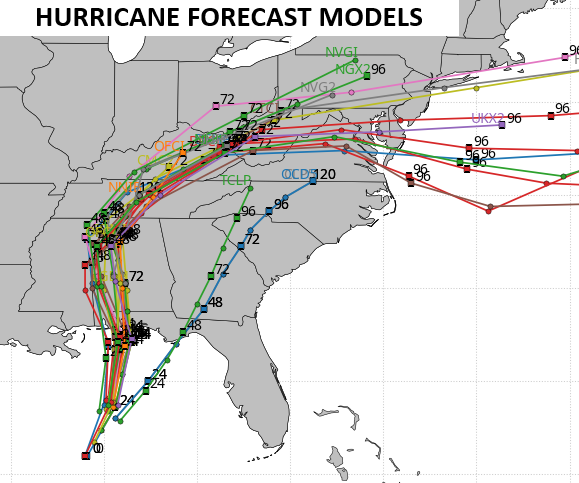
The Hurricane Forecast Models have also trended farther east into central and eastern Kentucky for the track of the low…
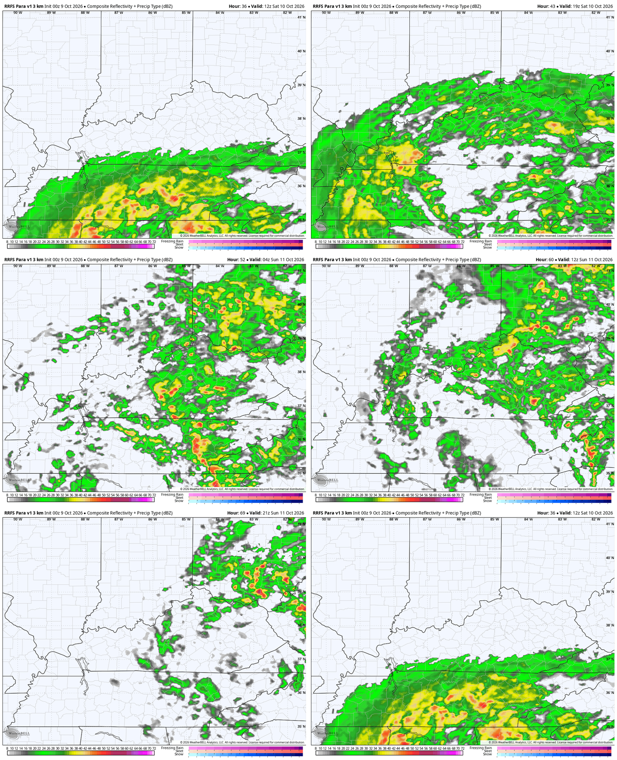
The future radar from the RRFS matches up really well with the forecast track from the NHC and the Hurricane Models. Watch these spiraling bands of showers and storms spinning around the low on this animation that starts at 8am Saturday and ends at 8pm Sunday…
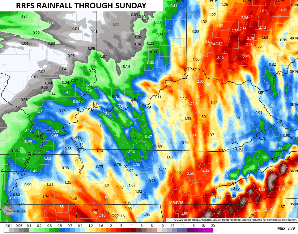
The signal is there for a corridor of enhanced rains across central Kentucky, especially. Here are the rain numbers from the RRFS for the weekend ahead…
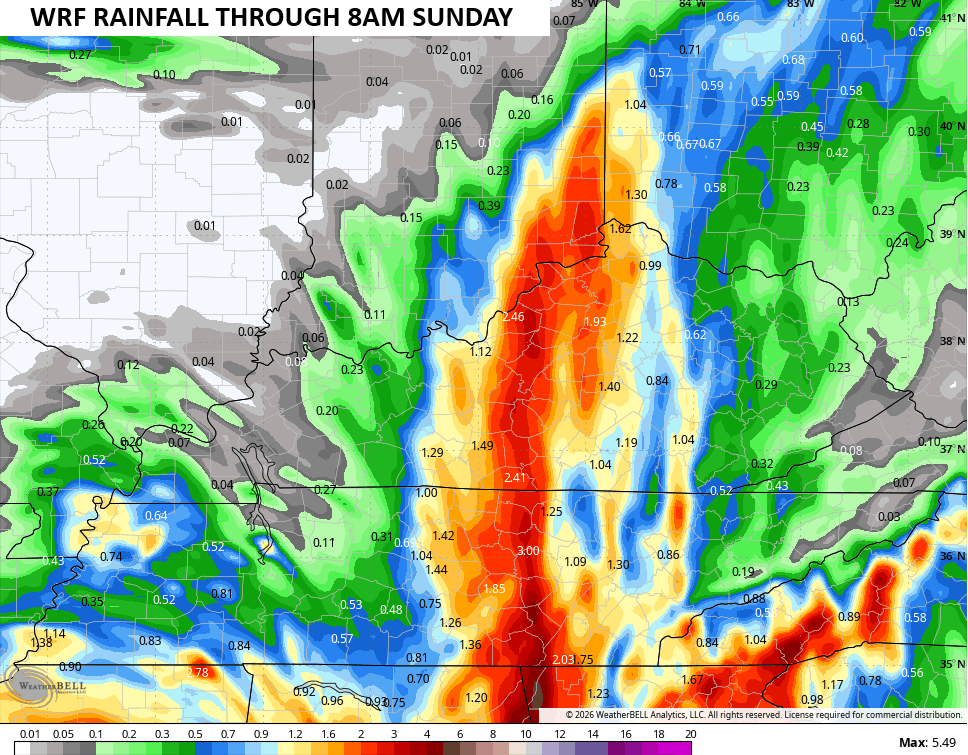
The WRF only goes through Saturday night, but you can see the corridor of heavy rains…
Local flash flooding issues will be possible from Saturday evening through Sunday afternoon.
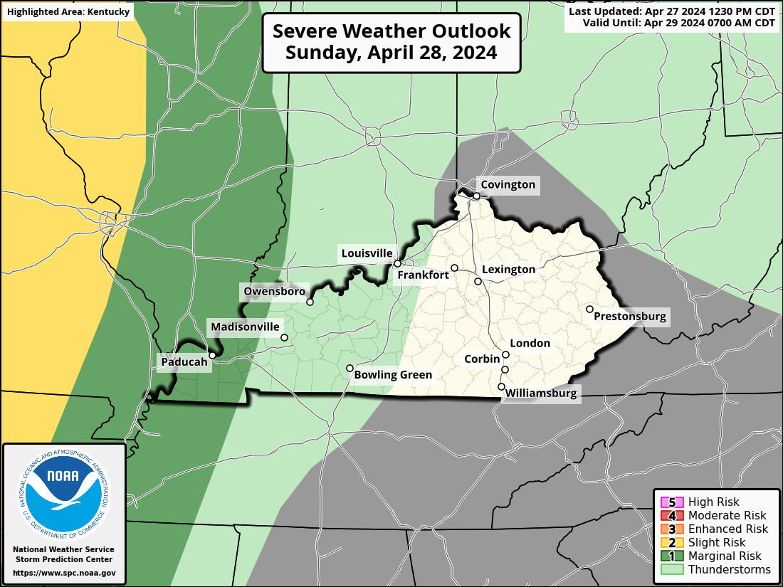
I can’t rule out a few strong storms Saturday night into Sunday. Here’s what the Storm Prediction Center is thinking in terms of any severe weather chances for Saturday and Sunday…

As always, I leave you with your daily storm tracking toys…




Current watches

Possible Watch Areas

Make it a fantastic Friday and take care.

Thanks Chris. This system bears watching, especially the track of the remnant low and the placement of the heavier rain bands. Central Kentucky needs the rainfall, but the Southeast Ridge has repeatedly produced disappointing totals in my area. Let’s see how the actual track verifies.
Without any floods, this will simply be beneficial and nothing to worry about.
As expected, once the storm reaches KY, the models are showing the rain shield being pulled to the east of Warren County, and very evident when you look at the radar image. So the BG area is likely to remain in a Moderate Drought condition.
The CPC has published its October update, which say the current El Nino is on track to exceed historic levels, and there is a greater than 83% chance that it will persist through March 2027. If that timeline holds, it would set up a transition to Neutral in the spring, and trigger greater than normal severe storm intensity through mid to late spring.
https://www.cpc.ncep.noaa.gov/products/analysis_monitoring/enso_advisory/ensodisc.shtml
Sounds about right
A great deal of the force behind that curve to the east is due to the influence of the southern jet, which is being amped up by the El Nino.