Good Saturday, everyone. What’s left of Hurricane Isaias is blowing into the bluegrass state today, bringing rounds of showers and thunderstorms to go along with gusty winds. This system will likely cause local issues across central and eastern Kentucky through Sunday.
Isaias came ashore Friday evening near Destin, Florida. This system slowly weakens today as it moves northward across Alabama with the center of this thing moving into Tennessee then Kentucky later tonight and Sunday.
Here’s the latest information from the National Hurricane Center…

Spiraling bands of showers and a few thunderstorms spin across the state today, increasing from south to north. Rain will have overspread much of the state by the middle of the afternoon, continuing into the evening.
This future radar from the RRFS starts at 8am today and runs into the wee hours of Sunday morning…
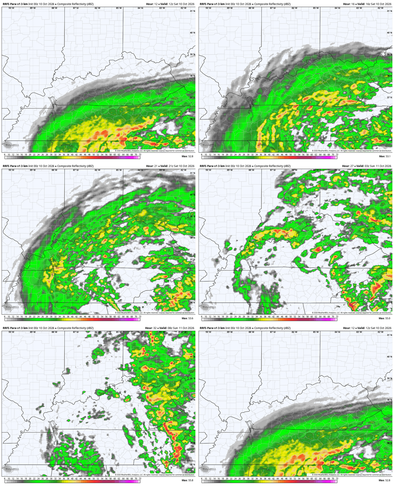
Winds during this time will really increase with late afternoon and evening gusts reaching 30mph-40mph at times.
I don’t think we see much in the way of strong or severe storms out there today and neither does the Storm Prediction Center…

The center of circulation from Isaias will cross the state Sunday and will still have a pretty tight spin with it. Showers and thunderstorms will be spiraling around this low, especially in central and eastern Kentucky…
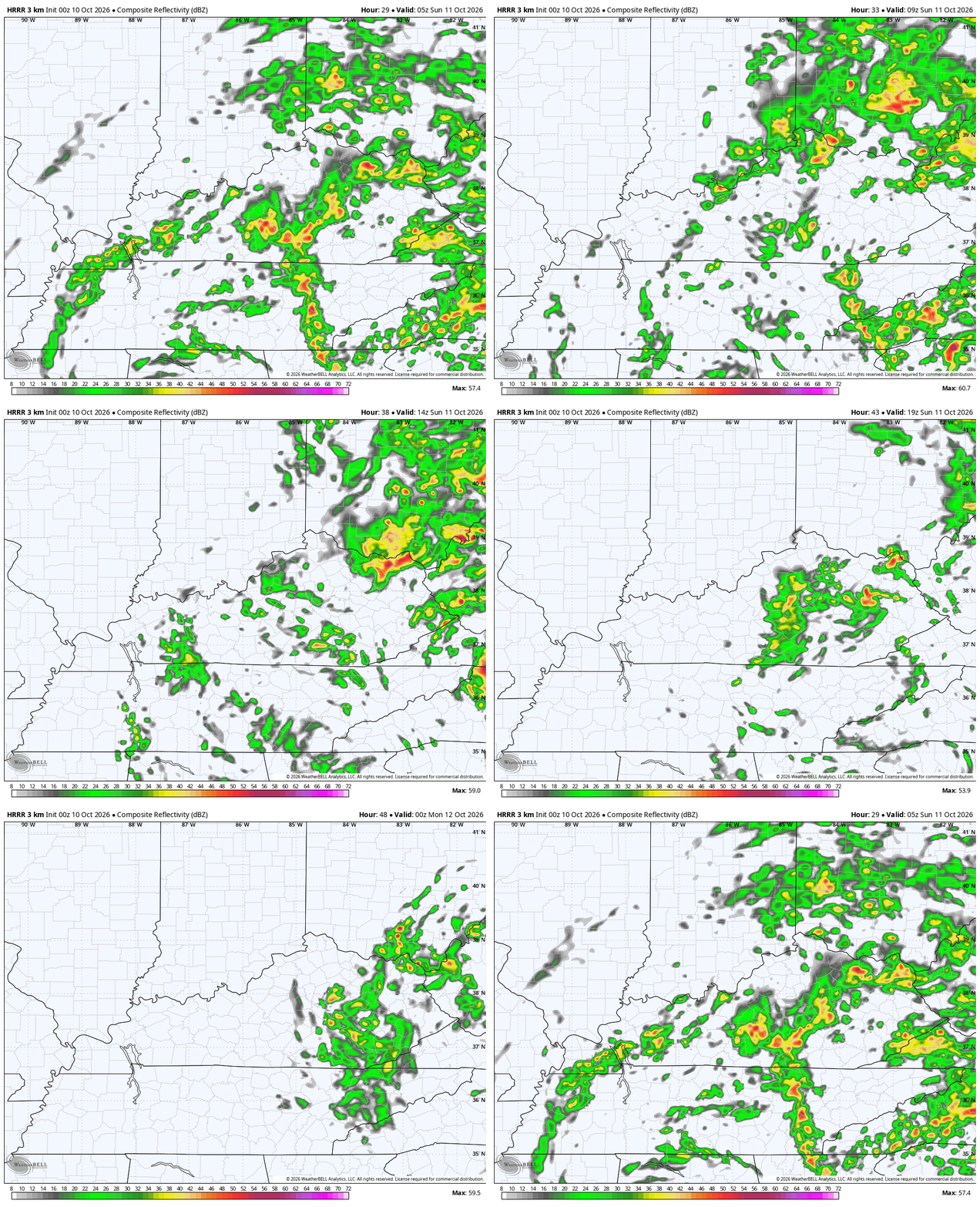
This type of setup can result in a few strong or severe storms going up along and ahead of the center of circulation. I’ve also seen similar instances in the past produce a bit of rotation with showers and storms.
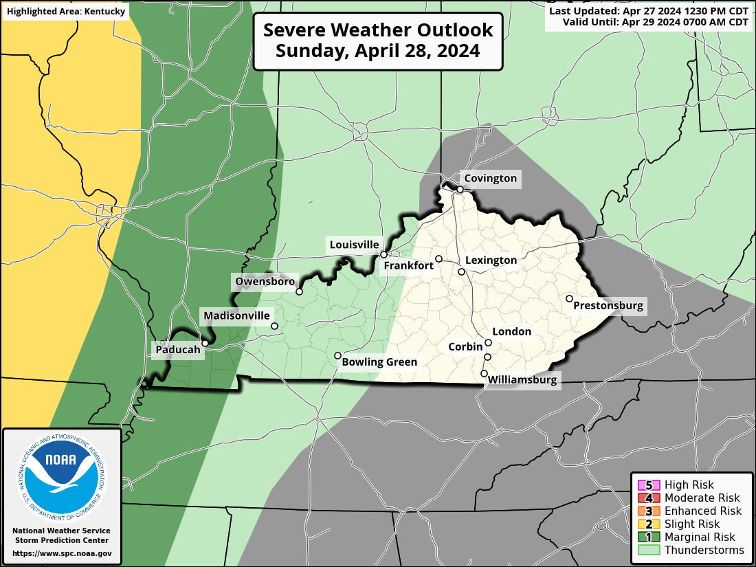
Here’s the Sunday Severe Weather Outlook from the Storm Prediction Center..
Lingering showers move away early Monday as warmer winds fight back in from the west. This is ahead of a weak front arriving on Wednesday with a much stronger cold front arriving behind it on Friday. This front likely brings the first taste of winter weather into parts of the Great Lakes and northeastern states, but may also bring some flake action to the high ground of the Appalachian Mountains…
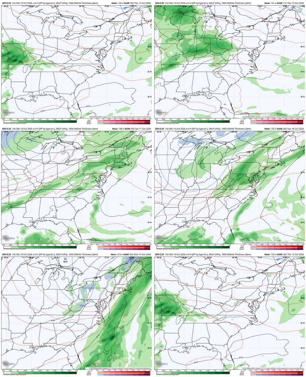
Did you notice that blue speck across far southeastern Kentucky? Yep…
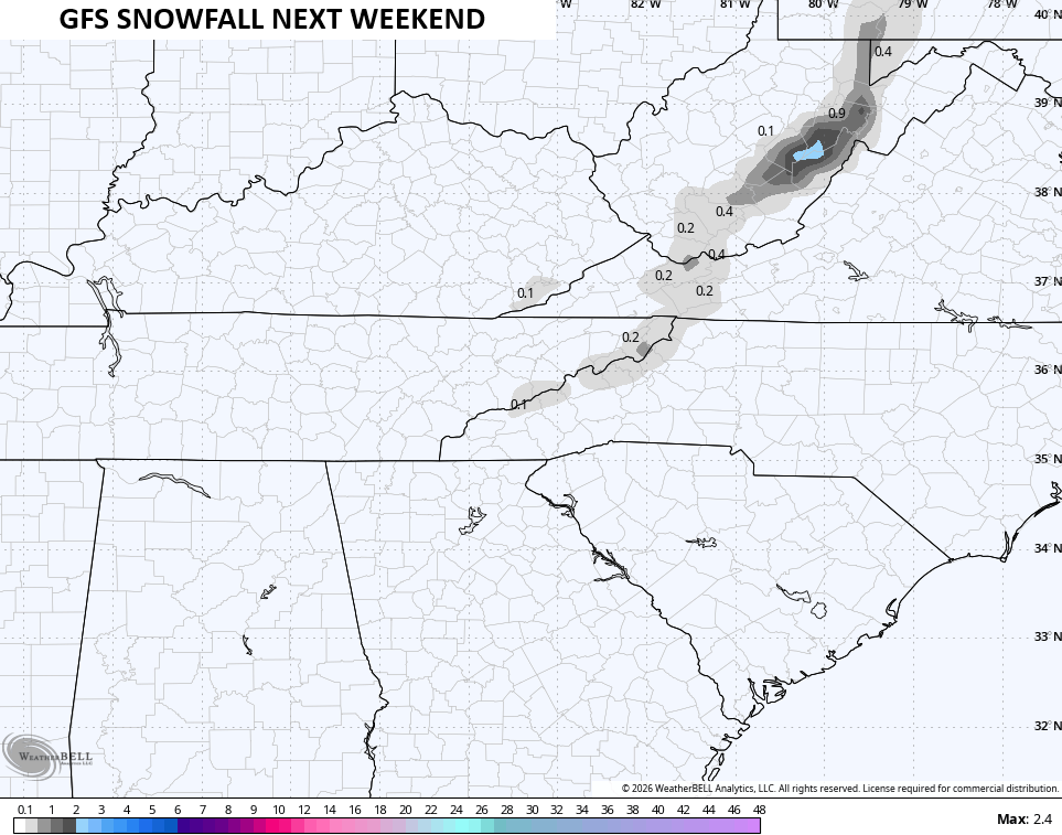
The odds are low, but it’s happened before and it’s always fun to look at. 🙂
This trough may also end the growing season next weekend into early the following week. Barney shows up on many models…
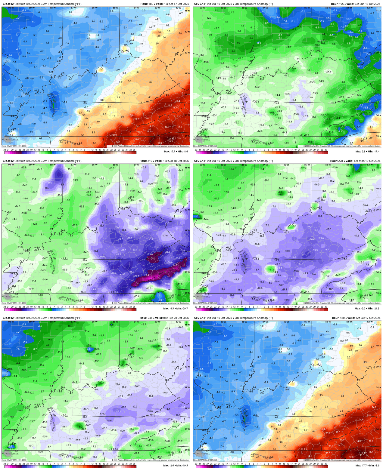
It’s my experience that October hurricanes that impact us from the Gulf are often pattern changers and this one appears to the catalyst for a change as well. Another thing that makes this impact so rare is that we historically don’t get tropical impacts during El Nino falls. As a matter of fact, since 1879, we’ve had 56 tropical/post tropical systems pass directly over some part of Kentucky. Only 8 of those have happened in an El Nino…
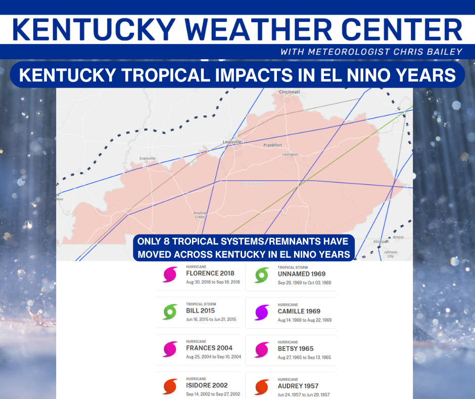
The current El Nino is a rare Super El Nino and will likely be the strongest ever recorded. It’s also the first Super El Nino to spin up a Gulf hurricane in September or October. Just another way this Super isn’t behaving like the small sample size we have of past Super El Ninos.
As always, I leave you with your daily storm tracking toys…




Current watches

Possible Watch Areas

Make it a fantastic Friday and take care.

Thanks Chris. Interesting setup. I’ll be watching to see whether Isaias truly breaks down the Southeast Ridge or whether it rebuilds after the system p*a*s*ses. The evolution of the Pacific pattern and PDO may tell us more about the longer – term outlook.
Much above normal temperatures with sunny skies are predicted for the Chicago Metro Area for the next several days, with highs near 80 today, in the mid 70s Sunday for the Chicago Marathon, and all the way in the mid 80s for Columbus Day. Normal high for this time of year here is around 65-66 degrees.