Good Tuesday to one and all. It’s an absolutely summer feeling day taking shape across Kentucky as we get set for a big change. Storms crash in over the next few days ahead of a potent fall cold front bringing the coldest air of the season for the weekend.
Temps today reach the low and mid 80s across central and eastern Kentucky, potentially pushing close to a few records. Highs in the west reach the upper 80s to near 90, again pushing toward record highs. Winds will be gusty from the southwest with a mix of sun and high clouds.
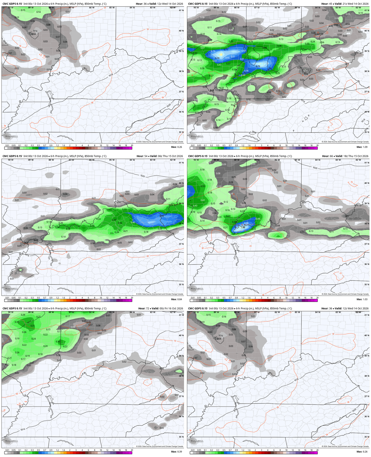
A cold front inches closer to the region from the northwest on Wednesday and slows down into Thursday. This brings a few rounds of showers and storms rumbling from across the state during this time. Here’s what this looks like…
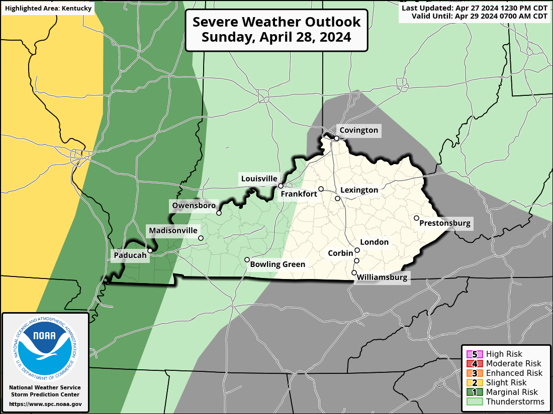
The low-end risk for a strong or severe storm will be with us, but I’m not sure if it’s great enough to get anything from the Storm Prediction Center. Here are their Severe Weather Outlooks for Wednesday and Thursday…

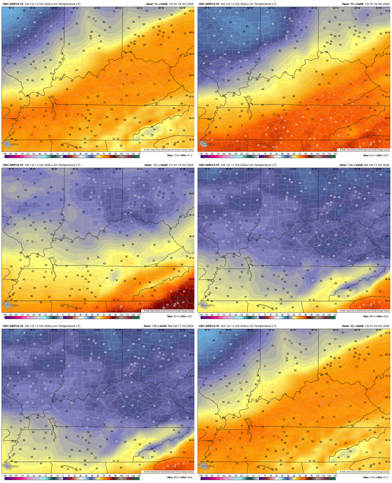
A potent fall cold front sweeps from west to east across the region late Thursday night into early Friday. Friday’s high temps will likely be in the 70s before the sun comes up with readings dropping into the upper 50s by the late afternoon then into the 40s during the evening. This animation shows the temp drop from 8am to 8pm Friday…
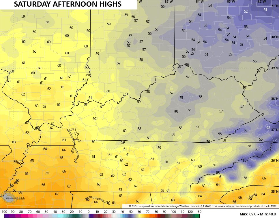
That sets the stage for the coldest air of the season over the weekend with highs on Saturday that may not get out of the 50s for many areas of central and eastern Kentucky…
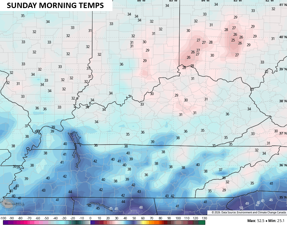
That brings us to the potential for widespread frost Saturday night and Sunday morning. Lows reach the low and mid 30s with the chance for a few areas to go below freezing…
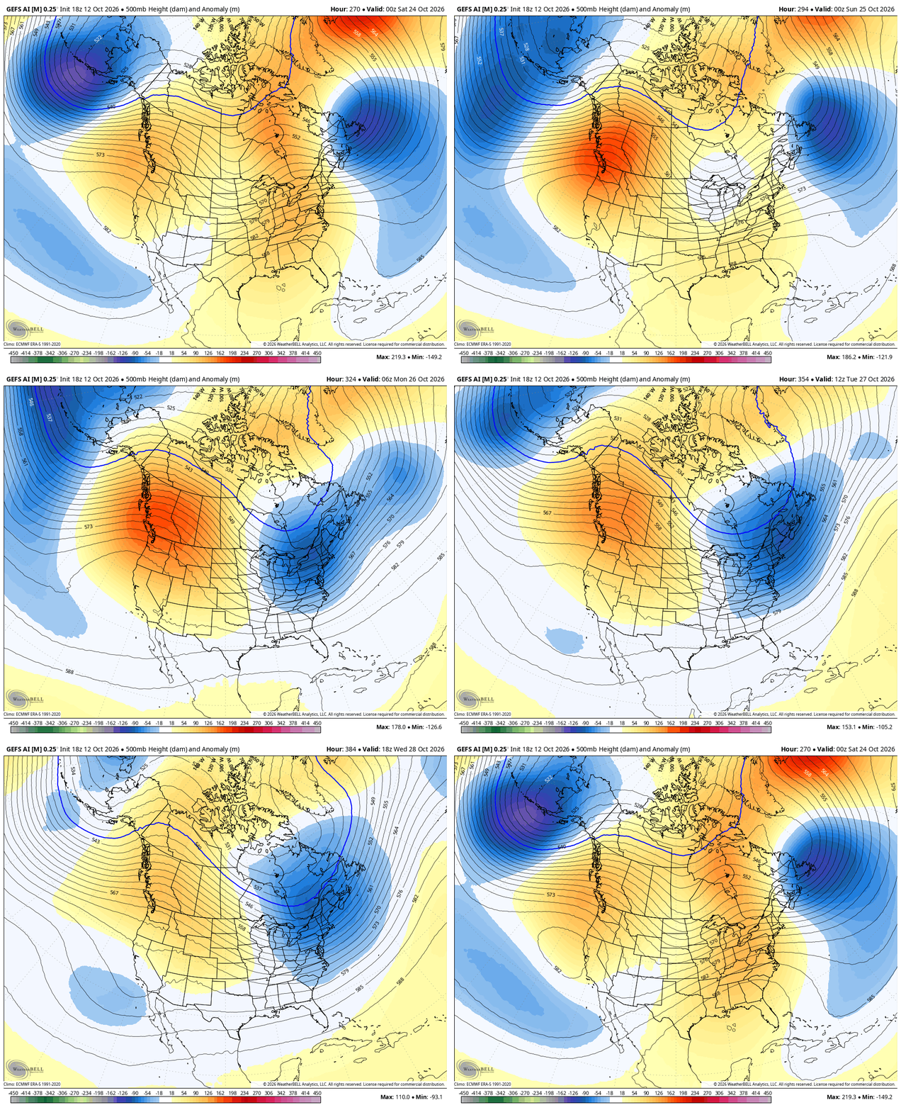
Pleasant temps remain through the first half of next week as temps climb a bit. This is ahead of what may be another big trough in the east for the final week of October…
The EURO Weeklies continue to go out deeper into November and now take us through Thanksgiving Day. The latest run shows some winter weather before we get to the big day…
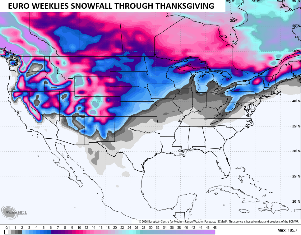
Hmmm. I can’t argue with that thinking as it’s similar to my early thoughts on winter.
As always, I leave you with your daily storm tracking toys…




Current watches

Possible Watch Areas

Make it a terrific Tuesday and take care.

Same old, same old…
Current temperature at my PWS in central Warren County is 92.5°F. Fortunately, the dewpoint is a bone-dry 59°F, so the wind chill factor is “only” 91.6! We had hoped that the hurricane would have helped to ease the current moderate drought, but 0.51″ didn’t really help much.
The big climate news is that above normal seas surface temperatures exist worldwide, with the most surprising fact being that this includes the most southern reaches of the Atlantic and Pacific Oceans, which are just emerging from winter. El Nino continues to build, and it though it currently exceeds the intensity of all previous instances, it isn’t expected to peak until Q1 of 2027. What I think this means is that weather models will continue to provide off the wall forecasts, with an occasional accurate prediction now and then. More serious, it will make predictions based on analog years much more difficult, and extremes in national and regional weather will be more of the rule than the exception.