Good Wednesday to one and all. We have an active weather day taking shape for parts of Kentucky as a cold front nears from the northwest. This boundary is the opening act to a much stronger cold front dropping in early Friday. That unleashes the coldest air of the season with frost likely this weekend.
The heat out there for Tuesday was absurd and gave us the hottest day ever recorded so late in the year…
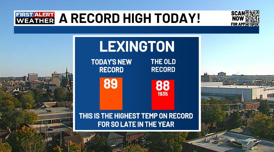
Today will be toasty again, especially across the south and southeast. Temps reach 85-90 in these areas with areas north and west seeing cooler temps as clouds and storms going up.
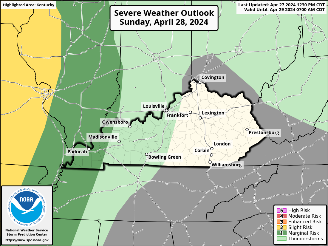
A few lines of strong to severe storms may rumble in from west to east. The greatest threat for areas of damaging wind will be across areas of western and northern Kentucky. This is now being included in the Severe Weather Outlook from the Storm Prediction Center…

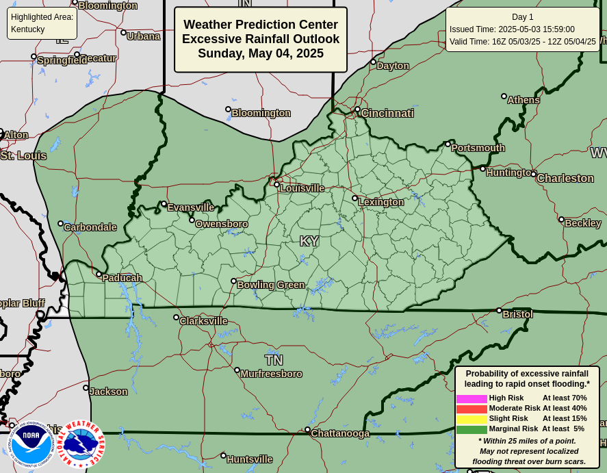
These storms may also contain streaks of very heavy rains that may cause hit and run local high-water issues. The Weather Prediction Center has a Marginal Risk to Slight Risk for Excessive Rainfall today…
The front retreats back to the north on Thursday and takes the severe storms risk back to the north…
Temps Thursday reach 85-90 on the Tennessee border and reach the 70s in the north. Winds will be cranking from the southwest as a more powerful cold front arrives Friday. This boundary brings some gusty showers rolling through as temps tank behind this front.
We start the day in the 70s before dropping through the 60s and into the 50s during the afternoon. The 40s then show up during the evening on a strong northwest wind. This temp animation runs from 4am Friday through Friday evening…
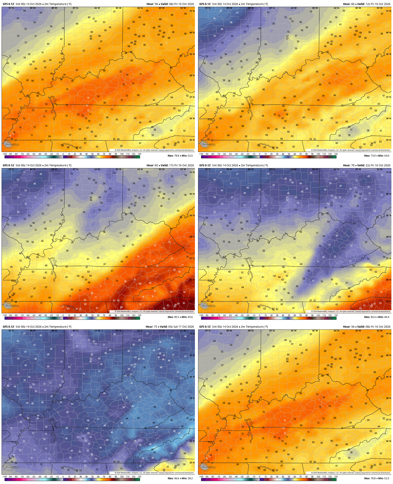
This northwest wind will also spit out some clouds and chilly showers across the eastern half of the state into Friday night and early Saturday. Highs on Saturday stay in the 50s for many areas, setting the stage for frost and a light freeze Saturday night and Sunday morning. This is well below normal air for the weekend…
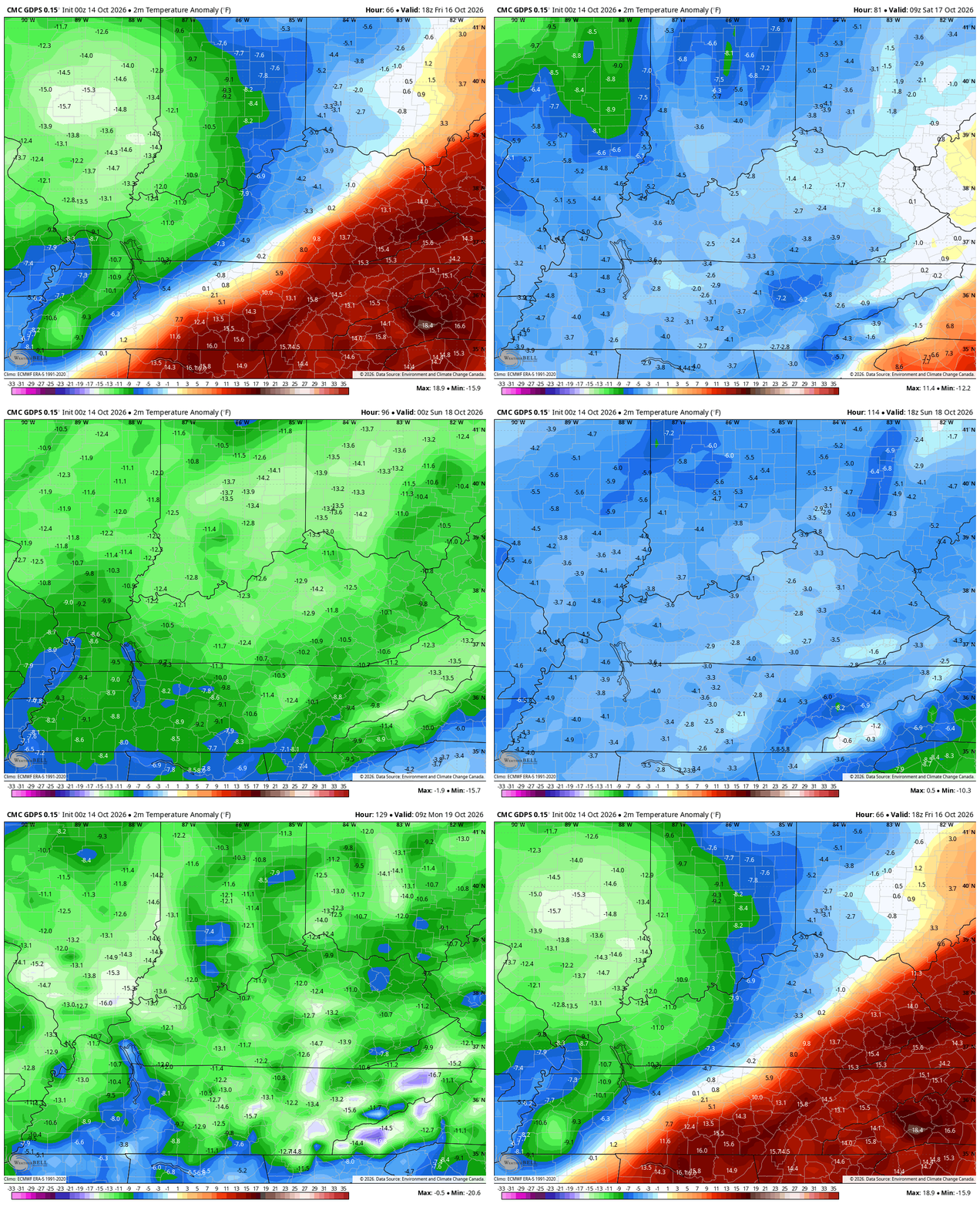
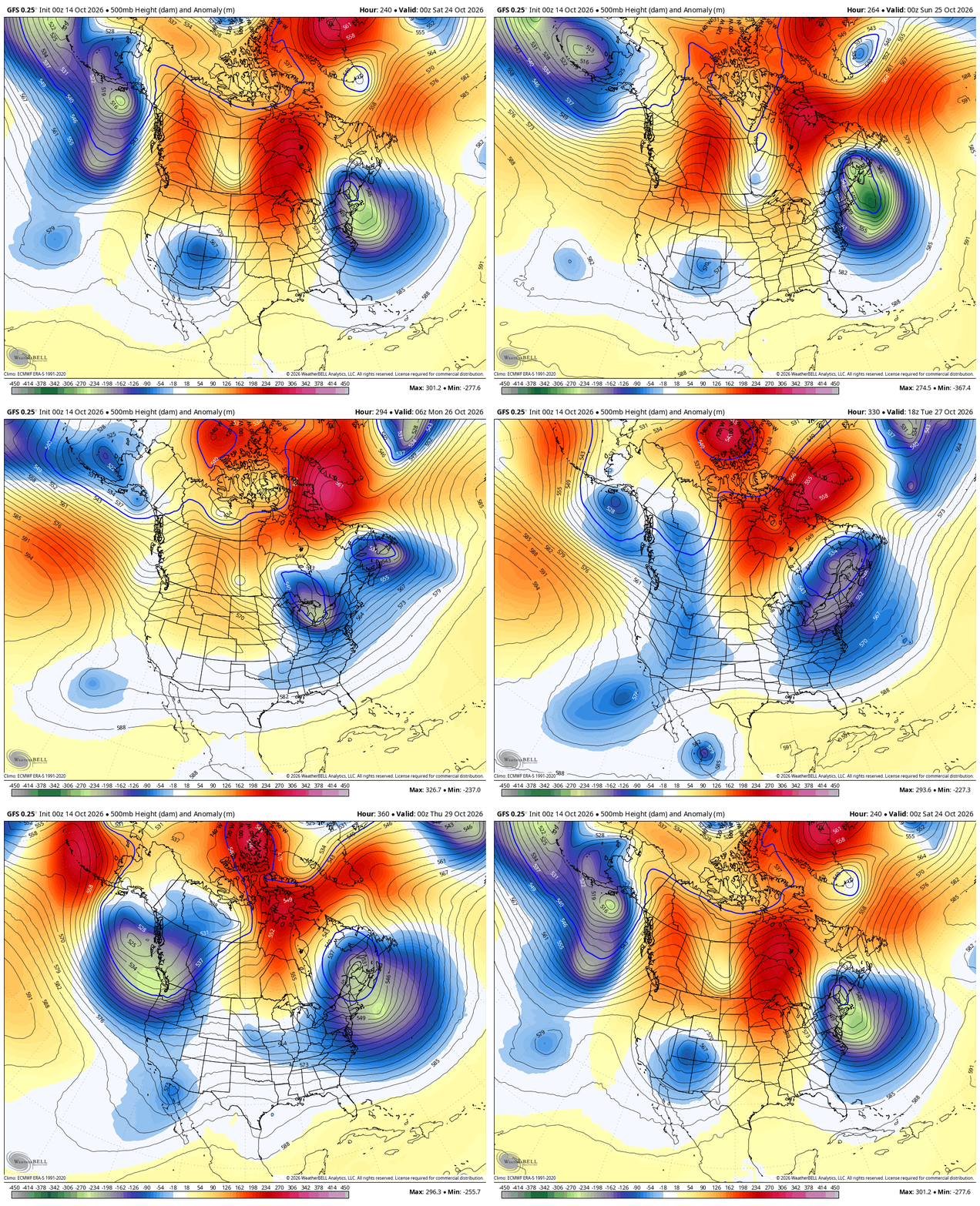
This leads us into what looks like a pretty fine looking and feeling week of October weather next week. Mainly calm skies show up with seasonable temps. High latitude blocking tries to show up as we head into the closing days of October…
It’s interesting to watch the upper air evolution on the EURO Weeklies. This animation from the end of October to Black Friday shows lower heights setting up across much of the lower 48…
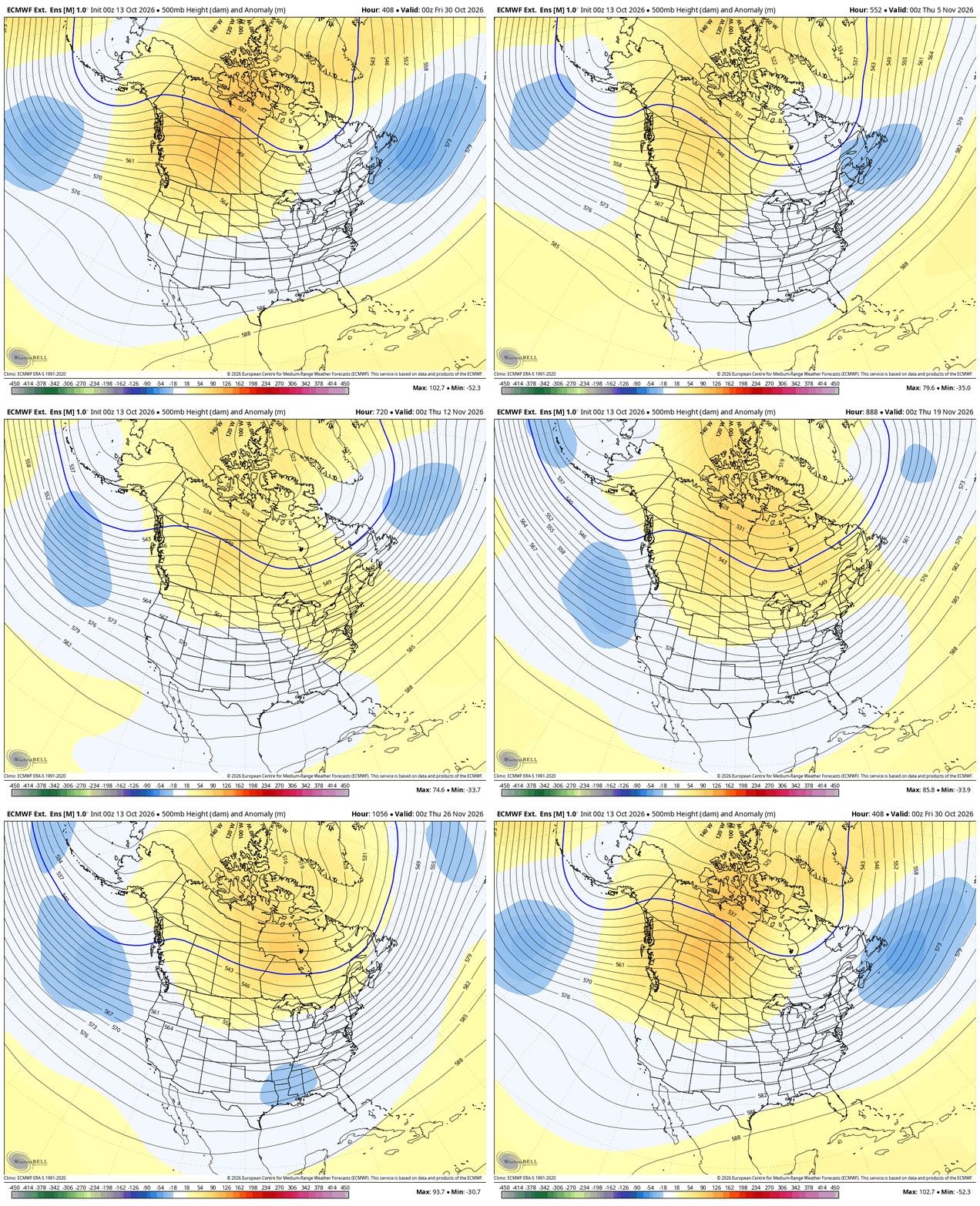
That look would likely result in normal to slightly below normal temps in our region for November.
As always, I leave you with your daily storm tracking toys…




Current watches

Possible Watch Areas

Make it a wonderful Wednesday and take care.

I still have my portable AC connected in my room until I’m absolutely sure any warmth/heat is over. So glad I bought and what shocks me most is how little energy it uses and I love keeping my room ICE COLD at night.
Three of the last four days have seen high temperatures of at least 80 degrees here in the Chicago Metro Area, including a record high of 88 degrees on Monday, breaking the old record of 84 degrees set in 1956. Normal high for this time of year is 64 degrees.
That upper air evolution chart illustrates the influence of an El Nino, where Canada, the north central and northeast regions of the country experience warmer than normal temps, near normal in the middle latitudes of the US, and below normal in the deep south, along with a strong west to east storm track across the mid latitudes. That represents an average but doesn’t factor in something else that historically trends above normal during an El Nino, and that is polar vortex intrusions. Climatologists are already picking up signal for a Sudden Stratospheric Warming event, which precedes a PV outbreak, to occur in early January. That could end up being more of an ice rather than snow event across southwest and south-central Kentucky.