Good Thursday, everyone. A few more storms are rolling across the region today as we get set for a massive weather change on Friday. A huge crash in temps will be followed by the first frost of the season this weekend.
As always, we start with the precious present. Highs today range from the mid 70s in the far north to the mid and upper 80s in the far south. Warm winds will push our boundary back to the north, with scattered showers and storms along it.
The overall low-end threat for severe threat gets pushed back to our north today…

Friday is a pretty wild day. Here’s a breakdown of how things play out:
Temps are in the 70s across central and eastern Kentucky at sunrise as the front moves into the west.
Gusty showers and crashing temps follow this front to the east.
Afternoon temps drop into the 50s for the entire state.
Those same numbers reach the upper 40s Friday evening as that strong northwest flow gets established.
Gusty, chilly showers and drizzle will be common Friday afternoon and evening.
Lingering showers continue into parts of southeastern Kentucky into early Saturday. This animation takes us from Friday morning through Saturday morning…
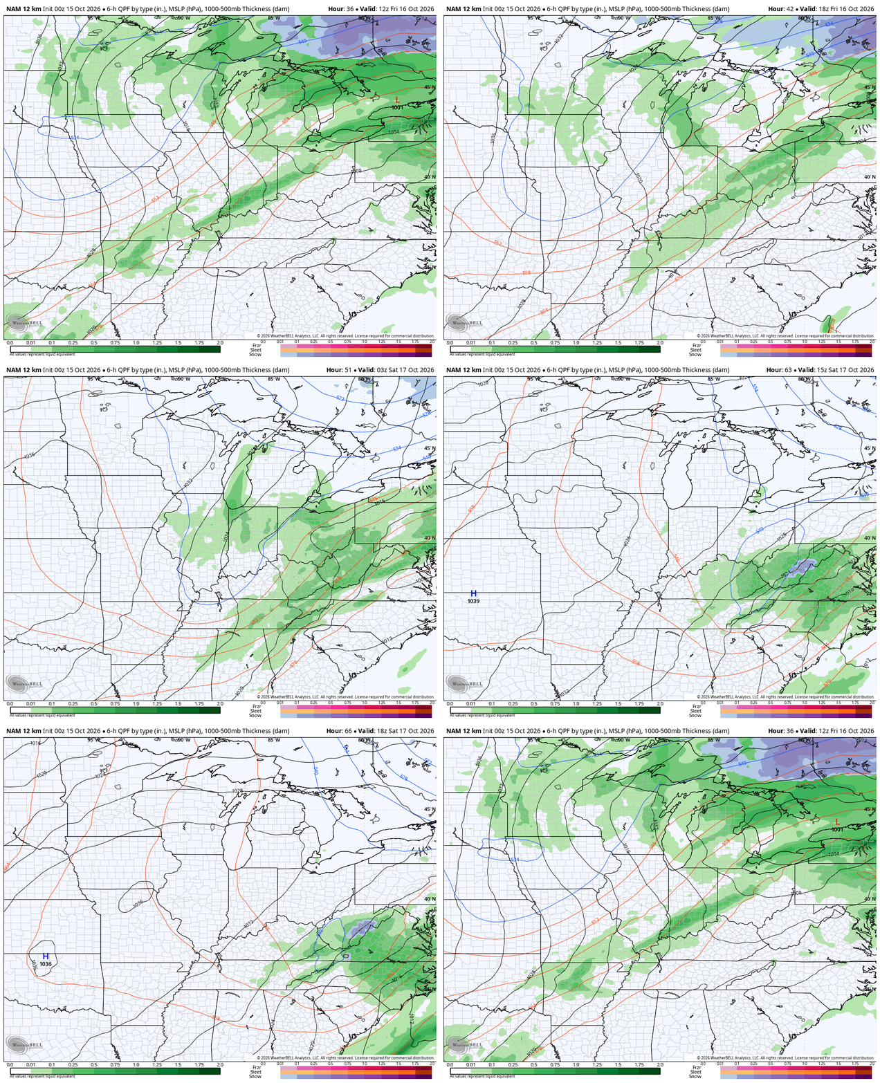
Notice some blue across the high ground of the West Virginia mountains? I told ya the models would revert back toward what they were showing several days ago! ha
The temp drop is rather dramatic on Friday. As mentioned, temps are in the 70s before the sun comes up before quickly dropping through the 60s, the 50s and then into the upper 40s. This temp animation takes us from 5am Friday to 11pm Friday…
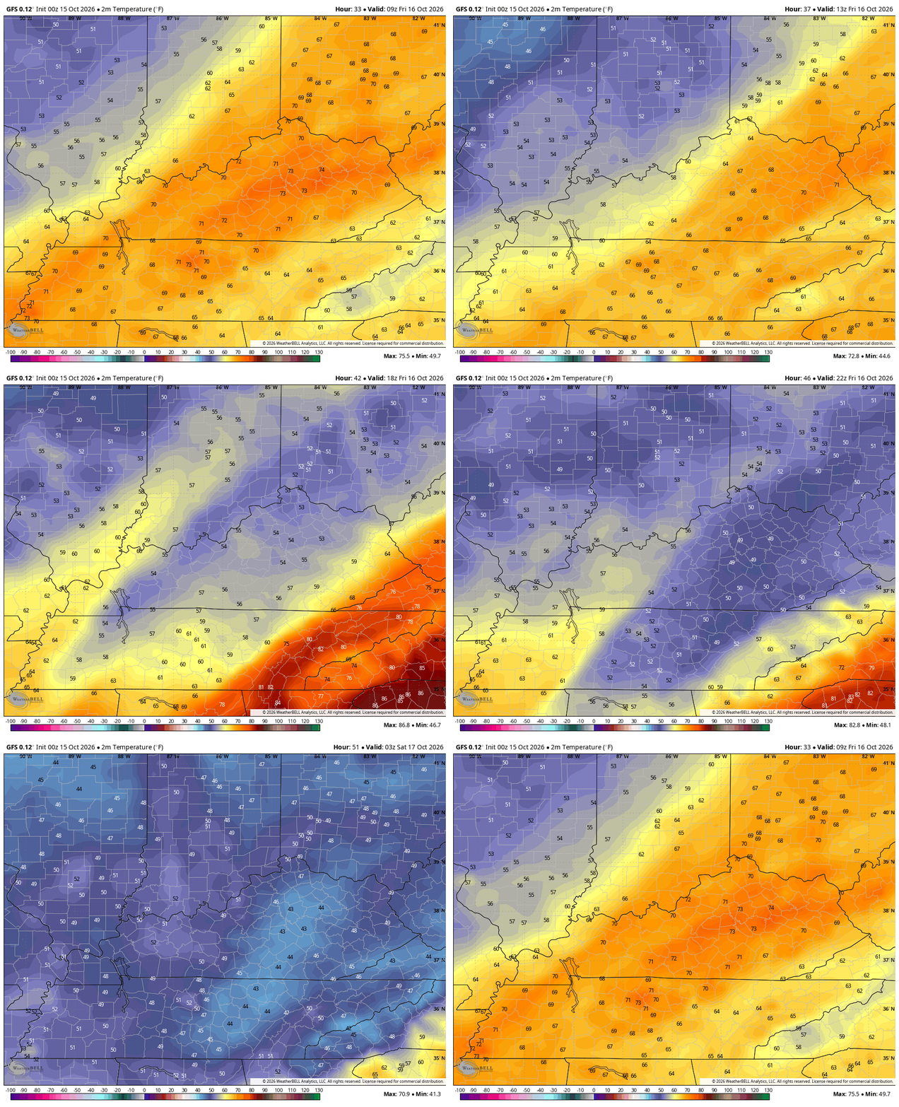
The high temp Friday likely occurs at 12:01am with the low temp occurring at 11:59pm. That’s pretty wild.
Highs on Saturday are in the 50s for most of central and eastern Kentucky on a blustery wind. As this wind settles down and skies clear, temps tank Saturday night with frost showing up by Sunday morning…
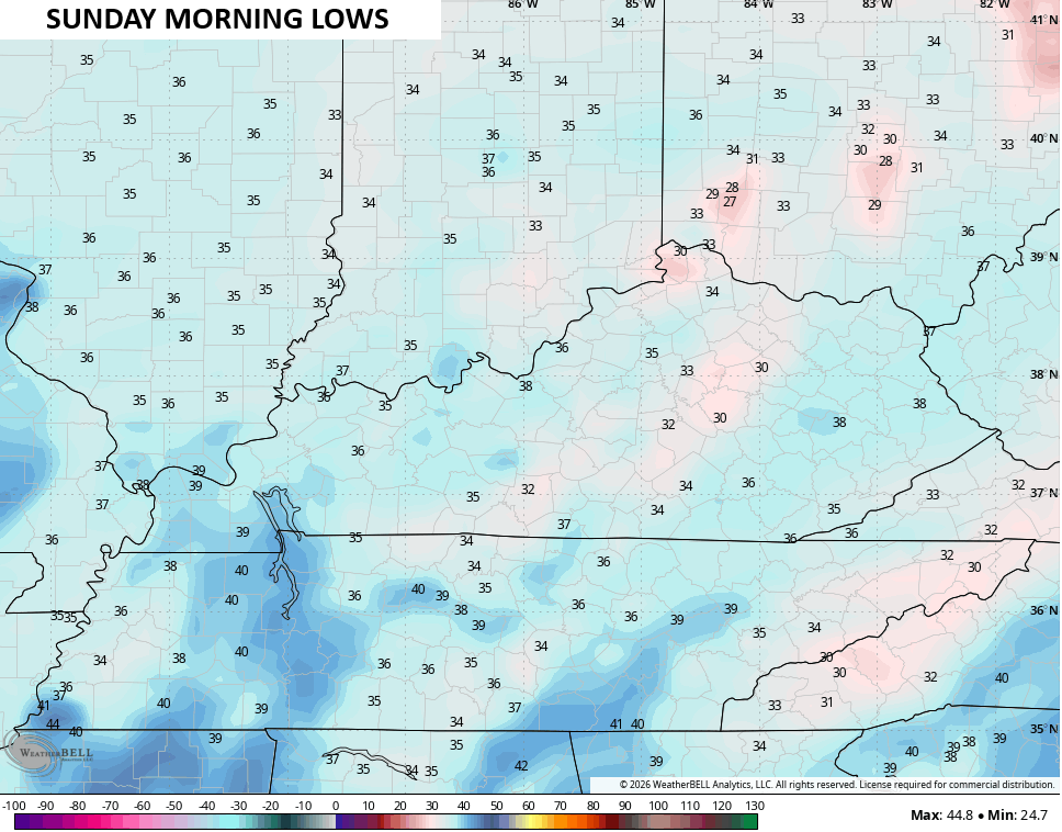
This kicks off a stretch of AWESOME fall weather days with lows in the 30s and highs ranging from the mid 60s to low 70s for much of next week.
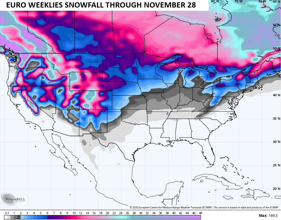
I continue to track the look of the EURO Weeklies which continue to show lower heights settling in across the southern half of the country. If we look at the entire Northern Hemisphere for a 30 day period ending November 28th, you can see the highest heights relative to normal are across Canada which forces the trough underneath…
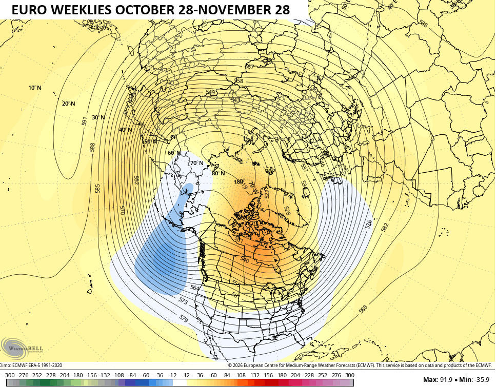
That pattern could deliver us some November flakes…
As always, I leave you with your daily storm tracking toys…




Current watches

Possible Watch Areas

Make it a terrific Thursday and take care.
