Good Friday, everyone. It’s a day of massive changes across Kentucky as a stout fall cold front blasts through the region. Temps tank out there today as gusty, chilly showers kick in. Behind this boundary comes frost and, perhaps, a light freeze this weekend.
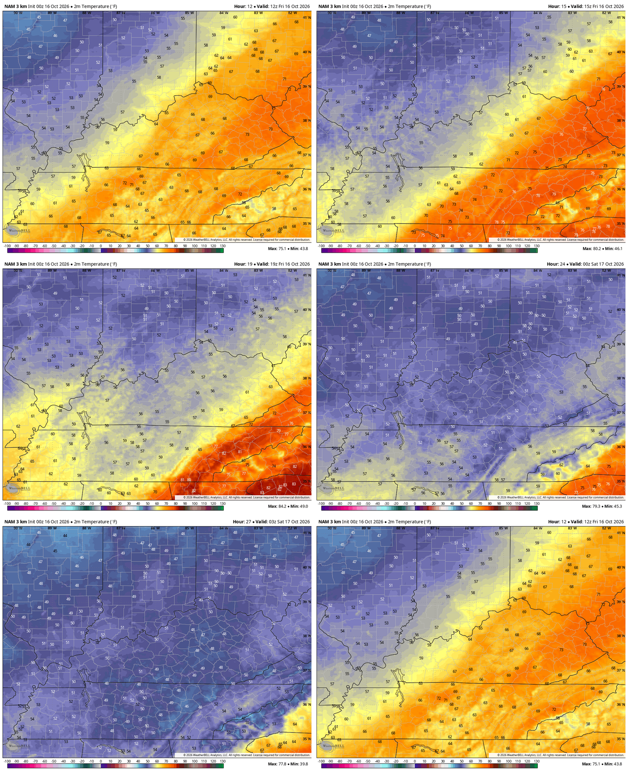
Temps this morning are in the 60s and 70s for much of Kentucky, but those numbers drop quickly from west to east as the front slams through. We hit the 50s by late morning and early afternoon with the 40s with us this evening.
Check out how quickly the numbers go down on this animation that starts at 8 this morning and ends at 11pm this evening…
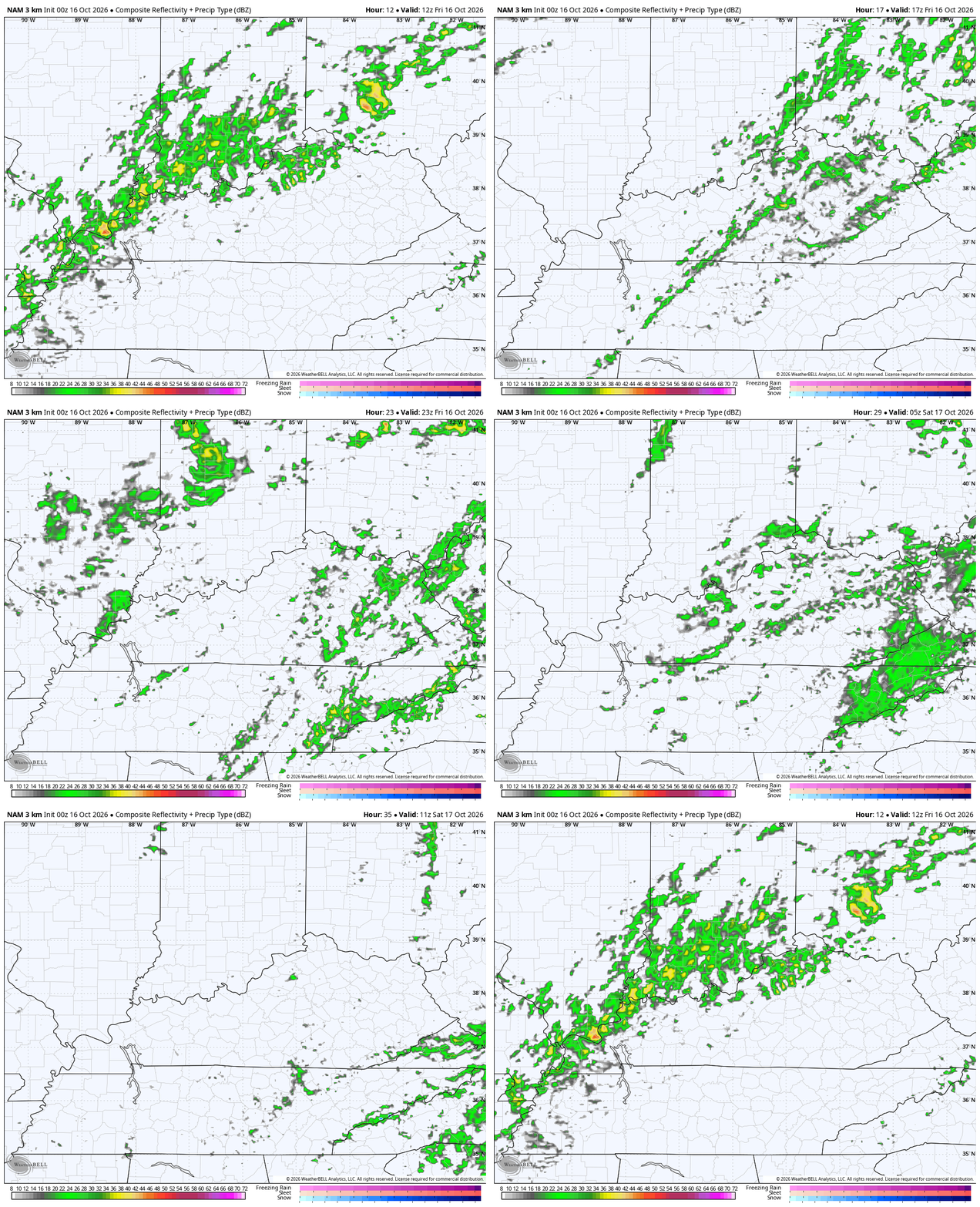
Showers increase and will take us through the evening with some of that lingering into the start of Saturday in the east and southeast. The future radar from 8am today through 8am Saturday…
Winds will gust to 30mph at times. Combine that with temps hitting the 40s with gusty showers and you have the making of a not so pleasant evening for high school football.
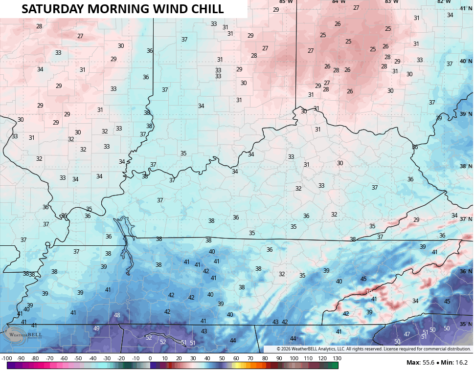
Temps by Saturday morning range from the upper 30s to mid 40s depending on the amount of clouds and showers over any one area. Wind chills will be around freezing or below to start Saturday…
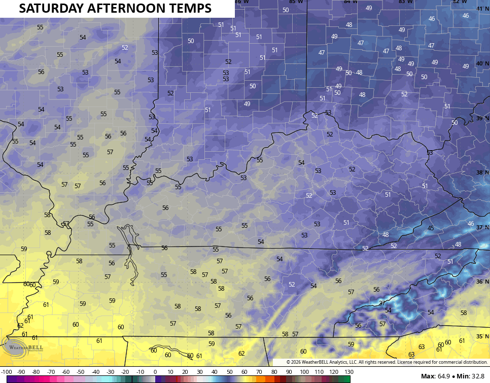
Highs on Saturday are flat out chilly with most areas staying in the low and mid 50s. If clouds linger, areas of the southeast may not get out of the 40s…
With clearing skies and light winds, frost is likely Saturday night into Sunday morning. There’s even the chance for a light freeze in some areas, especially in those colder valleys. A few of the higher resolution models are seeing the potential for upper 20s…
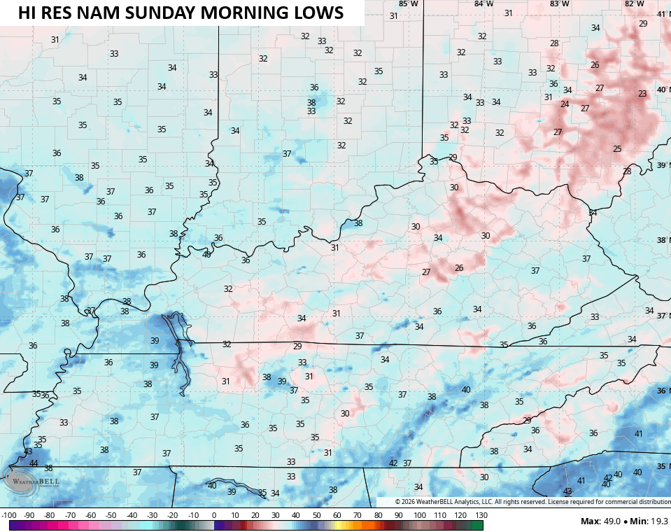
Sunday sees temps ranging from 60-65 with another night of frost set to follow that up. This kicks off a fantastic week of fall weather with crisp mornings and afternoons in the upper 60s to low 70s with dry skies.
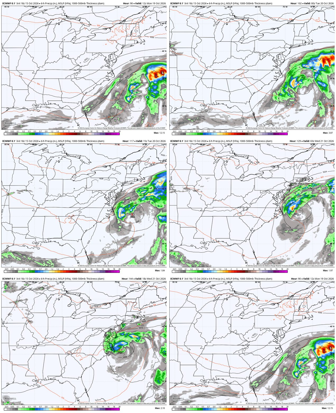
While we enjoy the dry skies, a system off the east coast will be spinning and may become some type of a hybrid storm that has a huge impact on the east coast. As you can see, this storm won’t be in any hurry to move…
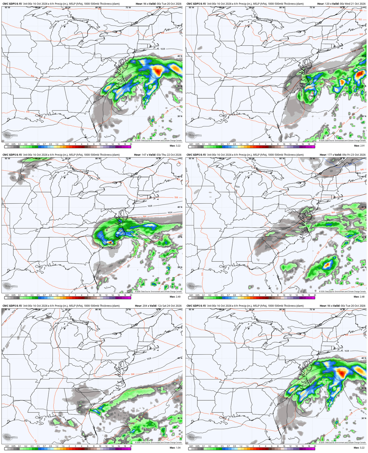
The Canadian is even trying to pull this thing far enough west to have a slight impact our weather later in the week…
As always, I leave you with your daily tracking toys…




Current watches

Possible Watch Areas

Make it a fantastic Friday and take care.
