
Good Saturday, everyone. The growing season ends tonight as freezing temps and frosty conditions arrive in the bluegrass state. This is a really chilly air mass for the weekend with some great fall weather following it up for early next week.
Lingering showers and clouds will be noted early today across eastern and southeastern Kentucky. Skies brighten as the day wears on, but high temps generally hang in the 50s. If clouds hang around into the afternoon, temps may not get above 50.
As winds go calm tonight, look out below!!
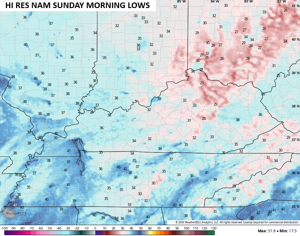
Temps by Sunday morning range from the upper 20s to middle 30s across the Commonwealth…
Sunday afternoon looks amazing and that kicks off an awesome stretch of fall weather. Highs early next week are in the upper 60s to low 70s with lots of sun. Much of what happens after this depends on what takes place along the eastern seaboard. That’s where a massive, slow-moving storm develops. This will likely meander around the east coast through next week, at least.
The Canadian keeps this thing around through the next 10 days…
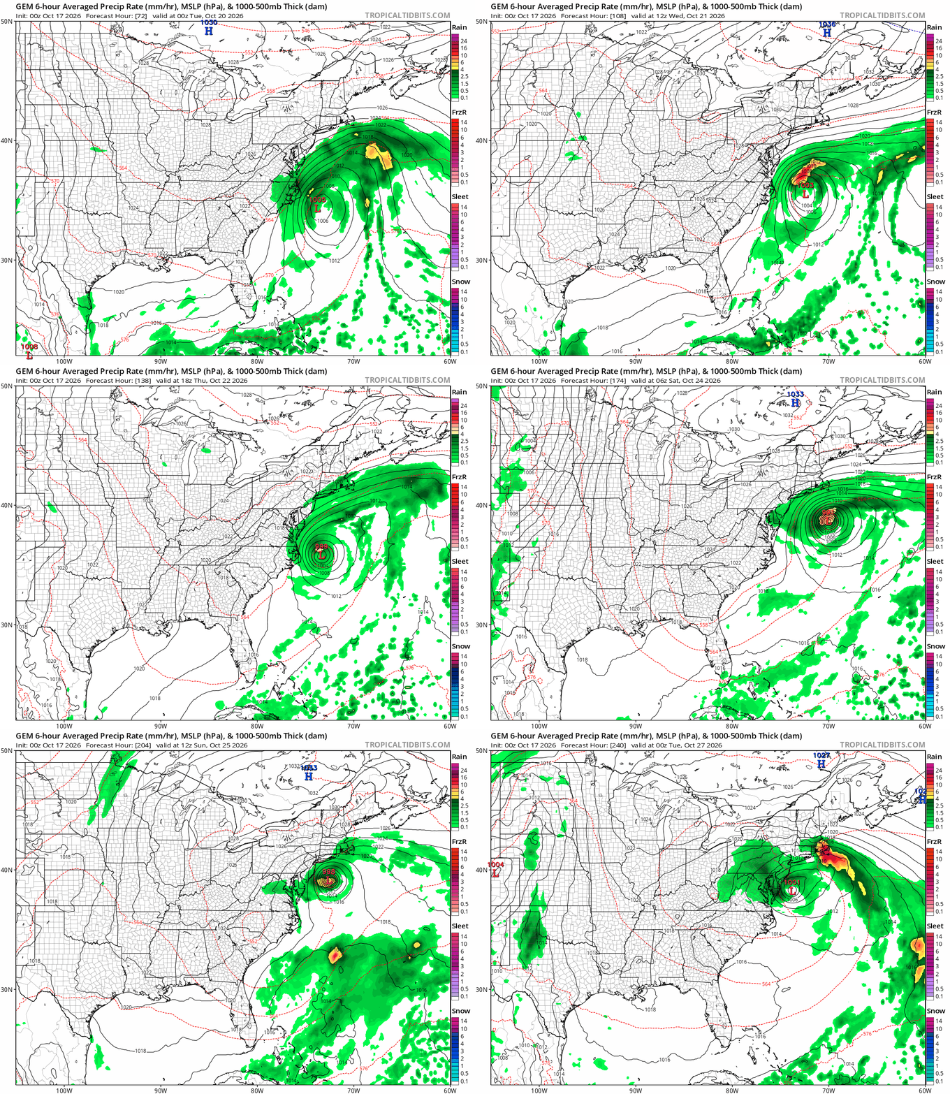
That would keep the pattern across the country pretty much backed up and stuck in place.
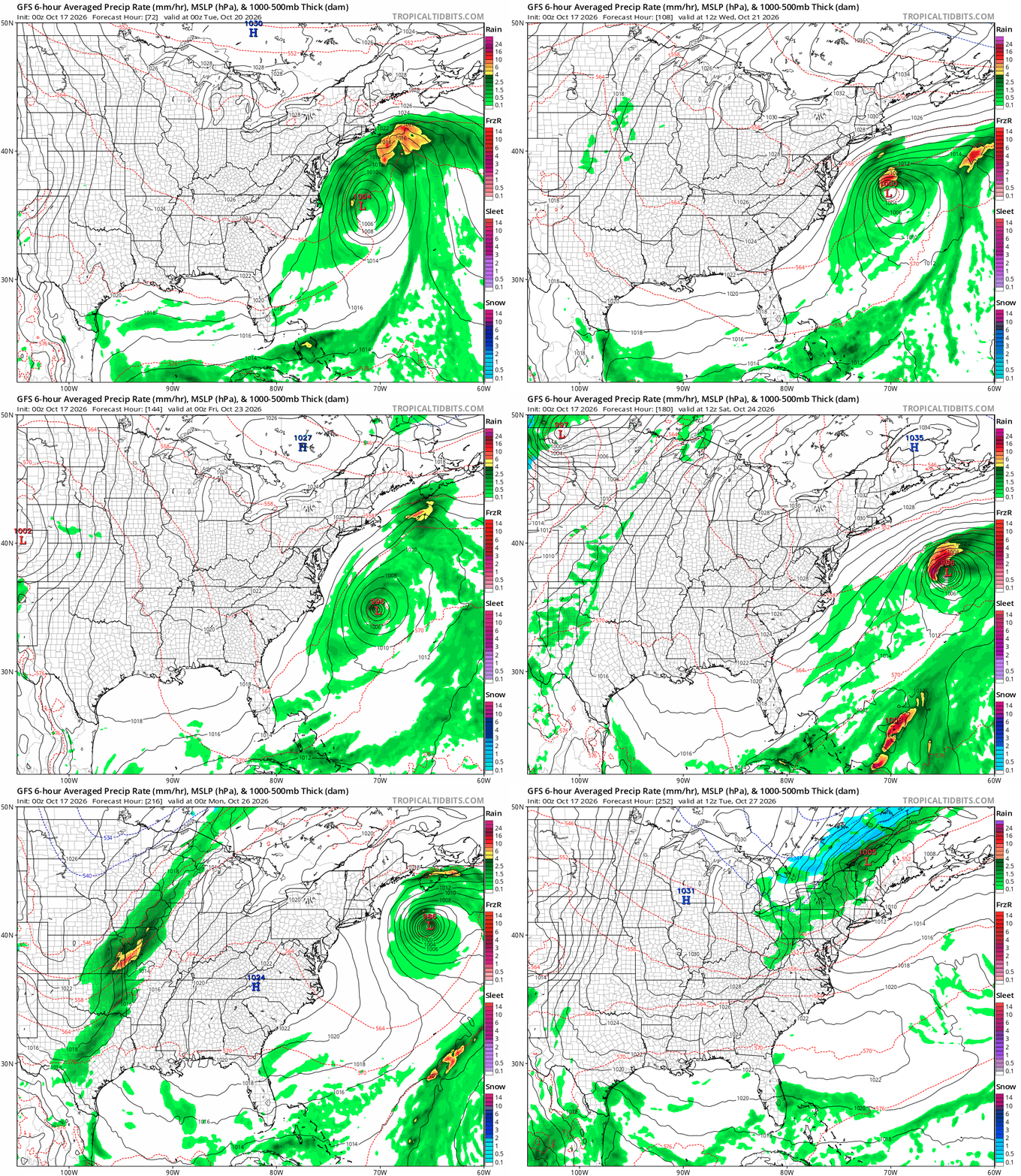
The GFS wants to let this storm spin out to sea quicker than the Canadian, allowing for the pattern to move again with a cold front late next weekend…
Looking at the GFS Super Ensembles analogs for the final week of October, we still don’t see the pattern behaving like an El Nino, let alone a Super El Nino. As a matter of fact, we see more La Nina’s on the analog list than El Nino years…
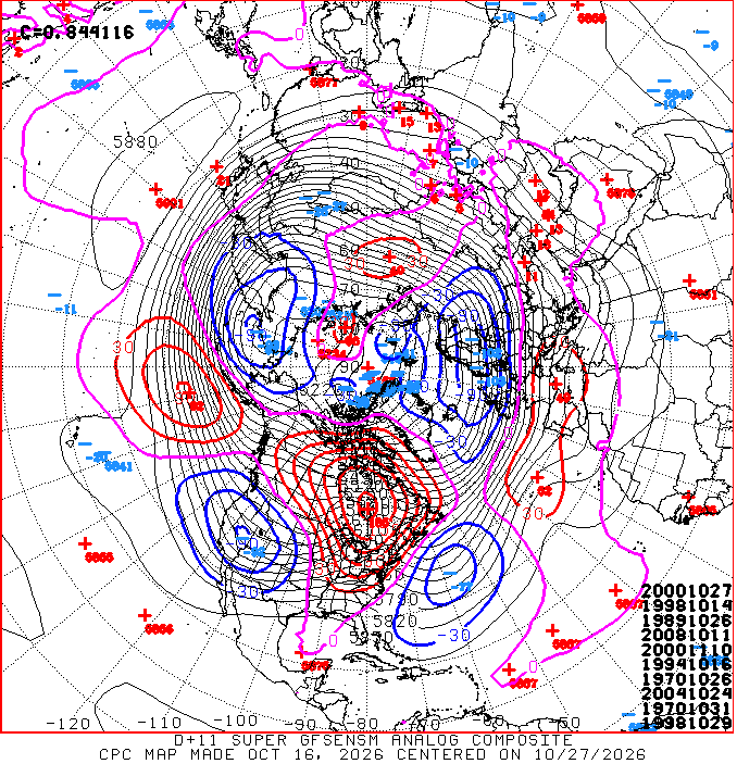
2000 is on the list twice with 1989 also showing up. Those are the top two coldest Decembers on record for Kentucky. Y’all know what that means? Nothing. But, it’s interesting to note the “best match” years continue to be years that aren’t even close to being a Super El Nino year like the one we have going now. This year will be the strongest El Nino ever recorded so we are in unchartered territory here.
As always, I leave you with your daily tracking toys…




Current watches

Possible Watch Areas

Make it a sensational Saturday and take care.

The el niño influence will likely make analog years and EURO weeklies look silly.