Good Monday to one and all. We’ve made it to Halloween week, and the overall pattern is pretty stable. Once we flip the calendar to November on Sunday, the pattern revs up and become very active for our region and much of the country.
Highs through Halloween are in the 70-75 degree range for many with overnight lows in the upper 30s to low 40s. We keep the awesome sky going bit looks like a close call with rain for Trick-or-Treating and Breeders’ Cup at Keeneland in Lexington.
We continue to watch for something tropical or semi-tropical to fire up off the southeastern coastline, but the National Hurricane Center isn’t highlighting anything as of this writing…

Vance continues to spin toward Mexico but is so slow and is really decreasing in intensity…

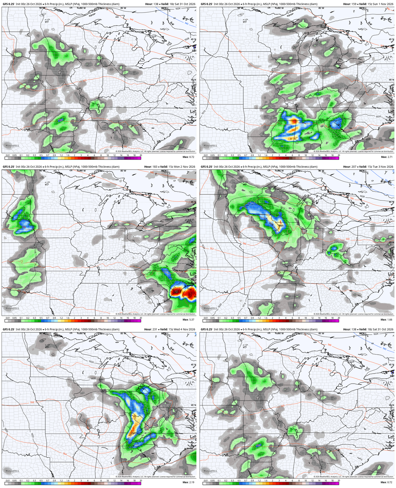
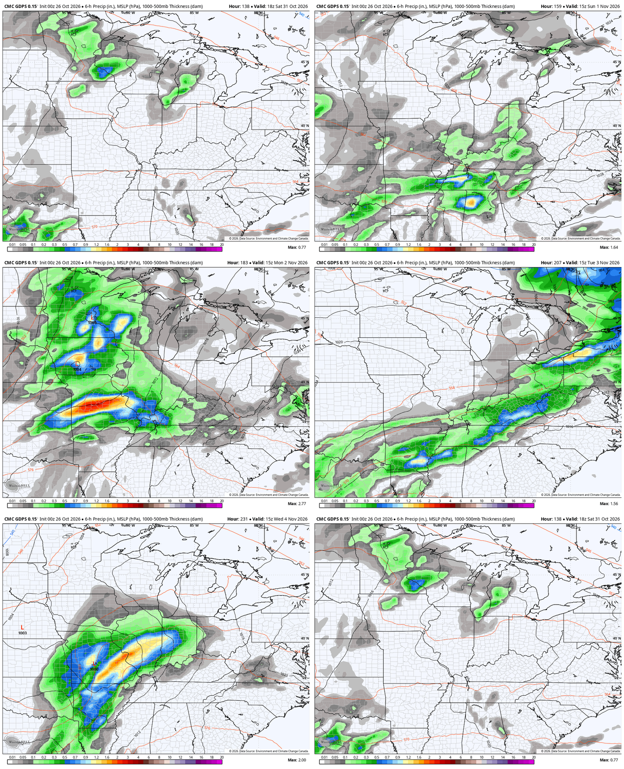
Some of Vance may get drawn into a storm system coming out of the Rockies into the Plains over Halloween Weekend. Part of the moisture from this may impact us with rain and storms by Halloween night and Sunday before the main storm system rolls through here early next week.
The models differ on how to handle this, but they see the setup well…
GFS
CANADIAN
I realize this update is sounding pretty much like every update from the past several days, but that’s where we are in the weather world right now. I still expect a very active November that features above normal rains with the threat for a severe weather event in the first half of the month. The mid-month pattern change toward colder may then bring us a snow event of some kind late in the month.
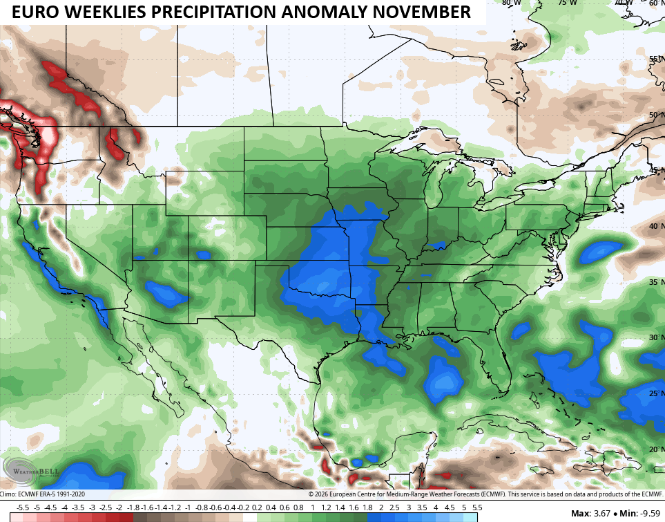
The EURO Weeklies continue with much normal precipitation for the month…
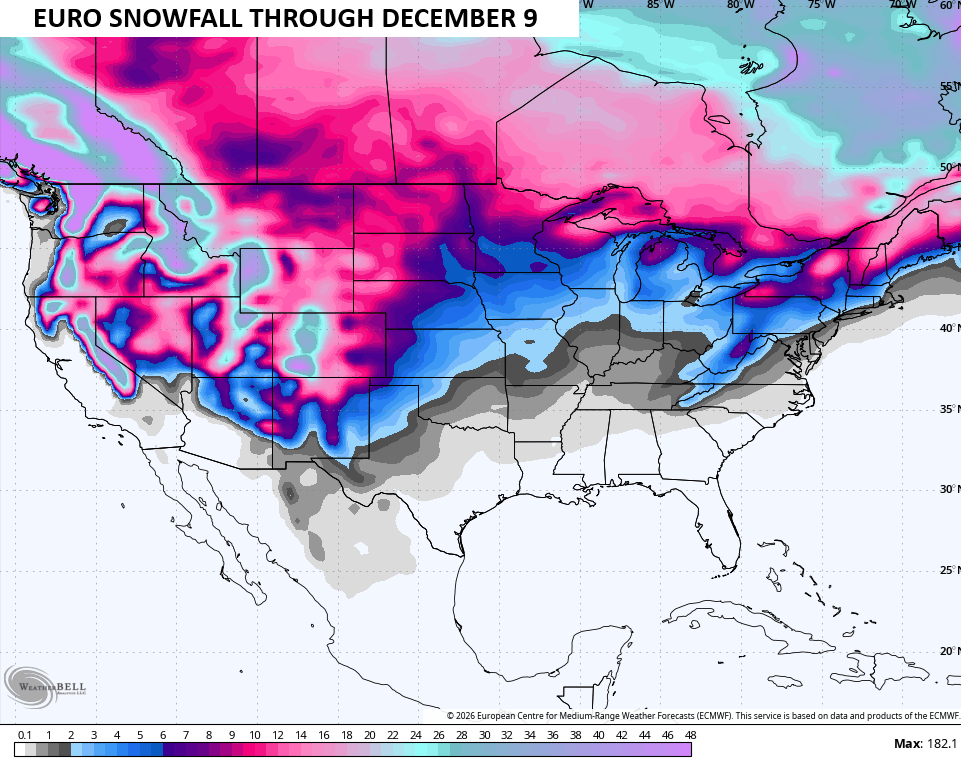
The Weeklies also see the snow chances later in November and early December…
The GFS Super Ensembles are still void of any Super Nino years for best matches to start November…
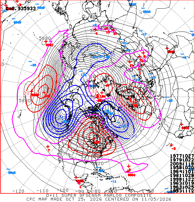
It’s interesting to note some harsh winter years keep showing up on the best match list.
Make it a magnificent Monday and take care.
