Good Tuesday, folks. You’re probably noticing some subtle changes showing up across Kentucky as some clouds zip across our skyline. These clouds are well ahead of a storm system set to impact our Halloween Weekend with the longer range still showing bigger changes.
Temps through Friday are in the 70s with a mix of sun and clouds. Overall, it’s a warmer than normal pattern.
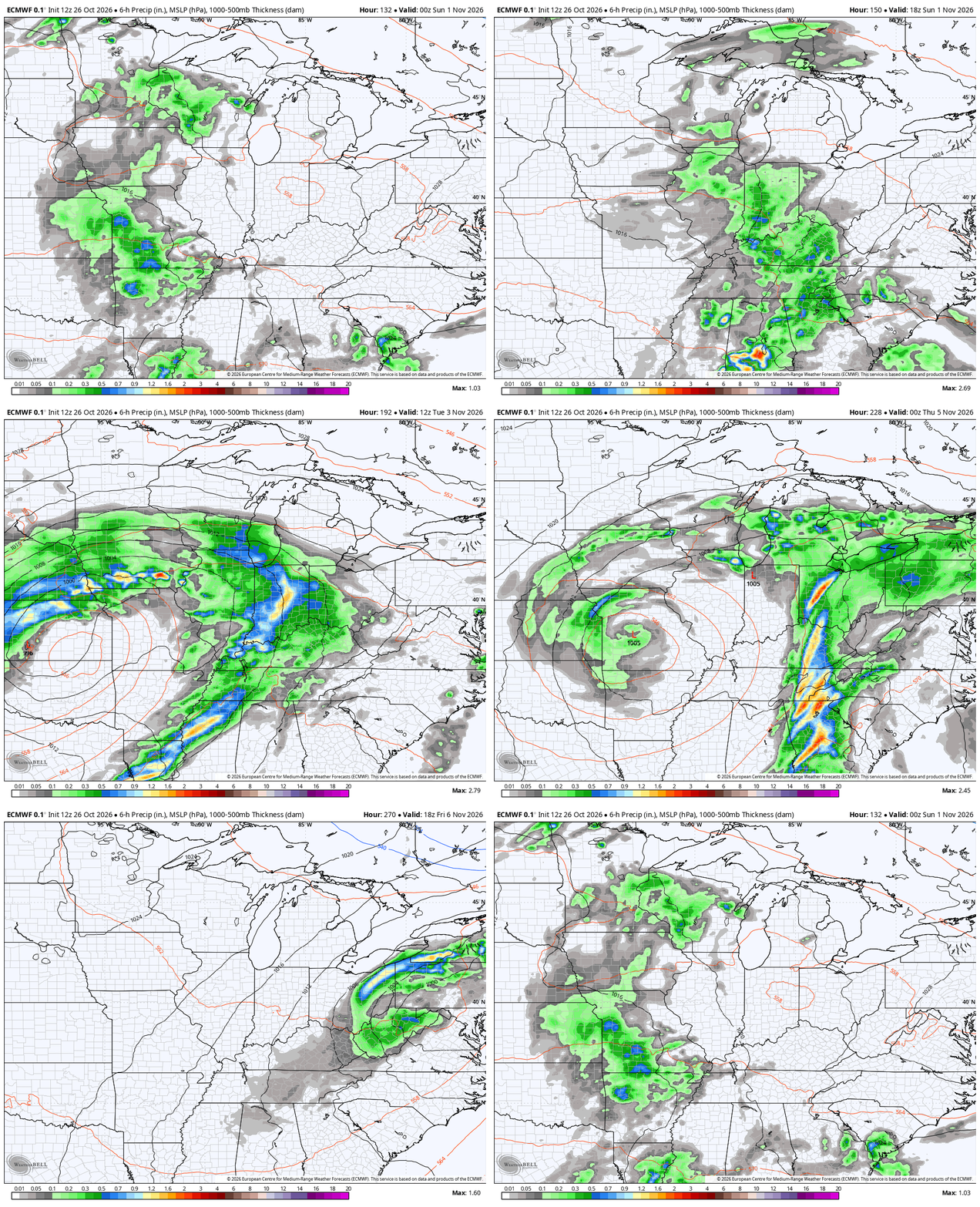
We have two systems set to impact our weather starting Halloween Weekend into early next week. The first system spins in with showers and some rumbles of thunder late Halloween into the first day of November on Sunday. That will then be followed by a bigger system that slowly spins through from Monday through Thursday of next week.
That system brings showers and storms into the region.
Here’s the EURO from Halloween afternoon through next Friday…
That would be followed by another system on the EURO, which is loaded with heavy precipitation…
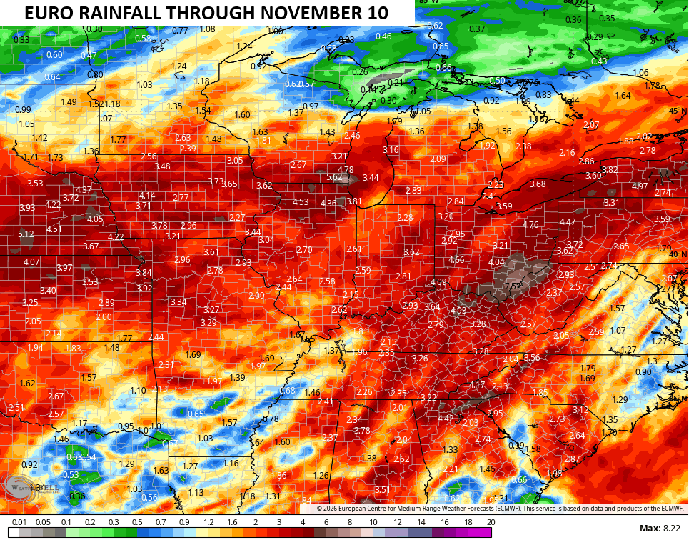
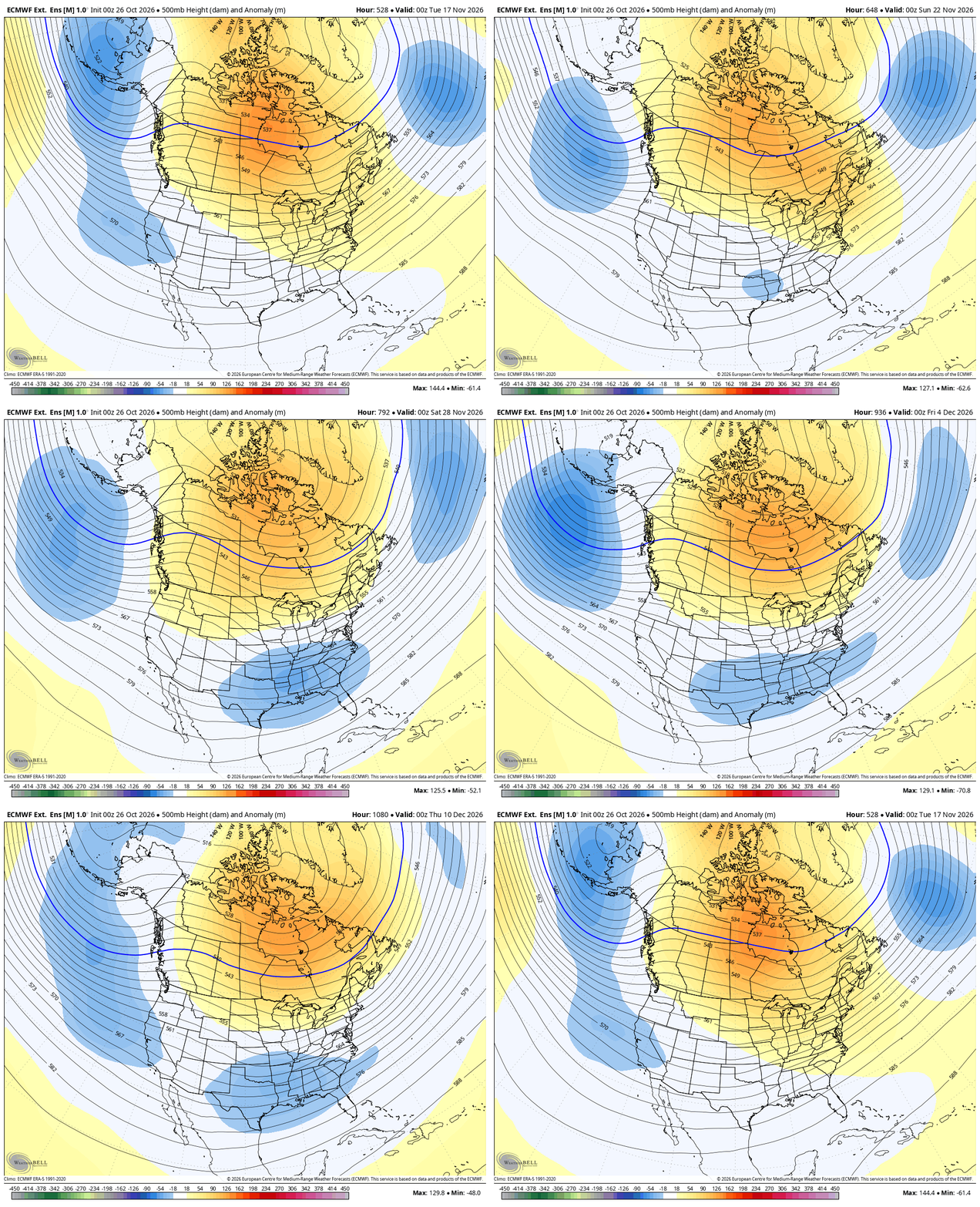
This stormy start to November likely continues through the middle of the month and may even produce some severe weather. This is ahead of what appears to be a pretty significant pattern change starting around mid-month. This leads us into a colder look for much of the country as blocking goes up across Canada extending to the Arctic.
The EURO Weeklies just keep cranking out that deepening trough into the first week and change of December. This animation starts in mid-November and rolls through December 10th…
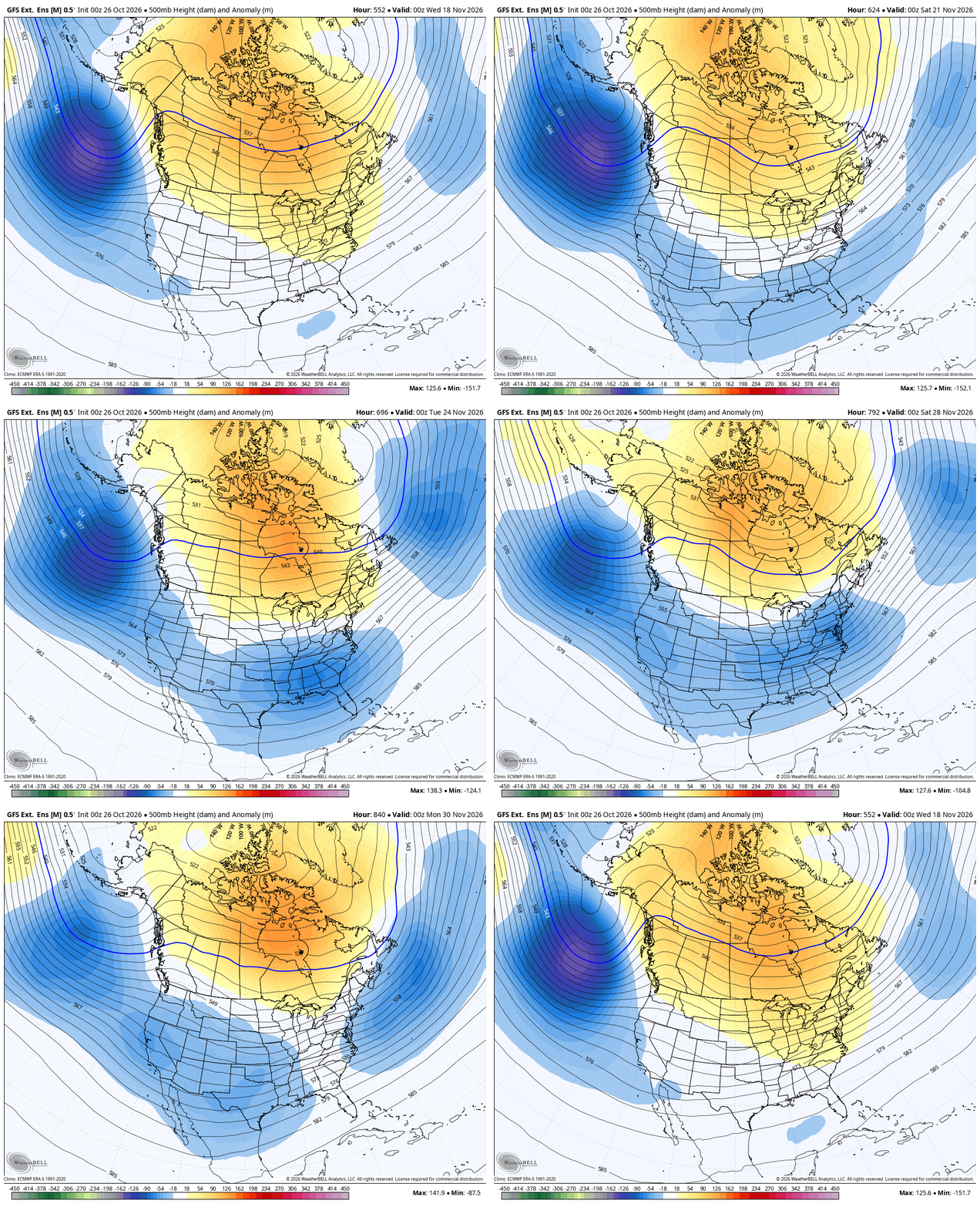
The GFS Extended only goes through Thanksgiving Weekend, but is also seeing this pattern…
Have a terrific Tuesday and take care.

Not buying the EURO weeklies yet. 🙂
Looks like the vaunted El Nino “southern storm track” finally appears poised to get with the program. Combine that with a mid to late November Polar Vortex incursion, and things could get very interesting in these parts!❄️
Thanks to the movie Day After Tomorrow, the words POLAR VORTEX scare the bejesus out of me haha
Lol!