Good Wednesday, folks. The weather pattern this October has been about as calm and awesome as you can ever get, but that’s about to change. This change arrives over the Halloween weekend with showers and some storms arriving, kicking off a very active month of November.
The weather still looks amazing through Friday with highs in the 70s.
I still think Halloween is a mainly dry day with increasing clouds and mild temps. These clouds are ahead of a system rolling in Saturday night and Sunday with showers and a rumble of thunder.
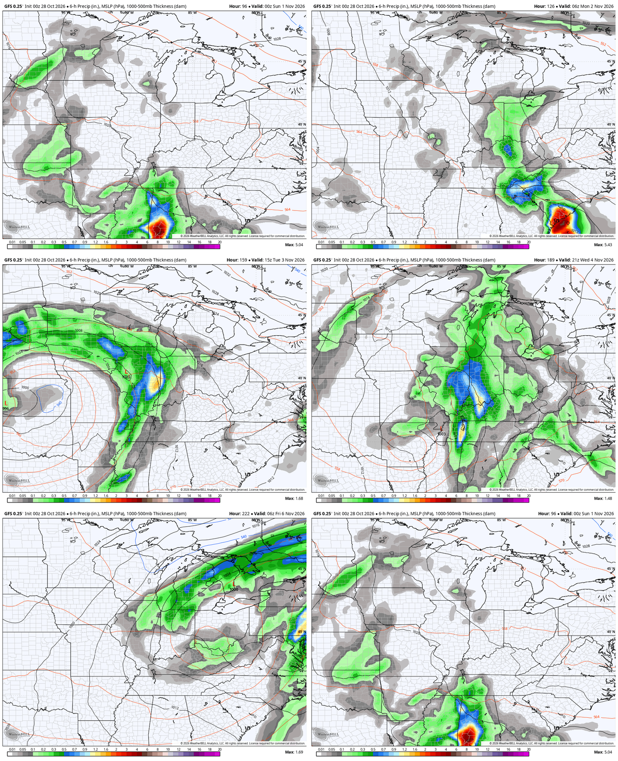
That will be followed by a cutoff, slow-moving low pressure that spins in from the west Tuesday into Wednesday with the exact arrival and departure times a challenge. These upper lows give the forecast models fits and we are seeing that happening right now.
Here’s the latest GFS from Halloween evening through next Friday…
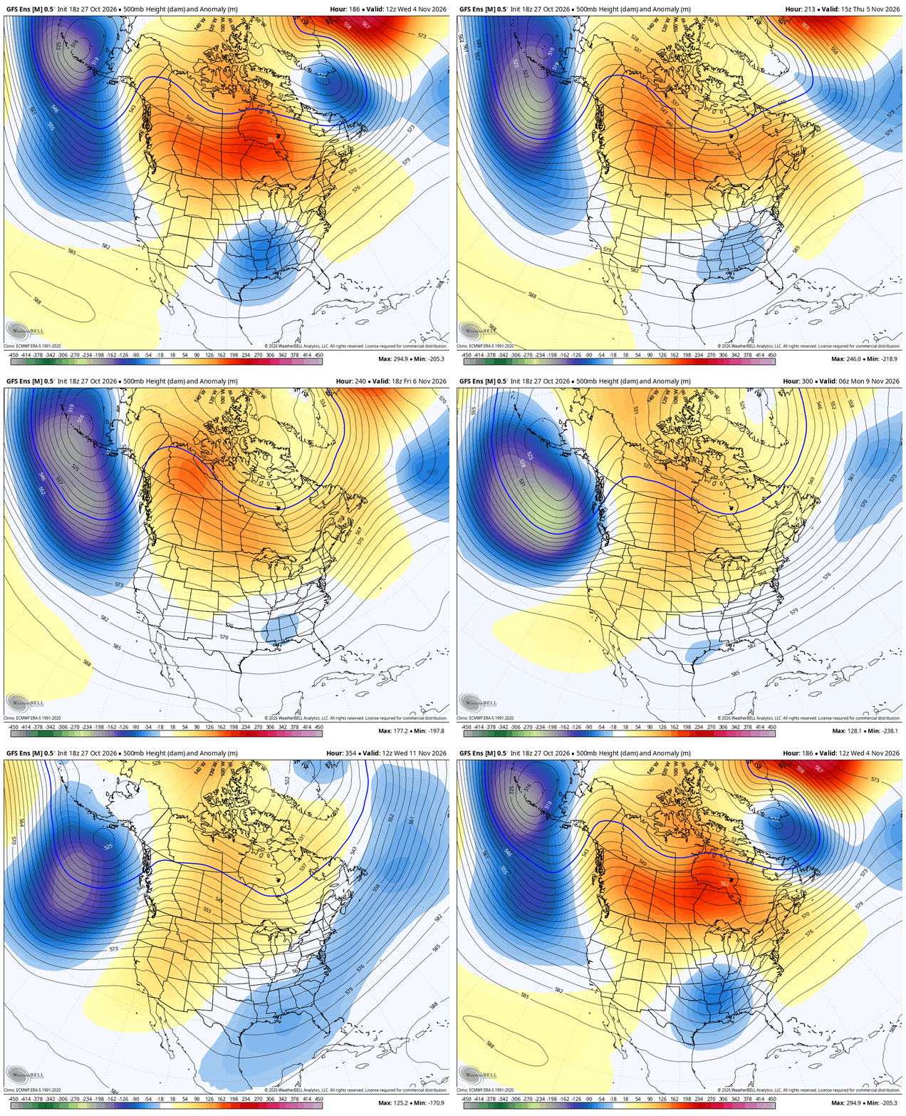
Looking a little farther down the road, the GFS Ensembles are getting far enough into the middle of November to see the beginnings of the trough developing under the blocking going up across Canada and into the Arctic…
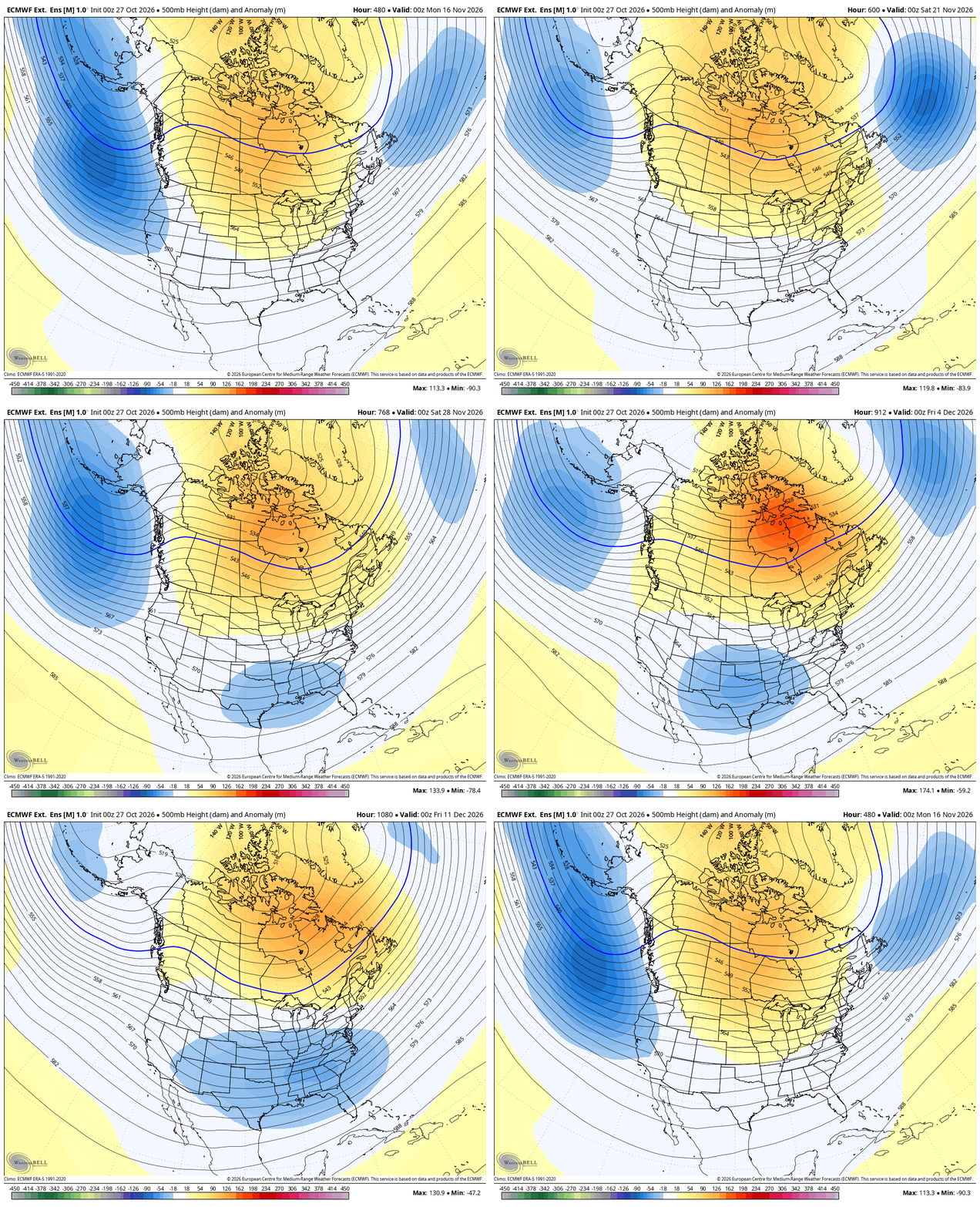
That’s something we’ve really been talking about for the past few weeks as the EURO Weeklies have been leading the way with this. The new run continues to indicate that trough continuing to develop from the middle of November into the first part of December. This animation starts November 15th and ends December 11th…
We are nearing the two a day post season, so spread the word!
Have a wonderful Wednesday and take care.
