Good Thursday, everyone. We continue with the awesome stuff ahead of changes blowing in for Halloween Weekend. Those changes mean we go from a very quiet pattern to a very active one for early November. The setup later in November may see winter try to start things a bit earlier than normal.
Temps today and Friday are deep into the 70s with a partly sunny sky. Enjoy!
Clouds thicken for Halloween/Breeders Cup Saturday, but the rain looks to stay to our west and south. Showers and a clap and a clap of thunder will increase Saturday night and Sunday, but this doesn’t look like washout type stuff.
Lingering showers hang on into Monday.
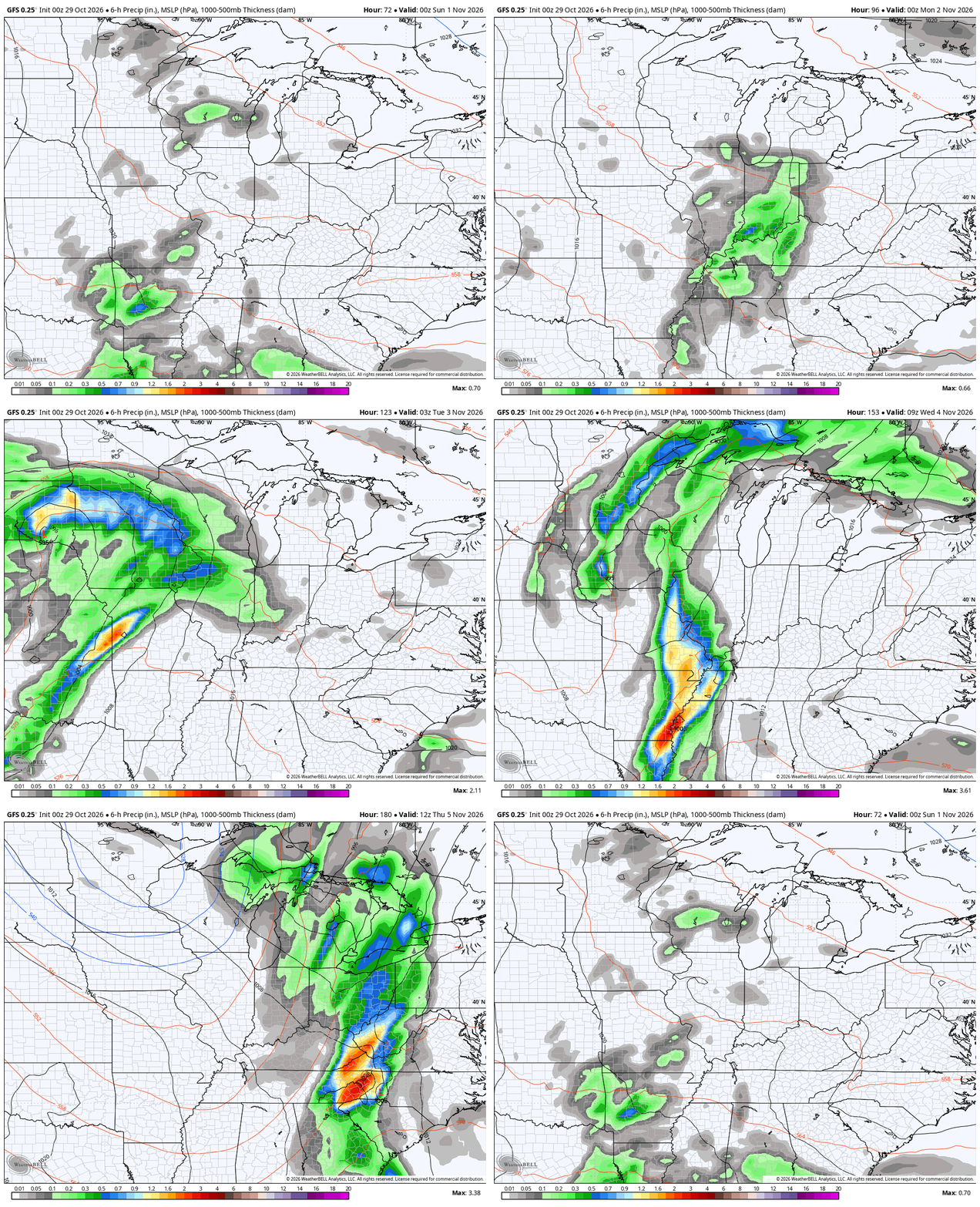
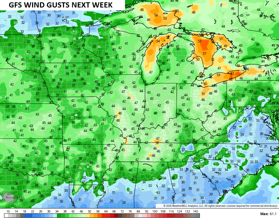
The big slow-moving system coming out of the Plains toward our region late Election Day through Thursday. This has the potential to be a disruptive system with showers and storms and gusty winds. The possibility is there for a few strong storms with heavy rains and that’s something to keep an eye on going forward.
While the models are struggling with the setup, the GFS has actually been the most consistent. Here’s the animation from the GFS starting Halloween evening and going through next Thursday…
You can see the wind potential showing up on that model run…
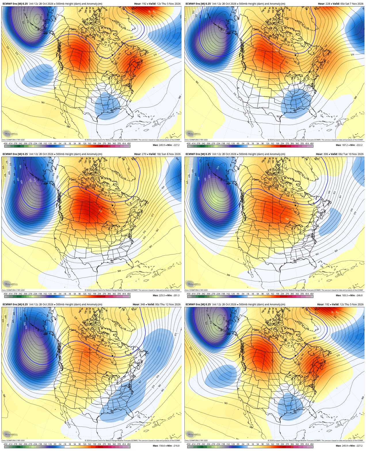
We know the pattern is skewed above normal to begin November and I’ve been tracking the potential for a mid-month switch. Now we have the Ensembles beginning to pick up on the change at the end of their respective runs.
The GFS Ensembles show the positive height anomalies getting pushed farther north into Canada with troughing developing underneath. This animation starts on the 5th and runs through the 13th…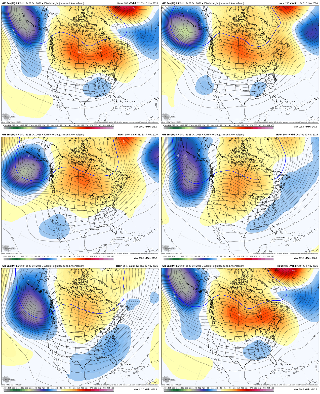
The Euro Ensembles are similar, but have a bigger ridge in the west…
As you know, the EURO Weeklies have been all over this pattern change for a while and they continue to be locked in. This latest animation starts on November 18th and runs through December 12th…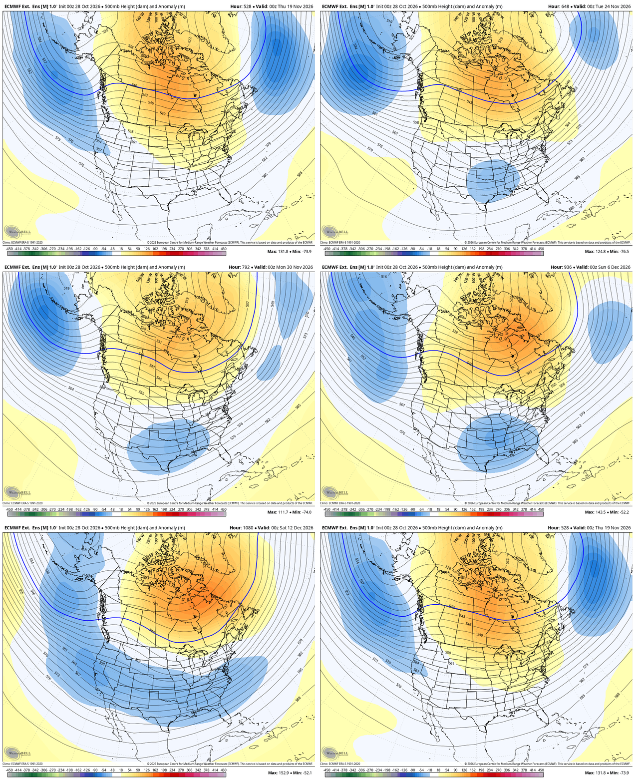
I may drop by for another update this evening. Make it a great Thursday and take care.

The EURO weeklies will flop.