Good Sunday, everyone. Old Man Winter looks to make an appearance in our region later in the upcoming week and because of that, KWC fires up the two a day posts. Y’all know winter is close when that starts!
The weather is seasonably chilly, but nice today. Temps aren’t as chilly into the start of the new week, but that won’t hold as the jet stream takes a big dip in the eastern half of the country.
This unleashes a true winter looking and feeling pattern that starts late Wednesday and rolls through next weekend. Low pressure spins across the region Wednesday into Thursday with rain and wind ahead of it and cold and snow behind it. As the low strengthens just to our northeast, this has the potential to bring a period of wrap around flake action into parts of our region.
From there, a strong northwest wind could bring lake effect flakes into our region at some point Friday into Saturday.
Now, exactly how all this plays out and just how much of an impact we see in Kentucky is a work in progress.
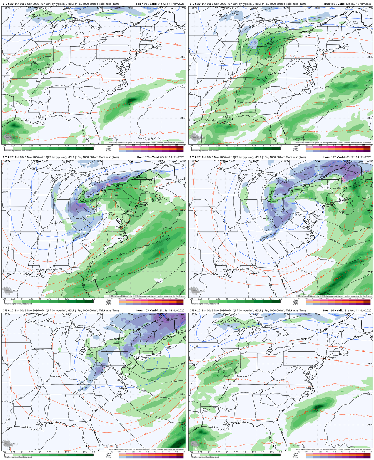
Here’s how the latest run of the GFS sees it all with this animation from Wednesday afternoon through Saturday evening…
And the snow map from that run…
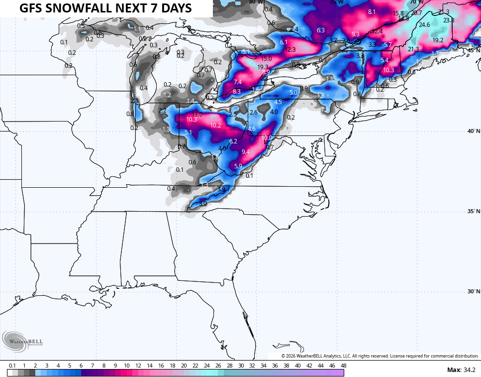
Again, take that with a big grain of salt from this far out and that goes for any forecast model.
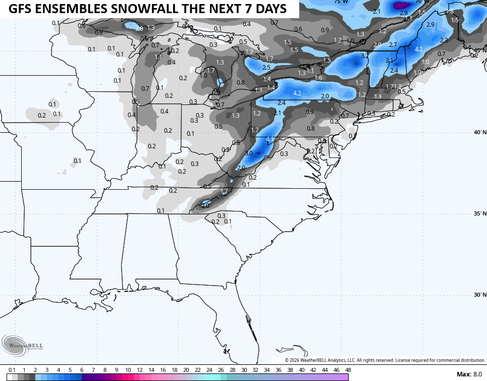
Here’s what the average of the GFS Ensembles are seeing…
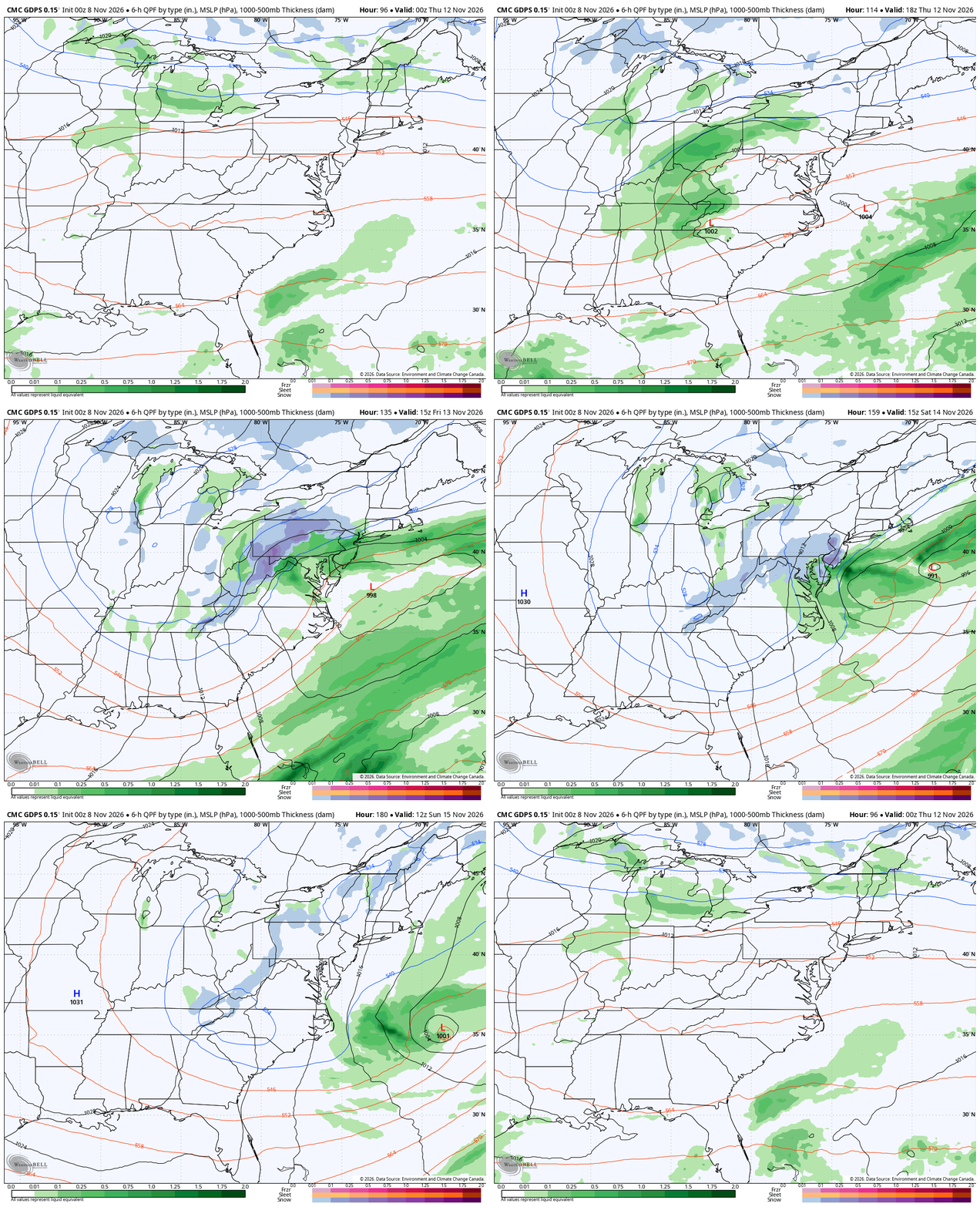
The Canadian isn’t as robust as the GFS with that low and is slower overall with the evolution, but it has a similar overall thought process. This animation starts Wednesday and goes through Sunday…
And the snow map from that run…
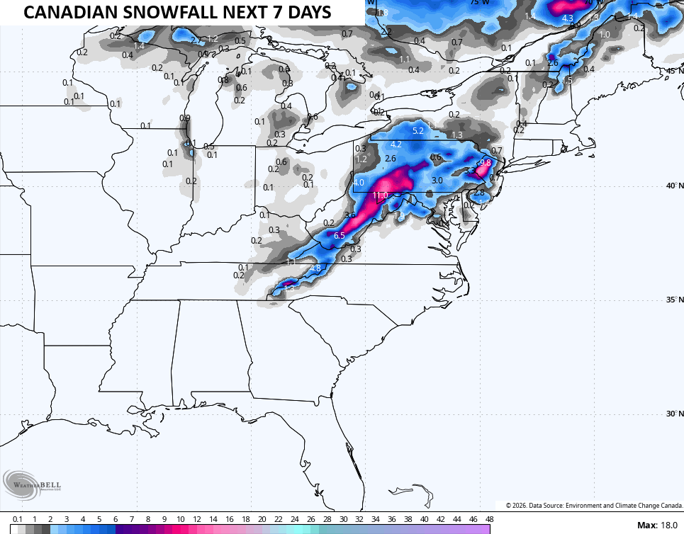
Can this system give us the first flakes of the season? Yes, absolutely. Can it be a little more in some areas? Yes, if things go right. Does this mean it’s a given we will for sure see the first flakes reported in our region? Not yet.
Once that system moves away, we find temps rebounding pretty quickly for a bit.
The bigger changes toward winter continue to show up later in the month before really digging in for December. The latest GFS Extended runs through December 11th and really shows the setup I’m talking about…
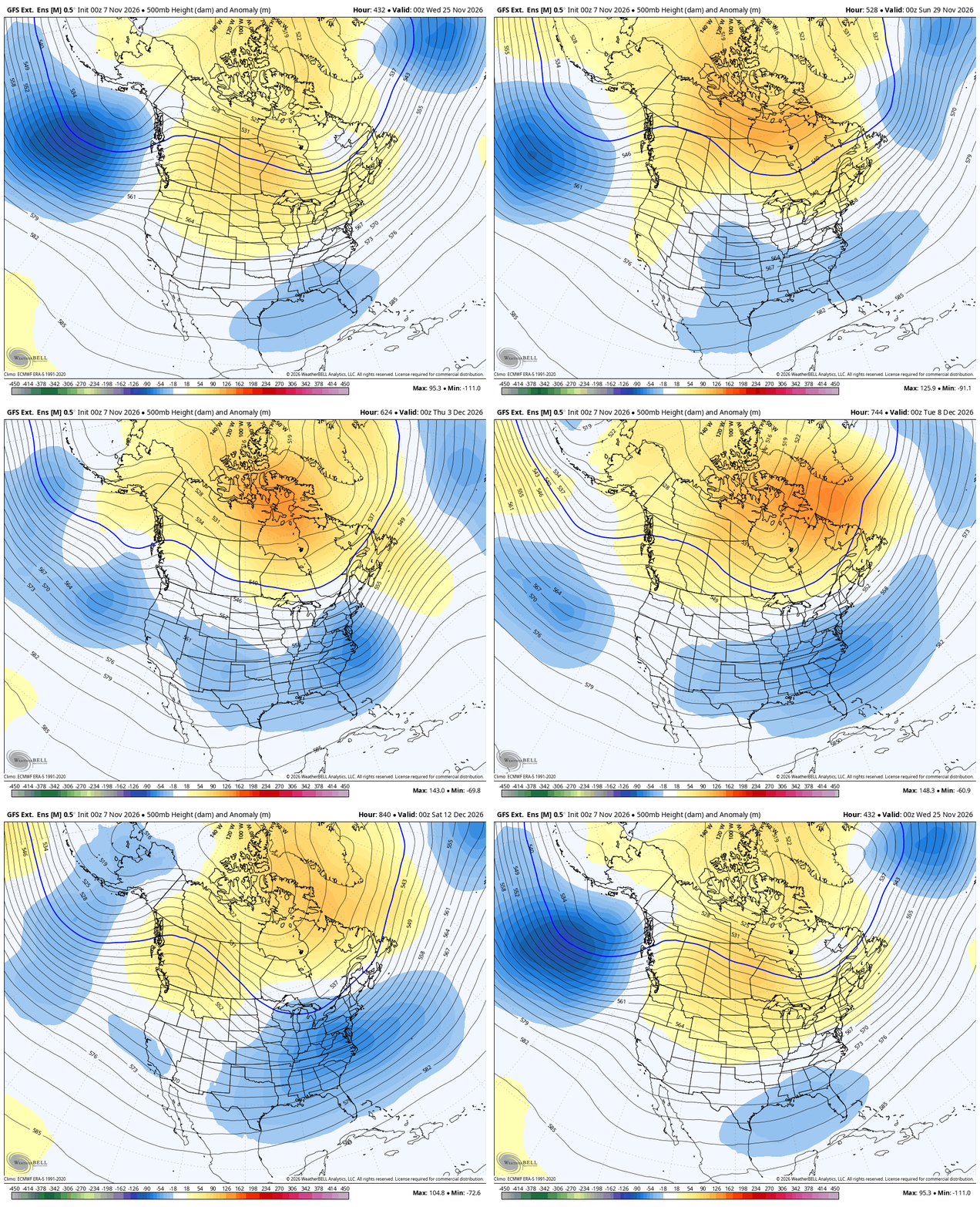
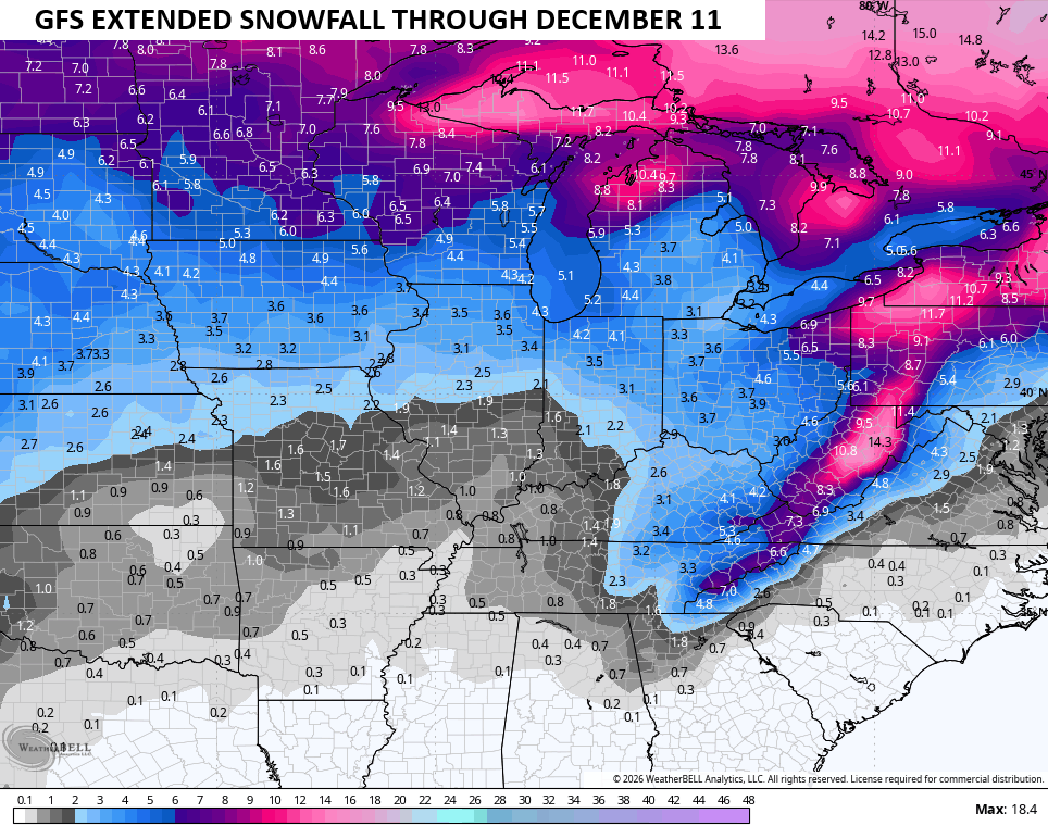
Notice how that trough deepens as we hit December? That would be one to produce early season snows around here and the snow map from that same model run likes that idea…
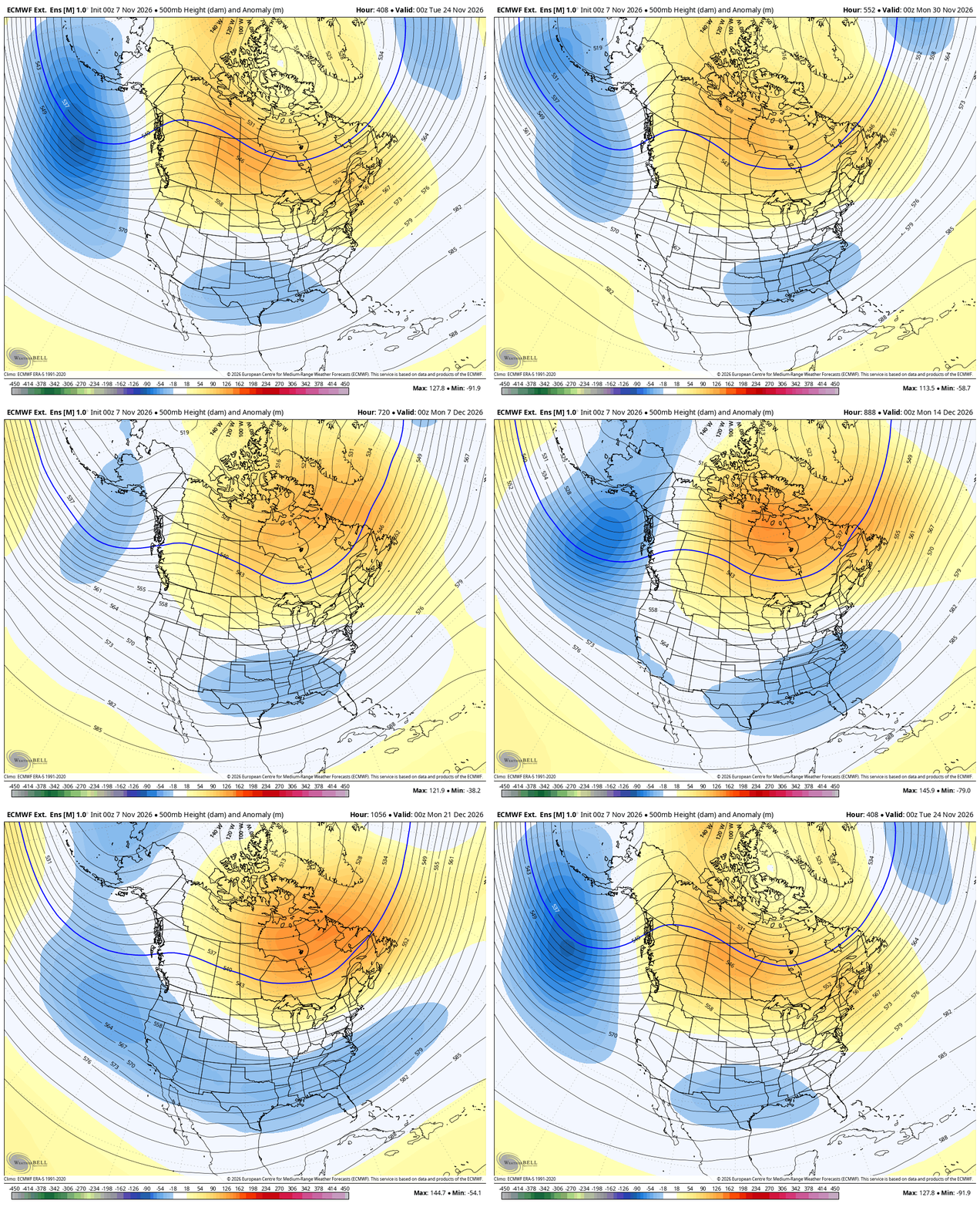
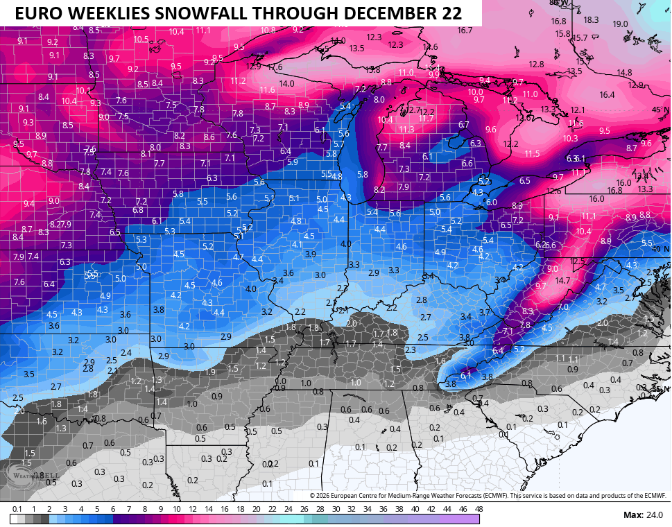
The EURO Weeklies have been leading the charge with this pattern for a while and they haven’t budged. The Weeklies go out farther in time and take us all the way to December 22nd…
The snow map during that time is the average of 101 different members…
I’ll see you guys later today with a quick update.
Make it a wonderful Sunday and take care.

The EURO weeklies are king of model hype, so definitely many grains of salt to be taken.
Here in the Chicago Metro Area, the only mention of snow by the local NWS office this week is for rain mixed with snow Friday morning, but by Saturday they are predicting highs in the low 50s. So if any snow accumulates at all, it certainly won’t last.