Good evening, everyone. It’s a seasonably chilly weekend across Kentucky, but it’s all eyes on the end of next week. That’s when Old Man Winter tries to pay an early visit to Kentucky and many areas in the eastern half of the country.
My time this evening is short, so let’s get after it.
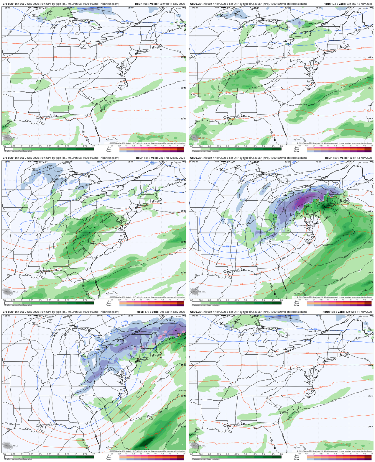
The forecast models continue to see this massive dip in the jet stream across the east starting Wednesday. This may feature a cut off massive upper-level low with a surface low spinning up near us before it pushes in the northeast.
This would bring rain in here late Wednesday into Thursday with crashing temps and the potential for a bit of wraparound snow action later Thursday. Very cold air diving across the Great Lakes may also pick up a little juice from Lake Michigan, bringing that far enough south to potentially give us some flakes.
Here’s the GFS with all this…
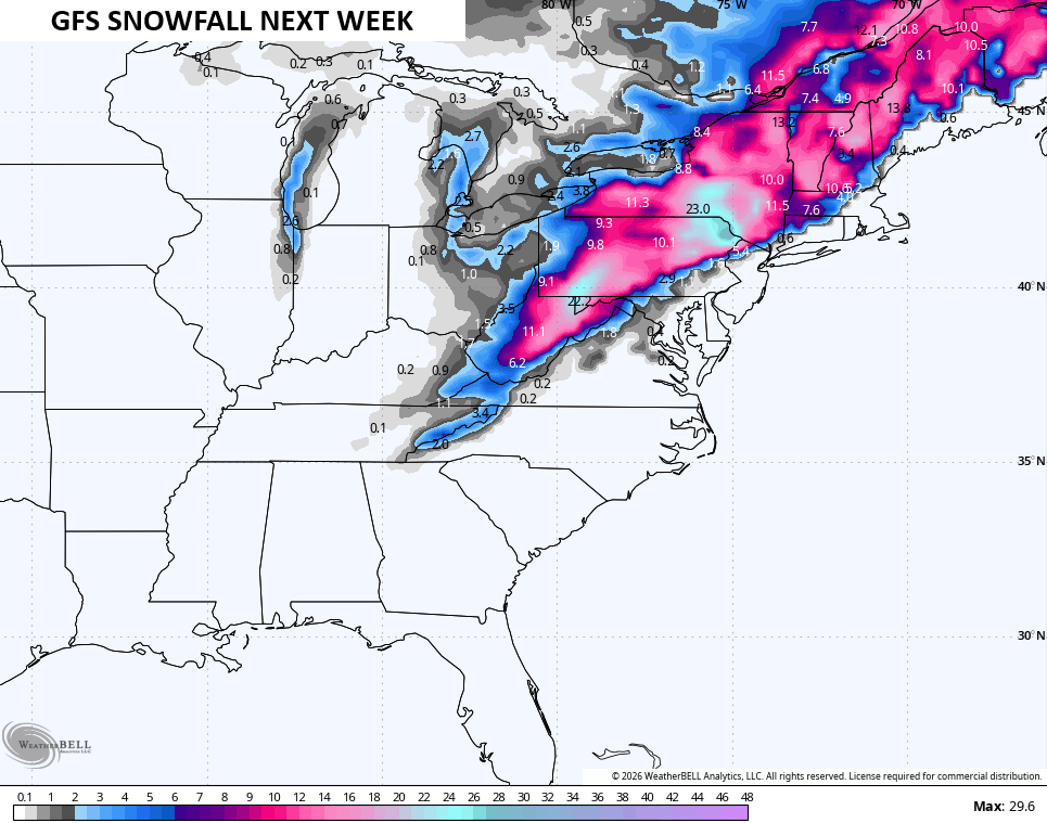
And the snowfall map from that particular run…
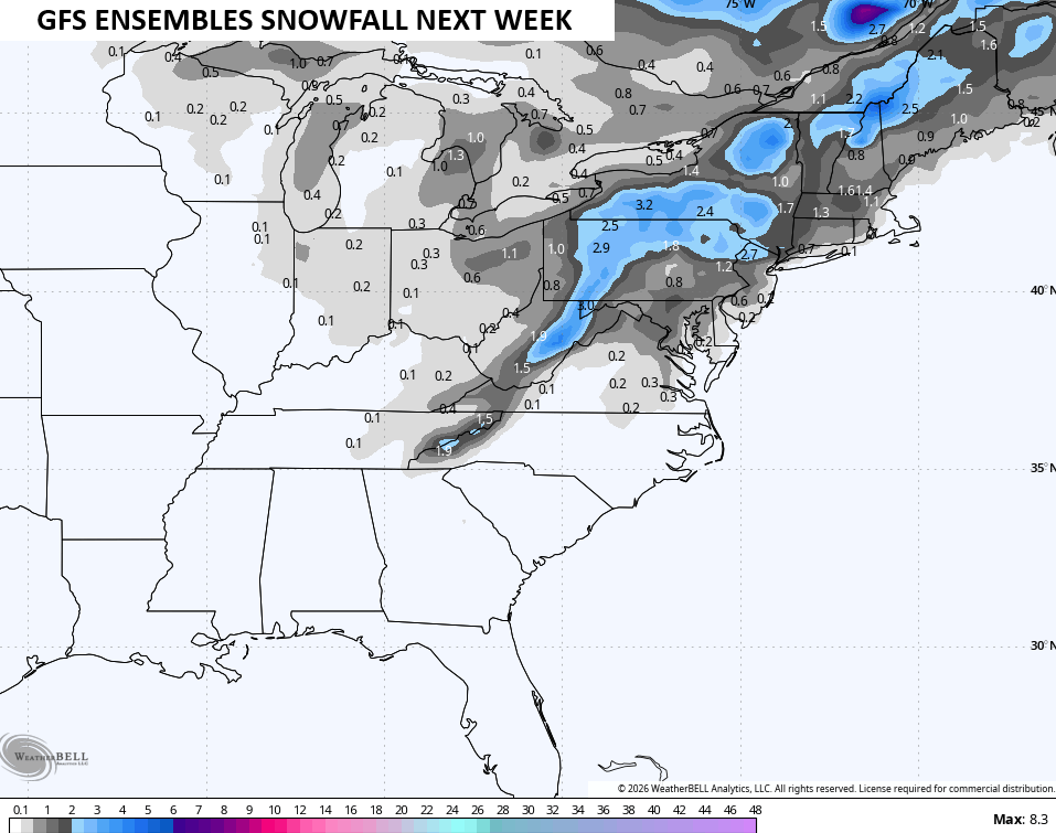
The average of the GFS Ensembles looks like this…
The Weather Prediction Center is even getting in on the action, showing a low-end chance for 1″ of snow back into our region…

While the potential for the first flakes of the season is increasing, this will also be a very cold air mass. Highs in the 30s will be possible with lows potentially reaching the upper teens over the weekend.
I’ll see you guys back here for the main update tonight. Enjoy the rest of the evening and take care.
