Good evening, folks. We’re putting the wraps on a seasonably chilly first weekend of November, but the pattern ahead will feature some unseasonable stuff. That comes with a late week cold blast that has the chance to bring the first flakes of the season into our region.
Overall, I really don’t have any changes to the late week idea.
The GFS continues to be the most amped up with this storm system and thus gives us a better chance to not only see the first flakes, but a little more. This animation runs from Wednesday afternoon through Sunday…
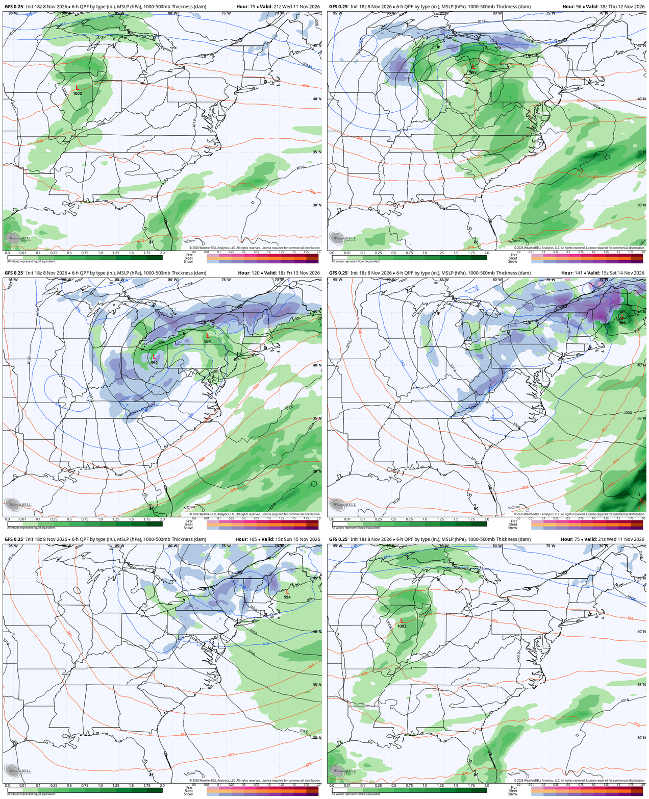
Notice how that goes from rain to backlash snows then some snow showers behind it all. Again, that’s probably a little too amped up, but that solution isn’t impossible.
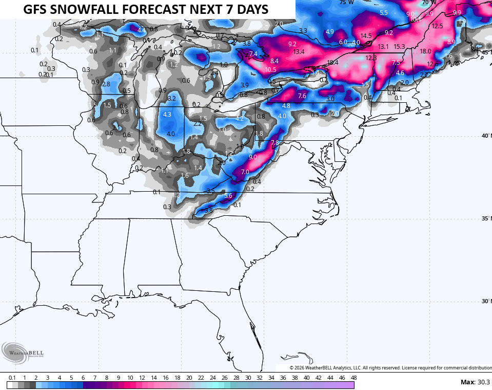
Here’s the snow map from that run…
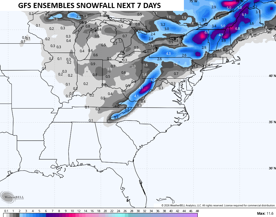
I tend to side a little more with the GFS Ensembles…
The EURO Ensembles are coming around to look similar to that…
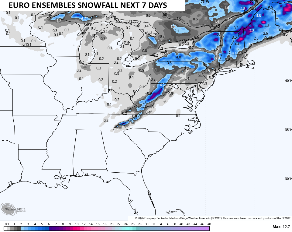
The EURO isn’t as jazzed up with the storm, and this is also a plausible solution…
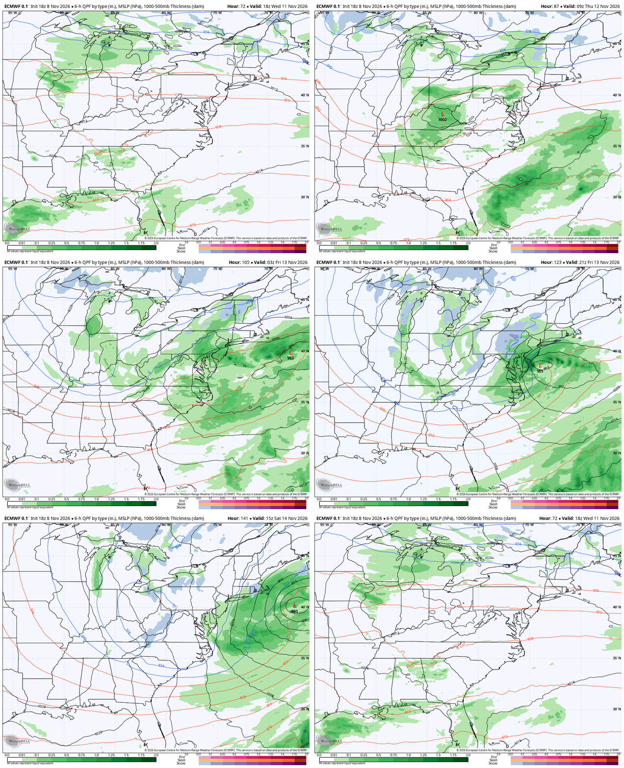
That would still bring the first flakes of the season in here.
This is also a healthy shot of cold air for the end of the week into next weekend. Highs on more than one day will likely be in the 30s with lows that can reach the upper teens and low 20s.
I’ll see you for the full update later tonight. Have a great rest of the evenin and take care.
