Good evening, folks. We have a few more mild days ahead of us before big changes blow in. These changes bring in a touch of winter for the end of the week and weekend, giving some folks the first flakes of the season.
I’m still riding the GFS Ensembles for the chance for some flakes across central and eastern Kentucky. The possibility is there for some sticking flakes late Friday across the high elevations in far southeastern Kentucky…
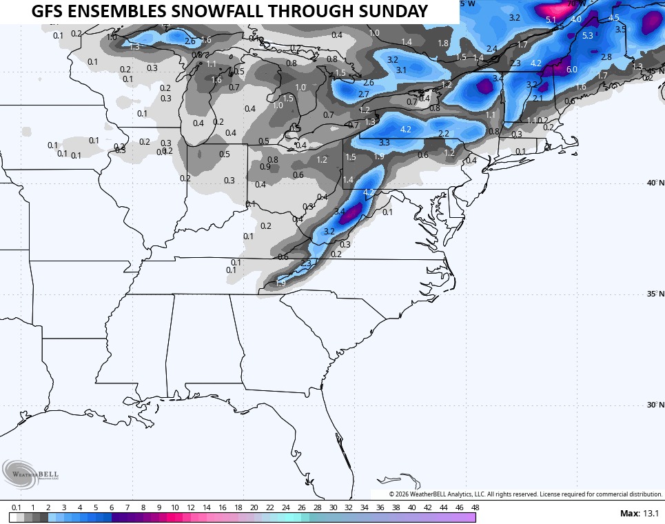
The forecast models are jumping around a bit with the storm system in the east, but they have the upper low passing on top of us with some rain and snow showers showing up Friday and Friday night.
This animation from the GFS starts Wednesday afternoon and runs through Saturday…
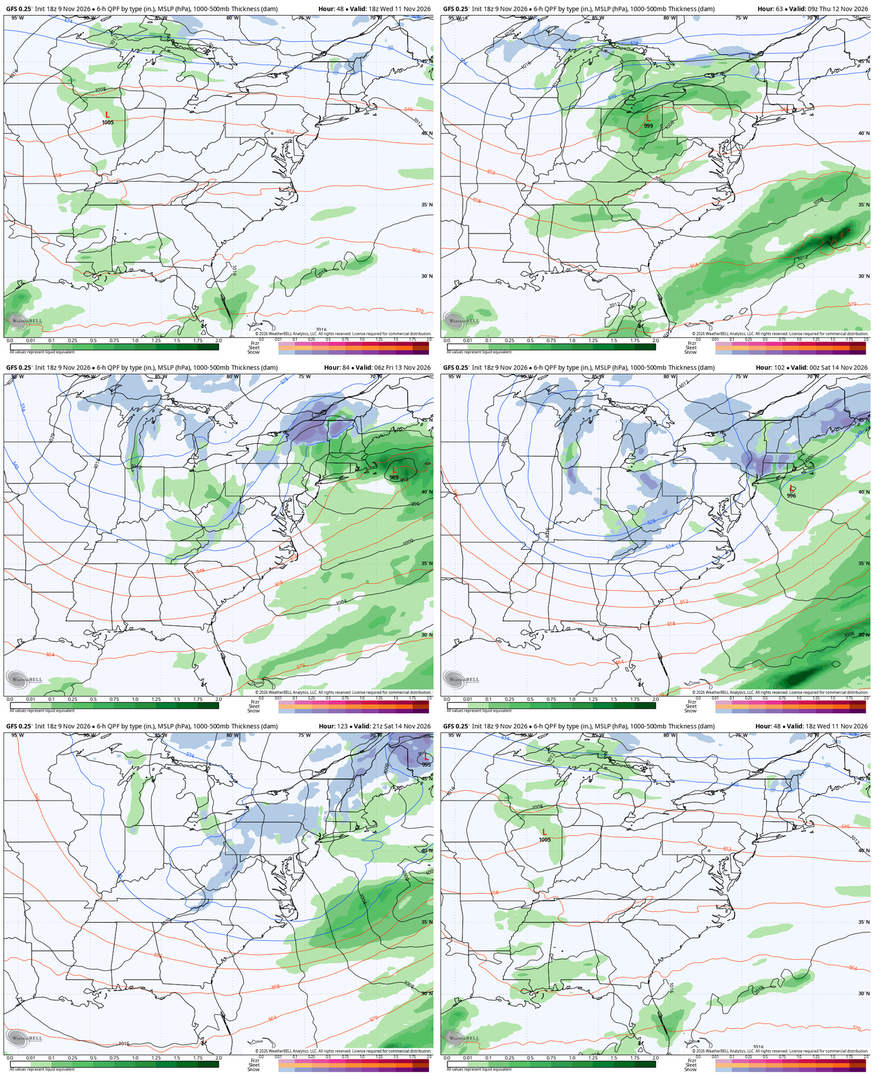
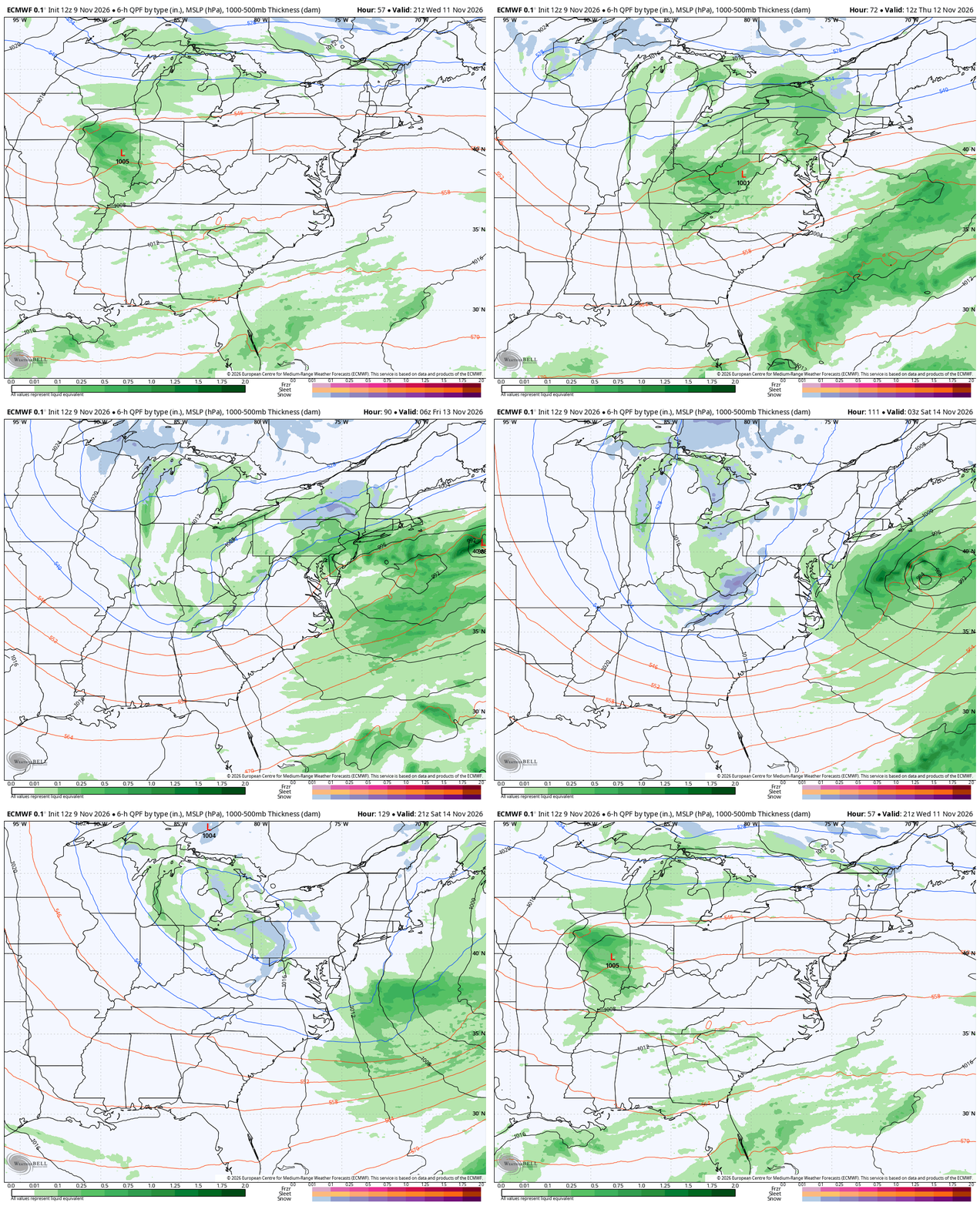
The GFS is slowing the whole system down, matching what the Canadian and Euro have been suggesting for a while now. Here’s the latest EURO…
The Weather Prediction Center continues to highlight the low-end risk for light accumulations across far southeastern Kentucky…

I’ll see you back here tonight with the full update.
Enjoy the evening and take care.
