Good Wednesday to one and all. Big changes are blowing in as the first of two cold fronts sweep across the area. Today’s front brings the potential for a few strong storms while the second front unleashes a small taste of winter. Yep, the first flakes of the season will likely fly across parts of Kentucky.
Temps are mild again today with readings deep into the 60s as southwest winds crank. These winds are ahead of a cold front sweeping in later this evening, bringing a broken line of showers and storms along for the ride.
Some of these storms may be strong or severe across western and central Kentucky. This is where we find the low-end severe storms risk from the Storm Prediction Center…

There’s just enough spin available for a local tornado threat for some of these same areas. Here’s where that threat exists from the Storm Prediction Center…

Pockets of damaging wind is a better possibility…

Gusty winds and a few chilly showers follow this front tonight into Thursday with highs generally in the upper 40s to low 50s.
As the second front rips through here, much colder are pours in from the northwest. Combine that with a big upper level system dropping through and you get more showers and the chance for a few snowflakes to show up Thursday night. The snowflake chance during this time is across the high elevations of far southeastern Kentucky.
The northwest flow will then touch off additional rain and a few snow showers late Friday into Friday night across central and eastern Kentucky. Not everyone will see these snow showers, but the forecast models are showing the flake potential…
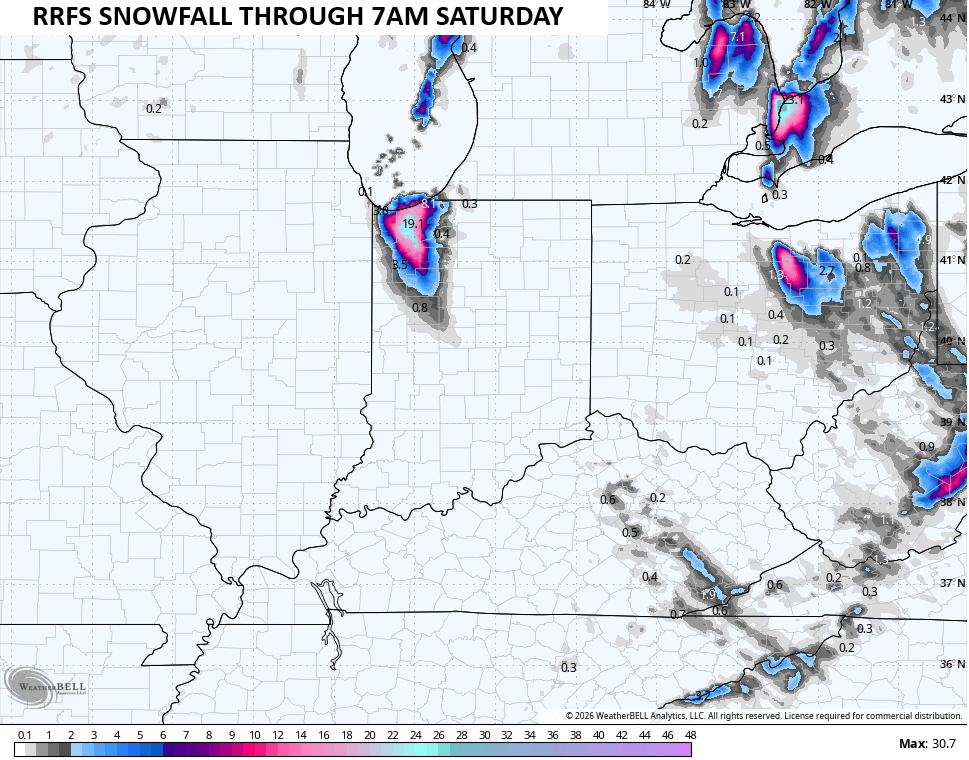
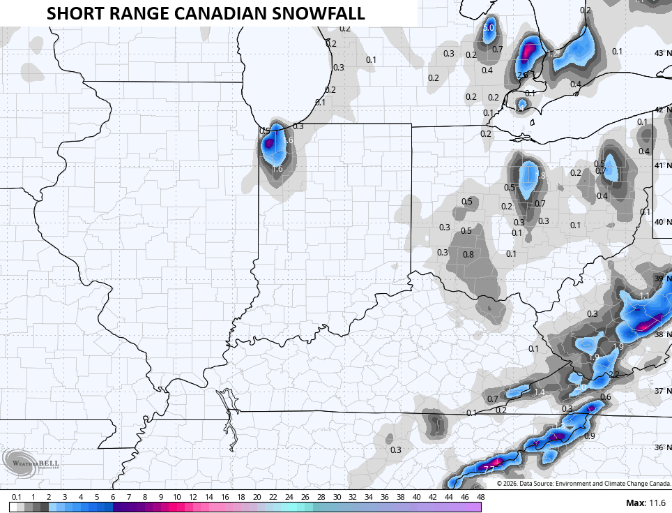
High temps on Friday hang in the upper 30s to low 40s across central and eastern Kentucky but wind chills stay in the low 30s. This sets the stage for lows reaching the low to mid 20s Friday night with wind chills that can drop into the upper teens at times.
Saturday is a blustery day with highs of 40-45 but the wind makes it feel colder. Sunday is a seasonably cold day with that air lingering into the start of next week. There is the chance for a southern system to get close enough to produce a shower or two to start the week.
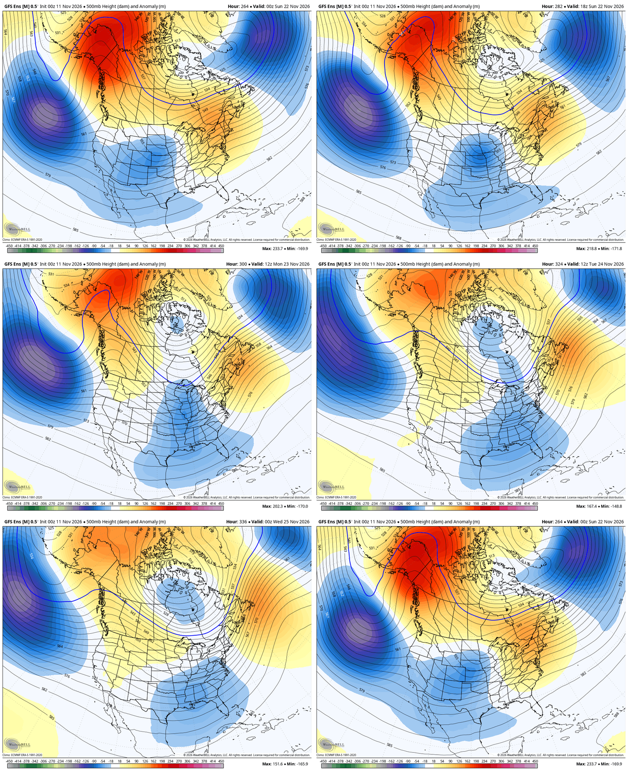
Temps will rebound throughout the week before we see those changes really setting up shop as we head into Thanksgiving Week. The extended models have done a good job picking up on the blocking signatures showing up this week and now we have this time period within range of the ensembles. They are seeing the block and resulting trough in our region…
Blocks like that mean we will likely see some pretty crazy looking storm systems showing up from time to time on the operational models. You know, similar to the one on the new EURO in the days leading up to Thanksgiving…
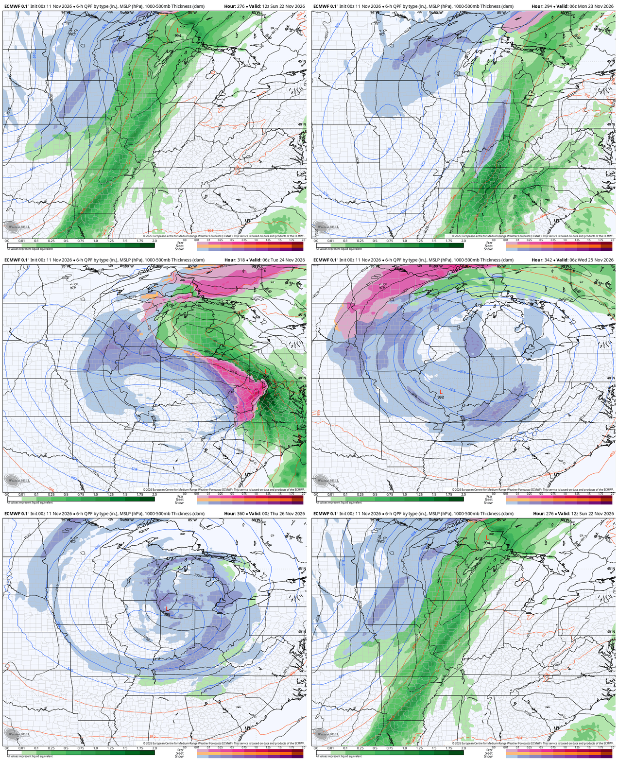
That’s just for fun, btw. 🙂
Speaking of those extended models like the EURO Weeklies, they continue to show significant blocking for the end of November that only strengthens into December. This animation runs
from just before Thanksgiving to Christmas Day…
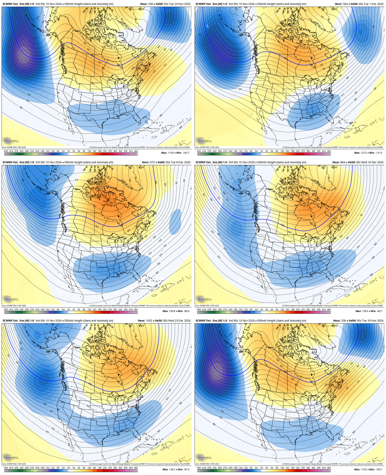
Not only has this been a remarkably stable signature from the Euro Weeklies, but it’s also amazing to see how stable that pattern is on a day-by-day basis for the month that is highlighted. That’s also the signature many of the seasonal models have been showing for the entire winter ahead.
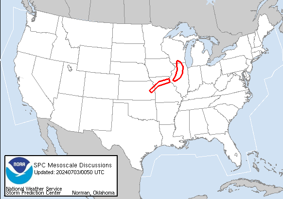
I’ll drop by for another update later today. As always, I leave you with your daily storm tracking toys…


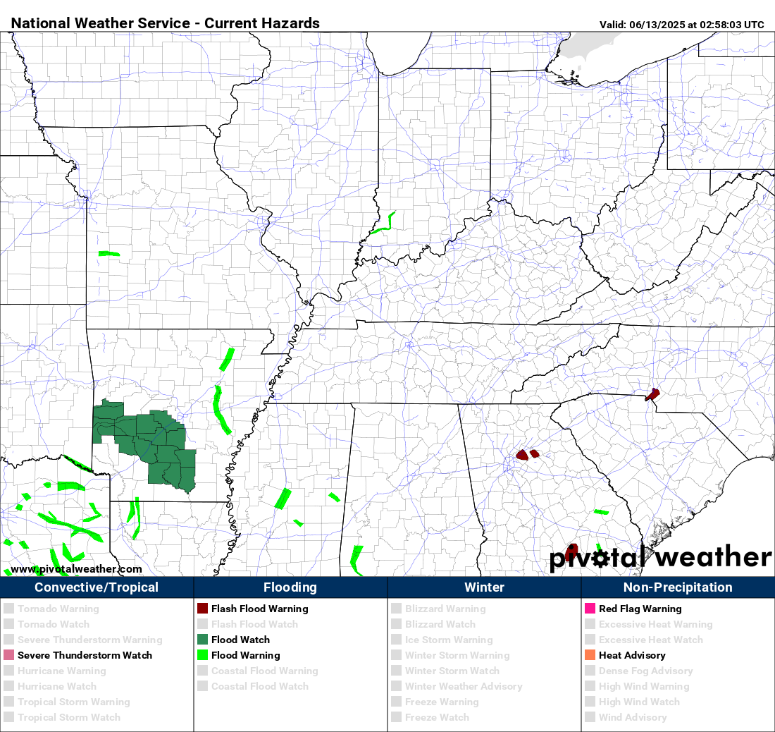

Current watches
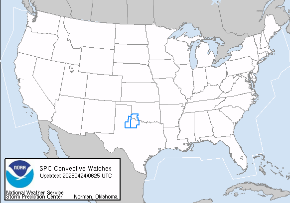
Possible Watch Areas
Make it a wonderful Wednesday and take care.

I feel that a big player in our future, during the runup to Thanksgiving and into December, will be a series of Polar Vortex intrusions. Most of these will be the “stretched PV” variety, which usually don’t persist as long as Sudden Stratospheric Warming PV. The SSW PV intrusions are usually stronger and persist longer, but they don’t typically stand out on the Weeklies forecast runs. The Polar Vortex could play a significant role in our weather during the early to mid winter timeframe, and there is the potential for significant interaction between the PV and the strong southern storm track from the super El Nino. There is also the fact that strong El Ninos during the winter months have a tendency to trigger SSWs. It’s all in the timing.
I think the long range models will bust.