Good Monday, everyone. Seasonably chilly air remains in place across Kentucky, but a milder wind kicks in for the rest of the week. This milder wind is ahead of a pattern change beginning Thanksgiving week with winter trying to flex in December.
Temps are mainly in the 50s for highs today and Tuesday with the 60s showing up starting Wednesday and taking us into the weekend.
It’s at that point things start to change. We find a cold front dropping into the region later Saturday into Sunday. At the same time, a low pressure is likely developing off the southeastern seaboard and may take on the look of a hybrid system. This system is giving the models fits, but they always do.
The GFS and Canadian ride the coast with this thing, but the EURO takes it out to sea…
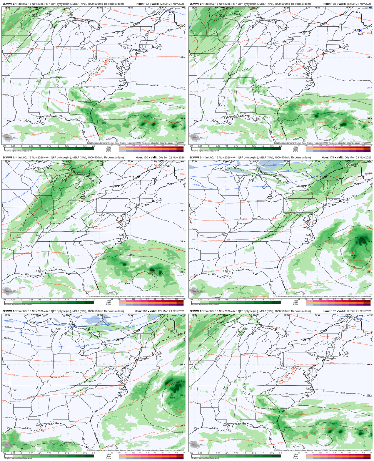
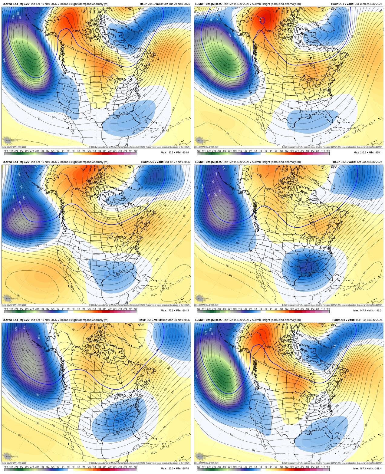
This sets the stage for a few more systems to sweep eastward across the country Thanksgiving week and weekend. The operational models will flip and flop more than usual in the coming days. The Ensembles will give a more steady signal.
The EURO Ensembles fit nicely with what the EURO Weeklies have been advertising for weeks now. Watch the positive height anomalies get locked in across Canada to the arctic and a massive ridge going into Alaska on this animation that starts next Monday and ends on the 30th…
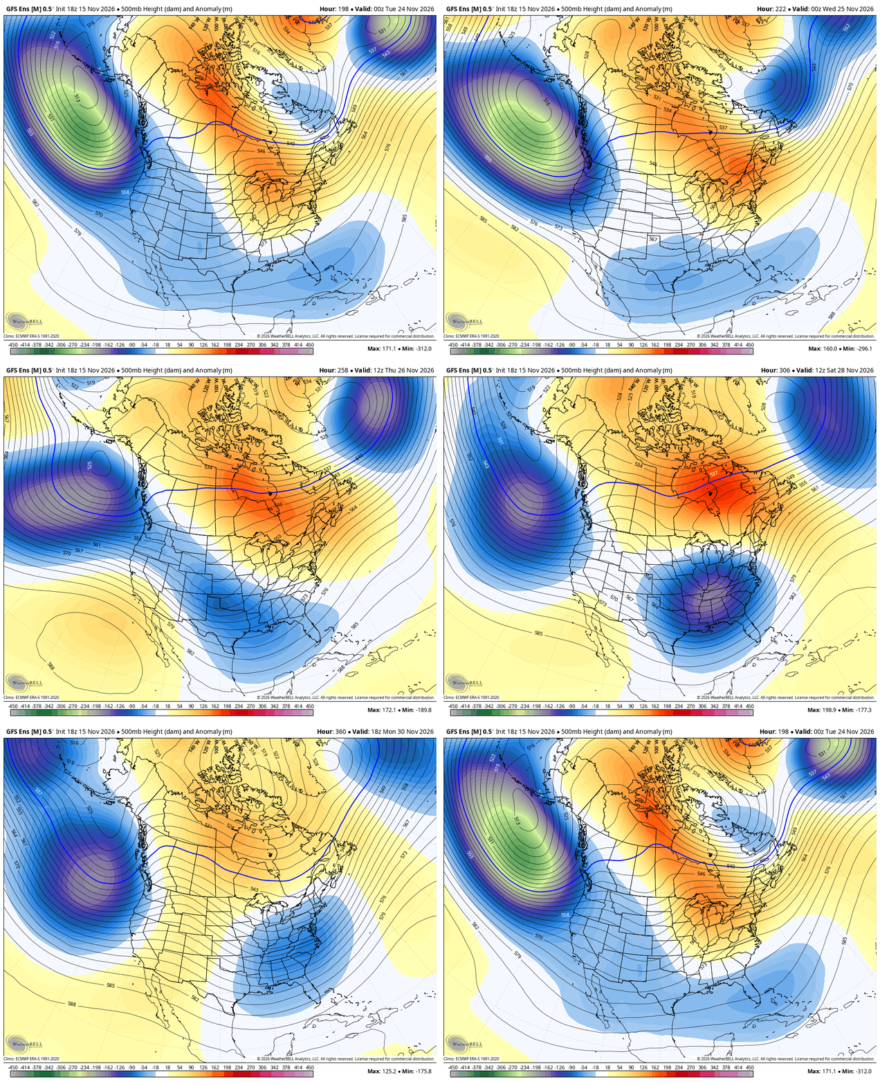
The GFS Ensembles during this same time are similar…
Both of those runs try to pop some winter weather around here in the closing days of the month…
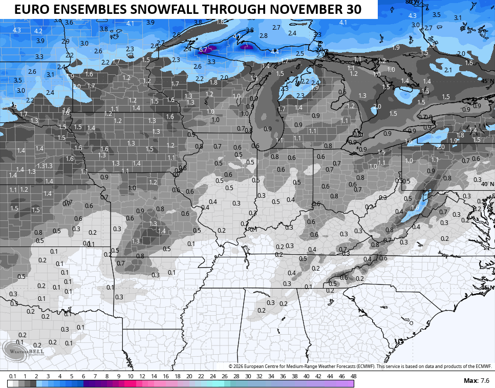
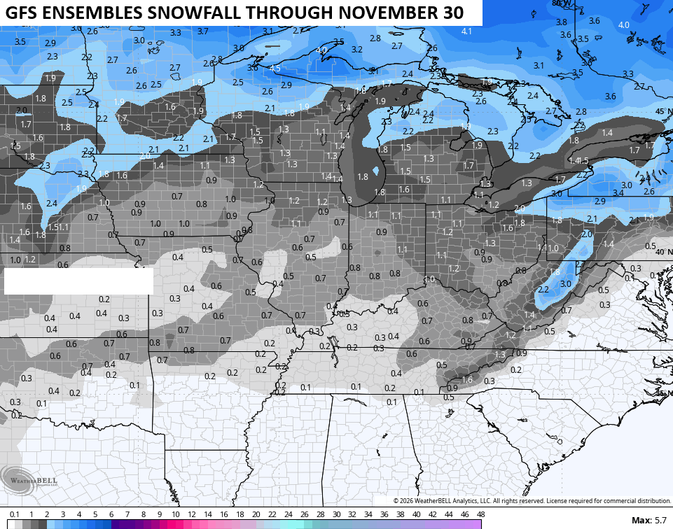
Remember, those are the medium range ensembles and not the weeklies.
Speaking of the EURO Weeklies, they are as steady as ever with keeping that same pattern going through the end of the run, which is almost to the end of December…
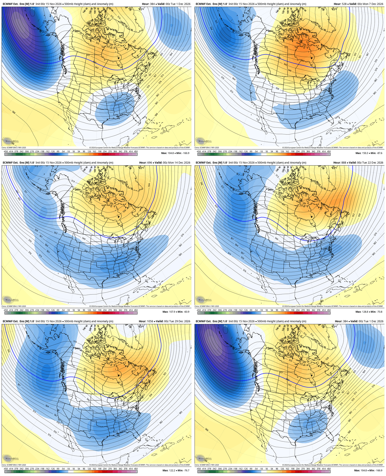
Not exactly a December pattern for a Super El Nino, but as you know, this one has not acted like it’s supposed to.
Another update comes your way later today. Make it a good one and take care.
