Good Wednesday to one and all. We are one week away from Planes, Trains and Automobiles Day here on KWC and it looks like our pattern is about to change for the long Thanksgiving travel period. This setup looks active and much colder.
Let’s begin with the mild of this week before looking ahead.
Highs are in the 60s today through Friday with dry skies. Enjoy.
The weekend finds those changes taking shape as low pressure rolls up the east coast while a cold front sweeps in from the west. This front won’t arrive until late Sunday or Sunday night, keeping those mild temps into the weekend.
The front will bring some showers from west to east through Monday as cold air plunges in behind the boundary…
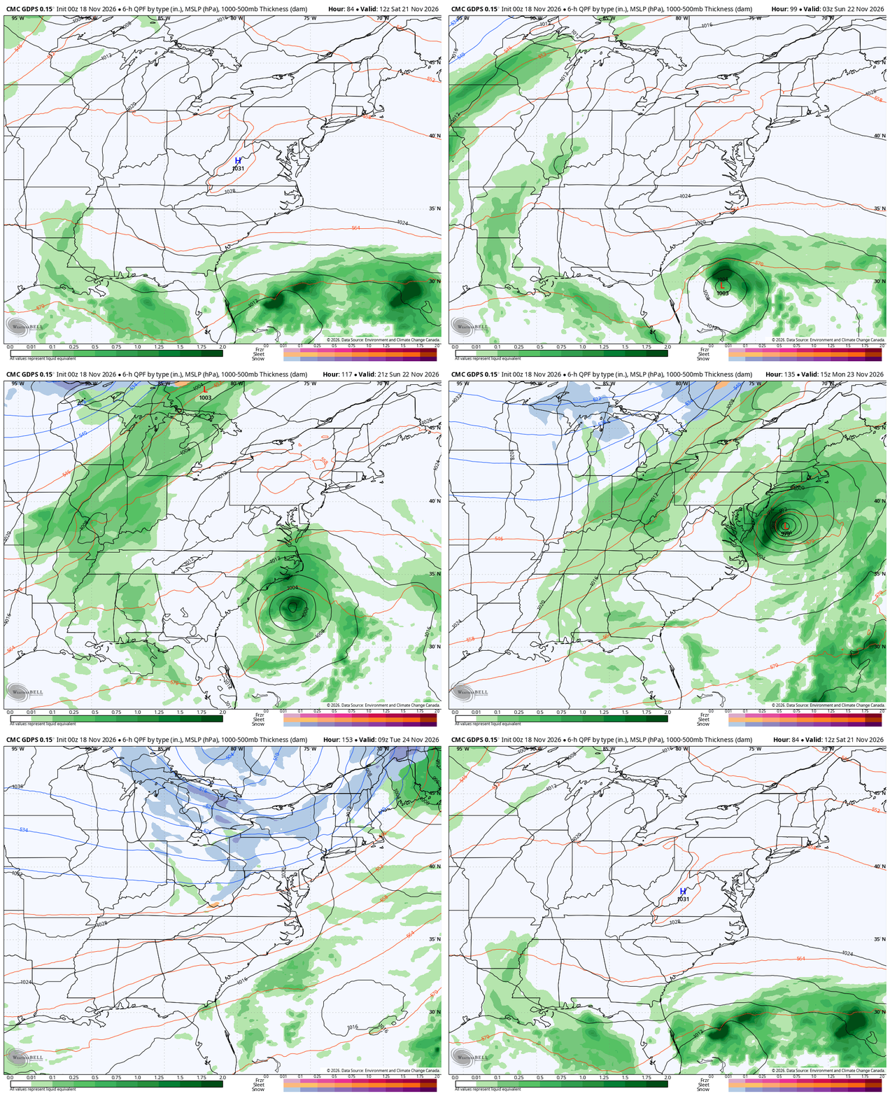
Much colder air crashes in on Monday with even colder air settling in for all of next week as temps go below normal.
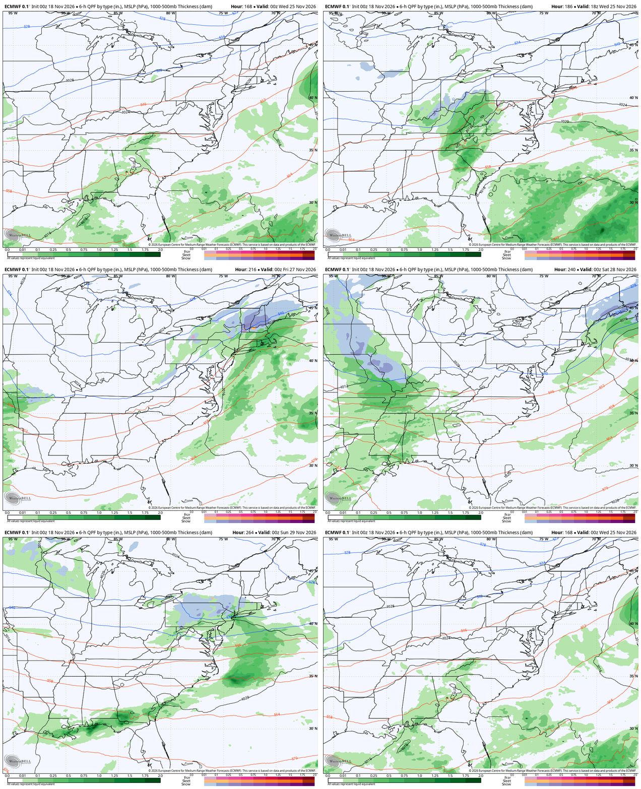
I’ve mentioned this is a busy pattern for Thanksgiving week and there’s so much energy crossing the country that the forecast models can’t keep up. Not only do they disagree on how to handle all this energy, but they totally change from one run to the next.
The EURO is taking the lead system into our region for the busy travel day on Wednesday and showing some rain and snow action. It follows that up with the next system bringing more of the same from Black Friday into the rest of the holiday weekend…
The GFS takes that initial system to our southeast Wednesday and Thanksgiving Day before bringing a monster system through here Black Friday into the rest of that holiday weekend, ending it all with some snow…
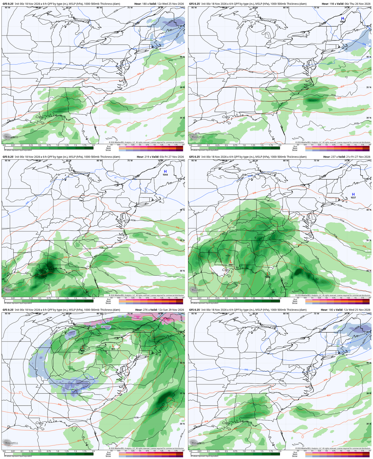
Just a wee bit of difference between the two!
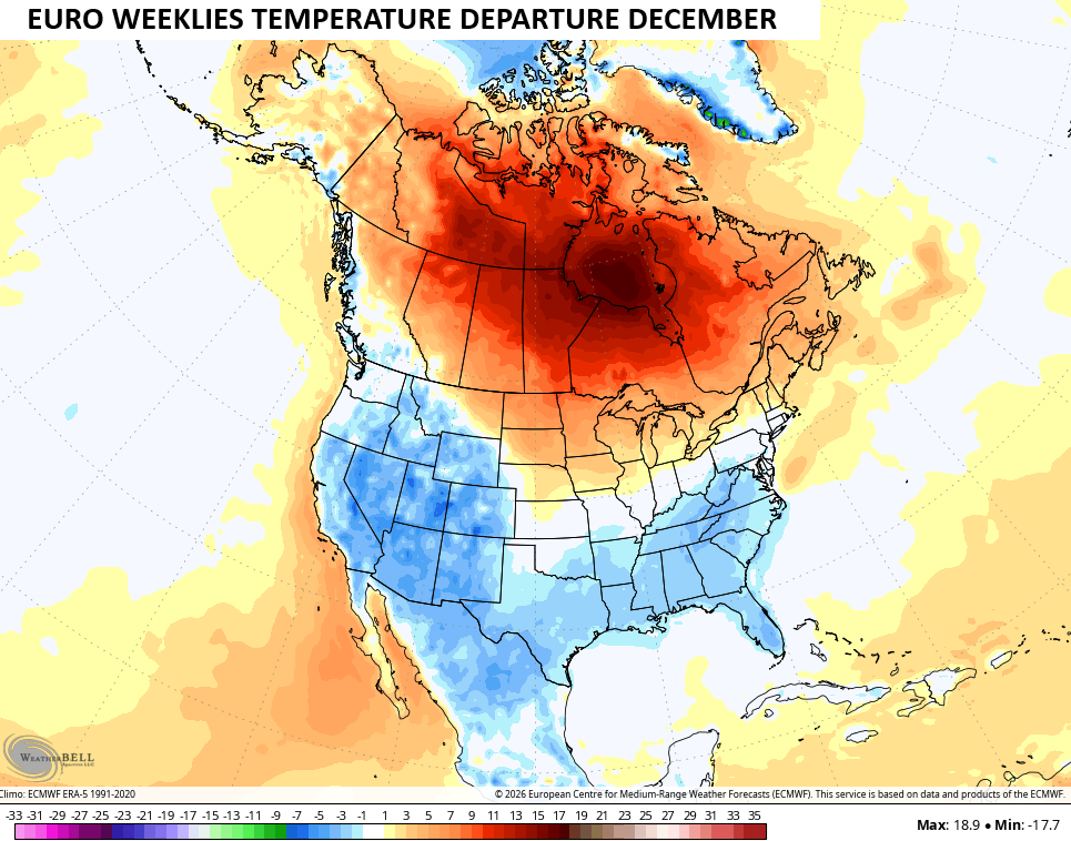
The EURO Weeklies had this pattern change nailed from nearly a month ago and it continues to show this really digging in for December. The blocking we’ve talked about is clearly visible across Canada into the Arctic with a trough underneath it across much of the country. This is a 30 day average from 101 members that make up the Euro Weeklies…
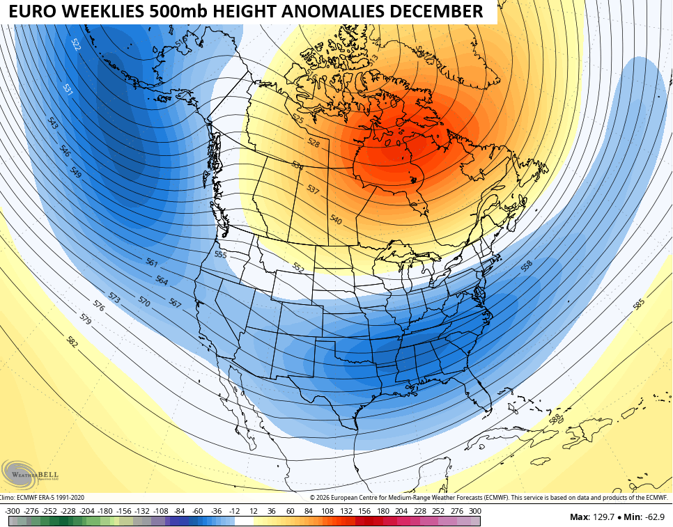
While not an exceptionally cold pattern, that setup does show below normal monthly temps from our region and south…
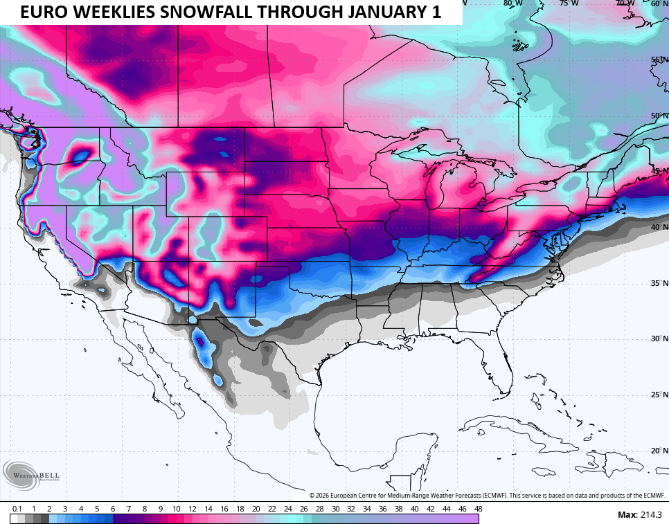
With an active storm track, snow chances will most certainly be with us. Here’s what the average looks like through New Year’s Day…
Speaking of winter, set your alarm…
I’ll be back with another update later today. Have a wonderful Wednesday and take care.
