Good evening, everyone. Awesome weather rolls on through the end of the week, but a cold front looks to change that in the coming weekend. This change brings a more active and colder setup for Thanksgiving week.
The first system set to impact our weather arrives this weekend. We have a low pressure likely to slowly roll northward along the east coast while a cold front marches toward us from the west. How these two interact will be the key on how much rain we can get and exactly when it arrives.
The latest GFS is a little closer to getting these two to shake hands with one another…
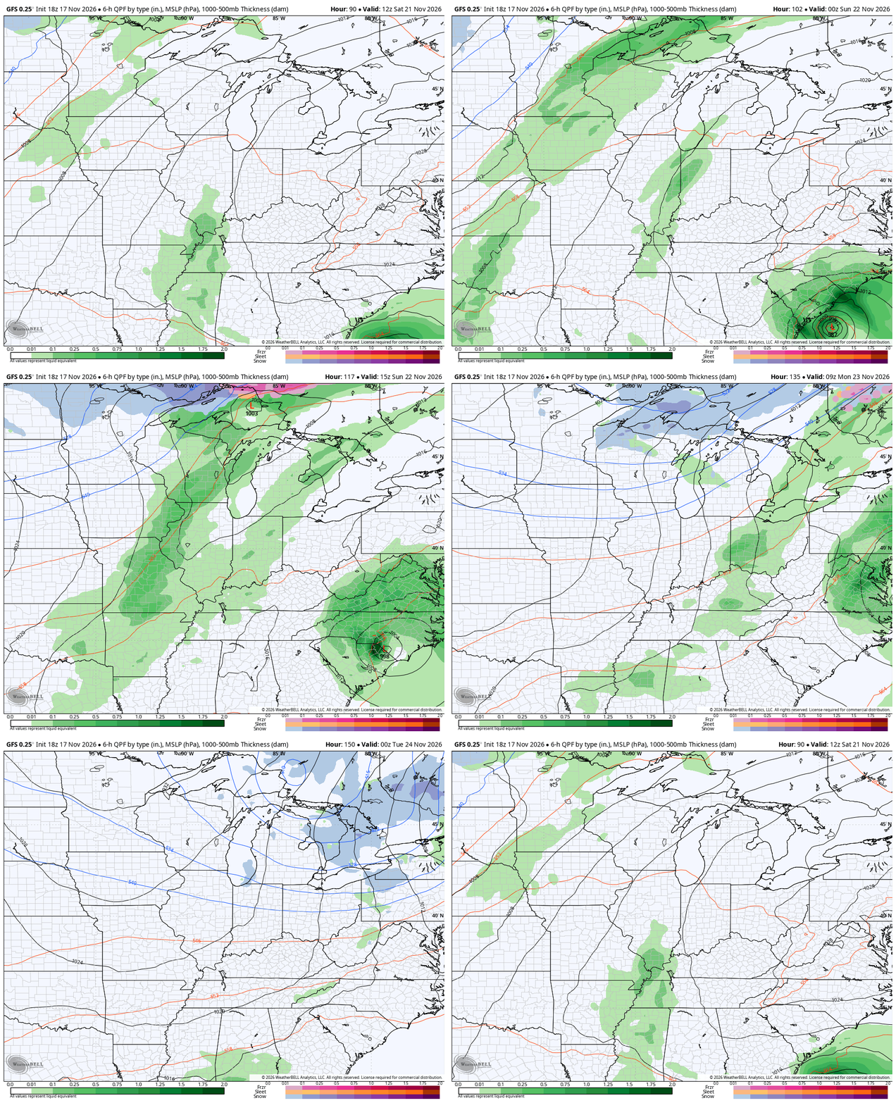
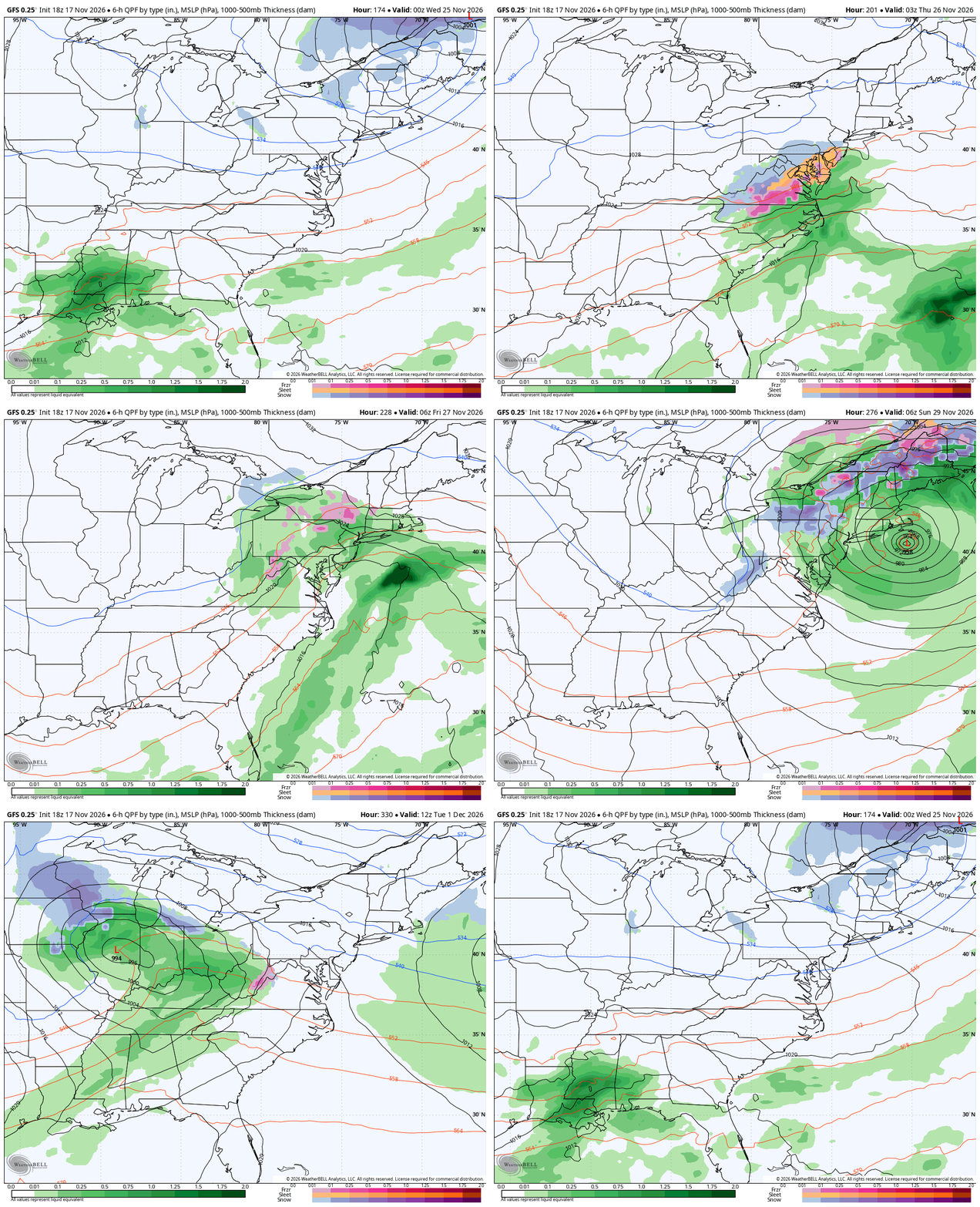
That run of the GFS brings in much colder air behind it for early next week, pushing the storm track farther south for the rest of the week and into the early the following week. Check out how that storm track looks from that run…
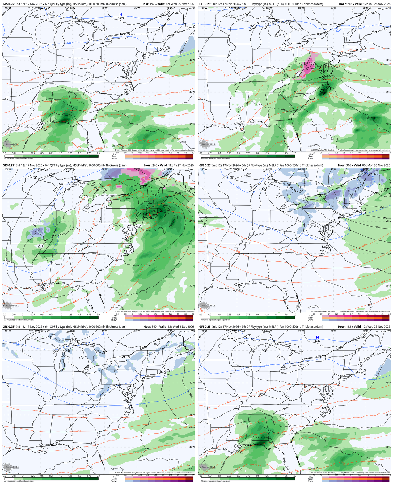
To illustrate the volatility in the pattern the same run from the GFS from a few hours earier looked like this for the same time…
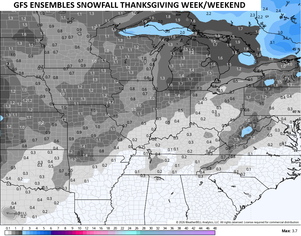
It is interesting that the colder scenario is also showing up on the GFS Ensembles which brings the chance for some long Thanksgiving holiday weekend…
Enjoy the evening and take care.
