Good Thursday, everyone. This incredibly mild pattern continues through the upcoming weekend before a dramatic change takes place. Temps take a big dip behind a cold front arriveing Sunday night. That sets the stage for a colder than normal Thanksgiving Week with the chance for some winter.
Temps today through Saturday are mainly in the 60s with the chance for 70 in a few spots Friday and Saturday. Yowza.
Speaking of this warm pattern, our September/October combo was the warmest ever recorded in Kentucky history…
Whoa! We just had the warmest September-October on record for the state of Kentucky. #kywx https://t.co/hBVZx4fMKz
— Chris Bailey (@Kentuckyweather) November 18, 2026
To make things even wilder, that system I’ve been talking about off the southeastern seaboard actually has the chance to become something tropical. The National Hurricane Center is highlighting this potential…
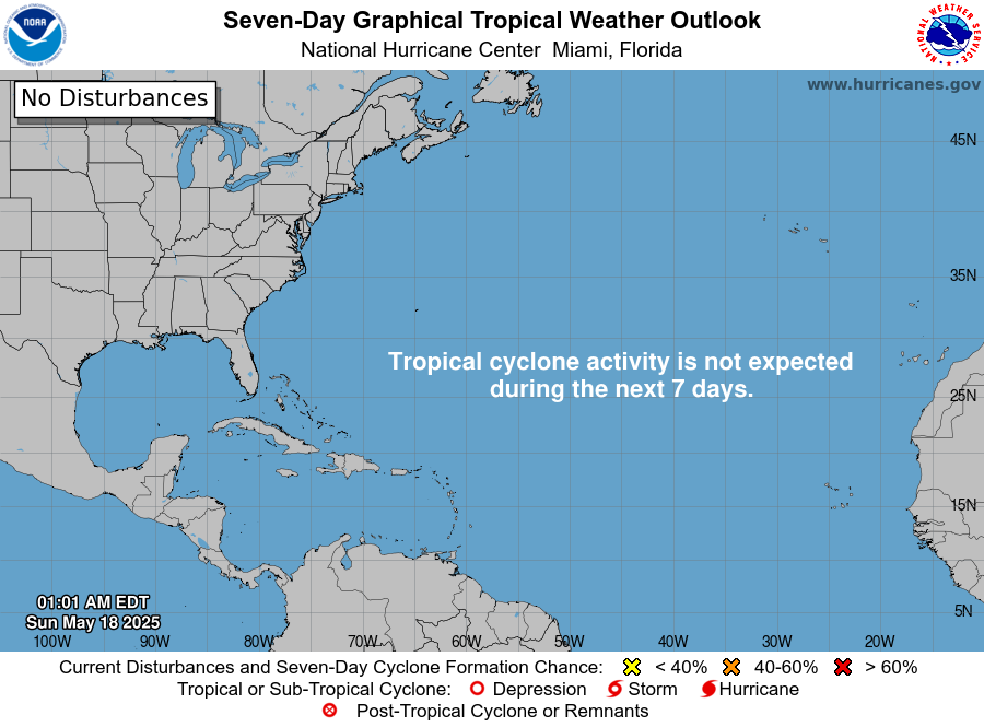
That system will hug the east coast through the upcoming weekend.
It’s at this time, we track a cold front into Kentucky from the west. This boundary moves from west to east late Sunday into Sunday night, bringing a gusty round of rain along for the ride. This animation shows the setup from Sunday morning through late Monday…
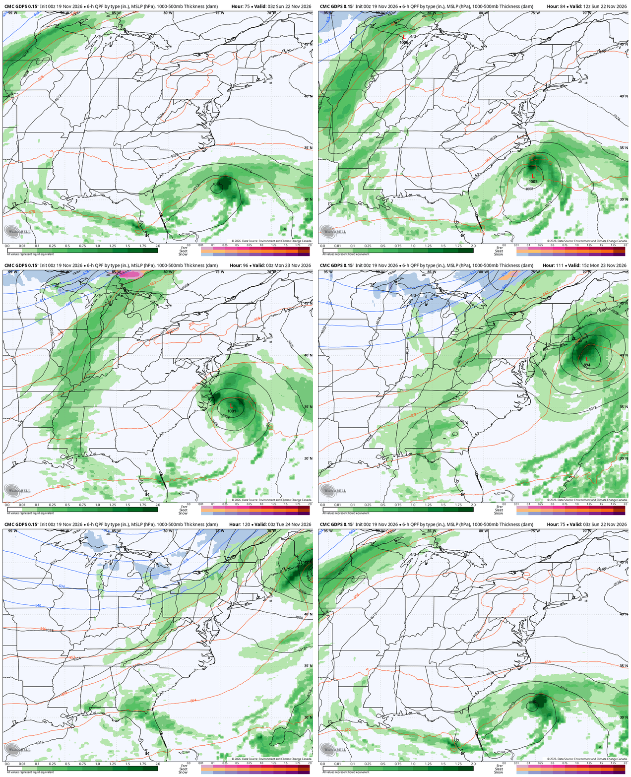
Much colder air then presses in from the north for the rest of the week, but the active southern storm track keeps cranking out systems. It’s so energetic that the forecast models have little hope of figuring this out for several more days. All the models are giving a totally different solution with each run.
Still, we are likely to see another storm system or two come from the south and lift northward impacting our region over the extended Thanksgiving Holiday Weekend. With a cold high to the north, the potential for some winter weather is there with any system that rolls our way.
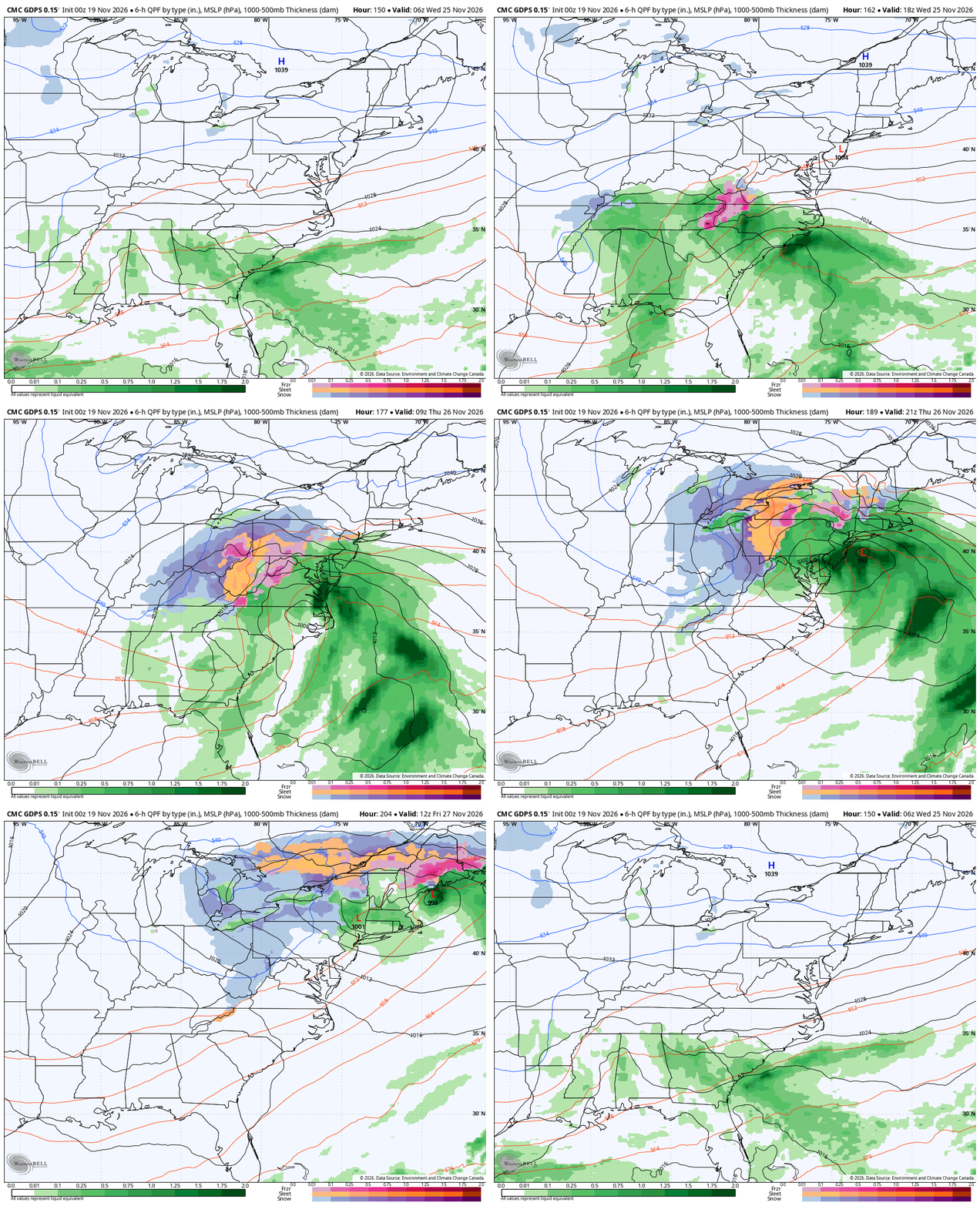
The system of interest may come on that busy travel day Wednesday into Thanksgiving Day. The Canadian has a nice little event…
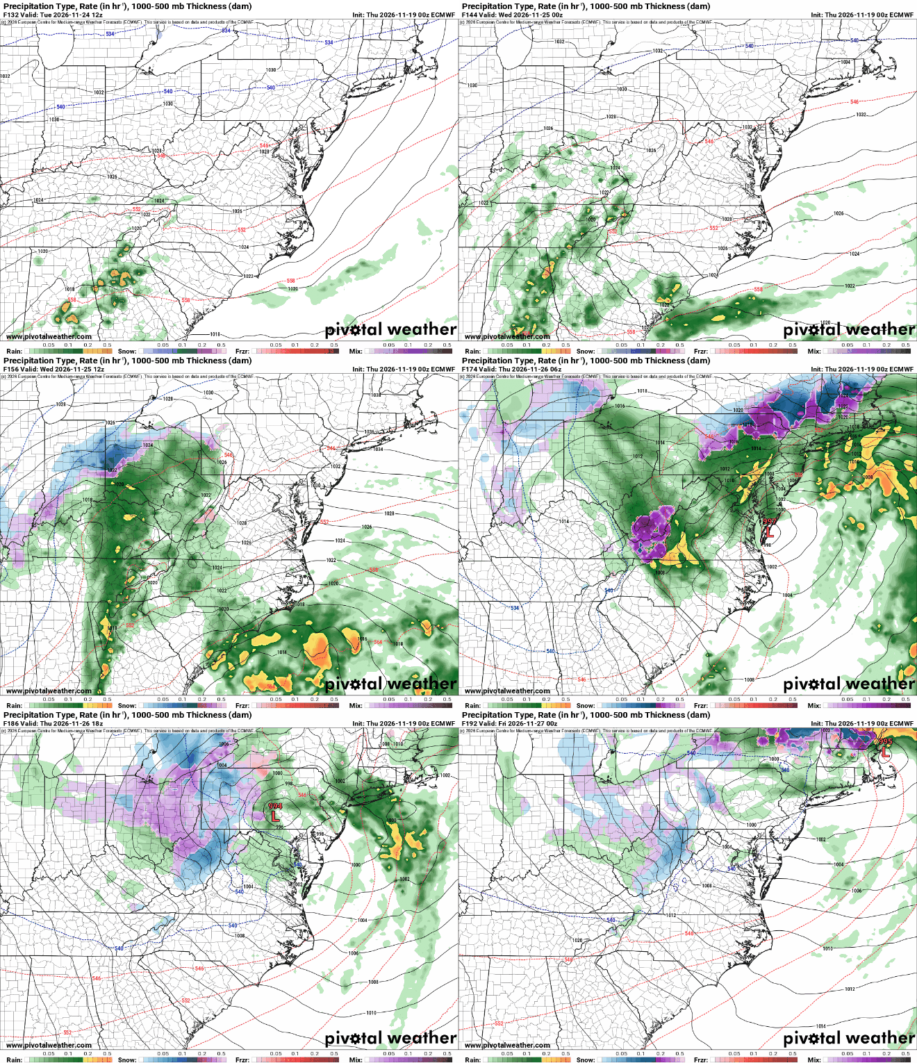
The EURO is looking similar with a potent storm system…
This is part of a pattern of well below normal temps. This is the 5 day average temp departure from the Canadian…
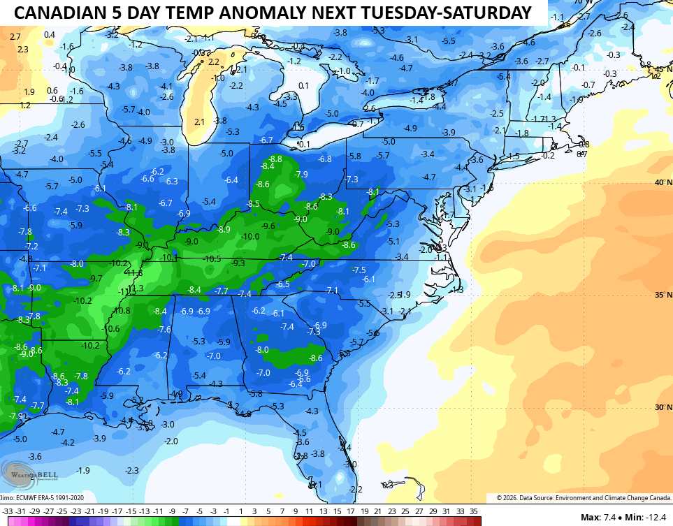
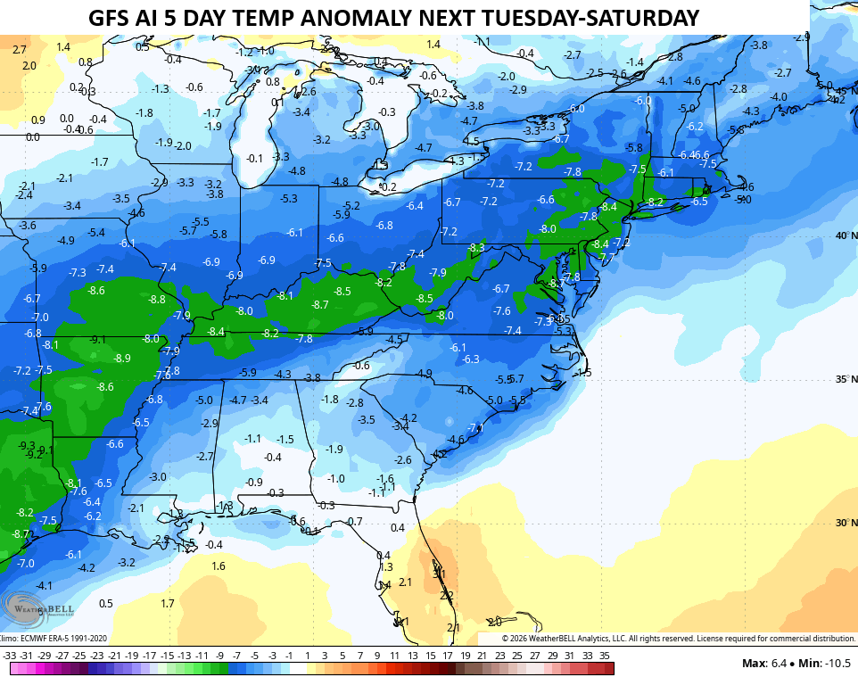
The GFS AI is similar during the same time…
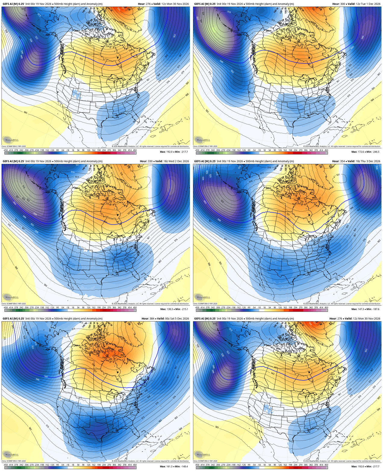
As you know for the past few weeks, I’ve pointed to Thanksgiving Week as the transition week to a more sustained winter setup for December. That’s still the case and the EURO Weeklies have been all over this for a while and now that we’re in range of the various ensembles, they’re picking up on the strong signal to start December…
I’ll have updates later today. Don’t forget tonight is the night for the Winter Forecast…
Have a terrific Thursday and take care.
