Good Friday to one and all. The mild weather out there continues to be something to behold, and it has a few more days left in the tank before we change it up. The changes start late Sunday as a cold front blasts through, ushering in a pattern that may very well feature some winter weather Thanksgiving week.
Temps today through Sunday generally run 65-70 for most areas with a few spots hitting the low 70s. Record highs for this time of year are in the upper 70s, so those are generally safe.
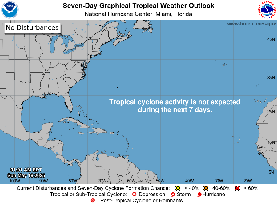
While we are enjoying this amazing weather, folks along the east coast are watching a developing storm system that has an outside chance of becoming tropical as it hugs the east coast. Here’s the National Hurricane Center’s outlook on this thing possibly developing…
Once that system gets out of the way, it allows a cold front to sweep in from the west Sunday night. This brings a round of gusty showers along for the ride as temps tank behind it from west to east…
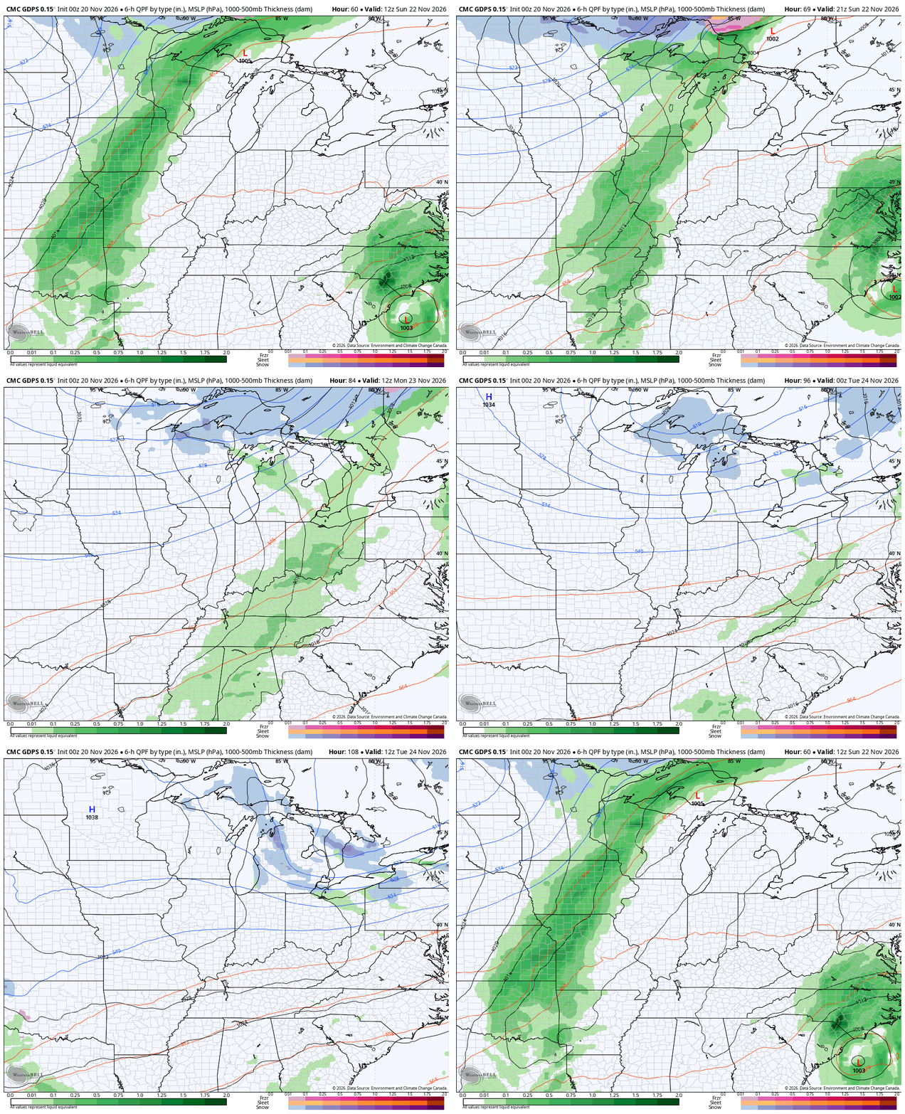
Seasonably cold air surges in behind that front into early next week. As I’ve been saying, this isn’t a super cold pattern by any means, but it’s much colder than this week and it will average colder than normal for this time of year.
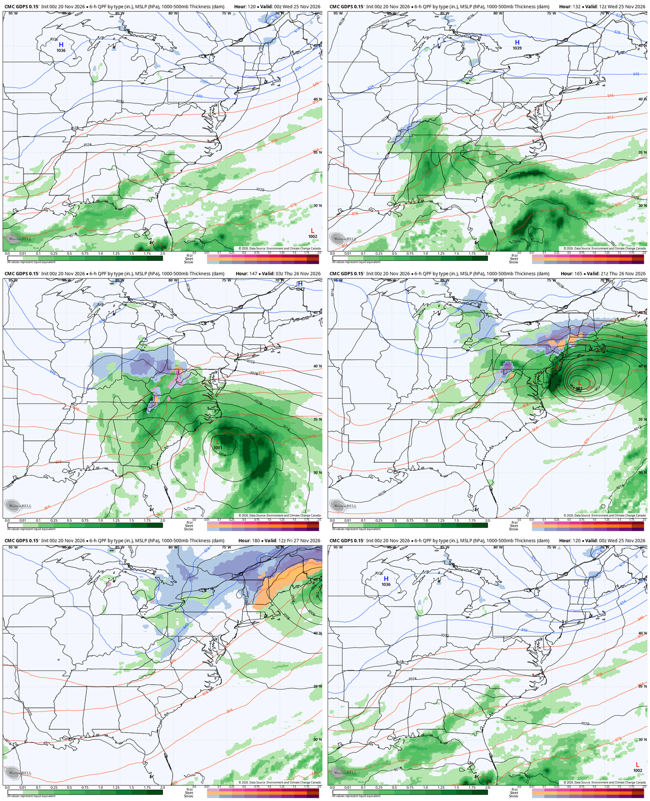
The pattern remains very active with a series of systems rolling out of an active southern branch of the jet stream. The first system should send one low toward us by Tuesday night and Wednesday with the main low going up along the east coast. How all this works out is still very much a work in progress with the models waffling a lot.
The likely end result for our region is a cold rain for Wednesday with the chance for some winter weather before that pulls away on Thanksgiving.
Here’s the latest Canadian with all that…
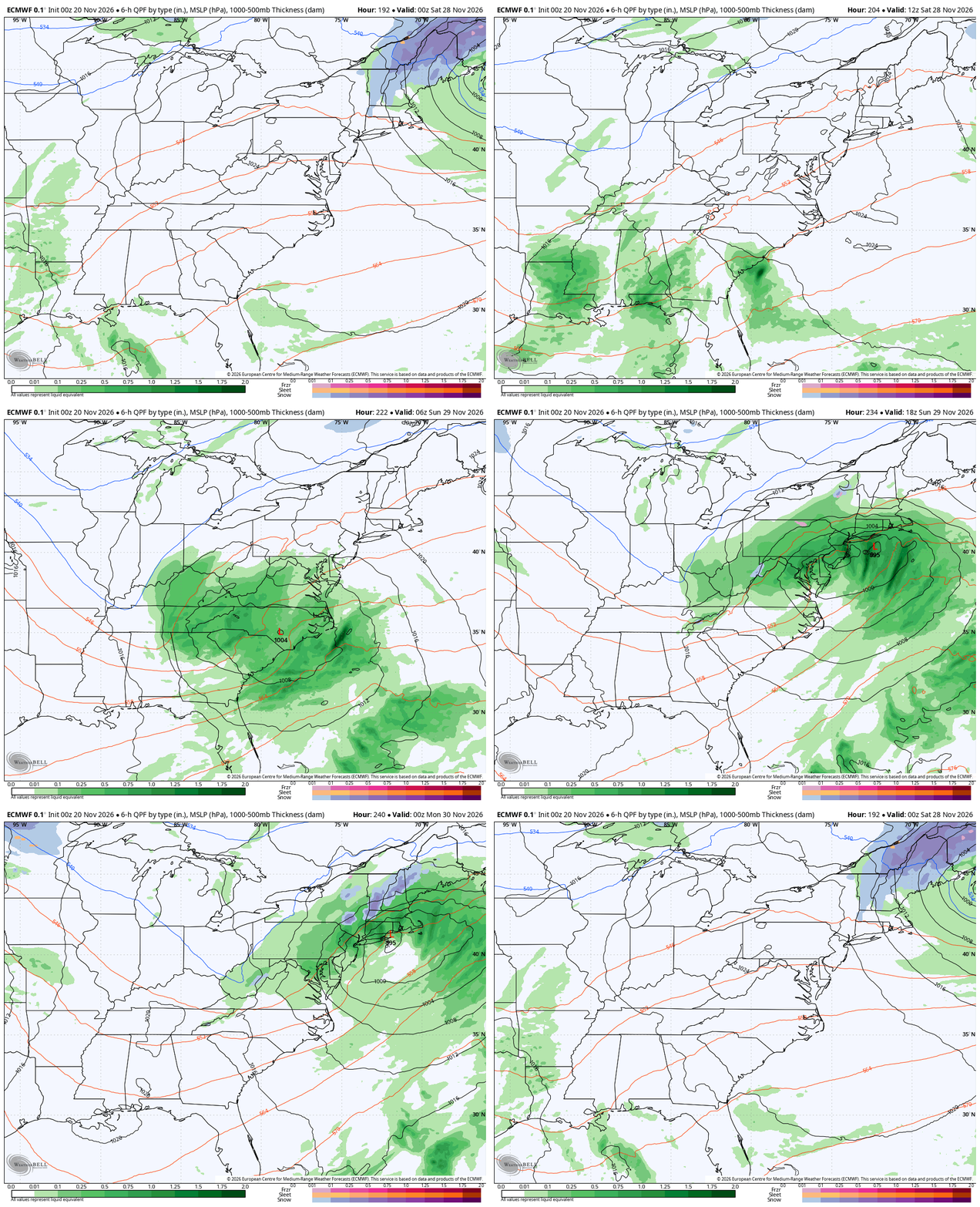
The Euro for the same time…
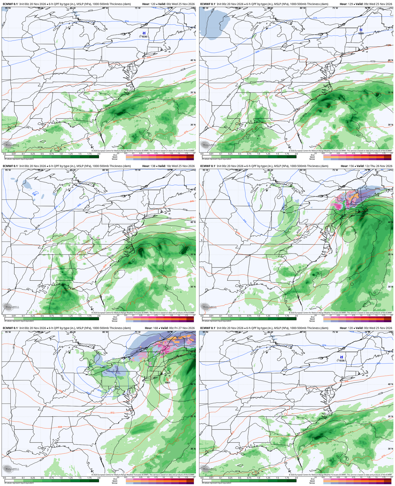
That will then be followed up by another system later in the holiday weekend…
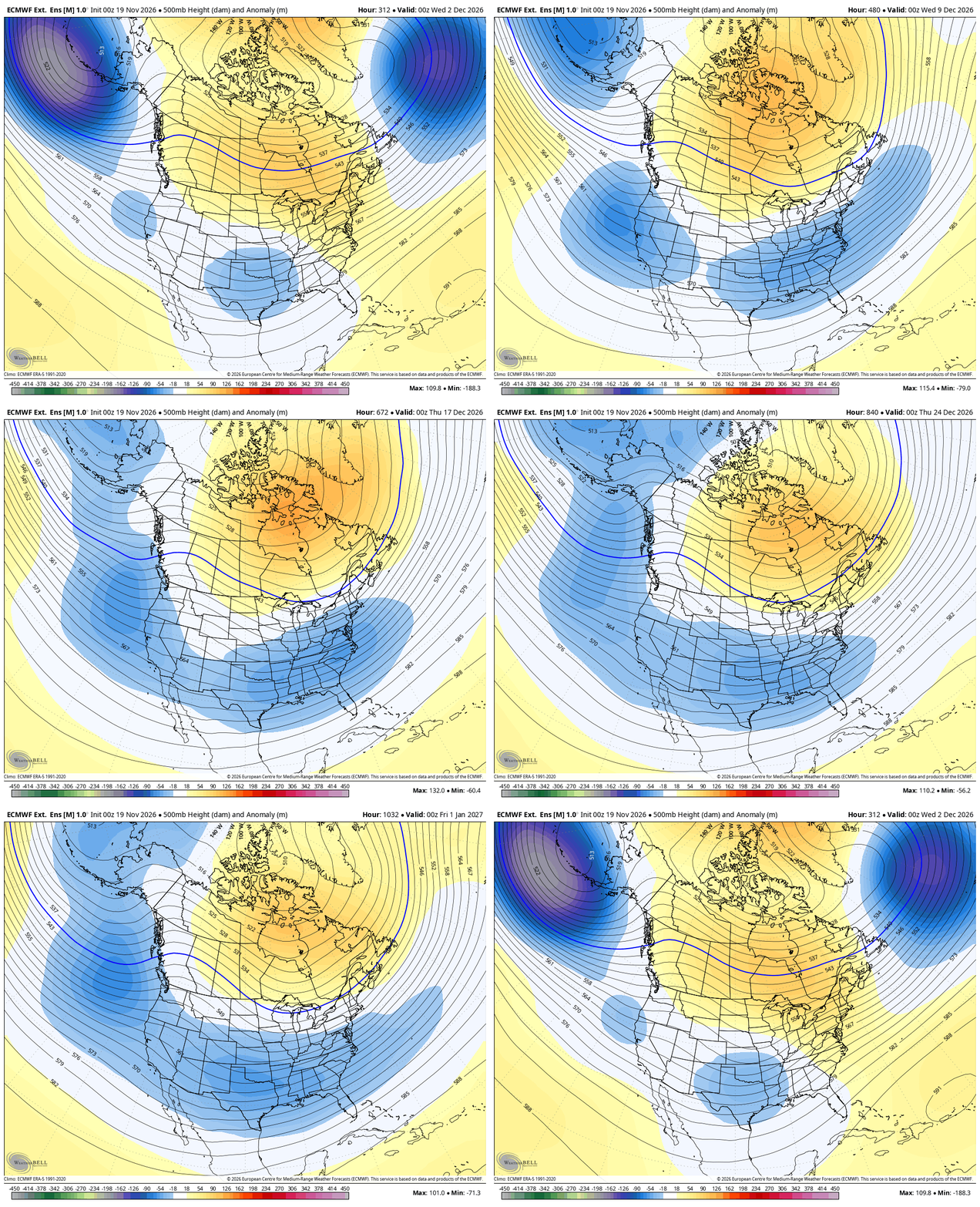
For December, there are no changes on the EURO Weeklies as we continue to see blocking showing up across Canada into the Arctic. That continues to allow these troughs to sweep across the country from west to east. This animation runs from December first through January third…
While that’s not an exceptionally cold pattern, it’s cold enough for winter weather and the EURO Weeklies are the snowiest they’ve been so far…
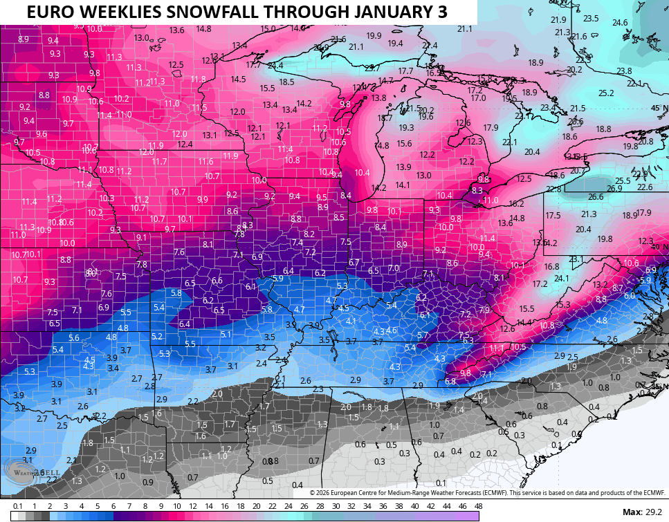
For this early in the season, that’s a pretty healthy signal for winter weather, folks.
Feel free to come see me today as I will be giving out free WKYT Ice Scrapers…

Make it a fantastic Friday and take care.

It be interesting what mother nature will bring this winter.
Once again, the EURO weeklies are overhyped.