Good Saturday, everybody! Incredible isn’t a strong enough word to describe the pattern we are seeing across Kentucky and surrounding areas. Mild temps and sunny skies roll on today, but a big change begins Sunday night. That’s when a cold front ushers in a totally different pattern for Thanksgiving Week.
Temps today range from the mid 60s to low 70s across the state with mostly sunny skies.
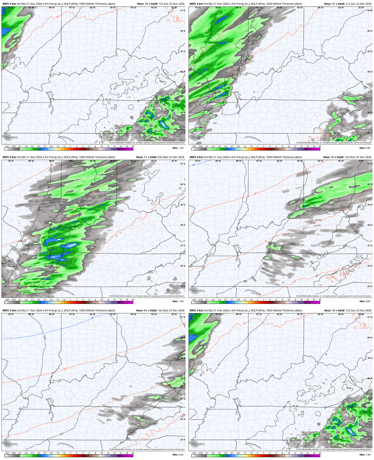
A system spinning slowly up the east coast will throw some clouds into the east and has a chance to bring a shower into the far southeast later tonight and Sunday. From there, we watch a front sweep in from the west during the afternoon and evening. This brings gusty showers along for the ride.
You will see how the showers decrease as they get into eastern Kentucky late Sunday night and Monday morning…
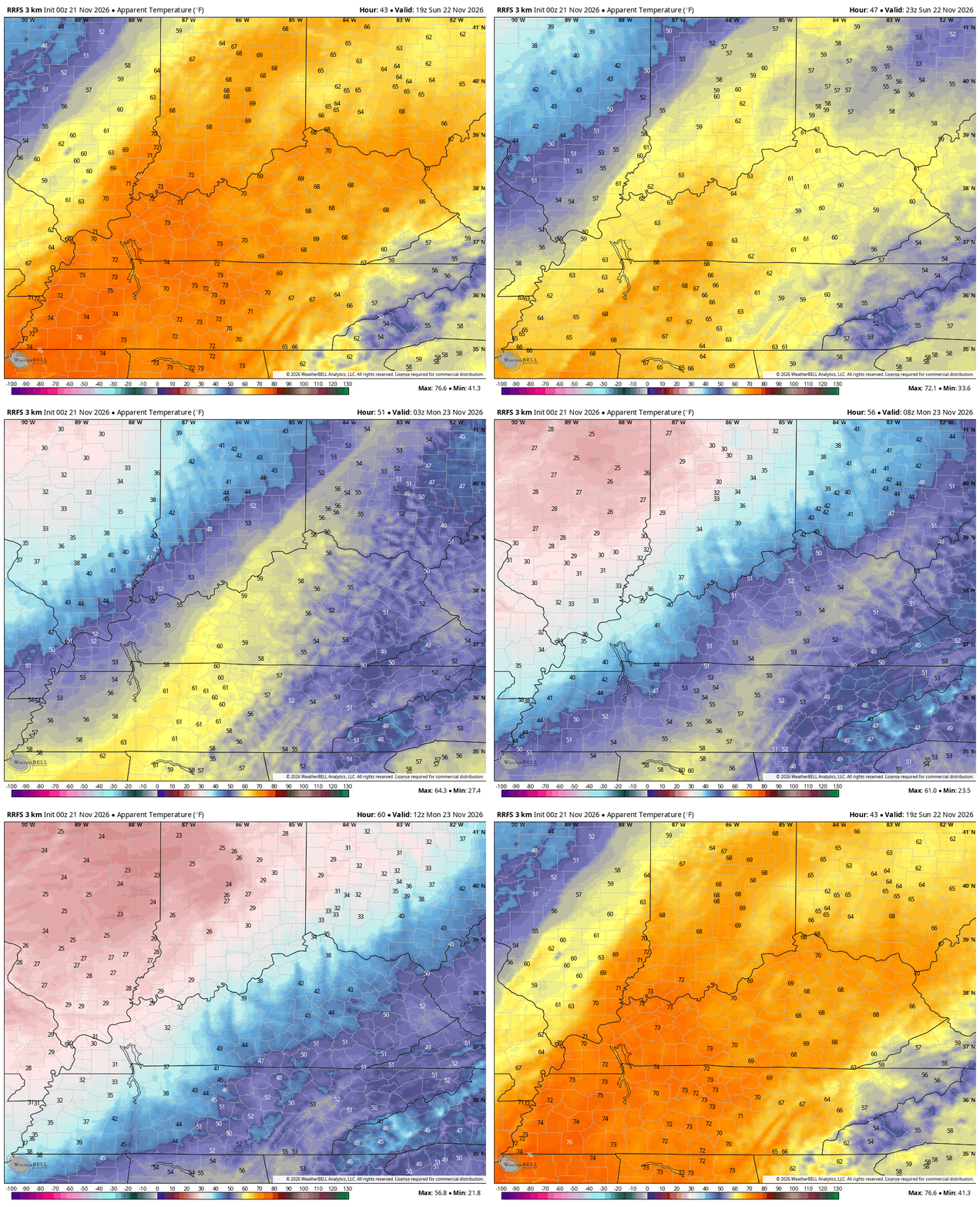
Temps reach the 65–70-degree range again on Sunday as winds crank from the southwest. Those winds quickly shift directions behind the front Sunday night as cold air crashes in. This initial surge of air isn’t super cold by any means, but it’s a stark difference from Sunday to Monday.
Check out what it feels like from Sunday afternoon to Monday morning…
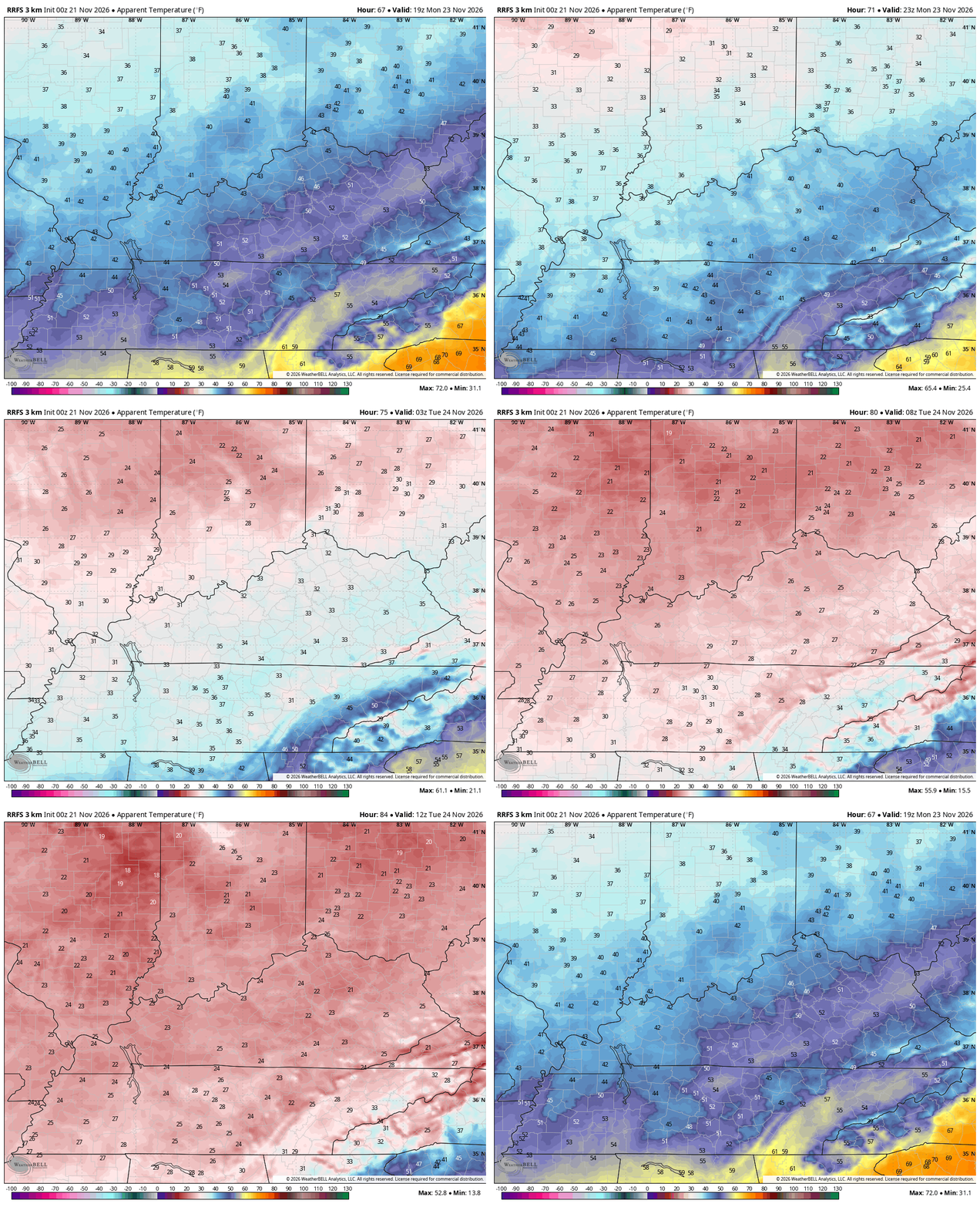
That air grows much colder late Monday into Monday night. Watch those wind chills really tank from Monday afternoon through 7am Tuesday…
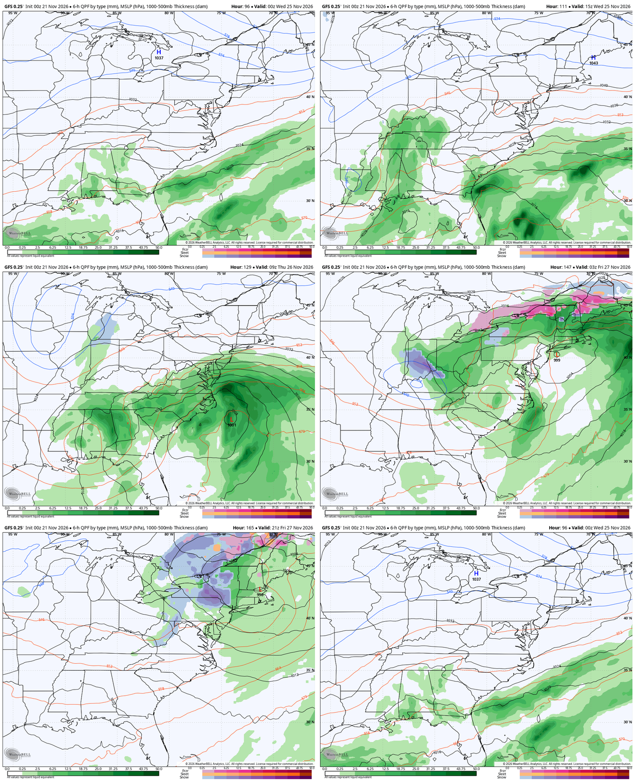
This brings us to a southern system set to impact our weather from Tuesday night into, at least, the beginning of that long Thanksgiving holiday travel period. One low is likely to work toward our region with some rain and maybe a touch of snow. At the same time, a second low is likely to develop and move anywhere from the Appalachian Mountains to the east coast.
I’m telling you, how all this plays out is a serious work in progress. It’s no secret that the forecast models have regressed this year and that seems to have really ramped up in recent months. They are struggling, especially the American Models.
The poor GFS had this system a week ago but couldn’t find it to save its life in recent days. Well, it’s back to seeing something in this animation from Tuesday night through Friday…
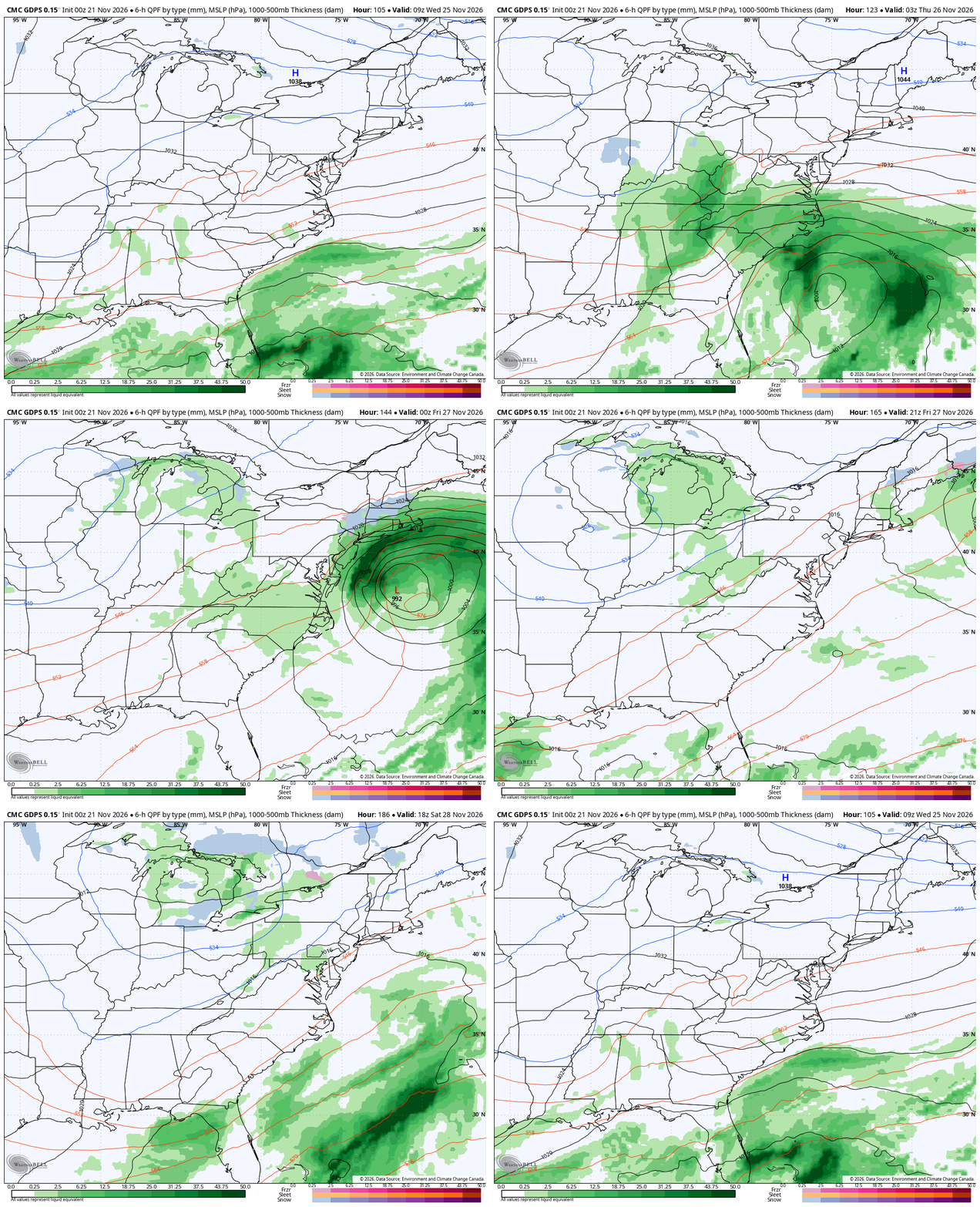
The Canadian has had some kind of system all along, but it hasn’t exactly been the mark of consistency as it dramatically changes from run to run. Here’s the latest version of the model…
Here’s the latest EURO…
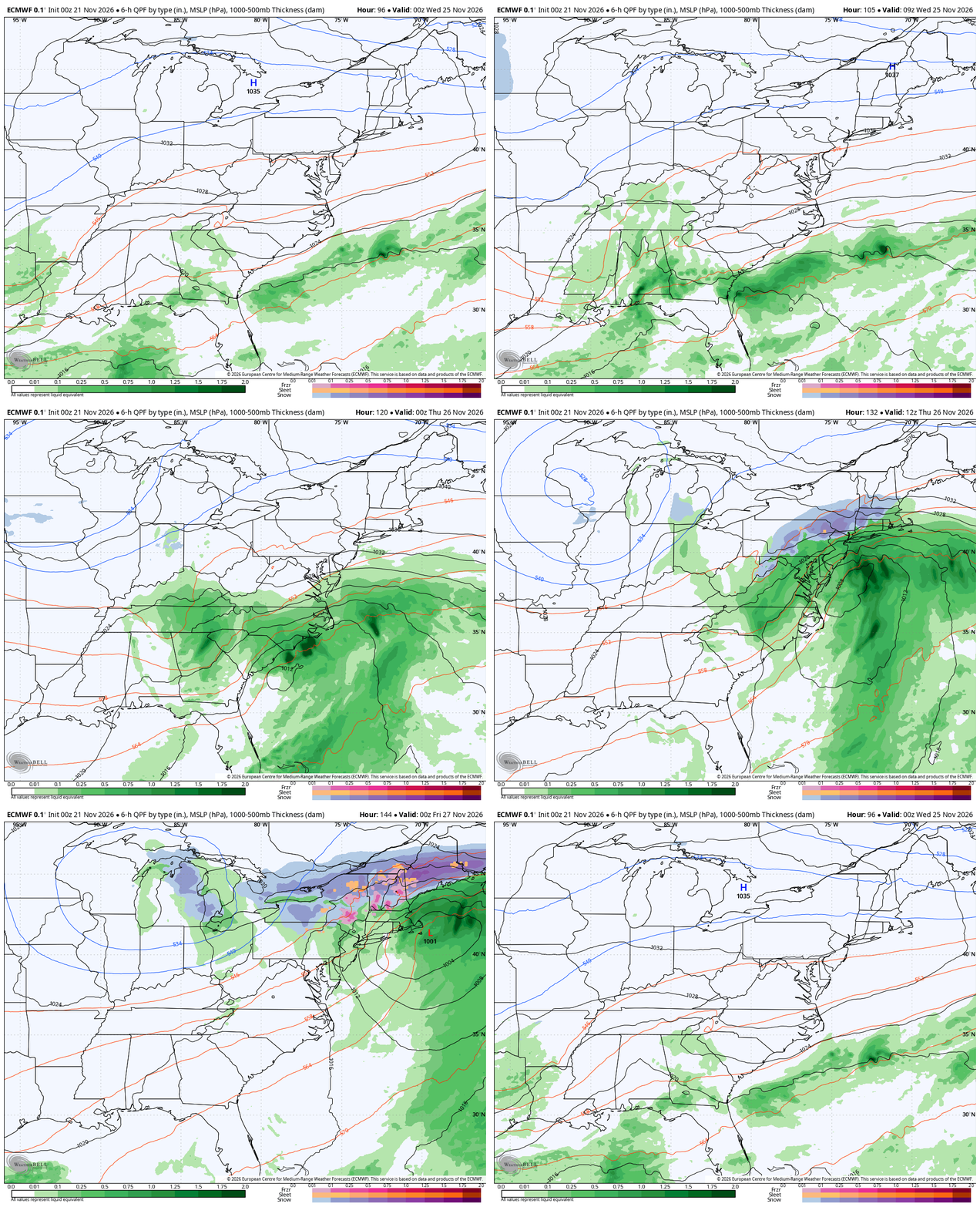
We will need to be on guard for another system developing in similar fashion later next weekend. Temps during this time average colder than normal for much of the eastern half of the country.
Once again, I have zero changes to the idea that December bears little resemblance to a typical Strong/Super El Nino December. There’s simply too much blocking across Canada to the Arctic showing up to allow for that to happen. This results in an undercutting jet from west to east across much of the country resulting in sizeable troughs sweeping through. This animation goes from the start of December into the first week of January…
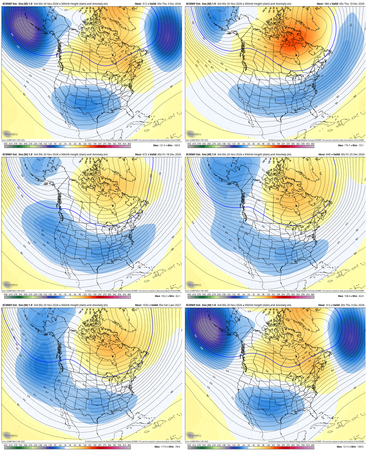
The consistency of the Weeklies is astounding to be honest.
The temperature anomaly map for that same period looks a lot like what I had in my winter forecast with much above normal temps across the far northern part of the country with below normal from our region and south…
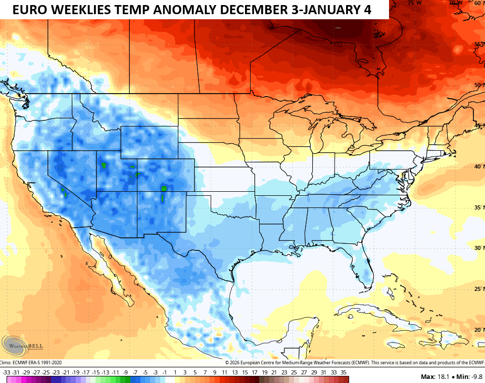
Here’s what that same map looks like up close and personal on our region…
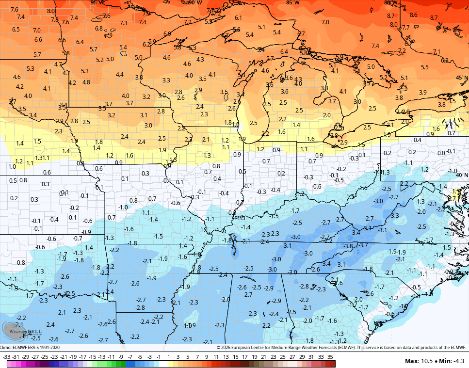
Again, that’s not a wildly cold signal, but it’s one that’s below normal and will likely result in frequent snows in our part of the world. For reference, the last Super El Nino December was in 2015 and the average temp that month in Lexington was 11 degrees above normal.
Nothing about this Super El Nino has played out like prior Super El Nino’s in our part of the world and I’ve been saying this since summer. Why would it start now?
I’ll throw another update later today. Make it a good one and take care.

The reason that I am not surprised at the accuracy problems plaguing forecast models these days, especially the GFS, is heat. I’m talking way above normal heat, both in the atmosphere and the oceans. Heat is the primary engine that drives weather systems, and when the amount of heat increases on a global scale as we have seen over the past decade, the systems we use to track weather changes break down, since the state of the atmosphere when those forecast models were written several decades ago, is quite different compared to present day.
This disparity extends to systems that rely on the GFS, like the forecasts published by the Climate Prediction Center. The various long-term precip and temperature charts on their site today strongly resemble what we would expect to see with a super El Nino, but when they are compared to current conditions, they break down. As we move into winter, I wouldn’t be surprised to see that disparity continue.
Friday’s 68-degree high at O’Hare Airport tied Chicago’s record high temperature for the date set way back in 1930 and 1913, as our very mild November continues.
Today’s predicted high of near 70 degrees will challenge the daily record of 72 degrees.
Mike, it’s going to be a weird winter across the northern tier of the country. Temperatures will be above normal, so that piece of the typical El Nino scenario will likely play out, but I wouldn’t give up on the snow possibilities. Historically, El Nino winters are more likely to see Polar Vortex intrusions, some climatologists who focus on PV are already forecasting a sudden stratospheric warming event, which is a precursor to PV activity, to occur in early to mid January. An active southern storm track should be in play by then, so the Ohio and Tennessee valley regions could see some frozen action.
Then again, when we talk about weather in the mid-2020’s, everything is on the table.
Good info!