Good Sunday, everyone. A strong cold front crosses the state tonight, bringing gusty showers and colder air in to start Thanksgiving Week. This starts a colder than normal holiday week with a big storm system moving in for the big day.
Our Sunday is windy and mild with temps 65-70 again as clouds thicken and winds increase. The system on the east coast may actually throw a little rain into the far southeast today, so keep that in mind.
The cold front sweeping in from west to east brings a gusty line of showers with it. Those showers will diminish some as they move into central and eastern Kentucky tonight into Monday morning.
Temps are much colder for Monday with readings ranging from the mid 40s to mid 50s and falling.
Seasonably cold air pushes in behind this for Tuesday ahead of what looks like a massive, disruptive storm system for much of the eastern half of the country. As we get closer, the intensity and size of this system is increasing as the models get a better handle on things.
One low works toward the lower Ohio Valley on Wednesday, bringing rain and a swath of snow on the northern and western shield of this. At the same time, a massive upper level system is developing and diving into our region from the northwest as a monster low pressure develops to our east. Exactly how all this plays out continues to be a work in progress, but we are within 3-4 days of this thing showing up so confidence in a dirsuptive storm is increasing.
The exact impact it has on the weather here in Kentucky will be the focus of the next few days as the models slowly come together on the details.
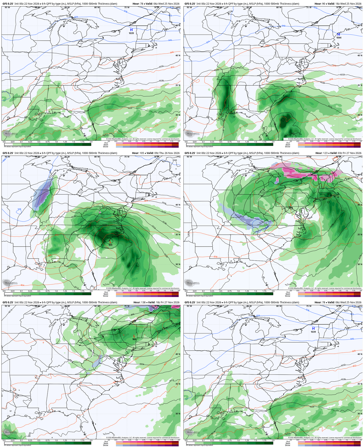
The GFS shows this monster storm bringing rain and wind in here Wednesday through Thanksgiving day with a swath of snow coming in under the track of the upper low late Thanksgiving Day…
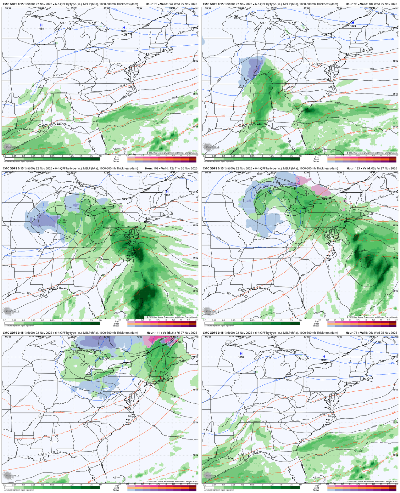
The Canadian Model has a similar overall idea, but is colder and stronger with the initial low and much weaker with the storm in the east. That brings rain and a swath of snow in the west with wraparound light snows and snow showers late Thanksgiving Day…
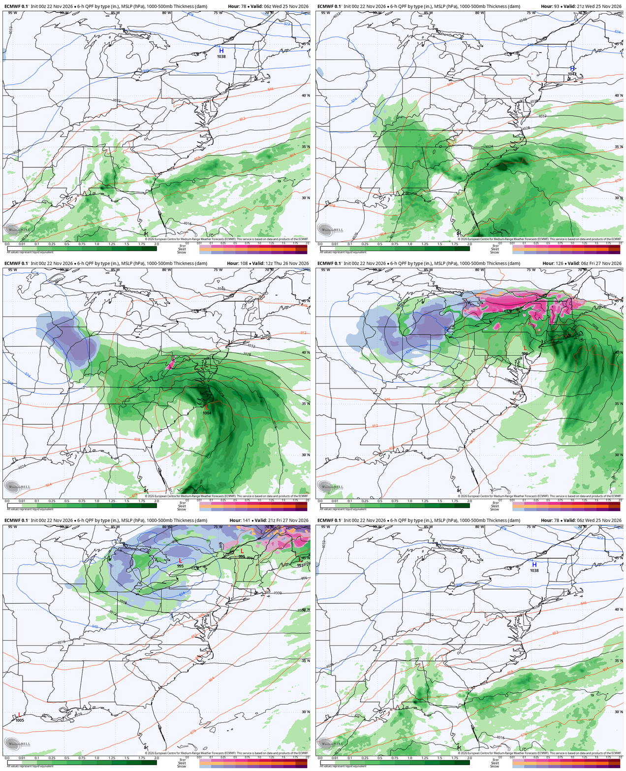
The EURO is a little bit of both of those model runs, but has the monster east coast storm with a slightly farther northward track of the upper low and subsequent wraparound snows…
With such a massive storm system like that, wind gusts are going to be a problem in the east. The EURO and GFS agree on some big time winds…
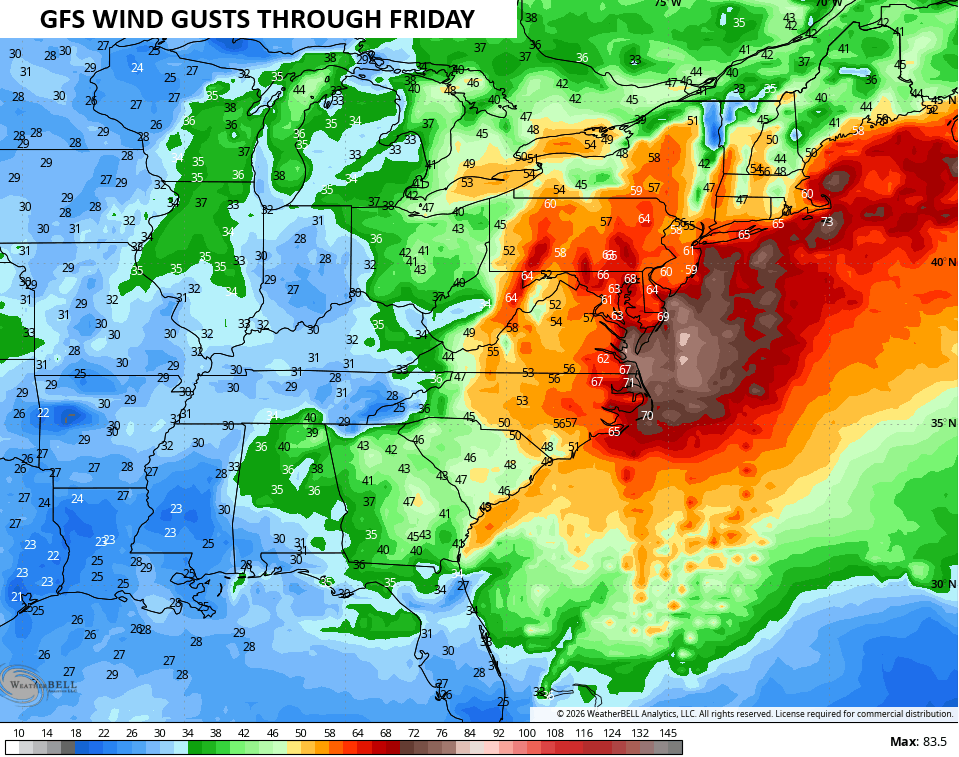
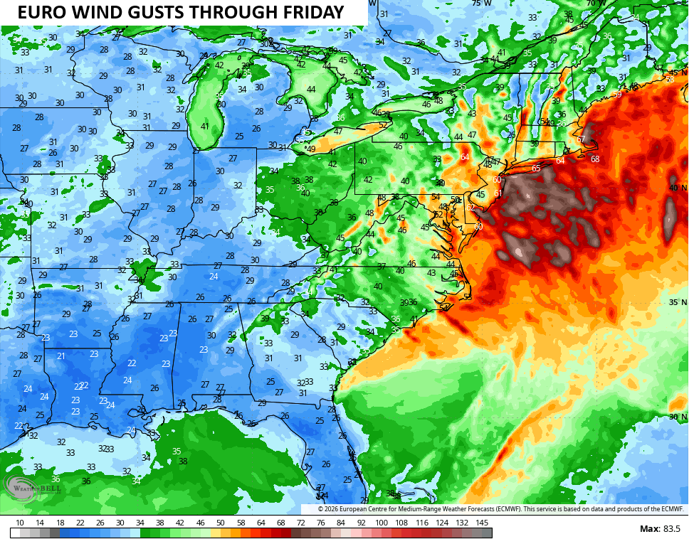
If those verify, think about the delays and cancellations we will see for the busiest travel period of the entire year!
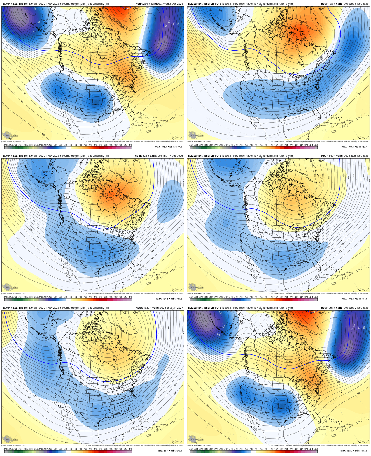
While temps average colder than normal for the week ahead into that holiday weekend, I do expect a brief bounce back ahead of the next troughs bowling in from the west in the first week of December.
About 3 weeks ago, the EURO Weeklies correctly showed this pattern change for Thanksgiving week, leading into much more of a winter look for December. The Weeklies have not waivered at all on blocking going up across Canada into the Arctic, allowing for troughs to sweep eastward underneath across much of the US. The new run looks like each and every run we’ve seen from the model for the past several weeks.
This animation runs from early December to early January and doesn’t show any deviation…
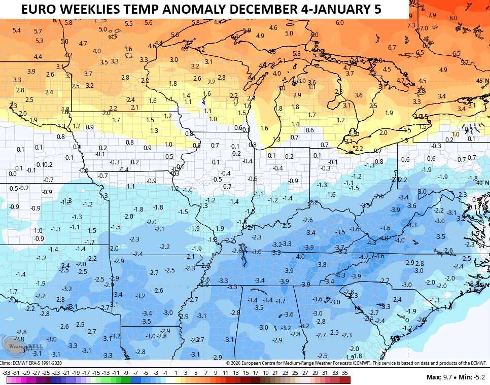
I don’t expect major cold out of this with some pretty healthy temp swings depending on storm tracks. Still, the EURO Weeklies show below normal temps across our region and south…
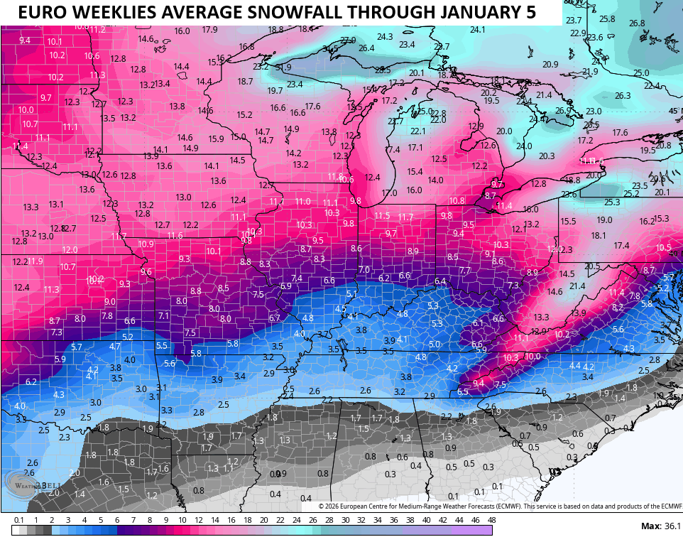
With this active storm track, the potential for a big December winter event is certainly on the table this year. The Euro Weeklies are made up of 101 different model runs, so everything we see from them is the average of 101 model runs.
Here’s that average for snowfall during the same time…
I leave you with your radars to track today’s rain in from the west…

Make it a great day and take care.

After a week where each day the high temperatures recorded at my PWS near Bowling Green reached the mid 70’s, we closed out the ween̈yesterday’s high was 80.6°F, so it’s an understatement to say I am ready for the pattern change. But sad to say the chances for some meaningful rainfall are slim to none. 2026 is likely to end up being one of the driest years on record, and November is holding true to form. Over the past 18 days we picked up just 0.24″ of rain, which is why burn bans remain in effect for Warren and all of the surrounding counties.
I still think the EURO weeklies are full of it.