A Winter Weather Advisory is now out for most of central and eastern Kentucky through Sunday Morning. Here’s a look… 
Those poor northeastern Ky counties continue to stick out like a sore thumb with almost every advisory issued. The NWS in Charleston, WV strikes again.
Previous Update
Good Saturday, folks. We have another clipper diving into the state today and this will bring another round of accumulating snows to the region. While light, this will be enough to cause traffic troubles from late this afternoon into tonight. The snow arrives from northwest to southeast this afternoon into the evening. It could come down at a pretty good clip and this will reduce visibilities at times. The ground is frozen and road temps are below freezing, so slick travel is a good possibility into the evening. Snow showers and flurries will carry us into early Sunday. My thoughts on accumulation hasn’t changes much from my last post. Lots of areas will wind up with up to an inch of snow with 1″-2″ across parts of the north and northeast. Gusty winds may approach 30mph at times and this will blow the snow around. The long range call remains the same… it’s gonna get cold and we have multiple snow chances on the way. The next one arrives late Monday into Tuesday with another arriving around Thursday. These will be accompanied by VERY cold temps. Check out the lows… 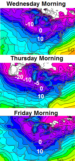 We now have a shot at temps heading close to 0 or a touch below. Highs in the teens look good for a few days during this time. Keep a close eye on the setup for next weekend… there could be a storm developing and working to our south and east. Behind that is likely to come a bitterly cold air mass. Let’s get to tracking today’s action…
  Current temperatures
  Winds
Winds  I-75 @ Winchester Road Lexington
  I-75 @ Iron Works Pike Lexington
  I-75 @ Clays Ferry Bridge South Between Lexington and Richmond
  US 60 @ US 127 Frankfort
  US 127 @ Frankfort Frankfort
  I-75 at MP 36 London
  I-71/I-75 at Buttermilk Pike Near Covington
  I-64 @ 3rd St. Exit Louisville
  Downtown Louisville @ 2nd & Broadway Louisville
  I will have updates as needed. Make it a great day and take care.

Looking at the camera views is interesting… Did anyone else get shutout completely on the snow? The cameras seem to snow, at least some, everywhere, everywhere except Richmond that is.
one freaking comment, SLEEP is FOR the weak people….
Tru dat. Count me among the weak unfortunately.
Nothing to be excited about so why post
you are the man, Chris! thanks for the good info and fun you put into this blog on an amazingly consistent basis.
SNOW – come on down!
U do a great job of posting updates on your blog. Thank u for your hard work. I am hoping for a record breaking snow this winter! Bots- bring on the snow!
Woke up to a beautiful snowfall in London, and it’s still snowing. We’ve had additional light accumulations with roads now completely white. Looking like there’s plenty of moisture around, so there may not be much of a break between yesterday’s snow and today’s. Enjoy your day!!!
Flurries here right now,
I thought the National Weather Service offices usually coordinated with each other so advisories and products wouldn’t have this problem
These clippers are fun to watch when it’s snowing in your backyard for 20 seconds — ha — but let’s hope the southern jet stream brings us a goody in the next two weeks. It’s been a few weeks since we’ve tracked a southern storm, and I’m certainly hoping all this cold will not go to waste. This coming cold snap will likely lead to a monster storm tracking somewhere through the midwest/mid-south/eastern part of the U.S. This winter has brought/is bringing some uncommon cold. Could an uncommon snow event happen too?? Let’s hope.
With this cold coming anybody think the Ohio may ice. Not sure about icing completely over but if these temperatures verify how would we not see some ice on the river
The snow in Lawrenceburg is not melting today (as of yet). It has been awhile since we put snow on snow. Another inch or so would be nice!
Clippers are great, last one overachieved in Frankfort, lets hope for more of the same tonight 🙂
I agree! Earlier this week when Chris forecasted 3, I said lets hope at least one of the three is an overachiever. So far so good. Now let’s go for 2 of 3!
Ended up with a very light dusting here in knott co. Might squeeze an inch out of both clippers combined
This “poor northeastern Ky county” is happy to not be included in the Winter Weather Advisory, thank you very much!
Fingers crossed that it stays this way.
Does this thing have overachiever written all over it?
RAP short term is in a bad mood today…a dusting to 0.1″ for Louisville ??
NAM shows up to a half inch for Louisville, then periodic snow showers that may add up to a total of an inch or so through daybreak tomorrow.
Don’t forget to scrape away the old snow before measuring the next system’s snow, if it’s measurable (calling out the RAP model).
The sun has taken care of the dusting we got so old snow won’t be a problem
Only 2 minutes left, I think Cats have wore ’em down.
Latest RAP short term is sniffing out a band of snow coming out of Missouri that may affect the region. However, still not spitting out any snow for Louisville yet. But, the 1″ line is not far north of us.
Clipper systems are usually Nowcasters as we found out Friday morning, some areas will do well others won’t, just the nature of these systems!
You are so right about the Charleston Weather Service. We had an inch and a half of snow down from early morning before TWS deigned to put out a Special Weather Statement yesterday about snow accumulation son roads and freezing conditions..
Modeling looked great a few days ago and as always now paint a different picture..Looks like cold and dry to end Jan…Something may still develop but i’m not gonna hold my breath…Looks like a pattern of cold and dry with warm ups and then followed by a cold rain is locked in..First week of Feb. is now in doubt also..Looks like a big warm up..I will officially be Ready4Spring in 2 weeks…
Im ready now!!!
We received 2″ out of yesterday’s clipper up here in Northern KY. Seasonal total at 21.5″ now.
Please don’t send your snow drought north “down-staters” ;-).
Yes we know if we post results contrary to thoughts its negative and frowned upon 😉
I’m sure official numbers in your area are not that high, but everyone has their own ruler interpretation in most back yards!
Variable to say the least this year in KY??
That is the numbers for CVG per a TV met yesterday evening. Before that the last I heard was 18.5″ last week.
I’m so ready for spring and warm temps. Ready to plant my flowers 🙂
Chris say for us to keep a close eye on the setup for next weekend for a storm! Oh, that makes us snow lovers salivate! Makes us hope and also put aside all past letdowns.
Well, we will see.
Humidity in Lexington is actually dropping as the clipper moves through!