Good Thursday to one and all. Temps are on the rise and that’s taking care of a lot of the snow and ice blanketing the bluegrass state this week. The temps are going to try to really take off on us over the next week and change. Is this spring starting or another false start? I think you already know my answer.
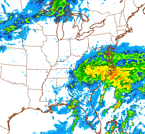
Things turn much milder today with many thermometer readings making a run at 50 degrees. Some low and mid 50s will be possible across southern and western parts of the state. There is a storm system along the southeastern seaboard that may throw some showers into southeastern Ky. The NAM is now picking up on this…
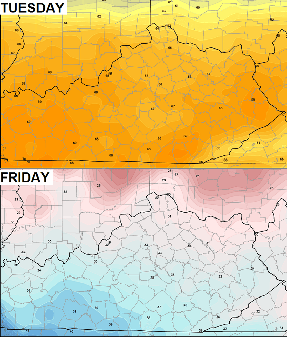
Temps for Friday will hit the 50s with a mix of sun and clouds and could be even milder on Saturday. Readings will be in the upper 50s to around 60 with southwesterly winds kicking up ahead of a cold front. That front brings a light shower in here for Sunday as temps scale back into the 40s.
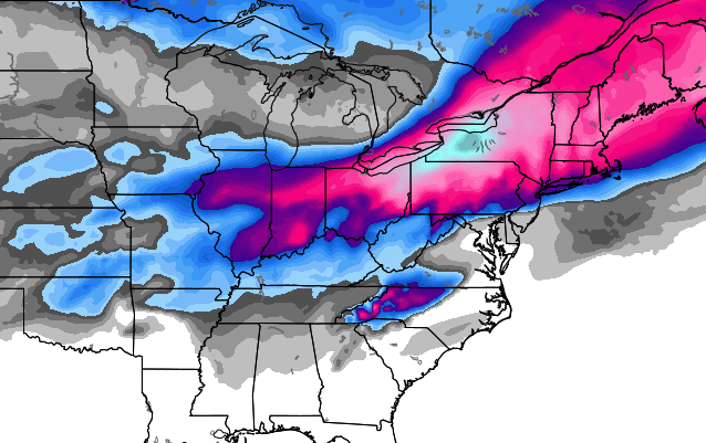
The temps will really bounce back early next week and will likely head into the 60s and could touch 70 degrees! While that is great and all, those numbers are likely to tank by the end of next week. Check out the nose dive from the European Model…
The model is showing a big winter storm rolling across the Ohio Valley by late next week…
 No thanks!
Enjoy the day and take care.

First.
If that storm on the Euro would just shift south a bit, we’d be in business! I’m a winter weather lover–so I’m liking this pattern. I’d love to see us crack the 30 inch mark on seasonal snowfall for the first time since the Mid 90’s.
The low side of the snow outlook from CB was 22″ for Fayette, Madison and surrounding counties. I’m sitting at 16.5″, so I’d like to get that 22″. If it takes continual regression back to winter ala “false starts” to achieve that number, then so be it. #Derbysnow
Chris M, you always seem to have all kinds of statistics… anyway, wondering how many days we’ve had snow on the ground this winter?
53 including today
It’s time for the white flag of surrender we don’t need any more “northern aggression”.
Interesting set up with the storm next week – not sure if any model has even the slightest clue yet but hey, it’s fun to watch haha
I’ll take my 60 degree temps and run thanks
Hey, your website is very awesome! I love having all this weather info on the web!!!
Very nice blog you have. I am happy to have so many good online resources when it comes to Kentucky weather.
Oh, for the love of Pete. Be cold or be warm- but make up your mind.
I have frozen plants, plants with buds, bulbs coming up- Mother Nature sure is throwing challenges at the gardeners among us!
I FULLY agree with your comment on the last map Chris…..No Thanks says it all. That thing needs to stay north into Wisconsin and Michigan but that’s a litttle too far ahead to worry about. .
NO NO NO
I am ready to get my camper up and cleaned out…ready to hit the road on the weekends and CAMP!!
Kentucky weather is bipolar. I thought the groundhog said 6 more weeks of winter,not 12.
Even if it snowed it wouldn’t last long, one would think. Not this late in the season
It would not–most March snowfalls melt within a day or two. This one has been unusual.
The webcams are only now showing some bare ground through the white cover in places like Glasgow, Bowling Green, Ft Campbell. Other places have relatively little snow left, even northern KY.
Areas like Ft Campbell got a high sleet/ice ratio, of course making it tougher to melt. A report from near Clarksville TN has four inches of sleet alone along with heavy ice and then some snow.
Again, something you don’t see often.
Simpson County KY (on the TN line between Bwg and Nashville) would normally be among the warmer places in KY, but they are the coolest of the mesonet sites at 39 degrees with their snow/sleet/ice pack. Everybody else is in the 40s and even a few lower 50s.
I disagree bring it on this winter is not over. The indicators would suggest a pleasantly cool summer as well which is always welcome. This “cooler” trend is now at or closing in on 12 months which was preceded by a long 18 or so month of “warmth”. I believe space weather has more to do with our weather than a lot would admit but I know we don’t have much to go on in the way of studies. We need more to take interest in this area imo.
The odds of having more snow from today on is VERY high.
Chances having at least a trace of snow after…
March 5: 97%
March 10: 95%
March 15: 90%
March 20: 75%
March 30: 50%
April 5: 25%
April 10: 10%
This is for Louisville specifically, but I’m sure it’s about the same for Lexington. (Source: http://www.wlky.com/weather/chances-for-snow-after-todays-date-based-on-past-years/24814010)
Oh no!!! My kids will never get out of school!!!
13 days until spring, more snow is coming at us before then sounds like, go big or go home old man winter!
Another asteroid was even closer to Earth today than the one yesterday. Spaceweather.com has a video of a fireball over New Mexico. A friend who is an astronomer told me years ago that when asteroids skim the Earth, they bring friends with them.
Has anyone read Jackson weather long range report…some of the language in that report suggests a significant storm next week…just can’t tell if they might be referring to rain or snow. Last thing S.E.Ky needs now is heavy rain. Not up to building a boat :-/
Don’t worry chatty the State is building one for you just like Noah’s. Can’t wait for it….only in Kentucky.