Good Saturday, everyone. We have some winter that continues to show up in the overall pattern, but things are slowly showing signs of a spring change. This should be the case given the time of year we’re in… spring! Let’s get into it.
Today’s weather looks pretty good, but not as good as Friday. A mix of sun and clouds will be noted as a cold front swings across the state and I can’t rule out a brief shower. Highs will generally run in the 50s, but some low 60s may still be around in the south and southeast.
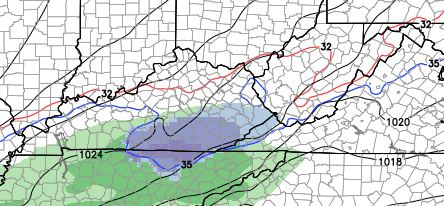
Colder air sweeps in tonight and early Sunday as a fast-moving system zips across the Tennessee Valley. This isn’t a big system and may only have a small impact on southern parts of the state. The NAM shows a touch of rain and snow early Sunday…
 Afternoon sunshine will take over on a cold northwesterly wind. Highs will only reach the 40s.
Monday is a cold day with 20s to start and low 40s for highs as clouds increase. Those clouds are ahead of a system diving in from the northwest and a low pressure develop to the southeast. We are likely to see a period of light snow and gusty winds across the region on Tuesday…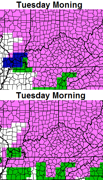
Some light accumulations will be possible for some areas on Tuesday. Temps behind this turn ugly for a few days. Check out how far below normal we are by Wednesday morning…
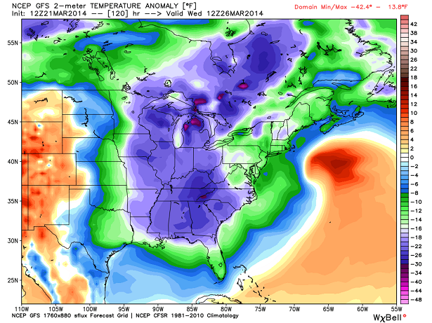 Temps in the teens are possible when you wake up Wednesday morning.
The good news is milder air shoots end by the end of the week as temps head back toward 60 degrees. We could even hear a rumble of thunder to start next weekend.
While the pattern continues to feature up and down temps into the following week… it is starting to look a little milder. That makes your friendly weatherdude a happy camper. 🙂
Enjoy your Saturday and take care.

Thank God for spring and GO CATS!
The next storm really goes crazy to our north and east on the 06z GFS. 960 MB LP off the coast of Nova Scotia at 12z Wednesday.
Thanks Chris. That is welcome news. Looking forward to being able to be outside without being bundled up like an Eskimo. So maybe we are seeing the light at the end of the tunnel after all! Have a great Satirday everyone. I gotta go to work.
The average high for today is 58–and by the 27th it hits 60. Looks like we might go to average or a bit above on a consistent basis as we move into April! Just got to get to Thursday.
I agree Wednesday’s morning lows look ridiculous could drop into the teens for some. Thursday does look to be the start of some warmer weather on a consistent bases, possibly.
62 here in Carrie at 1030 am
Must be nice! 48 here just to the West of Lexington with clouds at 1058 A.M.
Thank you Chris. Come on Spring!
Topped out at 67 today in Carrie, great day
The clouds went away and temp hit 59 here! My kind of day!
67 was the highest high on the KY Mesonet (high of 67 here in Nashville TN as well). The lowest was 56 which is still a good bargain.
It was a great day to take advantage of the sunshine. At the same time nice that technology helps you keep up with the mens’ and womens’ basketball tournament games even while you are outside 😉 .
As Chris Mercer touched on, we need to persevere through the upcoming cold until the warmth returns late next week.